![[December 25, 1944], HQ Twelfth Army Group situation map.](https://cybercemetery.unt.edu/archive/oilspill/20130108014650im_/http://www.loc.gov/collections/static/world-war-ii-maps-military-situation-maps-from-1944-to-1945/images/ict21204.jpg)
![[January 1, 1945], HQ Twelfth Army Group situation map.](https://cybercemetery.unt.edu/archive/oilspill/20130108014650im_/http://www.loc.gov/collections/static/world-war-ii-maps-military-situation-maps-from-1944-to-1945/images/ict21211.jpg)

![[Rough sketch of the Rich Mountain battle area extending from Beverly, W. Va. to Clarksburg].](https://cybercemetery.unt.edu/archive/oilspill/20130108014650im_/http://www.loc.gov/collections/static/hotchkiss-maps/images/cwh00078.jpg)
![[Map of Madison County, Va.].](https://cybercemetery.unt.edu/archive/oilspill/20130108014650im_/http://www.loc.gov/collections/static/hotchkiss-maps/images/cwh00046.jpg)
![[Base map of Pennsylvania].](https://cybercemetery.unt.edu/archive/oilspill/20130108014650im_/http://www.loc.gov/collections/static/hotchkiss-maps/images/cwh00207.jpg)

![[Sketch of the Manassas battlefield].](https://cybercemetery.unt.edu/archive/oilspill/20130108014650im_/http://www.loc.gov/collections/static/hotchkiss-maps/images/cwh00108.jpg)
![[Map of cavalry engagement near Bridgewater, Va. Oct. 4th and 5th, 1864]](https://cybercemetery.unt.edu/archive/oilspill/20130108014650im_/http://www.loc.gov/collections/static/hotchkiss-maps/images/cwh00193.jpg)
Results
-

Pictorial map of the seat of war, showing parts of the states of Maryland, Delaware, Virginia, and North Carolina, and also the coast line from ...
From: Harper's weekly, June 8, 1861, p. 360-361.
Site: American Memory-cultural Original Format: Map Date: 1861 -

Plan of the N.W. frontier /
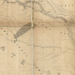
Shows the Mississippi River from St. Anthony Falls to St. Louis, the Missouri River west to South Dakota, the Illinois River east to Lake Michigan, and tributaries.
Contributor: Clark, William Site: American Memory-cultural - Main Catalog Original Format: Map Date: 1813 View catalog record -

Spartanburgh District, South Carolina /
LC Civil War maps (2nd ed.), S153
Contributor: Mills, Robert Site: American Memory-cultural - Main Catalog Original Format: Map Date: 1820 View catalog record -

Northern part of Florida
Scale 1:633,600.
Contributor: Lindenkohl, H. Site: American Memory-cultural - Main Catalog Original Format: Map Date: 1864 View catalog record -

Yŏjido.
Romanized.
Site: American Memory-cultural - Main Catalog Original Format: Map Date: 1800 View catalog record -

Plan of the west end of the public appropriation in the city of Washington, called the Mall : as proposed to be arranged for the ...
Pen-and-ink and watercolor.
Contributor: District of Columbia. Office of the Surveyor Site: American Memory-cultural - Main Catalog Original Format: Map Date: 1816 View catalog record -

Carta de la republica de Colombia.
Available also through the Library of Congress web site as a raster image.
Contributor: Erhard Hermanos Site: American Memory-cultural - Main Catalog Original Format: Map Date: 1886 View catalog record -

Map of the military Department of the Gulf /
Covers South Carolina, Georgia, Florida, Alabama, Mississippi, Arkansas, Louisiana, and eastern Texas.
Contributor: D'Avignon, Francis Site: American Memory-cultural - Main Catalog Original Format: Map Date: 1864 View catalog record -

A map of General Washington's farm of Mount Vernon from a drawing transmitted by the General.
Removed from: Letters from His Excellency George Washington, to Arthur Young, [etc.]. London, 1801. Opp. p. (E312.75.A27 Rare Book Rm.)
Contributor: Washington, George Site: American Memory-cultural - Main Catalog Original Format: Map Date: 1801 View catalog record -

Portions of Virginia and North Carolina, embracing Richmond & Lynchburg, Va. and Goldsboro & Salisbury, N.C.
Relief shown by hachures.
Contributor: United States. War Dept. Engineer Bureau Site: American Memory-cultural - Main Catalog Original Format: Map Date: 1864 View catalog record -

Map showing the railroad and highway bridge over the Missouri River at St. Joseph, Mo. and the railroads connecting therewith.
Scale 1:1,267,200.
Contributor: G.W. & C.B. Colton & Co Site: American Memory-cultural - Main Catalog Original Format: Map Date: 1872 View catalog record -

Coast of North Carolina & Virginia
Scale 1:200,000.
Contributor: Lindenkohl, A. Site: American Memory-cultural - Main Catalog Original Format: Map Date: 1863 View catalog record -

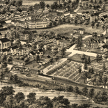
Bird's eye view of Flandreau, county seat of Moody Co., Dakota 1883.
Perspective map not drawn to scale.
Contributor: Brosius, H. Site: American Memory-cultural - Main Catalog Original Format: Map Date: 1883 View catalog record -

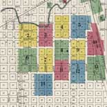
Plan of the city of Washington : seat of government of the United States /
Shows block numbers, wards, existing and proposed government buildings, and radial distances from Capitol.
Contributor: Elliot, William Site: American Memory-cultural - Main Catalog Original Format: Map Date: 1835 View catalog record -

Chickamauga Battlefield /
Scale ca. 1:12,200.
Contributor: McElroy, Joseph C. Site: American Memory-cultural - Main Catalog Original Format: Map Date: 1895 View catalog record -

Bird's eye view of Kalamazoo, Mich. 1883.
Perspective map not drawn to scale.
Contributor: Wellge, H. Site: American Memory-cultural - Main Catalog Original Format: Map Date: 1883 View catalog record -

Chart of the Red Sea : comprising the part above Jiddah, on Mercator's Projection, compiled from a stasimetric survey executed in the years 1830, 31, ...
Relief shown in hachures. Depths shown in soundings.
Site: American Memory-cultural - Main Catalog Original Format: Map Date: 1836 View catalog record -

Map of the city of Utica /
Oriented with north toward the upper left.
Contributor: Francis, Joseph H. Site: American Memory-cultural - Main Catalog Original Format: Map Date: 1873 View catalog record -

Map showing the location of Mount Rogers, Augusta Co., Va. /
Relief shown by hachures.
Contributor: Hotchkiss, Jedediah Site: American Memory-cultural - Main Catalog Original Format: Map Date: 1886 View catalog record -

Battle of Missionary Ridge or Chickamauga, Tenn.
Color coding indicates the location of Union and Confederate forces.
Contributor: Sneden, Robert Knox Site: American Memory-cultural Original Format: Map Date: 1861
Refine your search
Original Format
- Map
- Web Page [17]