![Plan général du Fort Septentrional du Detour des Anglois, tel qu'il est présentement : [Louisiana]](https://cybercemetery.unt.edu/archive/oilspill/20120921144242im_/http://www.loc.gov/collections/static/louisiana-european-explorations-and-the-louisiana-purchase/images/lh000949.jpg)
![[Detailed map of part of Virginia from Alexandria to the Potomac River above Washington, D.C. 1886].](https://cybercemetery.unt.edu/archive/oilspill/20120921144242im_/http://www.loc.gov/collections/static/civil-war-maps/images/cw0523000.jpg)


![[January 18, 1945], HQ Twelfth Army Group situation map.](https://cybercemetery.unt.edu/archive/oilspill/20120921144242im_/http://www.loc.gov/collections/static/world-war-II-maps-military-situation-maps-from-1944-to-1945/images/ict21228.jpg)
![[Base map of Alabama].](https://cybercemetery.unt.edu/archive/oilspill/20120921144242im_/http://www.loc.gov/collections/static/hotchkiss-maps/images/cwh00201.jpg)

![[Base map of Pennsylvania].](https://cybercemetery.unt.edu/archive/oilspill/20120921144242im_/http://www.loc.gov/collections/static/hotchkiss-maps/images/cwh00207.jpg)
![A correct map of a section of the United States showing the allignment [sic] of the Pittsburgh, Marion, and Chicago Railway between Chewton, Penna. and Marion, Ohio and connections.](https://cybercemetery.unt.edu/archive/oilspill/20120921144242im_/http://www.loc.gov/collections/static/railroad-maps-1828-to-1900/images/rr005350.jpg)
![[Topographical map of part of Washington D.C.].](https://cybercemetery.unt.edu/archive/oilspill/20120921144242im_/http://www.loc.gov/collections/static/civil-war-maps/images/cw0688500.jpg)


Results
-

Bell County /
Shows land ownership.
Contributor: Rosenberg, E. von Site: American Memory-cultural - Main Catalog Original Format: Map Date: 1919 View catalog record -

Nueces County.
Relief shown by hachures.
Site: American Memory-cultural - Main Catalog Original Format: Map Date: 1879 View catalog record -

Martenet's Map of Carroll County, Maryland : entirely from actual surveys /
Election districts identified.
Contributor: Martenet, Simon J. Site: American Memory-cultural - Main Catalog Original Format: Map Date: 1862 View catalog record -

Map of the village of Bucksport, Hancock County, Maine /
Cadastral map showing lot lines and names of landowners.
Contributor: E.F. Sanford & C.T. Leggett Site: American Memory-cultural - Main Catalog Original Format: Map Date: 1875 View catalog record -

Extract of military map of N.E. Virginia showing forts and roads.
Covers Washington D.C. metropolitan area.
Contributor: United States. War Dept. Engineer Bureau Site: American Memory-cultural - Main Catalog Original Format: Map Date: 1865 View catalog record -

Map of Washington County, New York /
Relief shown by hachures.
Contributor: Levey, Morris Site: American Memory-cultural - Main Catalog Original Format: Map Date: 1853 View catalog record -

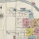
Standard atlas of Stark County, Illinois : including a plat book of the villages, cities and townships of the county, map of the state, United ...
LeGear. Atlases of the United States, 4379
Contributor: Geo. A. Ogle & Co Site: American Memory-cultural - Main Catalog Original Format: Map Date: 1907 View catalog record -


Heisei 15-nenbun zaisan hyōka kijunsho rosenkazu. Catalog Record - Electronic Resource Available
Description based on: dai 3-bunsatsu, published in 2003?
Contributor: Japan. Hiroshima Kokuzeikyoku Site: Main Catalog Original Format: Map Date: 2003 -

Hood Co., Texas /
Relief shown by hachures.
Contributor: Beaumont, G. N. Site: American Memory-cultural - Main Catalog Original Format: Map Date: 1918 View catalog record -

Standard atlas of McLean County, Illinois, including a plat book of the villages, cities and townships of the county.
Phillips, 4578
Contributor: Geo. A. Ogle & Co Site: American Memory-cultural - Main Catalog Original Format: Map Date: 1914 View catalog record -

An illustrated atlas of Cecil County, Maryland /
LeGear. Atlases of the United States, 4841
Contributor: Lake, Griffing & Stevenson Site: American Memory-cultural - Main Catalog Original Format: Map Date: 1877 View catalog record -

Dimmit County.
Blueprint
Contributor: Beaumont, G. N. Site: American Memory-cultural - Main Catalog Original Format: Map Date: 1901 View catalog record -

Official map of Sonoma County, California : compiled from the official maps in the County Assessor's Office, with additions and corrections to June 1st, 1900 ...
Relief shown by hachures.
Contributor: Ricksecker, L. E. Site: American Memory-cultural - Main Catalog Original Format: Map Date: 1900 View catalog record -

Plat book of St. Charles County, Missouri : compiled from county records and actual surveys /
"Copyright secured by the County Court, 1905."
Contributor: North West Publishing Co Site: American Memory-cultural - Main Catalog Original Format: Map Date: 1905 View catalog record -

Map of Haskell County, Texas /
Shows landownership.
Contributor: Texas. General Land Office Site: American Memory-cultural - Main Catalog Original Format: Map Date: 1879 View catalog record -

[Map of Royal Land Company of Virginia lands in Rockingham, and Augusta counties Virginia, and Pendleton County, West Virginia] /
Title, date, and scale from Stephenson's Civil War maps, 1989.
Contributor: Oltmanns, C. W. Site: American Memory-cultural - Main Catalog Original Format: Map Date: 1877 View catalog record -

Sketch of Washington in embryo : viz., previous to its survey by Major L'Enfant, 1792 /
Cadastral map showing landholdings in central Washington with owners' names.
Contributor: Faehtz, E. F. M. Site: American Memory-cultural - Main Catalog Original Format: Map Date: 1893 View catalog record -

[Map of portions of Jeff Davis County and Presidio County, Texas].
Shows landownership.
Contributor: Stakemann, M. Site: American Memory-cultural - Main Catalog Original Format: Map Date: 1894 View catalog record -

Standard atlas of Kendall County, Illinois : including a plat book of the villages, cities and townships of the county, map of the state, United ...
LeGear. Atlases of the United States, 4227
Contributor: Geo. A. Ogle & Co Site: American Memory-cultural - Main Catalog Original Format: Map Date: 1903 View catalog record -

Map of Frio County, Texas.
Shows land ownership.
Contributor: Texas. General Land Office Site: American Memory-cultural - Main Catalog Original Format: Map Date: 1879 View catalog record
Refine your search
Original Format
- Map