
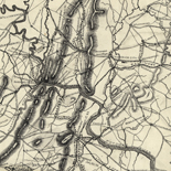


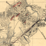
![[Sketches of portions of Madison County, Va.].](https://cybercemetery.unt.edu/archive/oilspill/20130108023847im_/http://www.loc.gov/collections/static/hotchkiss-maps/images/cwh00106.jpg)
![[December 18, 1944], HQ Twelfth Army Group situation map.](https://cybercemetery.unt.edu/archive/oilspill/20130108023847im_/http://www.loc.gov/collections/static/world-war-ii-maps-military-situation-maps-from-1944-to-1945/images/ict21197.jpg)


![[Plan of Fort Henry and its outworks.]](https://cybercemetery.unt.edu/archive/oilspill/20130108023847im_/http://www.loc.gov/collections/static/civil-war-maps/images/cw0414000.jpg)
![[January 3, 1945], HQ Twelfth Army Group situation map.](https://cybercemetery.unt.edu/archive/oilspill/20130108023847im_/http://www.loc.gov/collections/static/world-war-ii-maps-military-situation-maps-from-1944-to-1945/images/ict21213.jpg)


![[Map of cavalry engagement near Bridgewater, Va. Oct. 4th and 5th, 1864]](https://cybercemetery.unt.edu/archive/oilspill/20130108023847im_/http://www.loc.gov/collections/static/hotchkiss-maps/images/cwh00193.jpg)
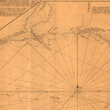
![[Coast of Maine from Frenchmans Bay to Mosquito Harbor].](https://cybercemetery.unt.edu/archive/oilspill/20130108023847im_/http://www.loc.gov/collections/static/american-revolutionary-war-maps/images/np000011.jpg)
![[Map of Chancellorsville battlefield, May 3-4, 1863].](https://cybercemetery.unt.edu/archive/oilspill/20130108023847im_/http://www.loc.gov/collections/static/hotchkiss-maps/images/cwh00138.jpg)
![[Map of parts of Caroline, Hanover, and Henrico counties, Va. west of the Mattaponi River and the Richmond, Fredericksburg, and Potomac Railroad].](https://cybercemetery.unt.edu/archive/oilspill/20130108023847im_/http://www.loc.gov/collections/static/hotchkiss-maps/images/cwh00025.jpg)
Results
-

Pictorial map of the seat of war, showing parts of the states of Maryland, Delaware, Virginia, and North Carolina, and also the coast line from ...
From: Harper's weekly, June 8, 1861, p. 360-361.
Site: American Memory-cultural Original Format: Map Date: 1861 -

A map of General Washington's farm of Mount Vernon from a drawing transmitted by the General.
Removed from: Letters from His Excellency George Washington, to Arthur Young, [etc.]. London, 1801. Opp. p. (E312.75.A27 Rare Book Rm.)
Contributor: Washington, George Site: American Memory-cultural - Main Catalog Original Format: Map Date: 1801 View catalog record -

Portions of Virginia and North Carolina, embracing Richmond & Lynchburg, Va. and Goldsboro & Salisbury, N.C.
Relief shown by hachures.
Contributor: United States. War Dept. Engineer Bureau Site: American Memory-cultural - Main Catalog Original Format: Map Date: 1864 View catalog record -

Coast of North Carolina & Virginia
Scale 1:200,000.
Contributor: Lindenkohl, A. Site: American Memory-cultural - Main Catalog Original Format: Map Date: 1863 View catalog record -

Map showing the location of Mount Rogers, Augusta Co., Va. /
Relief shown by hachures.
Contributor: Hotchkiss, Jedediah Site: American Memory-cultural - Main Catalog Original Format: Map Date: 1886 View catalog record -

Map showing the location of battle fields of Virginia /
"Poole Bros., Engr's, Chicago"--lower left corner.
Contributor: Chesapeake and Ohio Railway Company Site: American Memory-cultural Original Format: Map Date: 1892 -

Plan of the Battle of Chantilly, Virginia : September 1st 1862 5 to 9 p.m.
Color coding indicates the location of Union and Confederate forces.
Contributor: Sneden, Robert Knox Site: American Memory-cultural Original Format: Map Date: 1862 -

[Map of Loudoun County, Va., and parts of Fairfax County, Va., Jefferson County, W.Va., and Washington and Frederick counties, Md.].
Shows names of some residents.
Site: American Memory-cultural - Main Catalog Original Format: Map View catalog record -

Map of the drainage and catchment basin of Asylum Creek to illustrate a report on a water supply for the W.L. Asylum of Va. /
Shows outline of the catchment and drainage basin of the Asylum Creek a tributary of Lewis Creek in Staunton, Virginia and names of some residents.
Contributor: Hotchkiss, Jedediah Site: American Memory-cultural - Main Catalog Original Format: Map Date: 1879 View catalog record -

Preliminary chart of North Landing River (head of Currituck Sound), Virginia & N. Carolina.
Scale 1:40,000.
Contributor: United States Coast Survey Site: American Memory-cultural - Main Catalog Original Format: Map Date: 1861 View catalog record -

Map showing positions of Union and Rebel forces Septr 1861.
Color coding shows the location of Union and Confederate forces.
Contributor: Sneden, Robert Knox Site: American Memory-cultural Original Format: Map Date: 1861 -

Map of Albemarle County /
Shows villages, houses, names of residents, roads, and railroads.
Contributor: Dwight, C. S. Site: American Memory-cultural - Main Catalog Original Format: Map Date: 1864 View catalog record -

Battle field of Winchester, Va. (Opequon) [September 19, 1864]
Scale ca. 1:9600.
Contributor: Gillespie, G. L. Site: American Memory-cultural - Main Catalog Original Format: Map Date: 1873-01-01 View catalog record -

Volunteer militia and eastern army guide. One hundred and fifty miles around Richmond.
Scale ca. 1:920,000.
Contributor: Magnus, Charles Site: American Memory-cultural - Main Catalog Original Format: Map View catalog record -

One hundred & fifty miles around Richmond. 9th ed.
Scale ca. 1:880,000.
Contributor: Magnus, Charles Site: American Memory-cultural - Main Catalog Original Format: Map View catalog record -

[Five sketches on one sheet of areas in Culpeper County, Virginia, in the vicinity of Liberty Mills, Germanna, Ely's Ford, etc.].
Shows names of some residents.
Site: American Memory-cultural - Main Catalog Original Format: Map Date: 1863 View catalog record -

Cold Harbor. [June 1-3, 1864]
Scale 1:21,120.
Contributor: Michler, N. Site: American Memory-cultural - Main Catalog Original Format: Map Date: 1867 View catalog record -

A Representation, of the sea fight, on the 5th of Sepr. 1781, between Rear Admiral Graves and the Count de Grasse.
Scale ca. 1:444,000.
Site: American Memory-cultural - Main Catalog Original Format: Map Date: 1781 View catalog record -

Map of the state of Virginia containing the counties, principal towns, railroads, rivers, canals & all other internal improvements.
Relief shown by hachures.
Contributor: West & Johnston Site: American Memory-cultural - Main Catalog Original Format: Map Date: 1864 View catalog record -

Map showing the battle grounds of the Chickahominy, and the positions of the subsequent engagements in the retreat of the Federal army towards James River ...
Scale ca. 1:160,000.
Contributor: Sheppard, Edwin Site: American Memory-cultural - Main Catalog Original Format: Map Date: 1862 View catalog record
Refine your search
Original Format
- Map