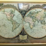
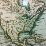
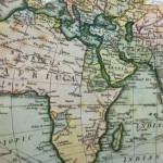
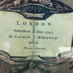
I had never really looked at the map in my office until Andrew pointed it out one day. I was surprised at how old it was! And how small the territory of the United States was! I thought I’d share with you images from it. For those that are curious, yes, it appears we all have maps in our offices. Do you?
A map of the world with Captain Cook’s tracks, Laurie & Whittle, May, 1794.


May 27, 2011 at 11:38 am
I have great map of Washington, D.C. with all of the neighborhoods!
May 27, 2011 at 1:12 pm
Christine,
I selected that map for my office. You know your office is my old office. I love maps and globes.
I hope you like it.
Shameema
May 27, 2011 at 1:36 pm
I have at least five antique maps im my office:
*Ortelius – World Map 1575
*Braun & Hogenberg – Sevilla 1578
*Faden – Battle of Bennington 1778
*Map of Spaom
*Map of Syria
Love them all !!
May 27, 2011 at 1:51 pm
Andrew – could you post a photo of your DC map?
May 27, 2011 at 2:25 pm
It’s an Ork poster of DC: http://www.orkposters.com/dc.html (the brown on green paper)