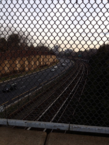
In 1982 Interstate I-66 opened, providing a direct high-speed connection (except at rush hour) between downtown Washington D.C. and its western suburbs in Virginia. I was barely out of high school at the time so its opening didn’t really register with me, but now I live mere blocks away from the highway so it’s an everyday part of my life.
What did the area near my house look like prior to the highway’s opening? Many of us are fascinated by old photographs of the places where we live, but advances in technology are now making it possible to incorporate geography into these memories; to leverage maps to help us visualize the history of our favorite places in new and innovative ways.
Incorporating geographic analysis into historical efforts gives us new insights into the value of place. For example, what if we could map geographic changes over time and document the changing paths of rivers over hundreds of years? What about documenting the different economic uses of a particular point in space over time?
One current effort on this front is exploring ways to incorporate historic information into OpenStreetmap. One of the interesting features of OSM is that it can be rolled back to different points in time to review changes that have been added to the database that underpins the map.
 This is not quite the same as being able to roll back to any arbitrary point in time, but researchers are exploring ways to incorporate the “time element” to OSM so that the database could also be rolled back so that a user could see what a particular place actually looked like on the map at a particular moment in the past.
Roads and buildings would change or disappear, river traces would subtly shift, fields and forests would reappear in areas that had long since been developed.
There are numerous technical challenges to making this work and they are being explored on the project’s OSM-Historic listserv and wiki: resolving historical time format conventions, identifying and reviewing sources of historical information, identifying how to tag and annotate sources of historical information, how to trace historical data provenance and a range of other issues.
Researchers point to Frankie Roberto’s presentation “Mapping History on Open Street Map” at the 2009 State of the Map conference in Amsterdam as an excellent starting point to understanding the challenges of incorporating time into geospatial applications. And while the OSM-Historic effort leverages existing infrastructures to potential broad benefit, it’s not the only mapping effort addressing historic challenges.
We’ll be highlighting some of these efforts at the South By Southwest Conference in March in our session “Why Digital Maps Can Reboot Cultural History.” Other interesting examples include Sabre Maps, an effort to integrate scanned images of older maps of the UK with the current OSM interface; OmnesViae: Roman Routeplanner, a reconstruction of an antique Roman map; and Pastmapper, a representation of San Francisco as it was in 1853, using geometries from a scan of the US Coast Survey Map from the David Rumsey Historical Map Collection.
What are some other examples of digital maps incorporating historical elements and how can we work through the challenges of historical time in maps?

