The Atlantic Neptune
Joseph Frederick Wallet Des Barres (1722-1824)
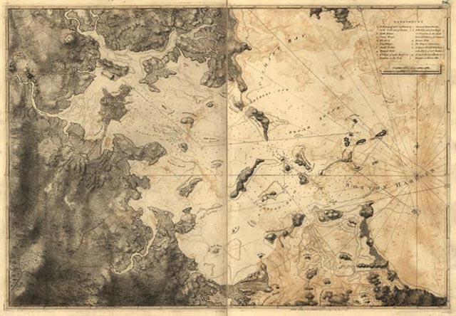
[A Chart of the Harbour of Boston],
from The Atlantic Neptune.
London: 1775
Engraved map
Geography and Map Division (26.13)
[G&M digital ID # gmd3m/g3301m/g3301pm/gan00002/an031024]
|
This chart of Boston Harbor, based primarily on 1769 surveys by
George Callendar, is an example of the detailed navigational charts
found in The Atlantic Neptune. First published in the mid-1770s
under the direction of British hydrographer Joseph Des Barres,
these nautical charts were the official source for the British
Royal Navy during the Revolutionary War. These engraved sheets
were produced and revised using the most recent innovations in
scientific cartography, accurately depicting the hazards and shoals
along the North American coastline.
|