

[Detail] Field of Gettysburg, July 1st, 2nd & 3rd, 1863
Collection Overview
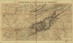
Civil War Maps, a subset of Map Collections: 1500-2004, contains approximately 2,240 Civil War maps and charts and 76 atlase and sketchbooks depicting battles, troop positions and movements, engagements, and fortifications. Included are maps of the whole United States, maps of major regions such as the Eastern or Southern States, maps of the Mississippi River, and state maps. The vast majority of the maps were prepared by Federal forces or by commercial firms in the North, but there are also a substantial number by Confederate military authorities and a few by Southern publishers.
Special Features
These online exhibits provide context and additional information about this collection.
Historical Eras
These historical era(s) are best represented in the collection, although they may not be all-encompassing.
- The Civil War and Reconstruction, 1850-1877
Related Collections and Exhibits
These collections and exhibits contain thematically-related primary and secondary sources. Also browse the Collection Finder for more related material on the American Memory Web site.
- Abraham Lincoln Papers at the Library of Congress
- African-American Experience in Ohio
- African American Odyssey
- African American Perspectives, 1818-1907
- Band Music from the Civil War Era
- Civil War Photographs, 1861-1865
- Civil War Sheet Music
- The Gettysburg Address
- Historic American Sheet Music, 1850-1920
- Narratives of the American South, 1860-1920
- Nineteenth-Century Song Sheets
- Pioneering the Upper Midwest: Books from Michigan, Minnesota, and Wisconsin, ca. 1820-1910
- Recovered Notebooks from the Thomas Biggs Harned Walt Whitman Collection
- Small-Town America: Stereoscopic Views from the Robert Dennis Collection, 1850-1920
- Taking the Long View: Panoramic Photographs, 1851-1991
- The Alfred Whital Stern Collection of Lincolniana
Other Resources
Recommended additional sources of information.
Search Tips
Specific guidance for searching this collection.
To find items in this collection, search by Keyword or browse the Subject Index, Creator Index, Title List, or Geographic Index.
For help with general search strategies, go to Finding Items in American Memory.
History

Secession, 1860-1861, c1917.
Civil War Maps provides students an opportunity to study the history of the American Civil War era through cartographic data. The maps of this collection portray the overall course and specific battles of the war between North and South. They also portray the issues of territorial expansion, slavery, and secession, which surrounded the genesis of the conflict. In addition, students can use the maps to study railroads, naval battles, and the history of cartographic mapping in the U.S.
Territorial Expansion, Slavery, and Secession
As the United States expanded westward, the issue of whether or not new states would be admitted to the Union as slave states or free states was at the center of political debates. Finally, in 1861, the issues of slavery and state rights erupted into the American Civil War when southern states seceded from the Union and created the Confederacy.
Students can search on secession and slave to see maps depicting newly admitted states. Using visual data of where free and slave states were located, students can gain an understanding of why the country divided as it did. Did all the states that left the Union share borders? What similarities and common interests are implied by geographic proximity? Some similarities might include states' economies and agriculture. How do these relate to secession and war? Students can choose particular states and do research to find out if there was debate within the states on whether or not to secede.
Protecting the Capitals

Panorama of the seat of war., c1861.
Both Union and Confederate forces fought to protect their capitals from invasion. Washington, D.C., the capital of the United States, was situated dangerously close to enemy lines. The capital of the Confederacy in Richmond, Virginia was not too far south from Washington.
Students can search on the names of the capitals. Based on the information in the maps, what bordered each capital? From which direction were the greatest threats likely to come? What forts were established to protect the capitals? This map includes both Washington, D.C. and Richmond, Virginia.
Students can conduct additional research to determine how the war progressed and if these capitals remained out of the enemy's hands. Photographs of the capitals are online in the collection Civil War Photographs, 1861-1865 and can be retrieved by searching on Richmond and Washington DC.
Railroads
The armies of the American Civil War made use of the railroad lines, a relatively new industrial development, transporting troops, ammunition, and other supplies. Because trains had set tracks and could only travel to certain destinations, railroads had a great impact on the course and outcome of the war. Students can search on railroad in Civil War Photographs, 1861-1865 to see images of trains used in the war. Some photographs show destroyed rail lines. Who might have destroyed these railroad lines and why? What was involved in repairing these lines, how long would it take, who repaired them, and how many people would be needed?

Students can search the collection on railroad to see where rail lines traveled. They can determine which parts of the country were best served by the railroad at the time of the war. How might the location of railroad tracks have affected various military decisions?
To learn more about railroad mapping and how the Civil War increased mapping of the rail lines, students can browse the collection Railroad Maps, 1828-1900 using the Title Index.
The War at Sea
The use of ships for battle, blockade, and transport was a major factor in the course of the Civil War. For example, at the start of the war, President Lincoln issued a Proclamation of Blockade against Southern ports. Throughout the war this blockade limited the ability of the South to stay well-supplied in its war against the industrialized North. The Union also used ships along the Mississippi River to take New Orleans, the South's greatest seaport. On the Confederate side, in March of 1862, the Ironclad Merrimack sank two wooden Union ships, changing Naval warfare forever, as wooden ships were now obsolete.
![Map shewing the several routes proposed for the passage of gunboats to the Lakes via: Erie and Oswego Canal; Champlain [Canal];](images/gunboat.gif)
Students can search on ship, harbor, river, navy, nautical, or naval to find depictions of the Union blockade and locations of navy yards. Students can conduct further research on New Orleans and naval battles and then search the collection on the names of battle sites. Students can search on navy in Civil War Photographs, 1861-1865 to see images of the vessels used during the war.
- Where were the major naval battles of the Civil War? How were battles fought at sea? What types of ammunition were used?
- Did the Union blockade of the South cover the entire coast? If not, which ports were blockaded and why?
- From where was the South attempting to import supplies? Were they at all successful?
Mapping the Country
When war erupted in the United States in 1861, there were only outdated maps of many parts of the country, if any. One of the primary tasks of the Union and Confederate armies was to create a cartographic record. Students can discuss why maps were so important to the war effort.
Students can read the special presentation History of Mapping the Civil War for an excellent overview of the mapping capabilities and techniques of the North and South. Discuss with students how the rush to map the country might have effected the beginning of the war. How would a general prepare for battle if he did not know the lay of the land? How was the cartographic information gathered? What risks were the cartographers exposed to in creating the maps? How could inaccuracies in their maps change the course of the war?
Students can browse the collection's Title Index, looking at various mapping techniques. As seen in the maps below, there are visual clues as to which maps were made in haste and which had the benefit of time. Search on sketch and color to find additional maps.


Critical Thinking
Civil War Maps provides students the unique opportunity to develop their historical thinking skills using reproductions of original maps from the Civil War era. Using these artifacts, students can study the course of the war, and research the careers of particular soldiers. By assuming the role of a soldier, students can gain a comprehension of the time period and learn to analyze and interpret maps. Finally, they may also practice issue-analysis and decision-making by examining a map as propaganda, and considering the role of the press during war-time.
Chronological Thinking

Students can use Civil War Maps to chart the course of the American Civil War. Have them begin by reading the Time Line of The Civil War in the collection Civil War Photographs. Students can then search Civil War Maps by battle name or location. They can note whether the maps they retrieve were created by Union or Confederate forces and what information about the battle is included.
By searching the collection on regional names, such as Northeastern States, Southern States, or Middle West, students can find maps of larger geographic areas. From a printed copy of one or several of these maps, the students can chart the progress of the war. They can label battle locations and their dates. Using several copies of the same map, students can also document which land was under whose authority at different points in the war. They can begin with the succession of southern states through to the end of the war. Shading with colored pencils can indicate who controlled which areas.
Historical Comprehension

From Civil War Maps students can gain an historical comprehension of what life in America was like in the 1860s. For example, students can search on battlefield or the names of battles and see where the battles were fought. They can look at roadways and deduce that traveling by foot or by horse were the common means of transportation. They can also search on railroad to see how trains may have aided in the transport of goods. Even the means of drafting the maps - by hand with pen or pencil -indicate the printing techniques available.
From these maps students also have the opportunity to comprehend what the typical soldier encountered during the Civil War. What types of fortifications are indicated on the maps? What was the climate for the regions where most fighting occurred? Were soldiers able to shoot from behind trees in forests? Or were there battles out in open fields? What buildings would a soldier find if his troop entered a town?
To further their comprehension of life at this time period, students can browse the photographs in Civil War Photographs looking for evidence of clothing worn and technology available. They can also search on Civil War in the following text-based collections for related narratives and then search in Civil War Maps on the names of towns and battles discussed in these narratives.
- African-American Experience in Ohio
- Narratives of the American South, 1860-1920
- Pioneering the Upper Midwest: Books from Michigan, Minnesota, and Wisconsin, ca. 1820-1910
- Recovered Notebooks from the Thomas Biggs Harned Walt Whitman Collection
Historical Analysis and Interpretation

In many cases the battles of the Civil War were fought by men unfamiliar with the area of the country in which they were fighting. Have students search the map collection on Gettysburg to find maps of this battle. They can then assume the role of a soldier who has never encountered this part of the country before. What can the students learn about the region from the map?
Add to the story by telling the students they are equipped with a gun and a sword. Where might they position themselves on the battlefield, given the opportunity? If their gun failed, where would they move to? What if they were then wounded? Is there a place for them to hide from the enemy?
Historical Issue-Analysis and Decision Making
Propaganda is a tool used to persuade citizens to the author's point-of-view. The material is designed to have a psychological impact on the viewer. Students can study commercial publisher J. B. Elliott's map entitled Scott's great snake. Published in 1861, this map is a cartoon depiction of Gen. Winfield Scott's plan to defeat the South both economically and militarily - a plan the press ridiculed as the "Anaconda Plan."

Scott's great snake, 1861.
Students can use this map as an example of one person's point-of-view on the course of the Civil War. After first reading outside resources describing Gen. Scott's intended course of action, students can determine what opinion this cartographer's map represents. Who was the cartographer trying to influence with this map?
Have students continue their research to determine what course of action Gen. Scott pursued and how this might have influenced the outcome of the war.
Continue this discussion with the students by having them consider what obligation they believe a newspaper might have to support the defenders of the nation? What is gained by periodicals publishing critiques such as Elliott's? What risks does a nation face in being critical of their own military forces, particularly during war?
Historical Research Capabilities

War maps and diagrams, 1861.
Included in Civil War Maps are some of the maps used by Generals William Tecumseh Sherman and Thomas J. Jackson, also known as "Stonewall" Jackson. Students can increase their historic research capabilities by researching the career or a particular battle of one of these prominent Civil War figures.
After doing this background research, have students search the collection on the name of one general or the name of one of their famous battles. Referring to the relevant maps in the collection, students can see what information the Generals had at their disposal during particular battles. They can also search for maps that might have been used by the general's opponents in the same battle.
This map is labeled: " Official plan of the forts at Hilton Head and Bay Point, Port Royal Harbor, S.C., showing one position of the naval vessels during the action of November 7, 1861." On that day, Captain Samuel F. Dupont's warships silenced Confederate guns in Fort Walker and Fort Beauregard. This victory enabled General Thomas W.Sherman's troops to occupy first Port Royal and then all the famous Sea Islands of South Carolina.
For further historic research, students can search on the same topics in the collection Civil War Photographs.
Arts & Humanities
Civil War Maps provides an excellent opportunity for students to develop their language art skills. Using the maps, they can study advertising techniques and language. They can examine maps and newspaper articles to learn to write their own articles. Similarly, they may write first-person accounts from a soldier's perspective, based on accounts from American Memory collections and their own imagination. In addition, students can write biographies and depict historic events visually, through their own maps.
Advertising
Included in Civil War Maps are maps created by publishing companies and sold to a market of citizens who were interested in the battles because of their family and friends' service in the war. To lure buyers, the maps often included advertisements promoting the map as the best of its kind or as one used by war soldiers.
For example, one popular publisher, James T. Lloyd, included extensive advertising on his maps. Students can search on the publisher's name to read some of these advertisements. Have them note what language, tone and style the advertiser has used. What message is the advertisement getting across? Does the student find it persuasive?

Students can then write their own advertisements for maps by browsing the collection's Title Index. Students can mimic and improve upon the language, tone and style used in Lloyd's maps.
This map includes the following promotional text: "Any one finding an error on this Map will be entitled to a copy, gratis, by writing to the Publisher."
Also included is the transcript from Gideon Welles, Secretary of the Navy, requesting a copy of a map and informing the publisher that Rear Admiral Chas. H. Davis is authorized to purchase a supply for his squadron.
Newspaper Article

War maps and diagrams, 1861.
The American Civil War marked the first time American newspapers ran maps frequently. Search the collection on newspaper to find examples of these maps.
Working from these examples and additional research of the battles and information depicted in the map, students can write newspaper articles describing the events on the map. Have students read newspaper articles from the Civil War era or modern day to glean what information should be included in their article - the Who, What, When and Why of the event. In addition, have students note how these facts are presented to the reader. Does the author convey support for one side over the other? Or does the reporting appear objective? Students can look at the language used, information included and photographs shown in the article to determine the author's objectivity.
First-Person Accounts

Writing in one's private journal or drafting a letter to family or close friends often incorporates more self-reflection than typical expository writing. Students can use this collection to practice the art of describing personal emotions and experiences.
Have students assume the role of a soldier in a particular battle. They can then search the collection for maps of that battle by searching on the name of the battle or its location. Students can then compose a journal entry or a letter as if they were a soldier at that battle.
Before writing, the students should spend time developing the character: What is the soldier's name? Where is the soldier from? Which army is he fighting for? How old is he? How long has he been enlisted? Does he have family, friends, or pets that he misses?
Once the character is set, the students can draft the letter or journal entry. They should include place names and features highlighted on the map. In addition, their writing should reflect the emotions they imagine a soldier would have prior to and during his fighting in this particular battle. What emotion is the soldier feeling now, reflecting on the events? If the soldier had his choice, what would he like to do at that moment? Is he making plans for the future and/or resigning himself to the possibility of death? What final words might he want to share with his family or friends?
Students can read the first-person accounts of Civil War experiences by searching on Civil War in these collections:
- African-American Experience in Ohio
- Narratives of the American South, 1860-1920
- Pioneering the Upper Midwest: Books from Michigan, Minnesota, and Wisconsin, ca. 1820-1910
- Recovered Notebooks from the Thomas Biggs Harned Walt Whitman Collection
Biography
Students can research one of the many famous soldiers from the Civil War. Where was the person born? In a free or slave state? What Civil War battle did he first participate in? What battle is he most famous for fighting in? Why? Where did he live his life after the war? What did he do?
Students can write a biography of this person and illustrate their report with maps from the collection. Search for maps of the person's home state, sites of battles, and where he died. Do these maps provide additional insight into the soldier's life? For example, before the war, did this person live in a place where he may have been exposed to the views of those who would later become the enemy at war? Did he travel far from home during the war? Or did he stay close to home and fight in areas familiar to him? How might this familiarity with battle sites have helped him at war?
Recording History Through Maps

The maps of this collection provide a record of the history of the Civil War primarily through visual data, not text. Students can study these maps and then create their own to develop their skills of conveying information about past events visually. It might help them to think of their audience as someone who does not speak English but must use the map to learn about the Civil War.
Have students begin by determining how the cartographers depicted information without text. Then, students can browse the collection by the Subject Index to see what information was included in a map's legend. What title appears on the maps? Is there a descriptive paragraph that provides background information for what appears in the map? Does the user gain an accurate understanding of the actual events depicted on the map?
Students can then research an event in history for which they will create a map. They might choose a Civil War battle, a battle from another war, a recent news event, or even something in their personal lives.
- What key information must the map include to accurately portray the event?
- Using only the map title, legend, and labels, what information can the student convey?
- Is the map an accurate portrayal of the event? How might people be confused by the map?
- Is a short paragraph needed to explain what cannot be portrayed on the map?