

[Detail] The Grand Canyon. Clarence E. Dutton, 1882.
The resources in Mapping the National Parks provide students information from a broad span of American history. An overview of this history is provided in the special presentations about the four national parks featured in the collection: Acadia, Grand Canyon, Great Smoky Mountains, and Yellowstone. Students can use the collection's maps to study the sociological significance of landscape, as well as a variety of historical topics pertaining to the settlement and expansion of America. In doing so, they will learn to derive maximum meaning from maps by considering them as products of the time period and culture in which they were created.
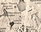
1) The Landscape
Radar mosaic, Yellowstone National Park, 1968. This map includes a press release from the Department of the Interior explaining the capabilities of radar to assist in mapping.
To understand a people - their economic, social, political and cultural systems - sociologists often begin by studying the physical landscape. The terrain, climate, natural resources, proximity to other people, and other geographic features influence nations in both obvious and subtle ways. Mapping the National Parks provides resources to assist students in their understanding of the development of America from a sociological perspective.
Search the collection on topography and geology to retrieve topographic maps of the national parks. Students can start by answering the questions below to become comfortable working with and understanding what these maps tell us about the physical landscape.
- What are the dominant physical characteristics and features of the landscape?
- What are the highest and lowest elevations?
- What are the names of rivers, lakes and streams in this area?
- What are the names of towns in this area?
- Where is the land located within the United States? Therefore, what do we know about the climate?

Arizona, 1962.
After answering these questions, ask students to consider how these features may have influenced the people living in these lands. For example, what was the influence of natural resources on housing, or the influence of climate on farming and thus economics? Or, in the case of Yellowstone and the Grand Canyons, students may find that the physical landscape may have precluded much habitation. As students continue using maps to study U.S. History, return to this discussion of how landscape influences history.
To assist in visualizing what the data on topographic maps represents, students may want to look at photographs and images of the national parks. Search on the names of the parks in these online collections:
- American Environmental Photographs, 1891-1936
- American Landscape and Architectural Design, 1850-1920
- Built in America, 1933-Present
- Evolution of the Conservation Movement, 1850-1920
- Taking the Long View: Panoramic Photographs, 1851-1991
- Touring Turn-of-the-Century America, 1880-1920
Students can also find additional information about these parks by visiting the National Park Service website.