
![[December 21, 1944], HQ Twelfth Army Group situation map.](https://cybercemetery.unt.edu/archive/oilspill/20121227223150im_/http://www.loc.gov/collections/static/world-war-ii-maps-military-situation-maps-from-1944-to-1945/images/ict21200.jpg)

![[January 3, 1945], HQ Twelfth Army Group situation map.](https://cybercemetery.unt.edu/archive/oilspill/20121227223150im_/http://www.loc.gov/collections/static/world-war-ii-maps-military-situation-maps-from-1944-to-1945/images/ict21213.jpg)
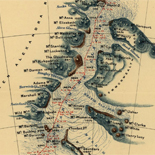
![[Sketch of the battles of Chancellorsville, Salem Church, and Fredericksburg], May 2, 3, and 4, 1863](https://cybercemetery.unt.edu/archive/oilspill/20121227223150im_/http://www.loc.gov/collections/static/civil-war-maps/images/cwh00129.jpg)
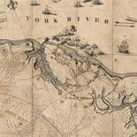
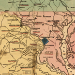
![[Topographical map of part of Washington D.C.].](https://cybercemetery.unt.edu/archive/oilspill/20121227223150im_/http://www.loc.gov/collections/static/civil-war-maps/images/cw0688500.jpg)

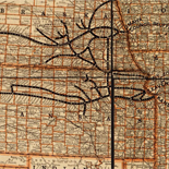
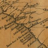
![A correct map of a section of the United States showing the allignment [sic] of the Pittsburgh, Marion, and Chicago Railway between Chewton, Penna. and Marion, Ohio and connections.](https://cybercemetery.unt.edu/archive/oilspill/20121227223150im_/http://www.loc.gov/collections/static/railroad-maps-1828-to-1900/images/rr005350.jpg)

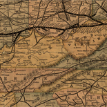
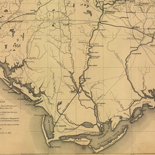
![Sketch-book of positions of forces of 2nd Corps A.N.Va., campaigns of 1864 : [Virginia]](https://cybercemetery.unt.edu/archive/oilspill/20121227223150im_/http://www.loc.gov/collections/static/hotchkiss-maps/images/cwh00003.jpg)
Results
-

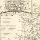
La Floride /
Relief shown pictorially.
Contributor: Sanson, Nicolas Site: American Memory-cultural - Main Catalog Original Format: Map Date: 1657 View catalog record -

Toonneel der steden van de Vereenighde Nederlanden, met hare beschrijvingen /
Dutch. Some maps in Latin.
Contributor: Blaeu, Joan Site: American Memory-cultural - Main Catalog Original Format: Map Date: 1652 View catalog record -

Maps Of Arcadia National Park - National Parks Maps
Early European Maps | British Maps | Nineteenth Century Nautical Charts | Mount Desert Island | USGS Maps | National Park Service Maps of Acadia Map of the Discovery of the East ...
Site: LOC.gov web pages Original Format: Map - Web Page Date: 1999-06-02 -
Maps Of Great Smoky Mountains National Park - National Parks Maps
Early European Maps | American Maps and Map Makers | Exploration and Geological Mapping | Environmental Maps | Early USGS Maps | USGS and the TVA -- Topographic Quadrangle Maps | National ...
Site: LOC.gov web pages Original Format: Web Page - Map Date: 1999-06-02 -

[Map of Lesser Antilles].
Depths shown by soundings.
Contributor: Vinckeboons, Joan Site: American Memory-cultural - Main Catalog Original Format: Map Date: 1650 View catalog record -

Carte des trois Arabies : tirée en partie de l'Arabe de Nubie, en partie de diuers autres autheurs /
Relief shown pictorially.
Contributor: Sanson, Nicolas Site: American Memory-cultural - Main Catalog Original Format: Map Date: 1654 View catalog record -

[Map of California shown as an island].
Relief shown pictorially.
Contributor: Vinckeboons, Joan Site: American Memory-cultural - Main Catalog Original Format: Map Date: 1650 View catalog record -

The Cartographic Setting - Louisiana European Explorations And The Louisiana Purchase
Evolving European and American Conceptions of Louisiana to 1803 Until 1803 the exploration and mapping of the territory acquired by the United States in the Louisiana Purchase was undertaken by the major ...
Site: LOC.gov web pages Original Format: Map - Web Page Date: 2007-08-13 -

Palestina, siue Terræ Sanctæ descriptio /
Relief shown pictorially.
Contributor: Jansson, Jan Site: American Memory-cultural - Main Catalog Original Format: Map Date: 1650 View catalog record -

Mexicque, ou Nouvelle Espagne, Nouvlle. Gallice, Iucatan &c. : et autres provinces jusques a l'Isthme de Panama, ou sont les Audiences de Mexico, de Guadalaiara, ...
Appeared in Sanson's Cartes générales de la géographie ... 1676.
Contributor: Sanson, Nicolas Site: American Memory-cultural - Main Catalog Original Format: Map Date: 1656 View catalog record -

[Map of a part of the island of Cuba and of the Bahamas].
Relief shown pictorially.
Contributor: Vinckeboons, Joan Site: American Memory-cultural - Main Catalog Original Format: Map Date: 1650 View catalog record -

Novvs atlas Sinensis.
Covers 16 provinces of China, Korea, and Japan.
Contributor: Martini, Martino Site: American Memory-cultural - Main Catalog Original Format: Map Date: 1655 View catalog record -
[Map of California shown as an island].
Relief shown pictorially.
Contributor: Vinckeboons, Joan Site: American Memory-cultural - Main Catalog Original Format: Map Date: 1650 View catalog record -
[Map of Lesser Antilles].
Depths shown by soundings.
Contributor: Vinckeboons, Joan Site: American Memory-cultural - Main Catalog Original Format: Map Date: 1650 View catalog record -

America Septentrionalis /
Relief shown pictorially.
Contributor: Jansson, Jan Site: American Memory-cultural - Main Catalog Original Format: Map Date: 1652 View catalog record -

Description du pais des Hurons.
Shows part of Ontario extending from Georgian Bay on the north (Partie du Grand Lac des Hurons) to Lake Ontario on the south and from Lake Huron on the west to Lake ...
Site: American Memory-cultural - Main Catalog Original Format: Map Date: 1651 View catalog record -

Terra sancta sive promissionis, olim Palestina recens delineata, et in lucem edita per Nicolaum Visscher.
Relief shown pictorially.
Contributor: Visscher, Nicolaes Site: American Memory-cultural - Main Catalog Original Format: Map Date: 1659 View catalog record -

Assyria vetvs diuifa in Syriam, Messopotamiam, Babyloniam, et Assyriam /
Available also through the Library of Congress web site as a raster image.
Contributor: La Rue, Philippe de Site: American Memory-cultural - Main Catalog Original Format: Map Date: 1651 View catalog record -

Le Bresil.
From his 1658 (i.e. 1660) Cartes générales de toutes les parties du monde (Phillips 4260).
Contributor: Sanson, Nicolas Site: American Memory-cultural - Main Catalog Original Format: Map Date: 1656 View catalog record -
Plantas das fortalezas, pagodes & ca. da ilha de Ceilão.
Relief shown pictorially only on map of Ceylon as a whole.
Site: American Memory-cultural - Main Catalog Original Format: Map Date: 1650 View catalog record -

Amérique septentrionale /
Relief shown pictorially and by shading.
Contributor: Sanson, Nicolas Site: American Memory-cultural - Main Catalog Original Format: Map Date: 1650 View catalog record -

Paskaarte om achter Yrlant om te zeylen, van Hitlant tot aen Heÿssant.
Available also through the Library of Congress web site as a raster image.
Contributor: Doncker, Hendrick Site: American Memory-cultural - Main Catalog Original Format: Map Date: 1658 View catalog record -
[Map of a part of the island of Cuba and of the Bahamas].
Relief shown pictorially.
Contributor: Vinckeboons, Joan Site: American Memory-cultural - Main Catalog Original Format: Map Date: 1650 View catalog record
Refine your search
Original Format
- Map
- Web Page [3]
Online Format
- Image
- Web Page [3]