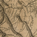
![Carte particulière d'une partie de la Louisianne ou les fleuve et rivierres [i.e. rivières] onts etés relevé a l'estime & les routtes [i.e. routes] par terre relevé & mesurées aux pas, par les Srs. Broutin, de Vergés, ingénieurs & Saucier dessinateur](https://cybercemetery.unt.edu/archive/oilspill/20121227223104im_/http://www.loc.gov/collections/static/louisiana-european-explorations-and-the-louisiana-purchase/images/ct000681.jpg)
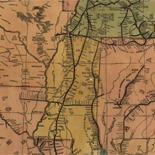
![[Map of Madison County, Va.].](https://cybercemetery.unt.edu/archive/oilspill/20121227223104im_/http://www.loc.gov/collections/static/hotchkiss-maps/images/cwh00046.jpg)

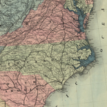
![A correct map of a section of the United States showing the allignment [sic] of the Pittsburgh, Marion, and Chicago Railway between Chewton, Penna. and Marion, Ohio and connections.](https://cybercemetery.unt.edu/archive/oilspill/20121227223104im_/http://www.loc.gov/collections/static/railroad-maps-1828-to-1900/images/rr005350.jpg)


![[January 1, 1945], HQ Twelfth Army Group situation map.](https://cybercemetery.unt.edu/archive/oilspill/20121227223104im_/http://www.loc.gov/collections/static/world-war-ii-maps-military-situation-maps-from-1944-to-1945/images/ict21211.jpg)

![[Sketch of the Manassas battlefield].](https://cybercemetery.unt.edu/archive/oilspill/20121227223104im_/http://www.loc.gov/collections/static/hotchkiss-maps/images/cwh00108.jpg)
![[December 23, 1944], HQ Twelfth Army Group situation map.](https://cybercemetery.unt.edu/archive/oilspill/20121227223104im_/http://www.loc.gov/collections/static/world-war-ii-maps-military-situation-maps-from-1944-to-1945/images/ict21202.jpg)
![Map of the Rappahannock River from [sic] Port Royal to Richards Ferry](https://cybercemetery.unt.edu/archive/oilspill/20121227223104im_/http://www.loc.gov/collections/static/civil-war-maps/images/cw0619600.jpg)
![[Rough sketch of the Rich Mountain battle area extending from Beverly, W. Va. to Clarksburg].](https://cybercemetery.unt.edu/archive/oilspill/20121227223104im_/http://www.loc.gov/collections/static/hotchkiss-maps/images/cwh00078.jpg)

Results
-

Korte beschryvinge van de landschappen des werelts enz.
Scales vary.
Contributor: Visscher, Nicolaes Site: American Memory-cultural - Main Catalog Original Format: Map Date: 1660 View catalog record -

Maps Of Arcadia National Park - National Parks Maps
Early European Maps | British Maps | Nineteenth Century Nautical Charts | Mount Desert Island | USGS Maps | National Park Service Maps of Acadia Map of the Discovery of the East ...
Site: LOC.gov web pages Original Format: Map - Web Page Date: 1999-06-02 -
Maps Of Great Smoky Mountains National Park - National Parks Maps
Early European Maps | American Maps and Map Makers | Exploration and Geological Mapping | Environmental Maps | Early USGS Maps | USGS and the TVA -- Topographic Quadrangle Maps | National ...
Site: LOC.gov web pages Original Format: Web Page - Map Date: 1999-06-02 -

[Nova et accuratissima totius terrarum orbis tabula].
Relief shown pictorially.
Contributor: Blaeu, Joan Site: American Memory-cultural - Main Catalog Original Format: Map Date: 1664 View catalog record -

Nova totius terrarum orbis tabula /
Relief shown pictorially.
Contributor: Wit, Frederik de Site: American Memory-cultural - Main Catalog Original Format: Map Date: 1660 View catalog record -

The Cartographic Setting - Louisiana European Explorations And The Louisiana Purchase
Evolving European and American Conceptions of Louisiana to 1803 Until 1803 the exploration and mapping of the territory acquired by the United States in the Louisiana Purchase was undertaken by the major ...
Site: LOC.gov web pages Original Format: Map - Web Page Date: 2007-08-13 -

Partie septentr, le du royaume d'Irlande, ou sont la province d'Ulster, et partie des prov.ces [sic] de Leinster, et Connaugh.
Available also through the Library of Congress web site as a raster image.
Contributor: Sanson, Nicolas Site: American Memory-cultural - Main Catalog Original Format: Map Date: 1665 View catalog record -

Partie meridio. le du royaume d'Irlande, ou sont la province de Mounster, et partie des prov.ces [sic] de Leinster, et Connaugh.
Available also through the Library of Congress web site as a raster image.
Contributor: Sanson, Nicolas Site: American Memory-cultural - Main Catalog Original Format: Map Date: 1665 View catalog record -

Plano del pt. de Valparayzo cituado en la costa de Chile en 33 gs. de latd. S y en 298 gs. y 40 ms. de ...
Depths shown by soundings.
Contributor: Pérez, Pedro - Pérez, Pedro Site: American Memory-cultural - Main Catalog Original Format: Map Date: 1668 View catalog record -

Nova totivs Americæ descriptio.
Available also through the Library of Congress web site as a raster image.
Contributor: Wit, Frederick de Site: American Memory-cultural - Main Catalog Original Format: Map Date: 1660 View catalog record -

Nova Persiæ, Armeniæ, Natoliæ, et Arabiæ /
Relief shown pictorially.
Contributor: Wit, Frederik de Site: American Memory-cultural - Main Catalog Original Format: Map Date: 1666 View catalog record -

A mapp of Virginia discovered to ye hills, and in it's latt. from 35 deg. & 1/2 neer Florida to 41 deg. bounds of New ...
Relief shown pictorially.
Contributor: Ferrar, John Site: American Memory-cultural - Main Catalog Original Format: Map Date: 1667 View catalog record
Refine your search
Original Format
- Map
- Web Page [3]
Online Format
- Image
- Web Page [3]