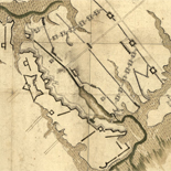
![Carte particulière d'une partie de la Louisianne ou les fleuve et rivierres [i.e. rivières] onts etés relevé a l'estime & les routtes [i.e. routes] par terre relevé & mesurées aux pas, par les Srs. Broutin, de Vergés, ingénieurs & Saucier dessinateur](https://cybercemetery.unt.edu/archive/oilspill/20121227222916im_/http://www.loc.gov/collections/static/louisiana-european-explorations-and-the-louisiana-purchase/images/ct000681.jpg)
![[Sketch of the battles of Chancellorsville, Salem Church, and Fredericksburg], May 2, 3, and 4, 1863](https://cybercemetery.unt.edu/archive/oilspill/20121227222916im_/http://www.loc.gov/collections/static/civil-war-maps/images/cwh00129.jpg)


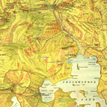
![[Map of parts of Caroline, Hanover, and Henrico counties, Va. west of the Mattaponi River and the Richmond, Fredericksburg, and Potomac Railroad].](https://cybercemetery.unt.edu/archive/oilspill/20121227222916im_/http://www.loc.gov/collections/static/hotchkiss-maps/images/cwh00025.jpg)
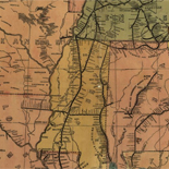
![Map of the Rappahannock River from [sic] Port Royal to Richards Ferry](https://cybercemetery.unt.edu/archive/oilspill/20121227222916im_/http://www.loc.gov/collections/static/civil-war-maps/images/cw0619600.jpg)


Results
-

[Taiwan yu tu]
Bird's-eye-view.
Site: American Memory-cultural - Main Catalog Original Format: Map Date: 1684 View catalog record -

Mediterranean Sea divided into its Principall parts or seas.
Based on La Mer Mediterraneʹe divisee enses Principales Parties, ou Mers by Nicolas Sanson.
Contributor: Berry, William Site: American Memory-cultural - Main Catalog Original Format: Map Date: 1680 View catalog record -

Hai jiang yang jie xing shi quan tu.
Scale ca. 1:760,000.
Site: American Memory-cultural - Main Catalog Original Format: Map Date: 1684 View catalog record -

The Mississippi /
Relief shown pictorially.
Contributor: Franquelin, Jean Baptiste Louis Site: American Memory-cultural - Main Catalog Original Format: Map Date: 1682 View catalog record -

Maps Of Arcadia National Park - National Parks Maps
Early European Maps | British Maps | Nineteenth Century Nautical Charts | Mount Desert Island | USGS Maps | National Park Service Maps of Acadia Map of the Discovery of the East ...
Site: LOC.gov web pages Original Format: Map - Web Page Date: 1999-06-02 -
Maps Of Great Smoky Mountains National Park - National Parks Maps
Early European Maps | American Maps and Map Makers | Exploration and Geological Mapping | Environmental Maps | Early USGS Maps | USGS and the TVA -- Topographic Quadrangle Maps | National ...
Site: LOC.gov web pages Original Format: Web Page - Map Date: 1999-06-02 -

North America divided into its III principall [sic] parts.
Available also through the Library of Congress web site as a raster image.
Contributor: Lea, Philip Site: American Memory-cultural - Main Catalog Original Format: Map Date: 1685 View catalog record -

The Cartographic Setting - Louisiana European Explorations And The Louisiana Purchase
Evolving European and American Conceptions of Louisiana to 1803 Until 1803 the exploration and mapping of the territory acquired by the United States in the Louisiana Purchase was undertaken by the major ...
Site: LOC.gov web pages Original Format: Map - Web Page Date: 2007-08-13 -

A mapp of the travels and voyages of the apostles in their mission and in partiular of Saint Paul.
Relief shown pictorially.
Contributor: Blome, Richard Site: American Memory-cultural - Main Catalog Original Format: Map Date: 1680 View catalog record -

Provincia d[e] S. Diego de Mexico en la nueba España tiene 14 co[n]ventos y desde el d[e] Oaxaca que esta en 17 gra[do]s ael le ...
Bird's-eye view.
Contributor: Ysarti, Antonio Site: American Memory-cultural - Main Catalog Original Format: Map Date: 1682 View catalog record -

Carte de la decouverte faite l'an 1673 dans l'Amerique Septentrionale /
Oriented with north to the right.
Contributor: Marquette, Jacques Site: American Memory-cultural - Main Catalog Original Format: Map Date: 1681 View catalog record -

Peloponnesus hodie Moreæ Regnum : distincté divisum in omnes suas provincias, hodiernas atque veteres, cui et adiuguntur insulæ Cefalonia, Zante, Cerigo et St. Maura /
Relief shown pictorially.
Contributor: Wit, Frederik de Site: American Memory-cultural - Main Catalog Original Format: Map Date: 1688 View catalog record -

L'Asie, : Selon les nouvelles observations de Mess.rs de l'Academie des Sciences, etc. /
Relief shown pictorially.
Contributor: Aa, Pieter van der Site: American Memory-cultural - Main Catalog Original Format: Map Date: 1680 View catalog record -

Bushū Toshima-gun Edo-shō zu.
Scale ca. 1:7,500.
Site: American Memory-cultural - Main Catalog Original Format: Map Date: 1682 View catalog record -

Amérique septentrion.lle [i.e. septentrionale] : composée, corigée, et augmētée, sur les iournaux, mémoires, et observations les plus justes qui en ón'́etes.tes en l'année 1685 & ...
Covers Canada, Hudson Bay region, and eastern United States.
Contributor: Franquelin, Jean Baptiste Louis Site: American Memory-cultural - Main Catalog Original Format: Map Date: 1685 View catalog record -

Carte nouvelle de la mer mediterranee.
Available also through the Library of Congress web site as a raster image.
Contributor: Sanson, Guillaume Site: American Memory-cultural - Main Catalog Original Format: Map Date: 1680 View catalog record -

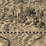
A chart of the Caribe Ilands [sic] /
Oriented with north to the right.
Contributor: Thornton, John Site: American Memory-cultural - Main Catalog Original Format: Map Date: 1680 View catalog record -

Le nouveau Mexique, appelé aussi Nouvelle Grenade et Marata, avec partie de Californie : selon les memoires les plus nouveaux /
Relief shown pictorially.
Contributor: Coronelli, Vincenzo Site: American Memory-cultural - Main Catalog Original Format: Map Date: 1685 View catalog record -

A map of Rariton River, Milstone River, South River ... (1685)
Bibliographic information on back reprinted.
Contributor: Reid, John Site: American Memory-cultural - Main Catalog Original Format: Map Date: 1685 View catalog record -

A new map of the country of Carolina.
Oriented with north toward the right.
Contributor: Gascoyne, Joel Site: American Memory-cultural - Main Catalog Original Format: Map Date: 1682 View catalog record -

Carte de la découverte faite l'an 1673 dans l'Amérique septentrionale.
Oriented with north to the right.
Contributor: Marquette, Jacques Site: American Memory-cultural - Main Catalog Original Format: Map Date: 1681 View catalog record -

[Aihun, Losha, Taiwan, Nei Menggu tu].
Scales differ.
Site: American Memory-cultural - Main Catalog Original Format: Map Date: 1689 View catalog record -

Totius Africæ accuratissima tabula /
Available also through the Library of Congress web site as a raster image.
Contributor: Wit, Frederik de Site: American Memory-cultural - Main Catalog Original Format: Map Date: 1688 View catalog record
Refine your search
Original Format
- Map
- Web Page [3]
Online Format
- Image
- Web Page [3]