

![Plano. I descripcion de la costa, desde el Cavo Cañaveral, hasta cerca de la boca de la Vir[g]inia, contando, costa de Florida, Georgia y Carolinas del S, y N, con todos sus puertos, este[ros ... ]letas, baxos, islas y rios; segun las vlti[mas not]icias, hata [sic] oy Octubre de 1756.](https://cybercemetery.unt.edu/archive/oilspill/20121228144335im_/http://www.loc.gov/collections/static/american-revolutionary-war-maps/images/ct000339.jpg)
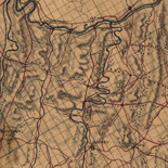
![Map of the Rappahannock River from [sic] Port Royal to Richards Ferry](https://cybercemetery.unt.edu/archive/oilspill/20121228144335im_/http://www.loc.gov/collections/static/civil-war-maps/images/cw0619600.jpg)
![A correct map of a section of the United States showing the allignment [sic] of the Pittsburgh, Marion, and Chicago Railway between Chewton, Penna. and Marion, Ohio and connections.](https://cybercemetery.unt.edu/archive/oilspill/20121228144335im_/http://www.loc.gov/collections/static/railroad-maps-1828-to-1900/images/rr005350.jpg)
![[Base map of Alabama].](https://cybercemetery.unt.edu/archive/oilspill/20121228144335im_/http://www.loc.gov/collections/static/hotchkiss-maps/images/cwh00201.jpg)
![[January 15, 1945], HQ Twelfth Army Group situation map.](https://cybercemetery.unt.edu/archive/oilspill/20121228144335im_/http://www.loc.gov/collections/static/world-war-ii-maps-military-situation-maps-from-1944-to-1945/images/ict21225.jpg)

![[Sketch of the battles of Chancellorsville, Salem Church, and Fredericksburg], May 2, 3, and 4, 1863](https://cybercemetery.unt.edu/archive/oilspill/20121228144335im_/http://www.loc.gov/collections/static/civil-war-maps/images/cwh00129.jpg)
Results
-

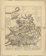
Battle of Brandywine, in which the rebels were defeated, September the 11th 1777, by the army under the command of General Sr. Wam. Howe.
Scale ca. 1:15,200.
Site: American Memory-cultural - Main Catalog Original Format: Map Date: 1777 View catalog record -

Plan of Fort Mifflin on Mud Island, with the batteries on Province Island.
Scale ca. 1:1,750.
Site: American Memory-cultural - Main Catalog Original Format: Map Date: 1778 View catalog record -

Battle of Brandywine in which the Americans were defeated : September the 11th, 1777 by General Sr. William Howe.
Scale ca. 1:15,300.
Contributor: Faden, William Site: American Memory-cultural - Main Catalog Original Format: Map Date: 1784 View catalog record -

[The course of Delaware River from Philadelphia to Chester, exhibiting the several works erected by the rebels to defend its passage, with the attacks made ...
Scale ca. 1:32,400.
Contributor: Faden, William Site: American Memory-cultural Original Format: Map Date: 1777 -

Plan of Genl Du Portail. Plan of the position of Valley Forge after Jany. 1778.
Scale not given.
Contributor: Duportail, Antoine-Jean-Louis Le Bègue de Presle - Duportail, Antoine-Jean-Louis Le Bègue de Presle Site: American Memory-cultural - Main Catalog Original Format: Map Date: 1778 View catalog record -

Mr. Armstrong's rough draft of the country to the west of Susquehanna.
Scale ca. 1:800,000.
Contributor: Armstrong, John Site: American Memory-cultural - Main Catalog Original Format: Map Date: 1755 View catalog record -

This plan of the city of Philadelphia and its environs (showing the improved parts) /
Relief shown by hachures.
Contributor: Hills, John Site: American Memory-cultural - Main Catalog Original Format: Map Date: 1797 View catalog record -

[Survey of region embraced by Somerset, Bedford, and Fulton Counties and including Cumberland, Md.
Scale 1:253,440; 4 miles to an in.
Contributor: Husbands, Hermon Site: American Memory-cultural - Main Catalog Original Format: Map Date: 1770 View catalog record -

British camp at Trudruffrin from the 18th. to the 21st. of September 1777, with the attack made by Major General Grey against the rebels near ...
Scale ca. 1:31,680.
Site: American Memory-cultural - Main Catalog Original Format: Map Date: 1778 View catalog record -
Battle of Brandywine in which the rebels were defeated, September the 11th. 1777, by the army under the command of General Sr. Willm. Howe.
Scale ca. 1:15,480.
Contributor: Faden, William Site: American Memory-cultural - Main Catalog Original Format: Map Date: 1778 View catalog record -

A map of Philadelphia and parts adjacent, /
From Gentleman's Magazine, [1777]
Contributor: Scull, Nicholas Site: American Memory-cultural - Main Catalog Original Format: Map Date: 1777 View catalog record -

Copy of a sketch of the Monongahela, with the field of battle,
Scale not given.
Site: American Memory-cultural - Main Catalog Original Format: Map Date: 1755 View catalog record -

A chart of Delaware Bay and River : containing a full and exact description of the shores, creeks, harbours, soundings, shoals, sands, and bearings of ...
Scale ca. 1:275,000.
Contributor: Fisher, Joshua Site: American Memory-cultural Original Format: Map Date: 1776 -

Captain Snow's sketch.
Scale not given.
Contributor: Snow Site: American Memory-cultural - Main Catalog Original Format: Map Date: 1754 View catalog record -

A plan of the west line or parallel of latitude, which is the boundary between the provinces of Maryland and Pensylvania : a plan of ...
Shows the Mason and Dixon line.
Contributor: Mason, Charles Site: American Memory-cultural - Main Catalog Original Format: Map Date: 1768 View catalog record -

A Sketch of the Battle of German. Tn., 4th October 1777, where the rebels were repulsed.
Scale ca. 1:16,200.
Site: American Memory-cultural - Main Catalog Original Format: Map Date: 1777 View catalog record -

A plan of the city and environs of Philadelphia,
Scale ca. 1:42,000.
Contributor: Scull, Nicholas Site: American Memory-cultural - Main Catalog Original Format: Map Date: 1777 View catalog record -

Pensylvania, Nova Jersey et Nova York cum regionibus ad Fluvium Delaware in America sitis /
Relief shown pictorially.
Contributor: Lotter, Tobias Conrad Site: American Memory-cultural - Main Catalog Original Format: Map Date: 1748 View catalog record -

British camp at Trudruffrin from [sic] with the attack made by Major General Grey against the rebels near White Horse Tavern.
Scale ca. 1:31,680.
Site: American Memory-cultural - Main Catalog Original Format: Map Date: 1777 View catalog record -

A map of Philadelphia and parts adjacent : with a perspective view of the State-House /
Rural buildings shown pictorially with occupants' names.
Contributor: Scull, Nicholas Site: American Memory-cultural - Main Catalog Original Format: Map Date: 1752 View catalog record
Refine your search
Original Format
- Map