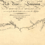
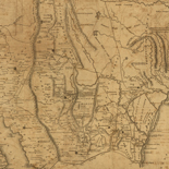
![Carte particulière d'une partie de la Louisianne ou les fleuve et rivierres [i.e. rivières] onts etés relevé a l'estime & les routtes [i.e. routes] par terre relevé & mesurées aux pas, par les Srs. Broutin, de Vergés, ingénieurs & Saucier dessinateur](https://cybercemetery.unt.edu/archive/oilspill/20121229012848im_/http://www.loc.gov/collections/static/louisiana-european-explorations-and-the-louisiana-purchase/images/ct000681.jpg)
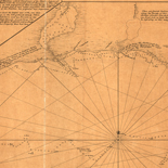
![Amérique septentrion.lle [i.e. septentrionale] : composée, corigée, et augmētée, sur les iournaux, mémoires, et observations les plus justes qui en ón'́etes.tes en l'année 1685 & 1686, par plusieurs particuliés](https://cybercemetery.unt.edu/archive/oilspill/20121229012848im_/http://www.loc.gov/collections/static/discovery-and-exploration/images/ct000667.jpg)

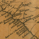
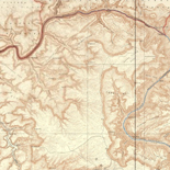
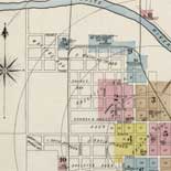
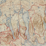
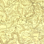
![[Sketches of portions of Madison County, Va.].](https://cybercemetery.unt.edu/archive/oilspill/20121229012848im_/http://www.loc.gov/collections/static/hotchkiss-maps/images/cwh00106.jpg)
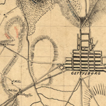
![[Topographical map of part of Washington D.C.].](https://cybercemetery.unt.edu/archive/oilspill/20121229012848im_/http://www.loc.gov/collections/static/civil-war-maps/images/cw0688500.jpg)
Results
-

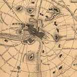
Map of Llano County : showing geology, mineral localities, topography, etc. /
Relief shown by hachures.
Contributor: Roessler, A. R. Site: American Memory-cultural - Main Catalog Original Format: Map Date: 1875 View catalog record -

Map of Palo Pinto County, Texas.
Shows land ownership.
Contributor: Texas. General Land Office Site: American Memory-cultural - Main Catalog Original Format: Map Date: 1879 View catalog record -

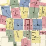
Map of Sullivan County, New York : from actual surveys /
Includes views, statistics of the county and 19 insets.
Contributor: C. Gates & Son Site: American Memory-cultural - Main Catalog Original Format: Map Date: 1856 View catalog record -

Map of Lee County /
Shows landownership.
Contributor: Maxcy, J. W. Site: American Memory-cultural - Main Catalog Original Format: Map Date: 1888 View catalog record -

W. W. Richie's map of Morgan County, Indiana : from official records & actual surveys /
Shows landownership.
Contributor: Currie, G. H. Site: American Memory-cultural - Main Catalog Original Format: Map Date: 1875 View catalog record -

Fannin County, Texas /
Shows landownership.
Contributor: Texas & Pacific Railway. Land Dept Site: American Memory-cultural - Main Catalog Original Format: Map View catalog record -

Illustrated atlas map of Cass County, Illinois : carefully compiled from personal examinations and surveys.
LeGear. Atlases of the United States, 4091
Contributor: W.R. Brink & Co Site: American Memory-cultural - Main Catalog Original Format: Map Date: 1874 View catalog record -

[Map of Nelson and Amherst counties, Va.] /
Relief shown by hachures.
Contributor: Dwight, C. S. Site: American Memory-cultural - Main Catalog Original Format: Map View catalog record -

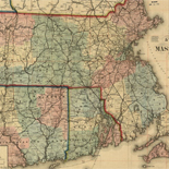
Map of the county of Hampshire, Massachusetts /
Relief shown by hachures.
Contributor: Walling, Henry Francis Site: American Memory-cultural Original Format: Map Date: 1860 -

Irion County / compiled and drawn E. Shutz̀e.
Shows land ownership.
Contributor: Shutz̀e, E. Site: American Memory-cultural - Main Catalog Original Format: Map Date: 1893 View catalog record -

Aransas Co.
Shows land ownership.
Contributor: Texas. General Land Office Site: American Memory-cultural - Main Catalog Original Format: Map Date: 1880 View catalog record -

Map of Elizabeth City CO, VA. : from actual surveys by E.A. Semple, Wm. Ivy and C. Hubbard /
Shows the names of some residents.
Contributor: Semple, E. A. Site: American Memory-cultural - Main Catalog Original Format: Map Date: 1892 View catalog record -

Standard atlas of Marshall County, Indiana : including a plat book of the villages, cities and townships of the county, map of the state, United ...
Includes indexes and portraits of early Marshall County residents.
Contributor: Geo. A. Ogle & Co Site: American Memory-cultural - Main Catalog Original Format: Map Date: 1908 View catalog record -

Atlas of Saunders County, Nebraska : containing maps of townships of the county, maps of state, United States and world, farmers directory, analysis of the ...
Copyright: G.W. Anderson.
Contributor: Anderson Publishing Company Site: American Memory-cultural - Main Catalog Original Format: Map Date: 1916 View catalog record -

Atlas of Lafayette County, Missouri.
Includes index.
Contributor: W.W. Hixson & Co Site: American Memory-cultural - Main Catalog Original Format: Map Date: 1920 View catalog record -

Map of Prince George Co., Va. /
Relief shown by hachures.
Contributor: Sommers, S. L. Site: American Memory-cultural - Main Catalog Original Format: Map Date: 1864 View catalog record -

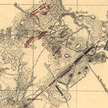
Sketch of Banks Ford.
Shows fortifications and names of some residents on the Rappahannock above Fredericksburg.
Site: American Memory-cultural - Main Catalog Original Format: Map Date: 1863 View catalog record -

Sketch book showing positions of Second Corps, A.N.Va. in engagements of 1864-5 : [Virginia] /
Shows several battles with troop movements and names of some residents.
Contributor: Hotchkiss, Jedediah Site: American Memory-cultural - Main Catalog Original Format: Map Date: 1865 View catalog record -

Map of Dr. Dellinger's mill property with 153 acres of land showing proposed changes of public roads, bridge site &c. /
Shows property in Augusta County, Virginia, near Middle River and names of some residents.
Contributor: Hotchkiss, Jedediah Site: American Memory-cultural - Main Catalog Original Format: Map Date: 1867 View catalog record -

Map of a portion of eastern Virginia, from a map in progress /
Shows names of some residents.
Contributor: Patton, J. Houston Site: American Memory-cultural - Main Catalog Original Format: Map Date: 1864 View catalog record
Refine your search
Original Format
- Map