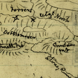
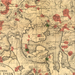
![[Sketches of portions of Madison County, Va.].](https://cybercemetery.unt.edu/archive/oilspill/20121229042935im_/http://www.loc.gov/collections/static/hotchkiss-maps/images/cwh00106.jpg)
![[December 25, 1944], HQ Twelfth Army Group situation map.](https://cybercemetery.unt.edu/archive/oilspill/20121229042935im_/http://www.loc.gov/collections/static/world-war-ii-maps-military-situation-maps-from-1944-to-1945/images/ict21204.jpg)
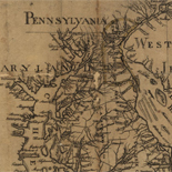
![Carte particulière d'une partie de la Louisianne ou les fleuve et rivierres [i.e. rivières] onts etés relevé a l'estime & les routtes [i.e. routes] par terre relevé & mesurées aux pas, par les Srs. Broutin, de Vergés, ingénieurs & Saucier dessinateur](https://cybercemetery.unt.edu/archive/oilspill/20121229042935im_/http://www.loc.gov/collections/static/louisiana-european-explorations-and-the-louisiana-purchase/images/ct000681.jpg)
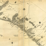
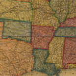
![A correct map of a section of the United States showing the allignment [sic] of the Pittsburgh, Marion, and Chicago Railway between Chewton, Penna. and Marion, Ohio and connections.](https://cybercemetery.unt.edu/archive/oilspill/20121229042935im_/http://www.loc.gov/collections/static/railroad-maps-1828-to-1900/images/rr005350.jpg)
![[December 23, 1944], HQ Twelfth Army Group situation map.](https://cybercemetery.unt.edu/archive/oilspill/20121229042935im_/http://www.loc.gov/collections/static/world-war-ii-maps-military-situation-maps-from-1944-to-1945/images/ict21202.jpg)
Results
-

Aftermath of the Encounter, Exploring the Early Americas
The encounter between the Americas and Europe altered both civilizations. This section covers three dramatic changes: Language and Religion, Competition for Empire, and Documenting New Knowledge.
Contributor: Sir Frances Drake - Amerigo Vespucci - Claudius Ptolemy - Alexander von Humboldt - John Gould - Juan Ponce de León Site: LOC.gov web pages Original Format: Book - Three Dimensional Object - Map - Photo, Print, Drawing - Manuscript - Web Page -

Exploring the Early Americas Overview
Features selections from the more than 3,000 rare maps, documents, paintings, prints, and artifacts that make up the Jay I. Kislak Collection at the Library of Congress.
Site: LOC.gov web pages Original Format: Book - Three Dimensional Object - Map - Photo, Print, Drawing - Manuscript - Web Page -

Peruuiae avriferæ regionis typus /
Shows portion of Central America, northwestern South America, southern United States, and coast of Tamaulipas in Mexico.
Contributor: Ortelius, Abraham Site: American Memory-cultural - Main Catalog Original Format: Map Date: 1584 View catalog record -

S. Augustini : pars est terra Florida, sub latitudine 30 grad, ora vero maritima humilior est, lancinata et insulosa.
Scale not given.
Contributor: White, John - Boazio, Baptista Site: American Memory-cultural - Main Catalog Original Format: Map Date: 1589 View catalog record -
S. Augustini : pars est terra Florida, sub latitudine 30 grad, ora vero maritima humilior est, lancinata et insulosa.
Scale not given.
Contributor: Boazio, Baptista Site: American Memory-cultural - Main Catalog Original Format: Map Date: 1589 View catalog record -

Floridae Americae provinciae recens & exactissima descriptio auctorè Iacobo le Moyne cui cognomen de Morgues, qui Laudōnierum, altera Gallorum in eam prouinciam nauigatione comitat est, ...
Relief shown pictorially.
Contributor: Le Moyne de Morgues, Jacques Site: American Memory-cultural - Main Catalog Original Format: Map Date: 1591 View catalog record -
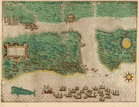
[Map and views illustrating Sir Francis Drake's West Indian voyage, 1585-6].
The first engraving is a map of Drake's voyage [showing Europe, western Africa, northern South America, and eastern North America]; the four other engravings consist of bird's-eye battle plan views of the ...
Contributor: Boazio, Baptista Site: American Memory-cultural - Main Catalog Original Format: Map Date: 1589 View catalog record -

Tabula Mexicae et Floridae : terrarum Anglicarum, et anteriorum Americae insularum, item cursuum et circuituum fluminis Mississipi dicti.
Shows the extent of New Spain and Florida, New France, the American colonies, and the West Indies, rivers, towns, and trade routes.
Contributor: Schenk, Peter Site: American Memory-cultural - Main Catalog Original Format: Map Date: 1710 View catalog record