| Home › Geology | ||||
  |
||||
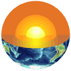
Geology is the study of the Earth. An understanding of Earth processes is essential to help mitigate losses resulting from natural disasters; to sustain the Nation's supplies of water, energy, and mineral resources; to provide for the advantageous development of the Nation's physical and economic infrastructure; and to enhance and preserve the quality of the environment. A significant component of geology involves mapping. Rocks, land surfaces, and currents in the oceans and atmosphere are mapped through direct contact or by using remote sensing from aircraft, satellites, and ships. 
Remote sensing also maps features hidden from view, such as the ocean floor or properties far below the Earth's surface. Geologists also map the location and magnitudes of processes as they change today. Such mapping may include recording surface elevations to measure subsidence, measuring earthquake ground motions, gaging streams gaging to determine rates and volumes of river flows, measuring gas emissions from volcanoes to forecast eruptions, or monitoring levels of water tables. Geologist also make maps that reconstruct such processes throughout the history of the Earth's 4.6 billion years. This information is fundamental to the sound management of our lands, water, and other natural resources. It improves the safety, health, and well-being of Americans. A general geologic map by itself provides an extraordinary
The National Atlas of the United States® includes a variety of maps germane to geology. The Geologic Map of the United States was derived from the first national geologic map put together since the advent of plate tectonics, a theory that created a revolution in our knowledge of the Earth and its history. The map has been produced at a scale that is appropriate for use as an overview of the geology of the entire country. Also included in the National Atlas is a dynamic map known as the Tapestry of Time and Terrain. This multimedia package has many intriguing features that weave together the topographic texture of the conterminous United States with its patterns of geologic time. In addition, more specialized maps related to geology are included in the National Atlas: maps devoted to specific hazards, such as landslides, earthquakes, and volcanoes; a shaded relief map that looks like an aerial photograph; maps that characterize energy and mineral resources and operations; and a series of rather technical maps that display many of the complex patterns associated with the Earth's magnetic field, which is vital for managing telecommunication systems. |
||||
National Atlas of the United States® and The National Atlas of the United States of America® are registered trademarks of the United States Department of the Interior Help us improve the National Atlas Privacy Statement, Disclaimer, Accessibility, FOIA http://www.nationalatlas.gov/geology.html Last modified: Monday, 14-Jan-2013 17:18:04 CST |
 |
|
 amount of information that is revealed through an understanding of what
the maps represent and what their colors and codes symbolize. The color
patterns on geologic maps show the distribution of various geologic materials
at the surface of the Earth. These materials include bedrock, which forms
the framework of the continent and is composed of solid rock materials,
such as granite, limestone, and sandstone; surface materials, which are
granular, often loose, materials that are deposited by wind, water, and
ice or forms in place through the chemical and physical effects of weathering;
and geologic
amount of information that is revealed through an understanding of what
the maps represent and what their colors and codes symbolize. The color
patterns on geologic maps show the distribution of various geologic materials
at the surface of the Earth. These materials include bedrock, which forms
the framework of the continent and is composed of solid rock materials,
such as granite, limestone, and sandstone; surface materials, which are
granular, often loose, materials that are deposited by wind, water, and
ice or forms in place through the chemical and physical effects of weathering;
and geologic  structures,
which are places where the rocks have been broken or crumpled by pressure,
resulting in, for example, faults, fractures, and folds. Map colors and
symbols indicate the age of these various materials and how they relate
to one another in space and time. Geologic maps also provide information
on the physical properties of geologic materials and can depict the sequence
of events that produced the materials and structures represented on the
map. Such information may reveal geologically recent events, such as volcanic
activity or evidence of earthquakes that can alert communities to potential
geologic hazards for which there is no historic record. Depending on its
scale and the amount of detail it depicts, a geologic map can serve as
a database for environmental decisions, land use planning, and/or mineral
exploration.
structures,
which are places where the rocks have been broken or crumpled by pressure,
resulting in, for example, faults, fractures, and folds. Map colors and
symbols indicate the age of these various materials and how they relate
to one another in space and time. Geologic maps also provide information
on the physical properties of geologic materials and can depict the sequence
of events that produced the materials and structures represented on the
map. Such information may reveal geologically recent events, such as volcanic
activity or evidence of earthquakes that can alert communities to potential
geologic hazards for which there is no historic record. Depending on its
scale and the amount of detail it depicts, a geologic map can serve as
a database for environmental decisions, land use planning, and/or mineral
exploration. 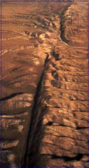 Geologic
maps were once based entirely on the work of geologists who would traverse
an area on foot or horse, recording on maps the character of rocks exposed
at the surface. This information was compiled to form geologic maps representative
of the region under study. Today, many more techniques are available,
from the sophisticated interpretation of aerial photographs to remote
sensing by satellites. Each new method has provided additional types of
data so that modern geologic maps contain an extraordinary wealth of vital
information. This information is of interest, and often of critical importance,
to a wide variety of users, including Federal, State, and local government
agencies, oil and gas exploration companies, land use planners, environmentalists,
hikers, and landowners of all types. It is used to support a broad variety
of decisions involving energy and mineral resource estimates of public
lands, planning for waste repositories and cleanup, seismic evaluations,
water quality assessments, resource management plans, geologic hazards
evaluation, and transportation planning.
Geologic
maps were once based entirely on the work of geologists who would traverse
an area on foot or horse, recording on maps the character of rocks exposed
at the surface. This information was compiled to form geologic maps representative
of the region under study. Today, many more techniques are available,
from the sophisticated interpretation of aerial photographs to remote
sensing by satellites. Each new method has provided additional types of
data so that modern geologic maps contain an extraordinary wealth of vital
information. This information is of interest, and often of critical importance,
to a wide variety of users, including Federal, State, and local government
agencies, oil and gas exploration companies, land use planners, environmentalists,
hikers, and landowners of all types. It is used to support a broad variety
of decisions involving energy and mineral resource estimates of public
lands, planning for waste repositories and cleanup, seismic evaluations,
water quality assessments, resource management plans, geologic hazards
evaluation, and transportation planning.