Science Features
 Loading Page...

Tucked inside the rocket payload fairing, the next Landsat satellite is ready to ride into space at Vandenberg AFB, CA. Courtesy of NASA.
Currently known as NASA’s Landsat Data Continuity Mission (LDCM), the satellite will be renamed Landsat 8 after three months of extensive testing. Operational control will then be transferred to USGS.
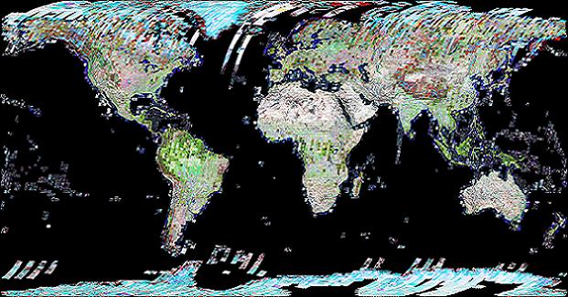
Landsat 8 will extend the longest continuous and comprehensive record of the Earth’s land as viewed from space. As the world’s population surpasses seven billion people, the impact of human society on the planet is increasing. The continuation of Landsat’s four-decade look at Earth will help monitor those impacts and more accurately forecast future environmental change.
Seeing beyond human sight
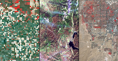
Landsat data can assist a broad range of specialists in managing the world’s food, water, forests, and other natural resources for a growing world population.
Landsat images from space are not just pictures. They contain many layers of data collected at different points along the visible and invisible light spectrum. Consequently, Landsat images can show where vegetation is thriving and where it is stressed, where droughts are occurring, where wildland fire is a danger, and where erosion has altered coastlines or river courses.
Landsat satellites give us a view as broad as 12,000 square miles per scene while describing land cover in units the size of a baseball diamond. From a distance of more than 400 miles above the earth surface, a single Landsat scene can record the condition of hundreds of thousands of acres of grassland, agricultural crops, or forests.
Landsat images reveal subtle, gradual changes, such as Wyoming rangelands greening up after a drought, as well as massive landscape changes that occur in rapidly growing urban areas. Landsat can also provide broad assessments of sudden natural or human-induced disasters, such as the number of acres charred by a forest fire or the extent of tsunami inundation. Landsat data have been used to monitor water quality, glacier recession, sea ice movement, invasive species encroachment, coral reef health, land use change, deforestation rates, and population growth.
Free data for innovation

The Wallow Fire, named for the Bear Wallow Wilderness area where the fire originated, was the biggest fire recorded in Arizona. Nearly 6,000 people were evacuated. Landsat 7, June 7, 2011.
The Department of the Interior (DOI) policy of unrestricted access and free distribution of Landsat data encourages researchers everywhere to develop practical applications of the data. Specific, purpose-driven applications of Landsat data can serve commercial endeavors in agriculture and forestry; they can enable land managers in and out of government to work more efficiently; they can assist scientists in defining and assessing critical environmental issues.
With its long-term historical record of the entire globe and widely recognized high quality of data, Landsat is valued all over the world as the gold standard of land observation. Ready access to authoritative Landsat images provides a reliable common record of Earth conditions that advances the mutual understanding of environmental challenges by citizens, researchers, and decision makers around the globe.
Interior and Landsat from the start
In 1966, at the start of the Landsat era, Interior Secretary Stewart Udall announced Interior’s new Project EROS, the acronym for Earth Resources Observation Satellites. In a statement that echoes to this day, Udall said, “…the time is now right and urgent to apply space technology towards the solution of many pressing natural resources problems being compounded by population and industrial growth.” 2007 video
Udall’s announcement was a catalyst for what eventually became the world’s first civilian land-imaging satellite, developed by NASA and launched on July 23, 1972.
USGS role in observing Earth

Mississippi River flooding near Memphis, Tenn., 2011. The 2006 image (left) shows the river in a more normal state, while the 2011 image (right) shows massive flooding. Landsat 5.
USGS and NASA have distinct roles in the Landsat program. NASA develops remote-sensing instruments and spacecraft, launches satellites, and validates their performance. The USGS then assumes ownership and operation of the satellites, in addition to managing ground-data reception, archiving, product generation, and distribution.
USGS has managed the operations of two Earth observing satellites — Landsat 5 and 7 — for over a decade. Recently, USGS announced that, after nearly three decades of service, Landsat 5 would be decommissioned over the coming months, bringing to a close the longest-operating Earth observing satellite mission in history.
Launched in 1984, Landsat 5 orbited the planet over 150,000 times while transmitting over 2.5 million images of land surface conditions around the world, long outliving its original three-year design life.
Vital observations by Landsat 5 of the Mount Saint Helens eruption, Antarctica, the Kuwaiti oil fires, the Chernobyl disaster, rainforest depletion, major wildfires and floods, urban growth, global crop production, and ice shelf expansion and retreat have helped increase our understanding and awareness of the impact of humans on the land.
Landsat 7, launched in 1999, continues to provide daily information about our planet from space, although an instrument problem reduces the amount of data it collects.
Observing tomorrow
The LDCM/Landsat 8 satellite carries two instruments, the Operational Land Imager (OLI) and the Thermal Infrared Sensor (TIRS). Advanced technology increases the reliability and sensitivity of these instruments, while the improved measurements are still compatible with the past Landsat data record.
The technical capabilities of LDCM/Landsat 8 move forward in three areas in comparison to Landsat 7: increased spectral coverage; higher data precision (the ultimate resolution is not changed); and increased quantity of data collection (60% more scenes per day). Landsat 8 will orbit Earth once every 99 minutes at an average altitude of 438 miles (705 kilometers), repeating the same ground track every 16 days.
Landsat 8 data is expected to be available within 100 days of launch from the USGS data archive.
Watching the launch
Further information
USGS Landsat Missions (latest satellite status and related information)
Landsat Data Continuity Mission (NASA)
Landsat: A Global Imaging Program (USGS Fact Sheet)
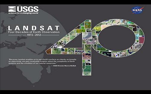
NASA-USGS 40th Anniversary of Landsat (July 2012)
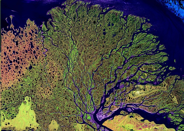
Earth as Art (a collection of Landsat scenes created for aesthetic purposes)
BBC interview on Landsat with Matt Larsen, USGS Associate Director
Landsat history (NASA)
What is the Economic Value of Satellite Imagery? (USGS Professional Paper)
The next Landsat satellite: The Landsat Data Continuity Mission (scholarly article)
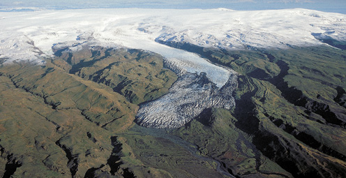
The extent and distribution of the world’s ice, primarily in the form of glaciers, provide insight about changes in the Earth’s climate and changes in sea-level. Read more
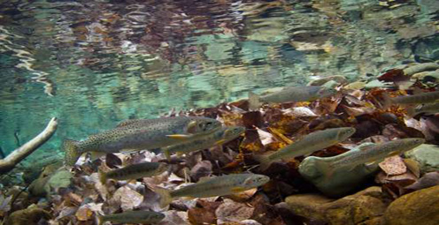
The recent past sheds light on preserving the future of economically and ecologically important native trout populations across the West. Read more

Washington, D.C., is a unique city full of landmarks and buildings that are recognizable worldwide. But how were these stone giants built? Read more
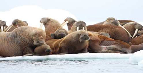
Watch USGS scientists in the Arctic track Pacific walruses to examine how these animals are faring in a world with less sea ice. Read more
The world's longest-running Earth-observing satellite program.
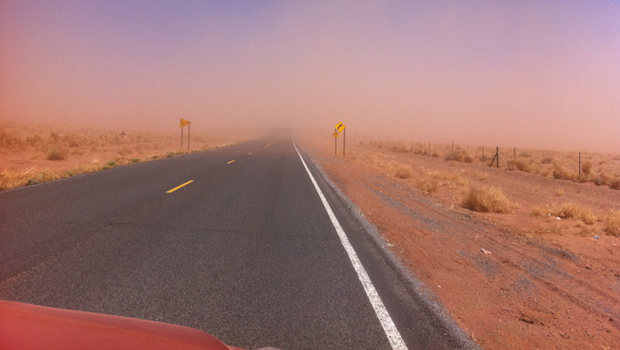
Dust storms July 21-22 blinded motorists, grounded flights and knocked out electricity. What’s causing the dust storms?
The majority of the nation is facing dry conditions; in most areas drought conditions are expected to persist or intensify. Read more
A contest to celebrate 40 years of Landsat. Read more
Please comment on the USGS’ draft science strategies! Read more

Timing is everything! Consider helping track changes in spring’s arrival
Need a historical map for your genealogy research? You are in luck. We’ve got what you need! Download and view USGS historical maps from the comfort of your own home.
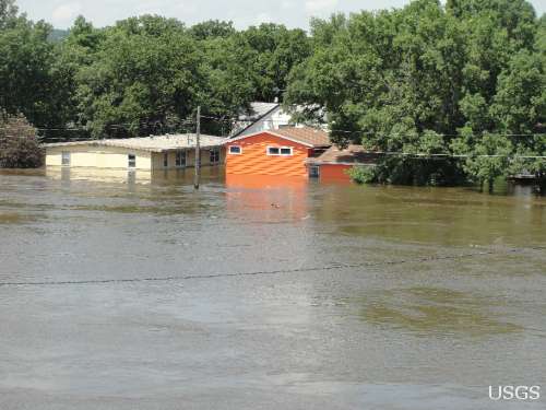
Flood Safety Awareness Week is March. 12-16. What can you do to prepare?
National Groundwater Awareness Week is Mar. 11-17, 2012. See how USGS science is connecting groundwater and surface water.
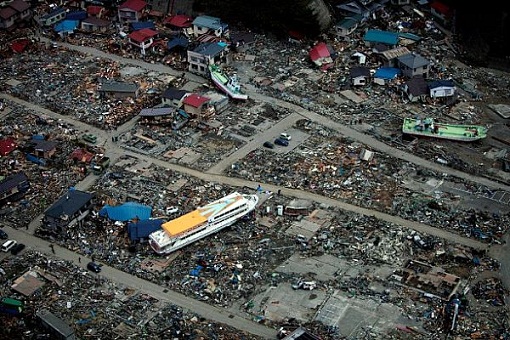
Since Japan’s March 11, 2011, Tohoku earthquake and subsequent tsunami, scientists at the USGS have learned much to help better prepare for a large earthquake in the United States.

Five USGS employees honored with Distinguished Service Awards for their service to the nation
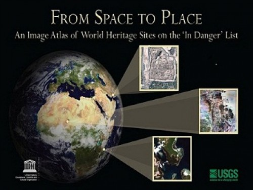
The USGS and UNESCO have produced a book that gives us a new way to look at our shared global heritage.
Groundwater in aquifers on the East Coast and in the Central U.S. has the highest risk of contamination from radium, a naturally occurring radioactive element and known carcinogen.
The proposed USGS budget reflects research priorities to respond to nationally relevant issues, including water quantity and quality, ecosystem restoration, hydraulic fracturing, natural disasters such as floods and earthquakes, and support for the National Ocean Policy, and has a large R&D component.

Caribou expert Layne Adams discusses the lives of reindeer — apart from their famous role on Christmas Eve. How they survive the cold.
Climate science is helping to predict food shortages, identify impacts on human health, and prepare for future conditions.
As demand grows, Landsat data can help us track trends in key resources. Remote-sensing satellites help scientists to observe our world, monitor changes, and detect critical trends in forestry, water, crops, and urban landscapes. Learn more.
A new study provides crucial information for difficult decisions regarding conservation, economic interests, and food and water security. Projected changes for 2010-2099

It's only the beginning of their careers, but these 3 young scientists have forged ahead with innovative research at the frontiers of science. How they've transformed their fields
Oct. 9-15, 2011, is Earth Science Week, themed "Our-Ever Changing Earth," and Oct. 12, 2011, is International Day for Natural Disaster Reduction. Answers to questions posed by a changing world
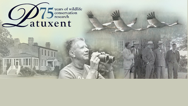
By 1936, devastating losses of wildlife populations were threatening the Nation’s natural resource heritage. America's first wildlife research center

A dust storm on Tuesday, October 4, blinded motorists and caused a large string of motor vehicle crashes, multiple injuries, and at least one death. What’s causing the dust storms?
USGS scientists study walruses off the northwestern Alaska coast in August as part of their ongoing study of how the Pacific walrus are responding to reduced sea ice conditions in late summer and fall.
USGS scientists are collecting water samples and other data to determine trends in ocean acidification from the least explored ocean in the world.
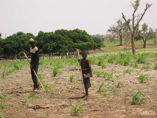
In support of the Famine Early Warning Systems Network, USGS scientists use satellite remote sensing to assess agricultural conditions that foretell famine.
New USGS research shows that rice could become adapted to climate change and some catastrophic events by colonizing its seeds or plants with the spores of tiny naturally occurring fungi. The DNA of the rice plant itself is not changed; instead, researchers are re-creating what normally happens in nature.
Now that field work has wrapped up at the Ice Age "Snowmastodon" fossil site near Snowmass Village, Colo., USGS and other scientists will begin work on unraveling the climate and environmental history of the area.
USGS scientists are studying the Earth’s conditions 3 million years ago to gain insight into the impacts of future climate. Join us Aug. 3 in Reston, Va., to learn how this information is used to better understand the magnitude of changes forecast for the end of this century.
USGS crews continue to measure streamflow and collect water quality and sediment samples in the Ohio and Mississippi River basins using state-of-art instruments.
Over the past four decades, about 14% of the ice and permanent snow of Washington's Mount Rainier has melted due to combined recent warming and reduced precipitation.
USGS science supports management, conservation, and restoration of imperiled, at-risk, and endangered species.
In a unique application of data, this year's report provides the nation's first assessment of birds on public lands and waters.
The USGS, NASA, and other organizations and Federal agencies are studying how climate change affects wildlife and ecosystems.

Using coral growth records and measurements of changing ocean chemistry from increased atmospheric CO2, USGS scientists are providing a foundation for predicting future impacts of ocean acidification and sea-level rise to coral reefs.
Increased dust storm activity may result from enhanced aridity in the Southwest, according to a USGS study.
Provide your input on the draft USGS Global Change Science Strategy by April 8, 2011.
Sea-ice habitats essential to polar bears would likely respond positively should more curbs be placed on global greenhouse gas emissions, according to a new modeling study published today in the journal, Nature.
Landscape photos taken in the same place but many years apart reveal dramatic changes due to human and natural factors. The USGS Desert Laboratory Repeat Photography Collection, the largest archive of its kind in the world, is 50 years old.
Decreasing pH and warming temperatures are changing ocean conditions and affecting coral and algal growth in South Florida. USGS scientists are conducting field measurements to learn more.
Many coastal wetlands worldwide including several on the U.S. Atlantic coast may be more sensitive than previously thought to climate change and sea-level rise in the this century.
USGS findings support recent predictions that climate change will stress ecosystems at lower elevations more than higher elevations. This information may guide future conservation efforts in helping decision makers develop regional landscape predictions about biological responses to climate changes.
The Earth as Art 3 collection, the latest set of Landsat satellite images selected for their artistic quality, reveals an intricate beauty in Earth’s natural patterns.
USGS scientists are investigating sea turtles and their habitats in Dry Tortugas National Park to provide insight that will be used as decision-support tools for managing coral ecosystems.
Looking for information on natural resources, natural hazards, geospatial data, and more? The USGS Education site provides great resources, including lessons, data, maps, and more, to support teaching, learning, K-12 education, and university-level inquiry and research.
The timing of animal migration and reproduction, and observing when plants send out new leaves and bear fruit, is increasingly important in understanding how climate change affects biological and hydrologic systems. Photo credit Copyright C Brandon Cole.
The United States Group on Earth Observations (USGEO) is working to connect Earth observations with public health, agriculture, climate, and data management and dissemination.
USGS studies the relationships among earth surface processes, ecological systems, understanding current changes in the context of prehistoric and recent earth processes, distinguishing between natural and human-influenced changes, and recognizing ecological and physical responses to changes in climate.
The USGS Science Strategy is a comprehensive report to critically examine the USGS's major science goals and priorities for the coming decade. The USGS is moving forward with these strategic science directions in response to the challenges that our Nation's future faces and for the stewards of our Federal lands.

7 p.m.—Public lecture (also live-streamed over the Internet)

USGS-led survey finds that national wildlife refuges rate highly with visitors.

As the climate has warmed, many plants are starting to grow leaves and bloom flowers earlier. A new study published in the journal, Nature, suggests that most field experiments may underestimate the degree to which the timing of leafing and flowering changes with global warming.

Stressed agricultural lands may be releasing less of the moisture needed to protect the breadbasket of a continent.

Spring rains in the eastern Horn of Africa are projected to begin late this year and be substantially lower than normal.

In recognition of World Forestry Day, let’s take a glimpse at USGS science to understand the fate of forests from climate change.

A new study concludes that fossil fuel emissions are likely contributors to a substantial amount of organic carbon found on glaciers in Alaska. Fossil fuel emissions, which contain organic carbon, can speed up the rate of glacier melt when deposited on glacier surfaces. In addition, the organic molecules associated with these deposits can be transportedContinue Reading

The U.S. Geological Survey had a very busy 2011 — below are a few of our highlights from last year.

Despite news articles warning of large-scale releases of methane due to climate change, recent research indicates that most of the world’s gas hydrate deposits should remain stable for the next few thousand years.
Join us on February 1 to view the Earth from space, and discuss the profound impact Landsat has on many facets of our economy, safety, and environment.

Scientists have discovered an outbreak of coral disease called Montipora White Syndrome in Kāneohe Bay, Oahu. The affected coral are of the species Montipora capitata, also known as rice coral.
USGS scientists will join thousands of scientists, managers, and decision makers in Boston this week to present new findings on toxics at the Society for Environmental Toxicology and Chemistry (SETAC) conference in the Hynes Convention Center, Nov. 13-17.

On Nov. 3, USGS scientists Patrick Barnard and William Ellsworth will present a public lecture in Menlo Park, CA, providing Bay Area residents information about USGS research in the San Francisco Bay Area, including recent discoveries beneath San Francisco Bay and ongoing studies to better understand earthquake probabilities and the potential hazards associated with strong ground shaking.

Rivers and streams in the United States are releasing substantially more carbon dioxide into the atmosphere than previously thought.

Climate Change Impacts to Tribal Communities The USGS is working with Native American communities and organizations to understand climate change impacts to their land and neighborhoods. Projects include interviews with indigenous Alaskans to understand their personal observations of climate change, as well as studying how climate change is impacting sand dunes and posing risksContinue Reading

As climate changes, it affects the timing of when leaves emerge, the amount of foliage that grows as well as the timeframe when leaves begin to fall.

How will accelerated glacial melting over the next 50 years as a result of climate change affect the unique Gulf of Alaska and Copper River coastal ecosystems? USGS scientists are studying these processes and impacts.

USGS scientists are assessing the potential to remove CO2 from the atmosphere for storage in other Earth systems through a process called carbon sequestration.

![]() U.S. Department of the Interior |
U.S. Geological Survey
U.S. Department of the Interior |
U.S. Geological Survey
URL: www.usgs.gov/blogs/features/usgs_top_story/observing-tomorrow-continuing-landsats-long-look-at-our-changing-world/?from=title
Page Contact Information: Ask USGS
Page Last Modified: September 14, 2011


