Computing GPS Orbits
Throughout most of the history of the U.S. access to accurate coordinates for arbitrary points within the country could only be obtained by measured differential vectors from a set of physical reference points with published coordinates. The coordinates for the reference points themselves were determined by prior geodetic observations relating them. Those latter observations were collected by the National Geodetic Survey (NGS) and collaborating groups over many years using classical methods.
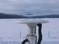
Since the advent of satellite geodesy in the 1960s but especially after the Global Positioning System (GPS) came into widespread use in the late 1980s, the technology to access accurate coordinates for arbitrary points has evolved significantly. Now it is no longer necessary to rely on a specific physical reference marker(s) with previously determined coordinates, at least not directly. Instead, a user equipped with an appropriate GPS antenna and receiver can determine their position with respect to published positions of the GPS satellites rather than to a nearby marker. The accuracy of the user-determined position is directly related to the accuracy of the GPS orbit information used and it is assumed that the priori orbit positions were determined with respect to some global fiducial network of tracking stations. Considering the current deployment of additional Global Navigation Satellite Systems (GNSS) to complement GPS, most recent developments have focused on multi-GNSS data though GPS remains the core of present capabilities.
Since the early 1990s, NGS has contributed to enabling such GPS/GNSS access to the national spatial reference system by computing high-accuracy GPS orbits. This work has been done together with and as a component of the International GNSS Service (IGS), which coordinates the collection of GNSS tracking data from a global network of reference stations.