StreamStats has the ability to analyze the stream network upstream and downstream from a user-selected point and to identify and provide information for other points of interest that are located along the network. This functionality is known as "stream-network navigation" or "network tracing." An explanation of stream networks is needed before this functionality can be fully understood and utilized.
A stream network is a digital representation of streams and constructed channels for a given area as would be seen on an aerial photograph or on a topographic map. As with photographs and maps, stream networks can be shown at various scales, with smaller scales having less detail than larger scales. In a digital stream network, connecting lines are drawn through lakes, wetlands, bridges, culverts, and any other features where the stream channel is not visible from maps or photographs, thus eliminating any breaks in the linear network. Area features such as lakes, ponds, and wide rivers are represented by polygons. Points represent locations of interest, such as dams, streamgages, diversions, and wastewater discharges. These features are referred to as point events, which have been indexed to the stream network. Features attributed to lengths along a stream, such as an impaired reach, are represented as reach events.
Reaches in the network are segments of surface water with similar hydrologic characteristics. Reaches are commonly defined by a length of stream between two confluences, or a lake or pond. Each reach is assigned a unique reach number and a flow direction. The length of the reach, the type of reach, and other important information are assigned as attributes to each reach. Point and reach events are assigned addresses that consist of the reach number and the percentage of the distance along the reach from the downstream end, making it possible to navigate upstream or downstream from a selected point to locate the events.
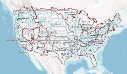
Network navigation is enabled on two different stream networks in StreamStats, the National Hydrography Dataset (NHD) and the National Hydrography Dataset Plus (NHDPlus). The NHD was developed by the USGS in cooperation with numerous other federal, state, and local agencies. Medium-resolution (1:100,000 scale) and high-resolution (1:24,000 scale) versions of the NHD are available nationally as seamless datasets, with higher resolution data available in some areas. Detailed information on the NHD and access to available data can be found on the NHD Web site.
The NHDPlus was developed through a partnership between the USGS and the U.S. Environmental Protection Agency (EPA). The NHDPlus has combines the medium-resolution NHD with a digital elevation model with 30-meter grid spacing to produce several derivative datasets that enable the definition of the land surface areas (catchment) that contribute flow to each stream reach, and numerous stream reach and catchment area attributes, such as reach slope, mean flow, and velocity estimates. Detailed information on the NHD and access to available data can be found on the NHDPlus Web site.
StreamStats has several tools that use stream-network navigation, including Raindrop Trace to Network, Show Network Path and Profile, Trace from Outlet, Ad Hoc Trace, Configure NHD Trace, and Estimate Flows Based on Similar Streamgaging Stations. These tools and how to use them are fully explained in the StreamStats User Instructions. The tools are used for navigation upstream or downstream along a chosen stream network and identification of features along the network. The starting point for a trace can be the outlet of a previously delineated drainage basin or any user-selected site along a stream. Tracing works only within the bounds or 4-digit hydrologic units in the Watershed Boundary Dataset (WBD).
The Configure NHD Trace tool is used before a trace is done to specify the network (NHD or NHDPlus) to be used, the direction of the trace, and the map layers that will participate in the trace. The map layers could consist of any types of features, such as dams and streamgaging stations, which have been associated to the stream network by means of a reach address. The Configure NHD Trace tool also allows users to load their own layer of indexed points for tracing. When the trace process is completed, a window will appear that contains a listing of any features found from the trace, and if available, links from the features to additional information about them.
The primary benefit of the trace functionality is to understand how the flow at a particular site of interest may be affected by upstream features or how downstream flow may be affected by existing or proposed activities at the selected site. The USGS has indexed a subset of the National Inventory of Dams dam locations and USGS streamgaging and water-quality stations to the NHD. The EPA and many state and local agencies have indexed numerous water-related datasets to the NHDPlus, and many similar efforts are underway. The layers that are available for tracing in StreamStats will vary by state and with time.
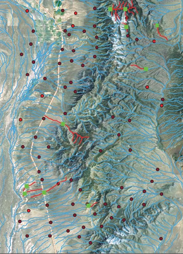
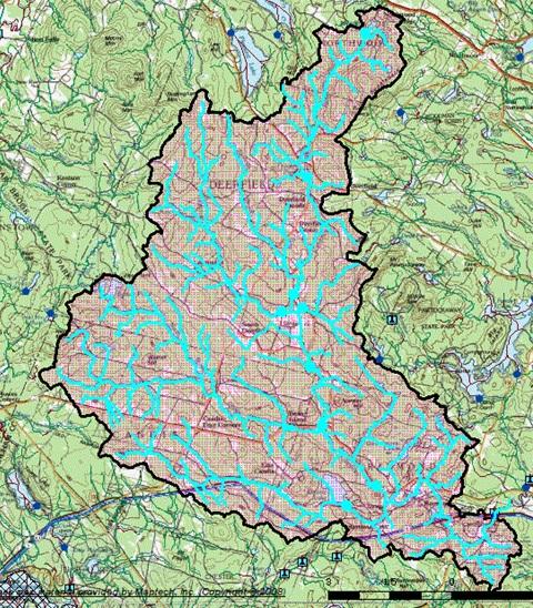
Below is a view of the StreamStats map frame that illustrates the results of an upstream trace for a selected point on a stream in New Hampshire, represented as a dark blue dot with red cross-hairs near the bottom right on the map. The drainage area for the selected site is shown as magenta with a black boundary. The part of the stream network and the point events that were found in the trace are shown in cyan. The accompanying report indicates that five water-quality stations, all of which also are streamgages, and one additional streamgage, as well as three dams, were found in the upstream trace. Users can obtain information for each of the reaches and the water-quality and streamgaging stations identified in the trace.
For more information on StreamStats, please see
http://streamstats.usgs.gov/index.html