
- GIS Research
- GIS Applications: Federal Government
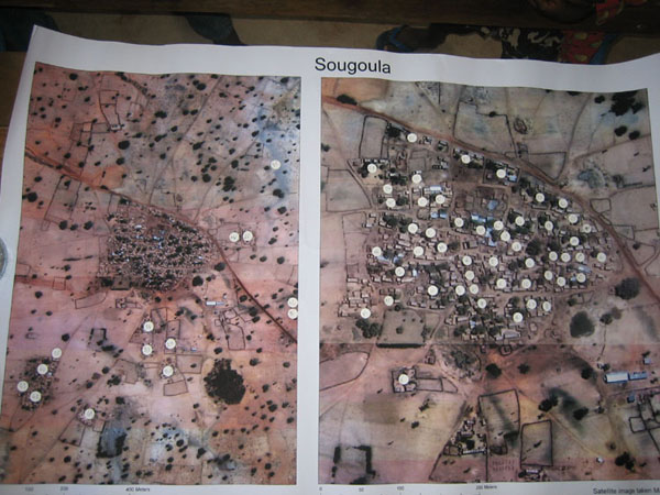
- Satellite Images of Mali Villages
GIS Applications
Satellite Images of Mali Villages
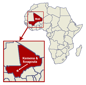
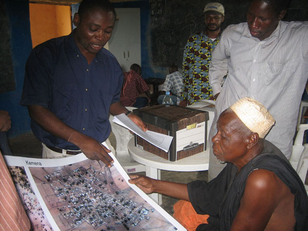
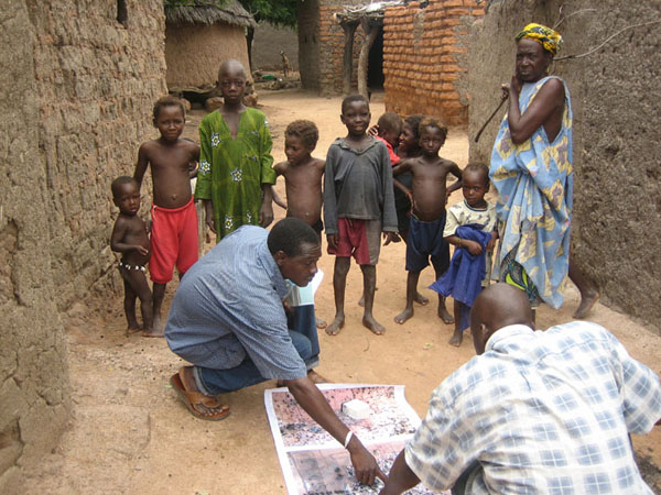
Workers from the Laboratory of Malaria and Vector Research at the National Institute of Allergy and Infectious Disease (NIAID) visited the villages of Kemena and Sougoula in Mali, Africa, as part of an effort to control leishmaniasis (a parasitic disease spread by the bite of infected sand flies). They presented the village chiefs with maps of their villages created from satellite imagery with assistance from NCI GIS staff. The photographs below show these maps and their use in planning the placement of sand fly traps. The field team reports that the maps were instrumental in discovering an area of the villages that was not covered by the traps.
"I wanted to share a few photos of the last trip to Mali when they gave the village chiefs the posters. They were completely amazed. It was interesting trying to explain how the pictures were taken. It was also interesting how, without ever seeing a bird's-eye view of their village before, they were able to orient themselves and find their house. The posters also helped our field team realize that they had overlooked an area of trees a few meters from the village that would be good habitat for sand flies. They can use the maps to decide where to place the sand fly traps and expand the collection area in hopes of finding infected flies."
- Dr. Jennifer Anderson, IRTA Postdoctoral Fellow at NIAID
-
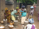
Arriving at the village.
-

Showing the satellite images to the chief.
-

Planning fly trap placement.
-

Completed trap plan.

For more information on leishmaniasis and this research project, see:
- NIAID – Laboratory of Malaria and Vector Research, Vector Molecular Biology Unit
Principal Investigator: Jesus Valenzuela, Ph.D. - International Centers for Excellence in Research - University of Mali, Bamako, Mali, Malaria Research Training Center
Principal Investigator: Seydou Doumbia - Leishmania Infection Information