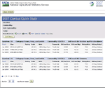
Find and download agricultural statistics for every state and county in the United States.
While Quick Stats is the best source of county level data from NASS, acreage and yield maps of county crop estimates are available here.
County data reference items
- County Data Release Schedule
- County and District Geographic Boundaries
- County and District Codes
- Commodity Codes
- Livestock County Estimates
Special Tabulations are publishable, resummarized data tables from the Census of Agriculture or NASS surveys. Requests for Special Tabulations are considered when the requested data are not published elsewhere.
 CropScape is a geospatial data service which offers advanced tools such as interactive visualization, web-based data dissemination and geospatial queries and automated data delivery to systems such as Google Earth.
CropScape was developed in cooperation with the Center for Spatial Information Science and Systems at George Mason University and is hosted their website.
![]()
Land Use Strata for Selected States
To query Census of Agriculture data, please use the dropdown below. To view the Census publications, click here:
 Quick Stats 2.0 Beta
Query the Census of Agriculture database to retrieve customized
tables with Census data at the national, state and county levels as far back as 1997.
Last modified: 06/30/10
- Query NASS Data from a Data Base
- Search for Data by Commodity
- Ask a specialist
- View Data in Charts and Maps
- Request a Blank Survey Form
- Understanding Agricultural Statistics
- Data Quality Measures
- Request a Special Tabulation
- Dairy Products Mandatory Program
- Citation Request


