Home > NCEP Quarterly Newsletter
NCEP Quarterly Newsletter - October 2012
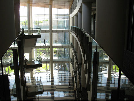
Entrance to the NOAA Center for Weather and Climate Prediction
Click image to zoomClick image to zoom
As of August 24, 2012, NCEP has completed its move into the new NOAA Center for Weather and Climate Prediction (NCWCP).
After nearly 40 years in the eight story World Weather Building located just off the Washington Beltway in Camp Springs, MD, five NCEP centers are now relocated at a brand new 268,000 sq. ft. facility located in College Park, MD, designed to facilitate scientific collaboration and the transition of research to operations. The five NCEP centers located at the NCWCP are NCEP's Central Operations, the Environmental Modeling Center, the Climate Prediction Center, the Hydrometeorological Prediction Center and the Ocean Prediction Center.

Approaching the NCWCP, one is immediately impressed by its sweeping architecture and modern design. While many may not see past the aesthetics of the building, behind that beauty are practical advantages designed into its layout and organization. From its very conception, the NCWCP was designed to facilitate collaboration and be a concrete demonstration of the one NOAA theme. The NOAA organizations (which in addition to the 5 NCEP centers, include two NESDIS organizations and OAR's Air Resources Laboratory) housed within its walls, while having a variety of missions, were deliberately placed in locations in the building to ease and increase the collaborations among them. The large amounts of open space, and a variety of meeting rooms and common areas also work to foster collaboration effectively.

The NCWCP is a candidate for gold certification by the U.S. Green Building Council's LEEDTM Green Building Rating System, which sets standards for green buildings, verifying that the building is environmentally responsible, profitable, and healthy for occupants. It was built from a water sensitive site plan, using materials with recycled and local content, and using highly efficient glass. Sunshades have been incorporated into the design on the south side of the building to optimize energy performance. More than 60 percent of the roof surface is covered with low growing plants for better insulation and protection. Outside are bio-retention areas, a storm water cistern to collect water for irrigation, and a four-story rainwater waterfall to efficiently drain the roof. Inside, day lighting sensors for the lighting systems, occupancy sensors, waterless urinals and dual-flush toilets have been installed. As well, carpets, paints and coatings were selected to preserve the quality of the indoor air.

NCEP looks forward to many exciting and successful years in this new facility.
Entrance to the NOAA Center for Weather and Climate Prediction
Atrium at the NOAA Center for Weather and Climate Prediction

Figure 1. Redundant core routers connecting the NCWCP and its wide area network
Click image to zoomClick image to zoom
The NOAA Center for Weather and Climate Prediction (NCWCP) ribbon cutting was held on October 15, 2012 (see http://www.ncep.noaa.gov/news/ncwcp/) and was a celebration of a once-of-a-lifetime milestone for many of us.
For NCEP Central Operations (NCO), this was the conclusion of a long journey that began almost a decade ago. NCO first became involved when an initial consultant study laid out the preliminary IT infrastructure and budget for the NCWCP. Soon after this study was conducted, NCO was charged with leading design and implementation of the common IT infrastructure for all NCWCP tenants.
Figure 1. Redundant core routers connecting the NCWCP and its wide area network
IT installation began in facility in early February, 2012. The first IT infrastructure implemented was a state-of-the-art wide area network and the redundant core routers, shown in Figure 1, that interconnect NCWCP with this network.
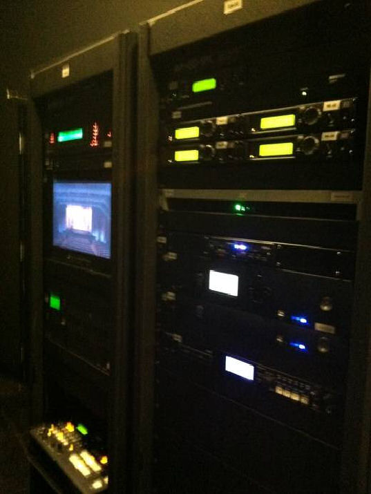
Figure 2. A/V tele-conference equipment for the NCWCP auditorium
NCO worked closely with NESDIS, Air Resources Lab, the other four NCEP Centers in NCWCP, and the NOAA CIO office to lead the planning and execution of the common IT services serving the multiple NOAA NCWCP tenants. These services include a robust high speed network, a Voice Over Internet Protocol (VOIP) phone system, building-wide wireless networking, common IT helpdesk services, facilities and data center integration, IT security, and a state-of-the-art audio visual (A/V) infrastructure for the auditorium and conference center. A/V and virtual tele-conference equipment for the 500 seat auditorium is pictured in Figure 2. The technical approach leveraged common IT infrastructure to provide effective and innovated IT solutions at the lowest possible price for all tenants.

The decade of IT planning came together in the final months of FY12 with NCO leading the charge bringing up the IT infrastructure and ensuring the IT infrastructure worked for all NCWCP tenants. At the same time, NCO led the IT efforts of vacating the World Weather Building (WWB) with decades of entrenched IT structures. The overall IT execution was near flawless and NCWCP was up and running without losing a single operational product.


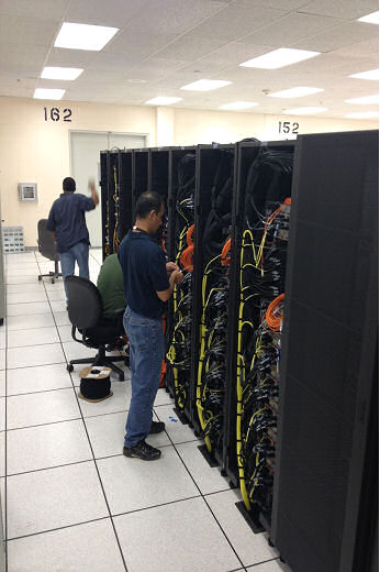
Gyre being installed in the Orlando, FL facility in early October 2012.
Click image to zoomClick image to zoom
The Weather and Climate Operational Supercomputing System (WCOSS) project provides NCEP with its next generation of high performance computing for the production of weather, climate, ocean, and space weather operational guidance.
The project includes a five to ten year contract with IBM to provide two new supercomputers that are upgraded every two to three years. The project, launched a year ago, has delivered the first of two new systems in Reston, VA. The new primary system, named Tide, is undergoing IBM/NOAA acceptance testing and exceeded all benchmark performance requirements during the October 18, 2012 live test demonstration. The second system, named Gyre, is installed in Orlando, FL and is undergoing IBM's pre-acceptance testing.

The next major milestone in the project was reached in October as the transition team of more than 260 scientists and IT professionals started working on Tide, porting and testing NOAA's operational high performance computing software systems and applications to the new system.

Gyre being installed in the Orlando, FL facility in early October 2012.

The transition team, comprised of development staff from across NCEP, NWS and NOAA, is successfully leveraging previous transition work performed on the NOAA Research and Development supercomputers Zeus and Gaea to port and test software systems on Tide and Gyre.

The project is on schedule to complete transition to Tide and Gyre by the end of FY13.

Tide and Gyre will each be a 208 TeraFLOP system, containing 10,048 cores, 2.59 PetaBytes of useable storage, installed with Intel Sandy Bridge processors running RedHat Linux. For WCOSS questions please email Luis.Cano@noaa.gov.

Service Center Activities
FAA Air Traffic Control Center in Warrenton, VA.
Click image to zoomClick image to zoom
Federal Aviation Administration (FAA) Systems Operations held their annual End of Season Review (EOSR) and the General Collaborative Decision Making (CDM) meeting at MITRE-CAASD in McLean, VA, October 23-25, 2012.

Aviation Weather Center (AWC) Domestic Operations Branch Chief, Debra Blondin, and National Aviation Meteorologists, Mike Eckert and Brandon Smith, attended the review, along with personnel from the FAA Air Traffic Control System Command Center (ATCSCC), FAA enroute and terminal facilities, domestic and international airlines, business aviation, and the NWS Office of Climate, Water, and Weather Services (OCWWS). The discussions centered on ways to improve the management of the National Airspace System (NAS) by enhancing collaboration and utilizing decision support services and tools.

The AWC National Aviation Meteorologists (NAMs) have proved to be invaluable to the traffic managers and specialists at the FAA ATCSCC. The NAMs provide direct decision support on weather impacts across the NAS. FAA National Operations Manager, Jim Bedow, says "The NAMs are a great asset to the facility and provide outstanding insight to aviation weather impacts for traffic flow management." The AWC's Aviation Weather Testbed (AWT) has also provided several new tools for traffic flow management including the Aviation Weather Statement (AWS), a test product produced by the NAM focusing on aviation impacts caused by convection across the northeast United States, and the Extended Convective Forecast Product (ECFP) planning tool which is based on the Short-Range Ensemble Forecast (SREF)Calibrated thunder guidance. Furthermore, AWC received accolades from both industry and government partners for the enhanced version of the experimental Aviation Winter Weather Dashboard (AWWD) which has been released for use for the 2012-2013 winter season for the Core 29 airports and alternates.

FAA Air Traffic Control Center in Warrenton, VA.

Beijing International Airport Forecast Office
Click image to zoomClick image to zoom
As weather and international air travel are independent of borders, aviation meteorology requires strong international relationships. The Aviation Weather Center (AWC), one of the few forecast centers in the world with global forecasting responsibility, constantly works to build these relationships.
During calendar year 2012, the AWC will have hosted meteorologists from the United Kingdom (UK), Brazil, Germany, Canada, Taiwan, Japan and South Korea, while visiting China, Canada and Peru. The AWC also maintains a strong relationship with its World Area Forecast Center (WAFC) counterpart in the UK, to the point where the AWC and UK exchange service backup responsibilities.
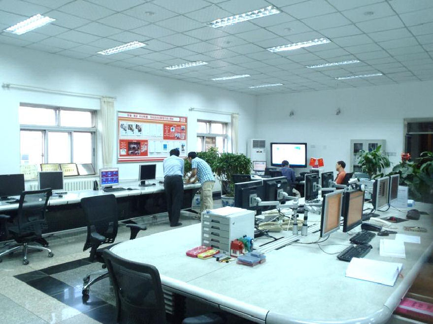
Beijing International Airport Forecast Office

The AWC recently began efforts to expand its ongoing training relationship with the Civil Aviation Authority of China (CAAC). In recent years, the Asia-Pacific region has experienced the world’s strongest growth in air travel, making the CAAC a critical partner in providing weather for safe and efficient world airspace travel. As part of this effort, International Operations Branch Chief Matt Strahan visited the CAAC’s training center in Beijing, along with their Beijing Airport Forecast Office and their Aviation Meteorological Center, which is similar to the AWC.

The intention of both the AWC and CAAC is to expand the current one week per year of training that AWC provides to 20-25 CAAC meteorologists. The expanded program would be modeled after the Hydrological Prediction Center’s (HPC) South American training desk, where visiting South American meteorologists gain experience by issuing forecasts for South America during a four month tour of duty at HPC. The AWC version of the training desk would start with Chinese meteorologists, but would eventually offer opportunities to meteorologists from other Asian countries. The advantages of such a program would be safer air travel across Asia, and improved data sharing between the United States and Asian countries.


Dr. Kevin Trenberth addresses workshop attendees at the 37th Climate Diagnostics and Prediction Workshop Banquet.
Click image to zoomClick image to zoom
The 37th Climate Diagnostics and Prediction Workshop (CDPW), hosted by Colorado State University (CSU) and the Cooperative Institute for Research in the Atmosphere (CIRA), and co-sponsored by the Climate Prediction Center (CPC) of the National Centers for Environmental Prediction and the National Climatic Data Center (NCDC), was held October 22-25, 2012 in Fort Collins, Colorado.
This meeting brought together approximately 140 climate scientists from around the United States and the world, including scientists from Nigeria and China. 8 students were granted travel awards to attend the conference and to present their work. Attendees represented diverse affiliations from various US federal agencies, international government agencies, universities, and private sector companies. Through presentations and interaction, many of those that attended were able to learn about new scientific methods, technology usage, and to begin building potential partnerships. Many also learned about new products and tools that will be useful in their field that they were previously unaware of.

The themes of the conference included the following: 1) improving forecast skill and technique, 2) understanding tropical and extratropical variability (including ENSO, the MJO, and the annular modes), 3) attribution of high impact weather and climate events, 4) improving climate services, and 5) drought and the hydrologic cycle. In regards to the last theme, a joint session was held with the Climate Program Office’s Drought Task Force on the last day of the workshop.

Dr. Kevin Trenberth addresses workshop attendees at the 37th Climate Diagnostics and Prediction Workshop Banquet.

Keynote speakers during the meeting included Dr. Randy Dole, deputy director for research in the Physical Sciences Division of the Earth System Research Laboratory, who discussed the attribution of climate events, and Dr. Eric Maloney, professor at Colorado State University, who discussed new understanding of MJO dynamics. A poster event with ~35 presenters was held on Tuesday evening. During the formal banquet on Wednesday evening, Dr. Kevin Trenberth discussed "The New Normal" and the way scientists should consider viewing weather events in relation to a changing climate.


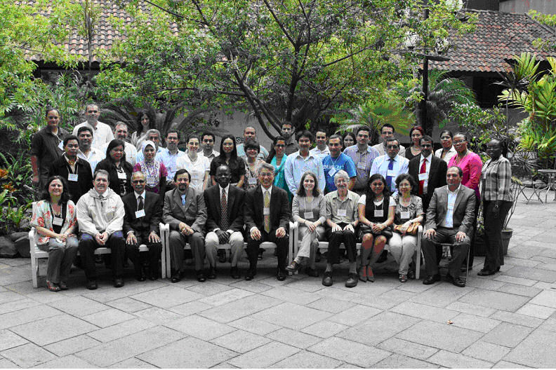
Group Picture for the Fourth International Training Workshop Climate Variability and Predictions – Pacific Basin, San Jose, Costa Rica, 17 August, 2012.
Click image to zoomClick image to zoom
NCEP's Climate Prediction Center (CPC) led the Fourth International Training Workshop Climate Variability and Predictions (4ITWCVP) - Pacific Basin.
The training workshop was held in San Jose, Costa Rica, 8 – 17 August 2012. It is part of a series of global climate training workshops primarily funded by the US Agency for International Development (USAID) and conducted by the National Oceanic and Atmospheric Administration (NOAA). Dr. Wassila Thiaw of CPC is NOAA's point of contact for the workshop. For the 4ITWCVP, the Korean Meteorological Administration (KMA), the Asian Pacific Economic Commission (APEC) Climate Center (APCC), the World Meteorological Organization (WMO), and the University Corporation for Atmospheric Research (UCAR) were cosponsoring agencies and provided support to the workshop. The objective of the training workshop was to increase the capacity of institutions in the Pacific basin in climate monitoring, predictions, and climate risk assessment and to enhance climate services. The workshop had 30 participants from countries in Central America, South America, and Southeast Asia, and included professional meteorologists from National Meteorological Services (NMSs), and scientists and students from universities and other institutions. The lecturers were drawn from expertise in several agencies, including APCC, International Research Institute for Climate and Society (IRI), KMA, NOAA's CPC, the Servicio Meteorologico Nacional of Mexico, the University of Buenos Aires in Argentina, the University of Costa Rica, USAID, and WMO. A total of 20 one hour lectures were given and 33 hours of onsite labs based on seasonal rainfall prediction conducted. All lectures are posted on the CPC web site:
http://www.cpc.ncep.noaa.gov/products/international/workshop/costa-rica/
Group Picture for the Fourth International Training Workshop Climate Variability and Predictions – Pacific Basin, San Jose, Costa Rica, 17 August, 2012.

ARRFEX participants discuss the numerical models before making their forecast. (Photo credit: Dave Novak, HPC). From left to right: Ben Moore (ESRL), Yan Luo (EMC), Kenny James (HPC), Victor Stegemiller (NWRFC), and Jon Rutz (Univ. Utah).
Click image to zoomClick image to zoom
The Hydrometeorological Testbed at the Hydrometeorological Prediction Center (HMT-HPC) hosted the 2012 Atmospheric River Retrospective Forecasting Experiment (ARRFEX) at the new NOAA Center for Weather and Climate Prediction (NCWCP) from September 17-28, 2012.
The experiment was a collaborative effort between HMT-HPC and the NOAA Earth Systems Research Laboratory (ESRL), Physical Sciences Division.

Seventeen forecasters, model developers and researchers came together to participate in experimental forecasting exercises to help identify techniques that can be used to improve forecasts of atmospheric river (AR) timing, duration, location and quantitative precipitation. During the experiment, participants analyzed eight AR-induced heavy precipitation events that impacted the West Coast of the United States during the 2009-2012 cool seasons. The participants used a combination of operational and experimental guidance products to create forecasts of quantitative precipitation (QPF) and of probability of quantitative precipitation (PQPF), in pseudo real-time for each event. The experimental guidance featured the high-resolution (9 km) HMT-ensemble, as well as probabilistic guidance from ESRL's second generation reforecasting dataset. After issuing the experimental forecasts, participants were asked to compare their forecast, as well as guidance from various operational and experimental datasets, to the observed precipitation for each event.

These activities served not only to identify biases, trends, and weaknesses of the guidance, but also to examine the viability of using probabilistic forecasts to increase awareness of extreme precipitation events at 3- and 5-day lead times. Preliminary results show that higher resolution ensembles may provide increased value in forecasting extreme precipitation amounts, and that the analog approach used by the reforecast dataset helps alert forecasters to the potential for an extreme event. Given these results, the HMT-HPC will work to transfer these datasets into operations.

ARRFEX provided a valuable opportunity to allow forecasters, researchers and model developers to work together in a pseudo real-time forecasting environment. This collaboration will continue to lead to further development and enhancement of forecast guidance and datasets that will help advance the predictability of extreme precipitation events in the future.

ARRFEX participants discuss the numerical models before making their forecast. (Photo credit: Dave Novak, HPC). From left to right: Ben Moore (ESRL), Yan Luo (EMC), Kenny James (HPC), Victor Stegemiller (NWRFC), and Jon Rutz (Univ. Utah).

Wallace Hogsett (HPC Science and Operations Officer) and Ed Danaher in front of the WWB representing two extremes. Wallace worked at the WWB for a few days, and Ed for a few decades.
Click image to zoomClick image to zoom
The following was contributed by Ed Danaher, Chief of the Forecast Operations Branch of NCEP's Hydrometeorological Prediction Center.

Several meteorological components of NOAA were located in the World Weather Building, commonly known as the WWB, from 1974 through 2012. It was always referred to as the WWB despite the prominent "NOAA Science Center" logo on the front of the building. When I began my career at the WWB in NOAA with NESDIS (National Environmental Satellite Service, NESS back then) in May 1974, the main operational units of NESDIS and the National Meteorological Center (NMC, later NCEP) were in Federal Office Building 4 (FOB4) in Suitland, MD. Only a few units had relocated from FOB4 to the brand new and much nicer WWB. The Washington forecast office, called a Weather Service Forecast Office (WSFO) in those days, was on the third floor of the WWB. NESDIS had a few staff in the building on the sixth floor, where the computers to generate sectors from the new GOES satellites were installed. There was a shuttle bus that brought paper maps hourly to the WWB from NMC in FOB4 and shuttled people back and forth. NMC operations and most other units that became part of NCEP relocated to the WWB in 1975. At that time the building was not fully occupied by NOAA. The building owner occupied the 8th floor and Allstate Insurance (and possibly others) had offices on the first floor. There was no food service, although a few vending machines were added in the late 70s or early 80s.

For the first few years the building had no guards or security. The building was not locked at night. In those days before the internet, I would often come into the building nights or on days off to look at the map display that was always kept current in the fourth floor briefing room where map discussion was held. My memories of those map discussions are quite vivid, and were of a different type than now held at HPC. If the managers present could get the presenter flustered, they won. The managers won a lot.

The technology at the time included teletype and fax machines. Text products were typed on typewriters by forecasters and retyped on teletypes by meteorological technicians (met techs). Forecasters used grease pencils to draw their maps on acetates (they weren't yet "graphics") and met techs redrew them neatly onto paper preprinted with background maps to be scanned into fax circuits. Radar and satellite data were much more limited than today. In the 1980s the WSFO relied on a fax machine to show radar imagery from Patuxent River. The images were monochrome with three levels of gray updated every 10 or 15 minutes. Satellite imagery was available via fax (one picture every 30 minutes). But the occupants of the WWB were lucky! Four times a day the 5th floor NESDIS photo lab distributed a 16 mm movie loop. There was a small room off to the side of the WSFO with a 16 mm projector where the loops of satellite imagery could be projected and viewed. This was a luxury shared by few forecast offices.

Model data were much more limited compared to today. If I recall accurately, in the 70s we had two runs per day of the 6-layer PE global model. The LFM went out to 24 hours, then was extended to 36 hours and then 48 hours, and the barotropic model was still taken seriously. There were more people doing less work. For example, surface analysis was a branch with its own Branch Chief. Six or eight meteorologists (probably interns) manually plotted the observations on the paper charts, which had been cut into segments corresponding to the teletype circuits then taped together for analysis. Three meteorologists prepared the analysis. Today surface analysis at HPC is handled by one person per shift, and that person has additional duties at times.

The technology gradually changed as workstations replaced paper, and more model data became available, but the physical environment didn't change much. Gradually NOAA took over the commercial space and by the 1990s, occupied the entire building. But the most significant changes I saw during my more than three decades in the WWB were in the science used in the preparation of forecasts. In the 70s, forecasters were limited to paper output from the models with a very basic set of parameters. With the coming of workstations, forecasters were able to look at multilevel gridded output and the level of science soared.

I don't want to leave the impression that those were difficult times to be a forecaster. In many ways, forecasting was more fun back then when the tools were cruder and you relied more on your experience and aptitude and felt great when you made a good forecasts.

While I have many fond memories of the WWB, both the opportunities to work there and the people I've had the honor and pleasure of working with, I am enjoying the much-improved facilities here in the NCWCP. The new building lends itself to more efficient operations and is a welcome change for HPC forecasters. Because of this I am happy to move on and leave the WWB behind. It was a big part of my life, certainly, but a chapter that is closed now and can recede into happy memories for me to savor in those far distant times in the future when I grow old. The letters WWB will no longer be a part of my life, but only a memory.

Or so I thought. A few weeks after leaving the WWB I bought a new car and they were accompanied by new license plates. Totally by chance they begin with three letters. You guessed it: WWB.
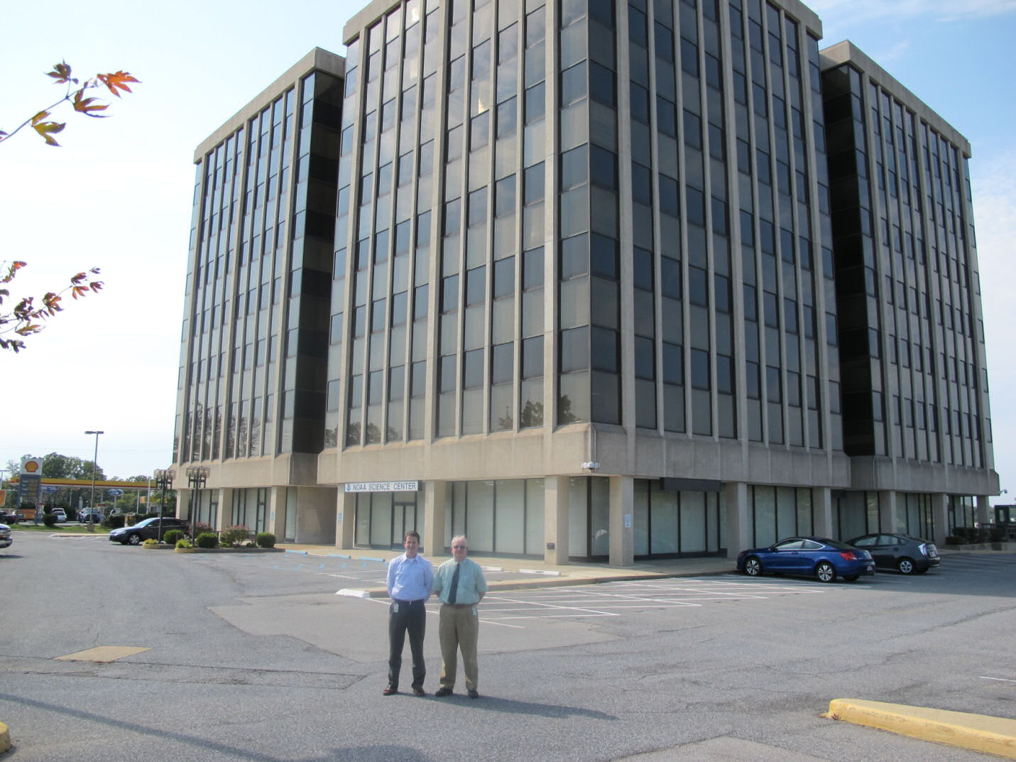
Wallace Hogsett (HPC Science and Operations Officer) and Ed Danaher in front of the WWB representing two extremes. Wallace worked at the WWB for a few days, and Ed for a few decades.

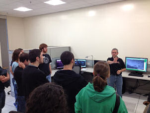
NCO, Scott Jacobs, providing a demonstration of the AWIPS II National Center Perspective software to students from Millersville University.
Click image to zoomClick image to zoom
The NAWIPS Migration Project continues to move forward with two Forecaster Initial Testing (FIT) sessions in September and October, 2012.
The primary focus of the testing was to confirm correction of problems uncovered in previous testing sessions that were fixed by NCO Systems Integration Branch staff. The most critical problem was system performance, in particular the speed at which data is loaded and displayed for the forecaster.

The FIT sessions proved successful in many respects. Participants were able to verify that system performance has improved greatly, and the system is now at or beyond acceptable levels for several test cases. While some areas still require attention, it was clear to the testers that the system has the capacity to perform adequately in an operational environment once the remaining issues are addressed. About 90% of previously submitted trouble reports were cleared, further demonstrating that AWIPS2 functionality is nearing that of the legacy NAWIPS system. Only about 50 new tickets were created, none of which identified a large gap in functionality. Most testers had the time to explore the National Centers Perspective in CAVE (Common AWIPS Visualization Environment) and visualize how they could do their work more effectively with the new technology and implementation. Testers and software developers worked side-by-side to discuss and explore new ideas and concepts that could improve efficiency and be implemented once the system is accepted.

Much work remains to be done before AWIPS II can be declared operational, however the latest FIT testing clearly demonstrated that this new system will be the system of the future for NCEP forecast operations.

For NAWIPS migration to AWIPS II questions, please email Michelle.M.Mainelli@noaa.gov
NCO, Scott Jacobs, providing a demonstration of the AWIPS II National Center Perspective software to students from Millersville University.
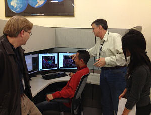
NCO, David Plummer (second from right), discussing AWIPS II Software with members of his team. (From left to right:  Greg Hull, Jun Wu, and Shova Gurung)
NCO, David Plummer (second from right), discussing AWIPS II Software with members of his team. (From left to right: Greg Hull, Jun Wu, and Shova Gurung)

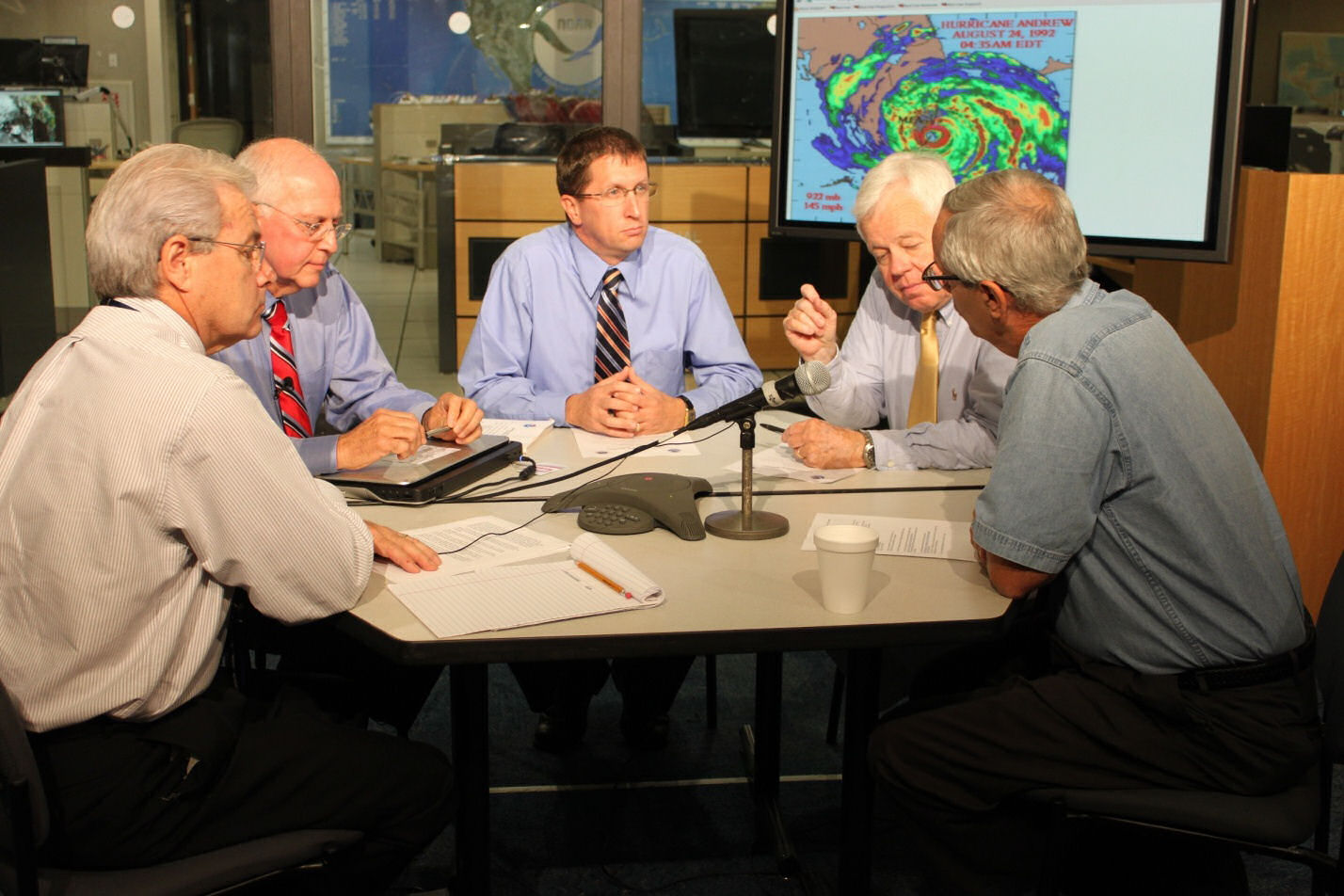
Left to right: Dennis Feltgen, Max Mayfield, Dr. Rick Knabb, Director; Dr. Hugh Willoughby, and Dr. Frank Marks, during the media teleconference.
Click image to zoomClick image to zoom
NHC hosted a media teleconference on July 24, 2012, to mark the 20th anniversary of Hurricane Andrew, the last Category Five hurricane to strike the United States.
A panel of experts was assembled to discuss the experience of forecasting Hurricane Andrew, advances made in hurricane forecasting since 1992 and remaining goals and challenges in hurricane research and forecasting. The panel included Rick Knabb, Ph.D., Director, NOAA's National Hurricane Center; Frank Marks, Ph.D., Director, NOAA's Hurricane Research Division; Max Mayfield, Hurricane Specialist, WPLG-TV Miami (NHC hurricane specialist in 1992), and Hugh Willoughby, Ph.D., Professor, Department of Earth and Environment, Florida International University (HRD Director in 1992).

The teleconference was moderated by Dennis Feltgen, NOAA Communications Public Affairs Officer at NHC. Each panelist provided their personal and professional insight of Andrew, and was followed by questions from the nearly three dozen media members on the call.

Left to right: Dennis Feltgen, Max Mayfield, Dr. Rick Knabb, Director; Dr. Hugh Willoughby, and Dr. Frank Marks, during the media teleconference.

National Hurricane Center Director Dr. Rick Knabb provides a television update on “Isaac” as the storm threatens the Caribbean and the U.S.
Click image to zoomClick image to zoom
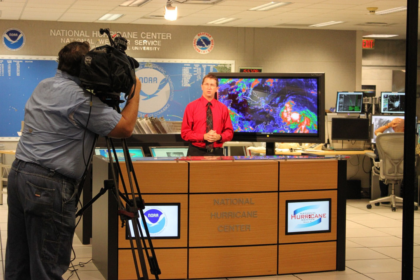
Hurricane Isaac proved to be a prolonged media event at NOAA's National Hurricane Center in Miami.
The NHC media pool was in operation for five days (August 25 to 29). More than 80 on-camera television interviews were provided to national outlets, and another 70 to local outlets. Several Miami-area TV stations sent cameras to NHC to broadcast live from the Center. Live top-of-the-hour updates were made available on the Internet and as an audio-podcast. NHC also made use of social media to get the message out, with a tweet sent at the issuance of every new advisory. NHC's Facebook page was updated with new posts every few hours, gaining more than 28,000 new "likes" and reaching an audience of 2.5 million visitors during the Isaac event.
National Hurricane Center Director Dr. Rick Knabb provides a television update on “Isaac” as the storm threatens the Caribbean and the U.S.

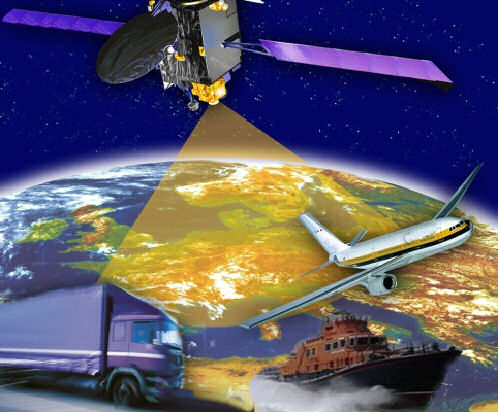
European Geostationary Navigation Overlay Service, ESA
Click image to zoomClick image to zoom
On September 5-6, 2012, NCEP's Space Weather Prediction Center (SWPC) staff participated in an International workshop on extreme space weather: "Geomagnetic storms, GNSS disruptions and the impact on vital functions in society" in Stockholm City Conference Center, Stockholm, Sweden.
The meeting was hosted by the Swedish Civil Contingency Agency (MSB), which is the agency responsible for emergency planning and response in Sweden.
European Geostationary Navigation Overlay Service, ESA
Over the past few years there has been a surge of interest around the world in studying the risks from extreme space weather, and a number of countries are currently reviewing their planning and preparedness to cope with these risks. At the European level, the European Commission organized a "Space Weather Awareness Dialogue" last October, gathering select number of experts. The general conclusion from this event was the need for continued international cooperation to increase knowledge, establish relevant networks and build resilience across national borders. More focused workshops on specific topics were called for to help advance this cause.

In response, over 40 policy shapers and experts from government, industry and academia from North America and Europe attended the MSB workshop in Sweden. Representatives from the US (NOAA and FEMA), Canada, and several European nations as well as from the European Commission and the European Organization for the Safety of Air Navigation attended.

While impacts on all types of infrastructure were discussed, GPS was largely the focus of the workshop. Presentations did not focus on space weather, but more on the impact of degraded or lost GPS signals, critical to several sectors. Speakers discussed both impacts and the provision of operational services in support of precise navigation and timing needs. Specifically, presentations addressed vulnerability and needs of telecommunications, electricity supply, and aviation. While the impacts on the various sectors were discussed and generally understood, it was clear that extreme storm probability estimates are necessary for preparedness across all sectors.

Similar to efforts in the U.S., space weather has now been included in the Swedish national risk assessment, one in a list of 24 risks. Other nations in Europe have listed space weather as having moderate to serious risks to technological infrastructure in their national risk assessments. And the European Union (EU) indicated that space weather will be included in a 2013 report on emerging threats. EU representatives also suggested that political commitment was necessary at the global level to assess space weather risks.


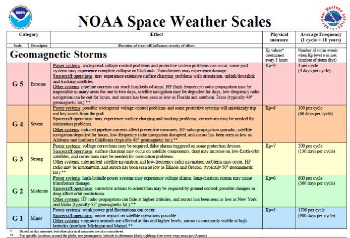
NOAA’s Space Weather Scales -Geomagnetic Storms
Click image to zoomClick image to zoom
SWPC participated in the North American Electric Reliability Corporation (NERC), Geomagnetic Disturbance Task Force (GMDTF) meeting in August, 2012, in Atlanta.
This was the beginning of Phase 2 of the GMDTF, a multi-year effort to address potential impacts of geomagnetic storms to the North American power grid. Phase 1 began over a year ago, culminating with the NERC report which was delivered in April of this year with several recommendations. Phase 2 activities involve implementation of these recommendations as appropriate. The primary goal of the GMDTF Phase 2 effort will be to review, and verify where applicable, the work products of NERC and other industry and scientific organizations in support of the four key areas: (1) Improvement of tools for industry planners to develop mitigation strategies; (2) Improvement of tools for system operators to manage Geomagnetic Disturbance (GMD) impacts; (3) Education and information exchanges between researchers and industry; and (4) Review the need to enhance NERC Reliability Standards. In addressing the recommendations above, Phase 2 will also directly support the Electricity Subsector Coordinating Council (ESCC) Critical Infrastructure Strategic Roadmap.
NOAA’s Space Weather Scales -Geomagnetic Storms
Space weather services will be one key piece addressed in GMDTF effort. The geomagnetic K and G scale continues to be a problem, but it was generally recognized that there’s really nothing better when forecasting a geomagnetic storm at the global scale. And utility representatives from the lower latitude states really emphasized their desire to have a regional specification and forecast. How SWPC disseminates geomagnetic storm alerts and warnings will also be revised. There are several actions SWPC will undertake to improve its support for the electric utilities. SWPC will redefine primary alerting processes for the electricity sector. SWPC will work closely with USGS, NASA, and industry to develop graphical products for the power grid. What can be provided (regional and/or latitudinal), and when will be addressed. SWPC will also work with the Electric Power Research Institute (EPRI) to gain access to the Sunburst geomagnetically induced current (GIC) measurements nationwide for geospace model validation and improvements.

Hardening the grid from the effects of GIC is also a primary focus of this group. Representatives from several agencies involved in developing GIC mitigation devices attended the meeting to advertise their solutions. The recent (18 Oct) Federal Energy Regulatory Commission (FERC), Notice of Proposed Rulemaking (NOPR) on Reliability Standards for Geomagnetic Disturbances may add an interesting dynamic to the task force efforts. The FERC NOPR could result in Reliability Standards that would require owners and operators to develop and implement a plan so that instability, or cascading failures of the Bulk-Power System, caused by damage to critical or vulnerable Bulk-Power System equipment, or otherwise, will not occur as a result of a GMD.

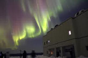
Bright aurora can portend power grid problems.

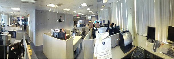
Vacant OPC operations area on fourth floor of World Weather Building
Click image to zoomClick image to zoom
After seemingly endless delays and years of planning, testing, and hard work, full OPC operations were moved to the NOAA Center for Climate and Weather Prediction (NCWCP) on the afternoon of Sunday, August 12, 2012.
OPC Director Dr. Ming Ji declared the Center was fully capable of operating at the NCWCP after over 48 hours of running dual shifts at the World Weather Building and the NCWCP without any forecast and analysis preparation problems and without any technical or data problems at the new site. In an email to staff that day, Dr. Ji congratulated all staff for a job well done. He also noted the historical nature of the event: OPC was the first Center to complete the transition from the World Weather Building (WWB) to the NCWCP.

The new location will bring OPC close to the University of Maryland campus and offer the possibility of collaboration with the researchers and students there. The NCWCP is a state of the art building and its facilities afford many opportunities to work with other scientists in NOAA and academia.

Below is a picture of the vacant OPC operations area after the declaration that the move was complete and the area was no longer the base of operations for the Center.

Vacant OPC operations area on fourth floor of World Weather Building
In This Issue...
NCWCP Open for Business
NCEP Central Operations Completes Information Technology Delivery at New NOAA Facility
NCEP Begins Model Transition to New Supercomputers
AWC Participates in FAA End of Season Review and General CDM Meeting
Aviation Weather Center Strengthens Ties with China
Climate Prediction Center's 37th Climate Diagnostics and Prediction Workshop
Fourth International Training Workshop Climate Variability and Predictions - Pacific Basin
HPC Hosts the Atmospheric Rivers Retrospective Forecasting Experiment
Some Personal Memories of WWB
AWIPS II Forecaster Initial Testing (FIT) Takes Place at the NCWCP
NHC hosts Hurricane Andrew 20th Anniversary Teleconference
Media Descends on the National Hurricane Center for "Isaac"
SWPC Participates in International Workshop on Extreme Space Weather
Efforts to Improve Space Weather Services for the Electric Power Industry
Ocean Prediction Center is First to Move to the NOAA Center for Climate and Weather Prediction, College Park, MD
 
Please fill out this comment form and a representative will contact you.

NOTE: Submission of name and/or email address is optional. However, without your complete e-mail address we cannot provide a reply.

Your Full Name:
Your E-mail Address:

Please enter your comments or questions in the space below: