
Welcome to SARSAT
Search and Rescue Satellite Aided Tracking
Around the world...around the clock...NOAA proudly stands watch. As an integral part of worldwide search and rescue, NOAA operates the Search And Rescue Satellite Aided Tracking (SARSAT) System to detect and locate mariners, aviators, and recreational enthusiasts in distress almost anywhere in the world at anytime and in almost any condition.
The SARSAT system uses NOAA satellites in low-earth and geostationary orbits to detect and locate aviators, mariners, and land-based users in distress. The satellites relay distress signals from emergency beacons to a network of ground stations and ultimately to the U.S. Mission Control Center (USMCC) in Suitland, Maryland. The USMCC processes the distress signal and alerts the appropriate search and rescue authorities to who is in distress and, more importantly, where they are located. Truly, SARSAT takes the "search" out of search and rescue!
NOAA-SARSAT is a part of the international Cospas-Sarsat Program to which 41 nations and two independent SAR organizations belong to. To find out more about SARSAT please feel free to explore our website. We hope you enjoy your visit!
SARSAT - A Lifeline To Survival!
Please read the warning on unapproved beacon batteries for important information regarding battery replacement
All U.S. coded beacons must be registered with NOAA. Read or download our registration brochure to learn more!
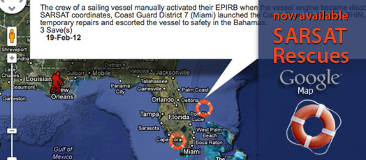
COSPAS-SARSAT Rescues through February 11, 2013
Number of People Rescued in Calendar Year 2013 in the United States: 14
- Rescues at sea: 10 people rescued in 5 incidents
- Aviation rescues: 0 people rescued in 0 incidents
- Terrestrial PLB rescues: 4 person rescued in 3 incidents
- Worldwide – Over 33,000+ People Rescued (since 1982)
- United States – 7,013 People Rescued (since 1982)
Total Rescues in Calendar Year 2012 in the United States: 263
- Rescues at sea: 182 people rescued in 54 incidents
- Aviation rescues: 22 people rescued in 13 incidents
- PLB rescues: 59 people rescued in 44 incidents
Recent Calendar Year Totals in the United States:
2011: 207 people
2010: 295 people
2009: 195 people
2008: 282 people
2007: 353 people
2006: 272 people
2005: 222 people
2004: 260 people
2003: 224 people
2002: 171 people
2001: 166 people