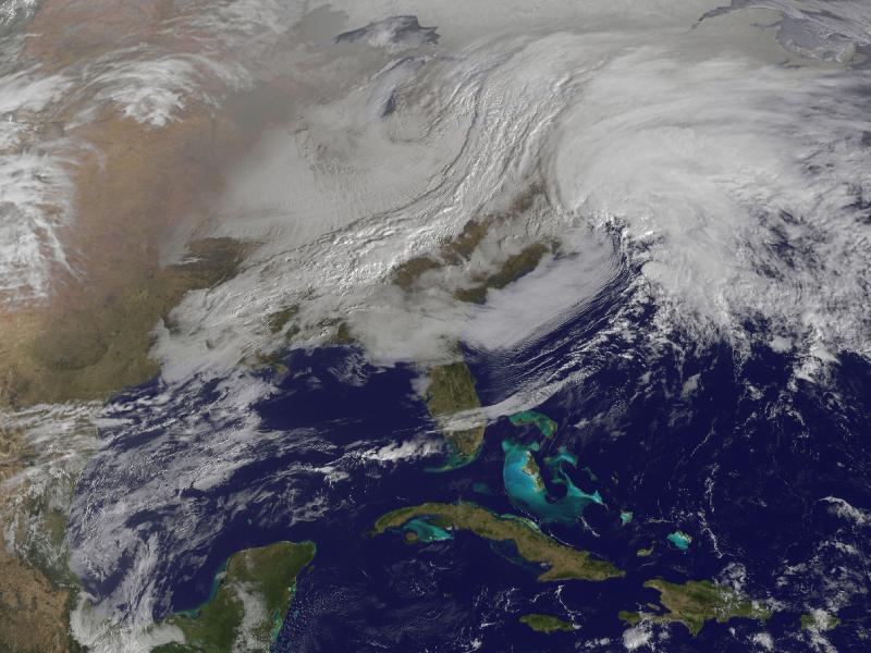
Image description: The satellite image, captured today at 9:01 a.m. EST, shows clouds associated with the western frontal system stretching from Canada through the Ohio and Tennessee valleys, into the Gulf of Mexico.
The comma-shaped low pressure system located over the Atlantic, east of Virginia, is forecast to merge with the front and create a powerful nor’easter. The National Weather Service expects the merged storm to move northeast and drop between two to three feet of snow in parts of New England.
Photo from NASA.
Stay safe in severe winter weather with these tips from Ready.gov.
April 27 and 28, 2011 brought the deadliest tornado outbreak in the United States since 1974.
For the latest information on how to help tornado survivors and apply for assistance, please visit the Federal Emergency Management Agency’s (FEMA) blog.
The above animation is from from NASA Earth Observatory:
The animation starts on April 26 and runs through the morning of April 28. The ingredients for severe weather are evident in the cloud patterns. A relatively stable mass of cold air—visible as a swirl of more-or-less continuous clouds—rotates in the north along the top of the image. Meanwhile, moist air pushes north and west from the Atlantic Ocean and Gulf of Mexico. The warm air contains small low clouds.
The collision between two such air masses is enough to generate severe weather, but the weather also was amplified by the jet stream on April 27. Though not directly visible in the image, the narrow band of fast-moving wind blew north and east between the two air masses. With surface winds blowing from the south and east, and the jet stream blowing from the west, powerful smaller-scale circulation patterns generated lines of intense thunderstorms.
When you return to a damaged home or business after a tornado, you should take extra precaution to stay safe:
- Check the foundation, porches, and overhangs for damage. If you find obvious damage, ask that a building inspector check the building first.
- Enter the building carefully - if a door sticks at the top as it opens, it could mean the ceiling is ready to cave in. Do not walk under a sagging ceiling until a professional checks it.
- Because of potential gas leaks, do not use any lights, candles, gas lanterns, or torches; use battery-powered flashlights and lanterns.
- If you smell gas or suspect a leak, turn off the main gas valve, open all windows, and leave the house immediately
- Do not turn on any appliances or switches (this includes home phones and cell phones).
- Notify the gas company, the police, fire departments, or state fire marshal’s office.
- Take pictures of the damage, both to the house and its contents, for insurance purposes.
If you survived a disaster, such as a major tornado, you may be eligible for federal assistance. If the President issued a disaster declaration for your county, you can apply for assistance from the Federal Emergency Management Agency (FEMA). For more information, or to apply over the phone, please call 1.800.621.FEMA (1.800.621.3362).
More tips on what to do after a tornado.