


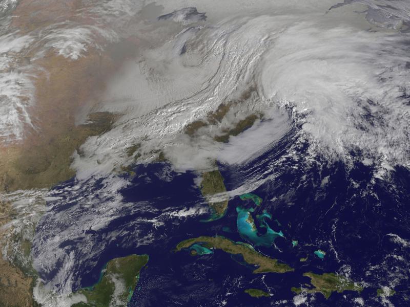
Image description: The satellite image, captured today at 9:01 a.m. EST, shows clouds associated with the western frontal system stretching from Canada through the Ohio and Tennessee valleys, into the Gulf of Mexico.
The comma-shaped low pressure system located over the Atlantic, east of Virginia, is forecast to merge with the front and create a powerful nor’easter. The National Weather Service expects the merged storm to move northeast and drop between two to three feet of snow in parts of New England.
Photo from NASA.
Stay safe in severe winter weather with these tips from Ready.gov.
