Air Quality Monitoring & Access to Data
The National Park Service Air Resources Division administers an extensive Air Monitoring Program that measures air pollution levels in national parks. The purpose of the Program is to establish current air quality conditions and to assess long-term trends of air pollutants that affect park resources. The data are also used to determine compliance with the National Ambient Air Quality Standards and to assess national and regional air pollution control policies. Measuring air pollution levels in parks is an essential part of the NPS air resource management program and provides vital information to Congress, air pollution control agencies, academia, and the public.
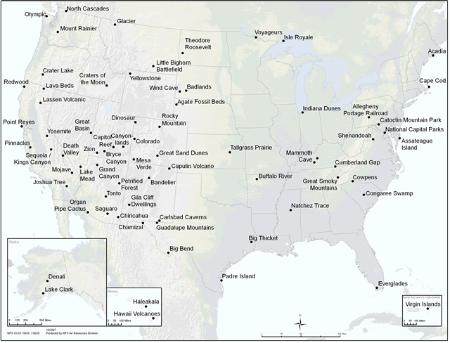
The NPS Air Monitoring Program consists of a network of air monitoring stations in almost 70 national parks across the country. Several of these sites have been in operation for over 25 years. The Program has three primary components: visibility, gaseous pollutants (mainly ozone), and atmospheric deposition (wet and dry). Meteorological monitoring is also conducted at many locations to aid in the interpretation of measured air pollution levels. For more information, please see the table below.
| Air Monitoring Programs | Visibility
 IMPROVE at Big Bend NP, TX
|
Ozone & Meteorology
 GPMN at Shenandoah NP, VA
|
Wet & Dry Deposition
 NADP at Virgin Islands NP, VI
|
|---|---|---|---|
| Network Names | IMPROVE (Interagency Monitoring of Protected Visual Environments) | GPMN (Gaseous Pollutant Monitoring Network) CASTNET (Clean Air Status and Trends Network) |
NADP (National Atmospheric Deposition Program) CASTNet (Clean Air Status and Trends Network) |
| Parameters Measured | fine and coarse particle (PM2.5 & PM10) mass, elements, sulfate, nitrate, organic and elemental carbon scenic views, scattering, and absorption |
ozone, wind speed, wind direction, ambient temperature, relative humidity, solar radiation, wetness | Wet: sulfate, nitrate, ammonium, cations, and mercury in precipitation Dry: sulfur dioxide, sulfate, nitric acid, nitrate, and ammonium; wind speed, wind direction, ambient temperature, relative humidity, solar radiation, wetness |
| Frequency of Measurements | 24-hrs every 3 days | continuous, hourly averages | weekly |
| Access to Data | Visibility Data | Ozone & Met Data | Wet Deposition Data Dry Deposition Data |
In addition to long-term monitoring, the NPS is involved in many special studies that tend to be short-term and more intensive in nature. These studies are often initiated to answer specific local and regional research questions, such as identifying sources of air pollution or assessing the potential risk of natural resources in parks.
Locations
The Air Resources Division monitors air quality in cooperation with several national networks. This monitoring complements the efforts of other federal, state, and local agencies. The following map shows where different monitors are located within the national park system. Links below the map provide site location information for each monitoring network.