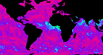
| Aerosol | Operational Products Aerosol Optical Thickness (100Km Global Analysis) |
|
|
| Clouds | Operational Products Clavr-x Cloud Liquid Water MSPPS Sounder Cloud Top Pressure (GOES) Total Precipitable Water SSM/I Developmental Products Fog Depth Fog/Low Cloud Imagery Low Cloud Base Regional Imagery |
|
|
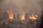
| Fire and Smoke | Operational Products Automated Biomass Burning Algorithm (ABBA) - from CIMSS Fire Id, Mapping and Monitoring Algorithm (FIMMA) Fire Product Archive GOES Aerosol Smoke Products (GASP): Hazard Mapping System (HMS) Fire and Smoke Analysis Developmental Products Fire Risk Smoke Text Product Web Based GIS Fire Analysis Satellite Imagery Fire/Smoke/Hot Spot Imagery Fire/Hot Spot Sectors: Florida | Northern California | Southern California GOES-East Sectors: Regional | WFO Sectors GOES-West Sectors: Regional | WFO Sectors Operational Significant Event Imagery - Fire Events (Archive) |
|
| Ozone & Atmospheric Chemistry | Operational Products Global Ozone Monitoring Experiment 2 (GOME-2) Total Ozone Solar Backscatter Ultraviolet Version 2 (SBUV/2) Developmental Products GOES Total Ozone - from CIMSS GOME Nitrogen Dioxide |
|
|
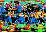
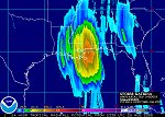
| Precipitation | Operational Products Ensemble Tropical Rainfall Potential (eTRaP) Microwave Rain Rate: MSPPS | SSM/I | SSM/IS Precipitable Water Index Rainfall Hydro Estimator Satellite Precipitation Estimate Messages (SPENES) Total Precipitable Water ATOVS | MSPPS | SSM/I | |
|
|
||
| Radiation Budget | Operational Products Absorbed Solar Energy - Daily & Monthly Available Solar Energy - Daily & Monthly Outgoing Longwave Radiation - Daily & Monthly |
|
|
| Soundings | Operational Products ATOVS Sounding: Atmospheric Temperature; Vertical Statistics MIRS Sounding: Moisture Profiles; Temperature Profiles IASI Sounding Skew-T Profiles: GOES; POES Sounder DPI Satellite Cloud Product (SCP) |
|
|
| Volcanic Ash | Operational Products HYSPLIT Trajectories SO2 Detects from Ozone Monitoring Instrument (OMI) Washington, DC VAAC - Volcanic Ash Advisories (Current Year Archive) Satellite Imagery Operational Significant Event Imagery - Volcano Events (Archive) Real Time GOES Volcano Imagery |
| Winds | Operational Products
High Density Infrared Cloud Drift Winds High Density Visible Cloud Drift Winds High Density Water Vapor Cloud Drift Winds GOES High Density Winds: 30 Days of Images Ocean Surface Winds: (provides a partial mitigation for QuikSCAT which failed November 23, 2009) |
|
|
|
||