Skip Navigation
FREE: Federal Resources for Educational Excellence - Teaching and Learning Resources From Federal Agencies
RSS


Home
Subject Map
Go
Arts & Music
Health & Phys Ed
History & Soc Studies
U.S. History Topics
U.S. Time Periods
World Studies
Language Arts
Math
Science
 
What's New
Calendar

Maps


See All 30 Resources
Image of the United States with longitude and latitude lines.

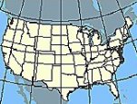
Nationalatlas.gov is a primary source of U.S. maps and geographic information. Zoom in on your state and...

The City of Washington Birds-Eye view from the Potomac – looking North. 1892

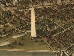
Zoom into Maps offers hundreds of historical maps -- maps showing European exploration of the Americas...

House in the Magnolia Bluffs area overlooking Puget Sound that was struck by a rapidly-moving landslide. The flow deposited material in the garage (upper level) and collapsed the front wall of the liv

Geologic Information describes activities of the Geologic Division of the Department of the Interior. The...

Image of teachers looking at a computer

Census in Schools offers lesson plans, fact sheets, and activities for learning about the 2010 census. How...


Interior Dept

Library of Congress

U.S. Geological Survey

U.S. Census Bureau
  See All 30 maps Resources  
    About FREE      Privacy     Security     Disclaimer     WhiteHouse.gov     USA.gov   ED.gov