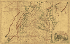
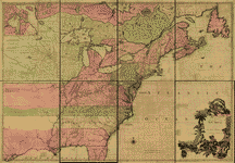
By the time of the earliest religious petition found in this collection, 1774, the Virginia county boundaries had changed from what is represented in the following maps. However, many county names and their general locations remain in use today. These early maps may serve as a rough guide to the Virginia county areas from which the religious petitions in this collection originated. In addition, these maps offer an interesting view of land-related concerns from the perspective of the colonial powers in the years leading up to the time of the Early Virginia Religious Petitions collection.
KEYS:  Descriptive Record
  Enlarge Image
 |
 |
 |
 |