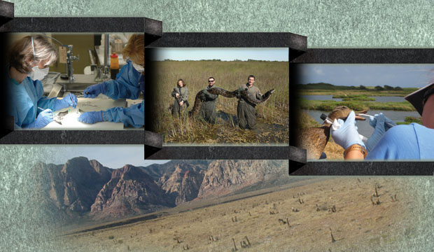
Science Features
 Loading Page...
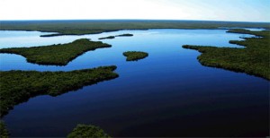
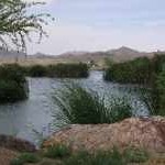
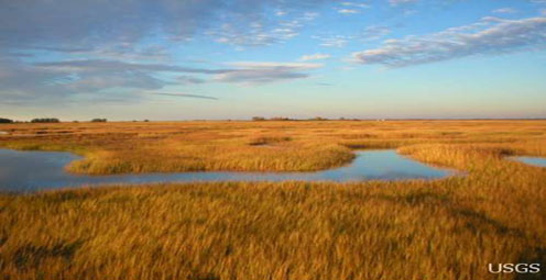
Mangrove islands bespeckle the bay in upper Lostman's River.
Celebrate American Wetlands Month and Wade into USGS Wetlands Research
Bogs, marshes, estuaries, coral reefs, lagoons, swamps, prairie potholes, lakes, pocosins, vernal pools, mudflats, fens, ponds, mires, deltas, billabongs, lagoons, floodplains: wetlands are the unsung heroes of the world’s ecosystems. They are critical to the world’s environmental, ecological, and socioeconomic health. May is the 21st annual American Wetlands Month, a time to celebrate the essential role wetlands play in giving us food; sheltering us from storms, floods, and coastal erosion; providing habitat for birds, fish, and other wildlife; and cleaning and storing water before returning it to us again.
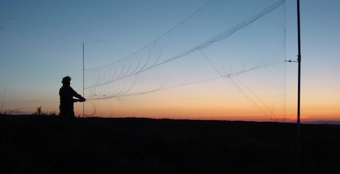
| CoreCast: Wade Into Wetlands Research
Audio clip: Adobe Flash Player (version 9 or above) is required to play this audio clip. Download the latest version here. You also need to have JavaScript enabled in your browser. Slideshow: Wade Into Wetland Research |
USGS scientists provide the critical scientific understanding about how wetlands work and their importance in our lives and the lives of the plants and animals that depend on wetlands for their survival. For example, USGS researchers are examining the vulnerability of North America’s prairie potholes to a warming climate. The loss of wetlands in the prairie pothole region of central North America due to a forecasted warmer and drier climate will adversely affect the millions of waterfowl that depend on the region for food, shelter, and raising young, according to research by the USGS and partners.
Created in 1991, American Wetlands Month helps inspire a better understanding of these ecosystems that are so vital to healthy environments and society. Important wetland research like this is happening all across the country — from sea-level rise to the importance of wetlands for carbon sequestration to constructed wetlands serving as cleaning filters for polluted and contaminated water. Our globally recognized USGS research informs managers and decision makers across the United States and the world how sustainable use of these important ecosystems is achievable.
Check out some of our wetlands research projects, highlighted below and visit the USGS wetlands site.
- Anne Kinsinger

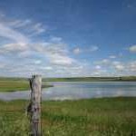
A prairie wetland at Ordway Prairie near Aberdeen, South Dakota.
Disappearing Ducks? North America’s Prairie Potholes Vulnerable to Warming Climates:
The loss of wetlands in the prairie pothole region of central North America due to a warmer and drier climate will negatively affect millions of waterfowl that depend on the region for food, shelter and raising young, according to research by the USGS and colleagues. The new research shows that the region appears to be much more sensitive to climate warming and drying than previously thought. A wetland model developed by the authors to understand the impacts of climate change on wetlands in the prairie pothole region projected major reductions in water volume, shortening of the time water remains in wetlands and changes to wetland vegetation dynamics in this 800,000-square kilometer region in the United States (North and South Dakota, Montana, Minnesota and Iowa) and Canada.

An aerial view of subsiding marshes in the Mississippi River Delta
Effects of Elevated CO2 and Climate Change on Coastal Wetlands: According to the Intergovernmental Panel on Climate Change (IPCC), higher CO2 concentrations in the atmosphere are primarily responsible for recent global warming, which contributes to sea-level rise through thermal expansion of oceans and melting of ice fields. To avoid submergence, coastal marshes must match sea-level rise by building vertically—through either surface deposition of mineral sediment or accumulation of organic matter by plants. Research conducted by USGS scientists and partners are showing how plants and their contribution of organic matter are important to marsh building, especially in sediment-starved areas such as the Mississippi River Delta. Their work further suggests that higher CO2 concentrations in the atmosphere may aid some marshes in keeping up with rising sea-levels, by stimulating plant production. For more information, view video on sea-level rise and the Mississippi Delta, and potential effects of elevated CO2 and climate change on wetlands. Learn more about how elevated atmospheric CO2 may help Coastal Wetlands keep pace with Sea-Level rise, the Potential Effects of Elevated Atmospheric Carbon Dioxide (CO2) on Coastal Wetlands, and current Global Change projects.

Aerial photo of Cat Island, Mississippi, after Hurricane Katrina.
The Northern Gulf of Mexico Ecosystem Change and Hazard Susceptibility project is working to understand the evolution of coastal ecosystems on the northern gulf coast, the effects of human activities on these ecosystems, and to assess the vulnerability of ecosystems and people to more frequent and intense hurricanes in the future. To listen to a podcast about research on hurricanes, watch the video “In Harm’s Way: Measuring Storm Impacts.” For more information on the research, visit the Northern Gulf of Mexico (NGOM) Ecosystem Change and Hazard Susceptibility project.
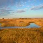
View near a groundwater well in North Dakota.
Predicting Coastal Persistence under a Changing Climate: USGS is conducting research in a variety of coastal areas to address critical questions regarding the vulnerability of coastal wetland systems to global change. Learn more about Integrating the Effects of Land Use and Global Climate Change on Hydrology and Vegetation of Northern Great Plains Wetlands and Prairie Wetlands and Climate Change-Droughts and Ducks on the Prairies [PDF].

Wood frog embryos in a partly ice-covered Wisconsin wetland.
Terrestrial Wetland Global Change Research Network: Interconnected wetlands and uplands are critical elements of most of the North American landscape and support our quality of life in profound ways. These landscape matrices are highly susceptible to climate change, land use, and other elements of global change, but we know little about how they are responding to these forces. To provide much-needed information about such responses, the USGS is leading a growing network of U.S. and Canadian partners who are using satellite and ground-based sensors to monitor key variables at research sites along North American environmental gradients.

An aerial view of subsiding marshes in the Mississippi River Delta.
Sea-Level Rise, Subsidence, and Wetland Loss in the Mississippi River Delta: Rising sea levels are threatening coastlines worldwide, but areas where the land is sinking due to natural and human-related activities are particularly vulnerable. The Mississippi River Delta contains vast areas of marshes, swamps, and barrier islands—important habitat for wildlife, as nursery grounds for marine life, and as protective buffers against storms and hurricanes. However, rapid land subsidence due to sediment compaction and dewatering increases the rate of submergence in this deltaic system. The construction of levees along the lower Mississippi River also has reduced delivery of sediments to coastal wetlands, which have been deteriorating as soil surfaces sink and wetland plants are subjected to excessive flooding. Other factors that have contributed to land loss include construction of canals and periodic hurricanes. Scientists are studying how natural and anthropogenic factors have combined with global processes such as sea level rise to cause wetland loss in the Mississippi River Delta. For more information watch these short videos: Sea-Level Rise, Subsidence, and Wetland and Coastal Louisiana: Impacts of Hurricanes on Salt Marsh and Mangrove Wetlands.
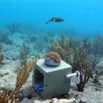
A curious reef squid hovers over a calcification-monitoring station.
Coral Reef Ecosystems: Coral reefs are known as the rainforests of the oceans with numerous and diverse communities of fish, crustaceans, sponges and algae. The CREST (Coral Reefs Ecosystem) project investigates the processes and monitors activities relevant to the health and resilience of shallow water reef environments. Research in Florida at Dry Tortugas and Biscayne National Parks and areas of the Florida Keys National Marine Sanctuary as well as the Virgin Islands are improving understanding and information about coral health, advancing the ability to forecast future changes in coral reef environment, and helping to guide management decisions.

A nest in a salt marsh in San Francisco Bay
Saltmarsh Restoration in the San Francisco Bay: In San Francisco Bay, a 15,000-acre tidal wetland restoration project is relying on USGS ecological and hydrological science to inform its planning phases and actions — actions that will provide America’s Silicon Valley with natural flood control, recreational access and wildlife habitat in the coming decades. For more info, please visit the USGS Western Ecological Research Center website also WERC from the field and the South Bay Salt Pond Restoration Project.
The marshes of Plum Island Estuary are among those predicted by scientists to submerge during the next century under conservative projections of sea-level rise.
Predicting the Success of Wetlands Restoration: It’s not as easy as one would think to restore a wetland, in great part because establishing native plants in an area where no native plants exist any longer is somewhat of a gamble. Jim Grace, a wetlands scientist at the USGS National Wetlands Research Center, and his colleagues note that managers need to use seeds or transplants that are genetically adapted to the restoration site. If they aren’t, the project can fail. To help solve this dilemma, Grace and Steve Travis, another USGS scientist, have developed a model to predict how well restoration efforts will succeed based on genetic traits of the plants and the geographic distance between the plant’s source and the restoration site.

A large Saharan dust storm leaves the West African coast to move over the Atlantic Ocean and cover downwind islands.
African Dust, Coral Reefs and Human Health: Coral reefs in the Caribbean are in decline due to human activities, high water temperatures, and coral diseases. Diseases, which were first reported in the 1970s, are on the increase and becoming more widespread. One source of the deterioration may be found halfway around the world as hundreds of millions of tons of mineral dust are transported through the atmosphere from the Sahara and Sahel regions of Africa to the Caribbean and Americas every year. Although African dust has been carried out of the Sahara and into the Caribbean and the Americas for hundreds of thousands of years, there have been significant changes in the past 40 years: the quantity of dust has increased and the composition has changed with more pesticides and other toxic chemicals being carried over in the dust. USGS scientists are investigating whether African dust is playing a role in coral reef declines throughout the Caribbean, and if there is a connection between African dust and high rates of asthma and other respiratory ailments in the region. For more info, watch a short video on African dust, coral reefs, and human health and The Effects of African Dust an Coral Reefs and Human Health.

A resident of Iwate Prefecture feeds a wintering flock of northern pintail ducks and whooper swans in Northern Honshu, Japan.
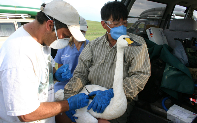
Global Health and Wetlands—The Spread of Bird Flu: In studying the spread of H5N1 avian flu and its potential risk to the United States, USGS researchers have partnered with the United Nations in China, Tibet, Bangladesh, Turkey, Egypt and elsewhere to study wild ducks and geese, using satellite technology to track their migratory paths through wetlands worldwide to uncover H5N1 transmission pathways. Such research will eventually help scientists and health professionals understand how and forecast where the potentially dangerous virus could spread. For more information, visit the USGS Western Ecological Research Center website or read the news release New Research Suggests Wild Birds May Play a Role in the Spread of Bird Flu.

Larval tapeworm found on a coral reef fish
Parasites and Healthy Wetlands: USGS researchers focus on the tiniest – but still essential – parts of wetlands. For example, studies in California have shown that tiny parasites that infest snails and fish can be promising tools to measure the wildlife diversity and ecosystem function of a healthy wetland. Learn more Night of the Brain Snatchers!, Parasites as Indicators of Wetland Biodiversity [PDF] and Parasites as aIndicators of Coastal Wetland Health.
Demonstration wetland at Henderson, Nevada
Demo Wetland: Municipal, agricultural and industrial development in the arid western U.S. depletes already-scarce water resources needed to maintain wetland and riparian (streamside) habitats. Loss of these habitats threatens many fish and wildlife resources, and so USGS researchers are examining techniques to naturally remove contaminants from reclaimed or contaminated water through the use of constructed wetlands.

A USGS researcher in an invasive phragmites stand, Great Lakes
Invasives and Wetlands in the Great Lakes: Many noxious, invasive species infest our nation’s wetlands. One example is a new type of phragmites, a wetlands grass from Europe that has rapidly spread across the continent, altering soil, producing copious seeds, and resulting in dense stands of mostly one-plant – phragmites – stands. The result: plant species’ diversity declines, and critical habitat for fish, reptiles, amphibians and birds is lost. The species is rapidly invading the few remaining marshes in the Great Lakes, but USGS scientists and their colleagues are using cutting-edge research to try to fight back. For more information visit, Innovative Phragmites Control Strategies and Forecasting Potential Phragmites Coastal Invasion Corridors.
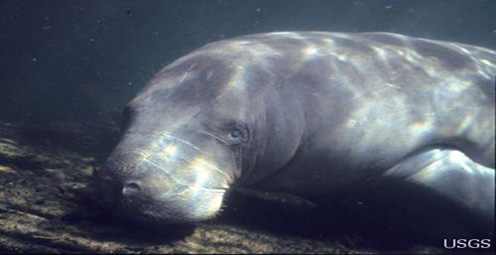
Manatees are often used as sentinels for emerging threats to the ocean environment and human health. Read more

The USGS plans to "app-lify" data with a contest through Challenge.gov. Prizes will be awarded to the best overall app, the best student app, and the people’s choice. Read more
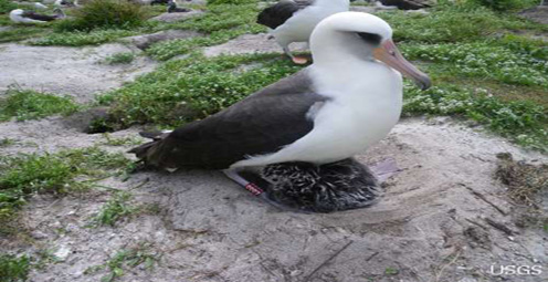
The world’s oldest known wild bird – now 62 – is a mother again. Read more
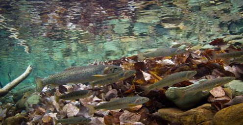
The recent past sheds light on preserving the future of economically and ecologically important native trout populations across the West. Read more
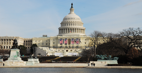
Washington, D.C., is a unique city full of landmarks and buildings that are recognizable worldwide. But how were these stone giants built? Read more
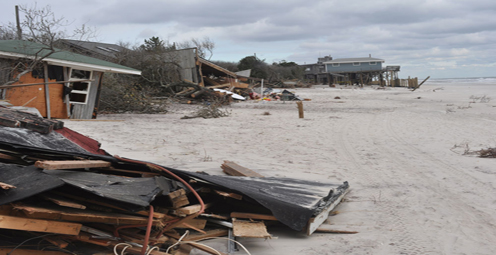
Hurricane Sandy is a stark reminder of just how essential it is for the Nation to become more resilient to coastal hazards.Read more

The 100 million tons of carbon sequestered in western ecosystems each year is an amount equivalent to – and counterbalances the emissions of – more than 83 million U.S. passenger cars a year. Read more
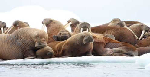
Watch USGS scientists in the Arctic track Pacific walruses to examine how these animals are faring in a world with less sea ice. Read more

Critically endangered birds whose numbers grew rapidly after successful translocations by USGS and USFWS biologists likely took a hit from the 2011 event. Read more

Trees Face Rising Drought Stress and Mortality as Climate Warms. Read more
Saltmarshes may slow the rate of climate change. Read more
USGS vigilant for West Nile virus in wildlife through surveillance, research, and mapping.
USGS and its partners are investigating the unusual deaths of New England harbor seals. Read more

USGS scientists look to see if water quality is improving. Read more

The majority of the nation is facing dry conditions; in most areas drought conditions are expected to persist or intensify. Read more


After dams tumble down, what happens next? Click here to find out! Read more

Maximizing alternative energy’s potential – how science can help grow the nation’s energy portfolio. Read more

Please comment on the USGS’ draft science strategies! Read more

USGS Details how climate change could affect water availability in 14 U.S. Basins. Read more
Western stream temperatures are not warming at the same rate as air temperature.Read more

Long polar bear swims provide tantalizing clues.Read more

The larger and more aggressive Eastern species thrives in a threatened species’ forest habitat.
While on your spring hike, beware of hitchhiking ticks—they may carry Lyme Disease.

For the first time since its discovery, White-nose syndrome has been found in the West.

The family picnic: food and fun...until unwanted guests show up! Learn what you can do to prevent West Nile virus from infecting your loved ones.

Timing is everything! Consider helping track changes in spring’s arrival

Flood Safety Awareness Week is March. 12-16. What can you do to prepare?
National Groundwater Awareness Week is Mar. 11-17, 2012. See how USGS science is connecting groundwater and surface water.

Since Japan’s March 11, 2011, Tohoku earthquake and subsequent tsunami, scientists at the USGS have learned much to help better prepare for a large earthquake in the United States.

Five USGS employees honored with Distinguished Service Awards for their service to the nation

It’s National Invasive Species Awareness Week. Did you know invasive species cost our country more than 100 billion dollars each year? Get to know America’s ten top invaders this week.

It’s National Invasive Species Awareness Week. Did you know invasive species cost our country more than 100 billion dollars each year? Get to know America’s ten top invaders this week.

It’s National Invasive Species Awareness Week. Did you know invasive species cost our country more than 100 billion dollars each year? Get to know America’s ten top invaders this week.
It’s National Invasive Species Awareness Week. Did you know invasive species cost our country more than 100 billion dollars each year? Get to know America’s ten top invaders this week.

The proposed USGS budget reflects research priorities to respond to nationally relevant issues, including water quantity and quality, ecosystem restoration, hydraulic fracturing, natural disasters such as floods and earthquakes, and support for the National Ocean Policy, and has a large R&D component.
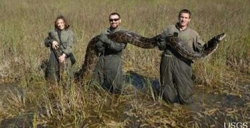
Mid-sized mammals in Everglades National Park are getting a big squeeze from invasive Burmese pythons, according to a USGS co-authored study published in the Proceedings of the National Academy of Sciences.

Bat populations, which provide valuable insect control, are declining at an alarming rate due to white-nose syndrome. Scientists have definitively identified the cause of this deadly syndrome.
Two adolescent cranes, raised by humans and reintroduced into the wild, were shot and killed. Sadly, they are not the first. How many killed this year? How many are left?

By 1936, devastating losses of wildlife populations were threatening the Nation’s natural resource heritage. America's first wildlife research center

As the team of responders struggled to end the worst oil spill in our Nation’s history, USGS scientist Paul Hsieh provided the critical scientific information needed to make a crucial decision.
The movie Contagion dramatizes the scenario of a global pandemic that begins with the spread of a disease from animals to humans. What are real-life experts doing to prevent a pandemic that originates with wildlife?

After years of planning, the Department of the Interior has begun removing two dams on the Elwha River in Washington. But how will the removal of these dams impact the river’s sediments, waters, and fish?

As a nation, we use more than 75 billion gallons of groundwater each day. September 13 is the National Groundwater Association’s “Protect Your Groundwater Day.” What we can do to ensure we continue to have enough of it?

Secretive and rare stream-dwelling amphibians are difficult to find and study. Scientists at the US Geological Survey and University of Idaho have developed a way to detect free-floating DNA from amphibians in fast-moving stream water.
Within the rivers, streams, and lakes of North America live over 200 species of freshwater mussels that share an amazing life history. Join us in Reston, VA to explore the fascinating reproductive biology and ecological role of one of nature’s most sophisticated fishermen.
USGS scientists are working to characterize the contaminants and habitats for a number of aquatic species along the lower Columbia River.
Forests play a significant role in removing carbon from the atmosphere by absorbing one-third of carbon emissions annually. This is according to a new U.S. Forest Service study conducted in collaboration with USGS scientists.
New USGS research shows that rice could become adapted to climate change and some catastrophic events by colonizing its seeds or plants with the spores of tiny naturally occurring fungi. The DNA of the rice plant itself is not changed; instead, researchers are re-creating what normally happens in nature.
A new study supports the ecological reliance of red knots on horseshoe crabs. The well-being of red knots, a declining shorebird species, is directly tied to the abundance of nutrient-rich eggs spawned by horseshoe crabs.
USGS crews continue to measure streamflow and collect water quality and sediment samples in the Ohio and Mississippi River basins using state-of-art instruments.
Native Bees are Selective About Where They Live and Eat -- It's National Pollinator Week, and here's groundbreaking research about the world of our native bees.
As hurricane season starts, researchers are modeling potential changes to coastal environments to identify communities vulnerable to extreme erosion during storms. Data collected before and after storm landfall are used to verify past forecasts and improve future predictions.
Follow the Pacific Nearshore Project as researchers from the USGS, Monterey Bay Aquarium, and other institutions sail Alaskan waters to study sea otters and investigate coastal health.
USGS science supports management, conservation, and restoration of imperiled, at-risk, and endangered species.
New USGS research shows that certain lichens can break down the infectious proteins responsible for chronic wasting disease, a troubling neurological disease fatal to wild deer and elk and spreading throughout the United States and Canada.
In a unique application of data, this year's report provides the nation's first assessment of birds on public lands and waters.

For reliable information about amphibians and the environmental factors that are important to their management and conservation, visit the new USGS Amphibian Monitoring and Research Initiative website.

A new article explains the economic importance of insect-eating bats to U.S. agriculture and how white-nose syndrome and wind turbines threaten these valuable animals.

Using coral growth records and measurements of changing ocean chemistry from increased atmospheric CO2, USGS scientists are providing a foundation for predicting future impacts of ocean acidification and sea-level rise to coral reefs.

Non-native lionfish are rapidly spreading along the U.S. Eastern seaboard, Gulf of Mexico, and Caribbean and have been preying on and competing with a wide range of native species.

On Midway Island, Wisdom, a 60-year-old albatross, and her chick made it through the tsunami that resulted from the magnitude 9.0 earthquake off of Japan on March 11.
Please answer questions about USGS Ecosystems science.
Join us in learning about wildlife conservation research with Dr. Matthew Perry as we celebrate the 75th anniversary of the USGS Patuxent Wildlife Research Center. Major programs include global climate change studies, Chesapeake Bay studies, and wildlife conservation monitoring.
Glen Canyon Dam High-Flow Experiments Provide Insights for Colorado River Management.
Demand for alternative energy sources leads scientists to consider microbes as potential sources of power.
Human health, ecological health, and environmental health are closely connected. Join us to learn how USGS science contributes to our understanding of how such environmental factors affect health threats.
A new identification guide provides images and geographic distributions of diatoms, an important group of algae.
A new USGS video highlights five decades of photographic documented change in coral reef conditions in the Florida Keys.
The USGS National Wildlife Heath Center is working with state agencies in investigating the death of thousands of birds in Arkansas and Louisiana.
Combining traditional ecological knowledge with empirical studies allows the the USGS, Tribal governments, and native organizations to increase their mutual understanding of the current health of Tribal lands and waters.
Scientists have found that the fungus associated with white-nose syndrome in bats is unlike that of any known fungal skin pathogen in land mammals. It is extremely destructive to bats wing skin and may cause catastrophic imbalance in life-support processes.
Sea-ice habitats essential to polar bears would likely respond positively should more curbs be placed on global greenhouse gas emissions, according to a new modeling study published today in the journal, Nature.
Remotely triggered thermal-imagery cameras will be used in a new non-invasive way to study mange in wolves.
Landscape photos taken in the same place but many years apart reveal dramatic changes due to human and natural factors. The USGS Desert Laboratory Repeat Photography Collection, the largest archive of its kind in the world, is 50 years old.
Decreasing pH and warming temperatures are changing ocean conditions and affecting coral and algal growth in South Florida. USGS scientists are conducting field measurements to learn more.
Many coastal wetlands worldwide including several on the U.S. Atlantic coast may be more sensitive than previously thought to climate change and sea-level rise in the this century.
Efforts are underway to restore the Greater Everglades Ecosystem, which has been profoundly altered by development and water management practices. Join us on December 1st when Dr. Lynn Wingard shares USGS research that is helping restoration management agencies develop realistic and attainable restoration goals for the region.
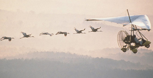
Eight specially trained whooping crane chicks hatched in May have now embarked on their first southward migration, with an ultralight airplane leading them. USGS researchers who hatched, raised, and trained the chicks at the USGS Patuxent Wildlife Research Center, are eagerly following the cranes on their journey.
Beak abnormalities, which make it difficult for birds to feed and clean themselves, are occurring in large numbers of Black-capped Chickadees, Northwestern Crows, and other species in the Pacific Northwest and may signal a growing environmental health problem.
The USGS strongly supports the national celebration of Geography Awareness Week, November 14-20, and this year’s theme: Freshwater. The “where” factor of geography integrates USGS studies in many fields of science.
Two new tools that enable the public to report sick or dead wild animals could also lead to the detection and containment of wildlife disease outbreaks that may pose a health risk to people.
USGS scientists are investigating sea turtles and their habitats in Dry Tortugas National Park to provide insight that will be used as decision-support tools for managing coral ecosystems.
Looking for information on natural resources, natural hazards, geospatial data, and more? The USGS Education site provides great resources, including lessons, data, maps, and more, to support teaching, learning, K-12 education, and university-level inquiry and research.
The Chesapeake Bay has long been an R&R destination for DC residents. However, the watershed’s overpopulation contributes to its decline. Join us when USGS’s Scott Phillips and Peter Claggett discuss new science efforts applied to restoring the Nation's largest estuary on October 6th.
Nutrient sources in both agricultural and urban areas contribute to elevated nutrient concentrations in streams and groundwater across the Nation.
The timing of animal migration and reproduction, and observing when plants send out new leaves and bear fruit, is increasingly important in understanding how climate change affects biological and hydrologic systems. Photo credit Copyright C Brandon Cole.
The USGS has been researching manatees in Florida and the Caribbean for decades, but little is known about Cuban manatees. A USGS biologist recently visited Cuba with a team of international manatee experts working to conserve manatees around the Caribbean.

USGS scientists have discovered a new turtle species, the Pearl River map turtle, found only in the Pearl River in Louisiana and Mississippi. Sea-level changes between glacial and interglacial periods over 10,000 years ago isolated the map turtles, causing them to evolve into unique species.
USGS scientists help land managers determine if fire is the appropriate strategy for controlling or enhancing specific plant species.
Did you know that contaminant-ridden dust from Africa may be harming coral reefs in the Caribbean? Scientists at the USGS are examining the air in Africa and in the Caribbean to determine what kinds of nutrients, microbes, and contaminants are traveling across the ocean.
Pharmaceutical manufacturing facilities can be a significant source of pharmaceuticals in surface water. The USGS is working with water utilities to try to reduce the release of pharmaceuticals and other emerging contaminants to the environment.
The USGS Science Strategy is a comprehensive report to critically examine the USGS's major science goals and priorities for the coming decade. The USGS is moving forward with these strategic science directions in response to the challenges that our Nation's future faces and for the stewards of our Federal lands.

Join us in Reston on December 5th at 7:00pm for our free public lecture on the impacts of offshore wind energy development on migratory seabirds!

USGS wishes The Wildlife Society happy 75th Birthday and looks forward to attending their annual conference. Stop by our booth!

7 p.m.—Public lecture (also live-streamed over the Internet)

Join us for the July Public Lecture on Invasive Species!

USGS-led survey finds that national wildlife refuges rate highly with visitors.

As the climate has warmed, many plants are starting to grow leaves and bloom flowers earlier. A new study published in the journal, Nature, suggests that most field experiments may underestimate the degree to which the timing of leafing and flowering changes with global warming.

Stressed agricultural lands may be releasing less of the moisture needed to protect the breadbasket of a continent.

Spring rains in the eastern Horn of Africa are projected to begin late this year and be substantially lower than normal.

After nearly 2 years of meticulous research, academic and government scientists confirmed that the 2010 oil spill had damaged local coral ecosystems

In recognition of World Forestry Day, let’s take a glimpse at USGS science to understand the fate of forests from climate change.

Join us on March 7 to learn about bat white-nose syndrome, which has killed an estimate 5 million bats, and to discuss the profound impacts this emergent wildlife disease may have in the 21st century.

The U.S. Geological Survey had a very busy 2011 — below are a few of our highlights from last year.

Scientists have discovered an outbreak of coral disease called Montipora White Syndrome in Kāneohe Bay, Oahu. The affected coral are of the species Montipora capitata, also known as rice coral.

Perhaps some of you have already experienced a sweet holiday smooch or two under the Christmas mistletoe, enjoying this fairly old kissing ritual for people. But mistletoe is important in other vital ways: it provides essential food, cover, and nesting sites for an amazing number of critters in the United States and elsewhere.
USGS scientists will join thousands of scientists, managers, and decision makers in Boston this week to present new findings on toxics at the Society for Environmental Toxicology and Chemistry (SETAC) conference in the Hynes Convention Center, Nov. 13-17.

On Nov. 3, USGS scientists Patrick Barnard and William Ellsworth will present a public lecture in Menlo Park, CA, providing Bay Area residents information about USGS research in the San Francisco Bay Area, including recent discoveries beneath San Francisco Bay and ongoing studies to better understand earthquake probabilities and the potential hazards associated with strong ground shaking.

Meet the R/V Muskie and the R/V Kaho, the USGS Great Lakes Science Center's two newest additions to its Great Lakes research fleet!

As climate changes, it affects the timing of when leaves emerge, the amount of foliage that grows as well as the timeframe when leaves begin to fall.

How will accelerated glacial melting over the next 50 years as a result of climate change affect the unique Gulf of Alaska and Copper River coastal ecosystems? USGS scientists are studying these processes and impacts.

The U.S. Geological Survey research looked at one of the world’s largest populations of long-tail ducks and found that hundreds of thousands of these elusive birds engage in a bizarre 30-50 mile morning commute from Nantucket Sound to the Atlantic Ocean, returning each evening.

Taking advantage of USGS expertise in satellite telemetry, geospatial mapping and analysis and waterfowl migration monitoring, researchers have tracked waterfowl across Asia, Eastern Europe, and Africa and discovered new flu transmission links.

USGS is working in collaboration with numerous state and federal agencies and tribes to obtain approval for field trials with vaccine-laden, peanut-butter flavored baits and evaluate the safety and effectiveness of the vaccine in grasslands.

Psychedelically colored wolves depicted by thermal imaging will shed light on how mange affects the survival, reproduction and social behavior of wolves in Yellowstone National Park.

![]() U.S. Department of the Interior |
U.S. Geological Survey
U.S. Department of the Interior |
U.S. Geological Survey
URL: www.usgs.gov/blogs/features/usgs_top_story/celebrate-american-wetlands-month-and-wade-into-usgs-wetlands-research/
Page Contact Information: Ask USGS
Page Last Modified: September 14, 2011