• You are here:
    Home

PTWC ISSUES WARNING FOR M7.7 HAIDA GWAII, BRITISH COLUMBIA EARTHQUAKE

The 28 October 2012 (0304 UTC) / 27 October 2012 (2004 PDT, 1704 HST) magnitude 7.7 Haida Gwaii earthquake generated small, non-destructive tsunami that were measured in Alaska, British Columbia and southward to Calfornia and in Hawaii; much smaller waves were also measured throughout the Pacific.  Tsunami Warnings were issued by WC/ATWC for SE Alaska and Northern British Columbia at 2007 PDT, and downgraded to Advisories at 0049 PDT 28 October for SE Alaska and at 0247 PDT for Northern BC.  Advisories were also issued for Southern BC through Northern California.   A Tsunami Warning was issued by PTWC for Hawaii at 1909 HST 27 October, and downgraded to an Advisory at 0101 HST 28 October.  Waves up to 5 ft were observed on Maui and the Hawaii Island, but little damage was reported statewide.  One person died on Oahu during the tsunami warning when a speeding vehicle rammed into parked cars that were waiting for the closed coastal road to reopen.

THREE MAJOR EARTHQUAKES STRIKE PACIFIC BASIN IN A NINE-DAY PERIOD

Three major earthquakes struck Central America and the Philippines from 27 August - 5 September 2012. Notable were the 27 August El Salvador earthquake (Mw 7.3) in which PTWC issued a Fixed Regional Warning; the 31 August East Philippine earthquake (Mw 7.6) in which PTWC issued an Expanding Regional Warning; and the 5 September Costa Rica earthquake (Mw 7.6) in which PTWC issued a Fixed Regional Warning. Tsunamis were measured in these events, with damage and injuries reported from the El Salvador event.

The El Salvador M 7.3 earthquake occurred on 27 August 2012 at 04:37 UTC at a depth of 131 km as a result of thrust faulting on or near the subduction zone interface between the Cocos and Caribbean plates. A maximum 36 cm amplitude tsunami was measured in Baltra, Ecuador. elsalva fritzEl Salvador preliminary maximum inland inundation was reported at 300 meters and maximum runup heights at 5 meters. Coastal flooding was also reported in Nicaragua. In the aftermath of the event, the Intergovernmental Oceanographic Commission (IOC) and ITIC were requested to coordinate post tsunami survey assessments and help improve capabilities of El Salvador to respond to future events. Post-tsunami surveys are essential for scientists to understand tsunamis and to evaluate potential improvements to forecasting models used by tsunami warning centers. NOAA's Pacific Tsunami Warning Center (PTWC) in Hawaii provides warning information to El Salvador and other countries throughout the Pacific. PTWC will benefit greatly from understanding how their predictions corresponded with the recent event field measurements. Post-tsunami survey methodology has improved in recent years with ITIC working closely with the IOC to develop a recently published manual to standardize the practice. (Photo credit: Dr. Hermann Fritz, Georgia Institute of Technology)

The East Philippine M 7.6 earthquake occurred on 31 August 2012 at 12:48 UTC at a depth of 35 km as a result of reverse faulting within the oceanic lithosphere of the Philippine Sea Plate. Preliminary location of the earthquake indicates this was an intraplate event, 50 or more km to the east of the subduction zone plate boundary between the Philippine Sea and Sunda plates. A maximum 12 cm amplitude tsunami was measured further north at Omaezaki, Japan.

The Costa Rica M 7.6 earthquake occurred on 5 September 2012 at 1442 UTC at a depth of 40 km as a result of thrust faulting on or near the subduction zone interface also between the Cocos and Caribbean plates. A maximum 15 cm amplitude tsunami was measured at Galapagos, Ecuador. PTWC initially issued a Caribbean Tsunami Watch, which was immediately withdrawn when the earthquake location was reevaluated to be on the Pacific side of Costa Rica. PTWC then issued a Pacific Fixed Regional Tsunami Warning.

ptwc coastal amp gcmt m7.3

 baltra

dart 43413

Captions: Left: PTWC RIFT model simulation showing the predicted coastal tsunami wave amplitudes from the 27 August 2012 thrust earthquake.

Right top: Although only a very small tsunami (0.1 m amplitude) was recorded on Acajutla, El Salvador sea level station, a much larger tsunami (0.4 m) was observed at Baltra, Galapagos Islands, Ecuador (PTWC).

Right bottom: DART 43413 deep-ocean instrument off Mexico recorded a 1 cm tsunami (PTWC).


M8.6 EARTHQUAKE GENERATES LOCAL TSUNAMI IN INDONESIA, 11 APRIL 2012

A M8.6 shallow strike-slip earthquake occurred at 0838 UTC 11 April 2012 off the coast of northern Sumatra, Indonesia, and was followed by a second shallow M8.2 strike-slip aftershock at 1043 UTC (USGS).  Both generated small local tsunamis with a maximum of 1.06 m measured at 1007 UTC in Meulaboh, Indonesia located about 395 km west southwest of the epicenter.  Waves heights up to 0.4 m were recorded throughout the region and as far away as Rodrigues Island, Mauritius in the western Indian Ocean (0.22 m wave amplitude).  Amateur video of the tsunami arriving in Indonesia was captured.

Since October 2011, Regional Tsunami Service Providers (RTSP) of Australia, India and Indonesia have been serving as the primary sources for tsunami advisories for the Indian Ocean, with the PTWC and Japan Meteorological Agency (JMA) continuing to operate a parallel service until the end of 2012. The RTSP provide tsunami alerts directly to national tsunami warning centers in each country, and the countries use the advice to assess and issue warnings and advisories to their populations.  The PTWC issued an Indian-Ocean wide Tsunami Watch at 0845 UTC, and JMA issued Tsunami Watch Information at 0855 UTC. PTWC cancelled its tsunami watch at 1318 UTC.

Public bulletins are available from the Australia, India, and Indonesia RTSPs, and from the PTWC.

This region of the Indo-Ausralian plate has been seismically very active throughout history, and includes the great M9.1 earthquake of 26 December 2004 that generated the deadliest tsunami ever killing nearly 230,000 in Indonesia and across the Indian Ocean. Immediately following the disaster, the IOC of UNESCO took the lead in coordinating activities and immediate action to establish an Indian Ocean Tsunami Warning and Mitigation System (IOTWS). The response included the start of an interim Advisory Service in 2005 through the PTWC in Hawaii and the JMA in Tokyo, and in 2011 the start of the permanent RTSPs for the Indian Ocean.

ptwc rift rift wphase cmt m8.57

 ptwc hani

wcatwc 23401r 04-13-2012

Captions: Left: PTWC RIFT model simulation showing the predicted maximum off-shore tsunami wave amplitudes from the 0838 MTC 11 April 2012 strike-slip earthquake.

Right top: Tsunamis recorded on the Hanimaadhoo, Maldives coastal sea level gauge (PTWC). The 1st tsunami (0.23 m amplitude) was generated by the M8.6 0838 UTC earthquake and the 2nd tsunami (0.18 m amplitude) was generated by the M8.2 1043 UTC earthquake.

Right bottom: DART 23401 deep-ocean instrument in the Bay of Bengal clearly shows the 2 tsunamis (WC/ATWC)


Tsunamis in the News

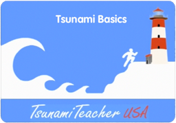
TsunamiTeacher USA - Tsunami Basics

tsunami_basics

Save your life! 

Learn the basics of tsunamis.

In 2011, ITIC created a 6-min video on the basics of tsunamis. Topics cover what a tsunami is, how to recognize a tsunami, and what to do when you know a tsunami is coming.  In the video, the Mayor of Poloa, American Samoa recounts his actions when the tsunami hit his village on September 29, 2009.  That day, waves were as high at 50 feet elevation.

Click here to watch video.  

Click here to watch video  youtube_logo
w/closed captioning.


Tsunami Sidelines

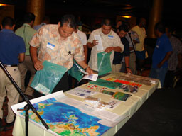
ITIC develops AWR-217 Tsunami Awareness Course for US DHS/FEMA

   ITIC, with SeismicReady Consulting and NOAA PMEL, has developed a 1-day certified Tsunami Awareness course (AWR-217) for the US Dept. of Homeland Security, Federal Emergency Management Agency (DHS). The course fills a gap as there is currently little institutionalized tsunami training in the USA. AWR-217 was done in partnership with the National Disaster Preparedness Training Center (NDPTC) of the University of Hawaii. NDPTC specializes in multi-natural hazards training for a wide range of US customers, including federal/state/local government officials and emergency managers, police, fire, and NGO’s in coastal communities.
   Since 2010, courses have been taught in American Samoa, CNMI, Guam, Hawaii, North Carolina, Puerto Rico, Washington, and the USVI.  The course was adapted for international use by ITIC, and taught in Fiji, Tonga, and Vanuatu.  Contact ITIC for more information.

Guam, July 2010
Guam, July 2010. 
©
ITIC

CNMI, July 2010
CNMI, July 2010.  © ITIC

Tonga, August 2010
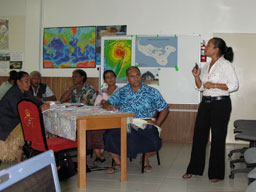
Tonga, August 2010.  © ITIC

 
IOClogonoaabox

find us on facebook

Featured Documents

Tsunamis on the Move


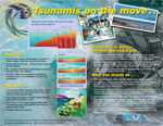
Tsunami Awareness Poster


Awareness poster available in English, Chinese, French, Japanese, Korean, Portuguese, Singalese.

 
tsu_poster_2010_thumbnail_12.6.10


Global Hazard Maps


Posters of Tsunami Sources, Significant Earthquakes and Significant Volcanic Eruptions. Also Tsunami Sources Icosohedron Globe.

 
great_waves_en_feb09_thumbnail Tsunami, The Great Waves

Available in English, Spanish, French and Chinese.

tsunami_glossary_cover_jan2009_thumbnail Tsunami Glossary

Available in English, Spanish, French and Bahasa. 

TT_insert_cover_thumbnail TsunamiTeacher

DVD copies for PC and Macintosh computers are available free of charge from the IOC Tsunami Co-ordination Unit, Paris (u.wolf@unesco.org), or from the ITIC, Hawaii (itic.tsunami@noaa.gov).

Designed and built by David Roberts
© 2012 International Tsunami Information Center | A UNESCO/IOC-NOAA Joint Partnership
737 Bishop Street Suite 2200, Honolulu, HI 96813, USA | Tel: +1 808 532 6422 | Fax: +1 808 532 5576