
Caribbean Tsunami and Earthquake Hazards Studies
Introduction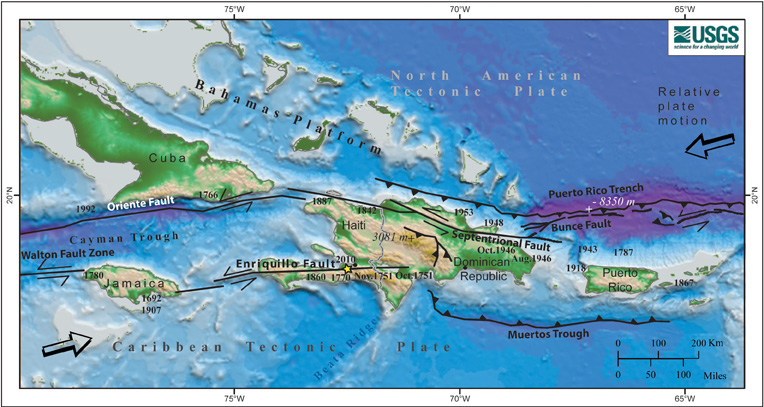 Map of the North American - Caribbean tectonic plate boundary. Colors denote depth below sea level and elevation on land. Bold numbers are the years of moderately large (larger than about M7) historical earthquakes written next to their approximate location. Asterisk - Location of the January 12, 2010 earthquake. Barbed lines- boundary where one plate or block plunges under the other one. Heavy lines with half arrows - faults along which two blocks pass each other laterally. Click on image to return to Introduction page. [Click here to download full-sized image, 1.34 MB] |


 U.S. Department of the Interior |
U.S. Geological Survey
U.S. Department of the Interior |
U.S. Geological Survey
URL: woodshole.er.usgs.gov/project-pages/caribbean/atlantic+trench_large.html
Page Contact Information: WHSC Webmaster
This page last modified on Monday, 14-Jan-2013 04:50:49 EST