![Carte particulière d'une partie de la Louisianne ou les fleuve et rivierres [i.e. rivières] onts etés relevé a l'estime & les routtes [i.e. routes] par terre relevé & mesurées aux pas, par les Srs. Broutin, de Vergés, ingénieurs & Saucier dessinateur](https://cybercemetery.unt.edu/archive/oilspill/20130108014615im_/http://www.loc.gov/collections/static/louisiana-european-explorations-and-the-louisiana-purchase/images/ct000681.jpg)


![[Topographical map of part of Washington D.C.].](https://cybercemetery.unt.edu/archive/oilspill/20130108014615im_/http://www.loc.gov/collections/static/civil-war-maps/images/cw0688500.jpg)

![Plano. I descripcion de la costa, desde el Cavo Cañaveral, hasta cerca de la boca de la Vir[g]inia, contando, costa de Florida, Georgia y Carolinas del S, y N, con todos sus puertos, este[ros ... ]letas, baxos, islas y rios; segun las vlti[mas not]icias, hata [sic] oy Octubre de 1756.](https://cybercemetery.unt.edu/archive/oilspill/20130108014615im_/http://www.loc.gov/collections/static/american-revolutionary-war-maps/images/ct000339.jpg)
![[January 15, 1945], HQ Twelfth Army Group situation map.](https://cybercemetery.unt.edu/archive/oilspill/20130108014615im_/http://www.loc.gov/collections/static/world-war-ii-maps-military-situation-maps-from-1944-to-1945/images/ict21225.jpg)
Results
-

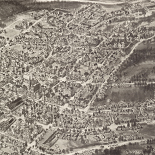
Map of Bennett County, South Dakota /
Relief shown by hachures.
Contributor: Bates, Charles A. Site: American Memory-cultural - Main Catalog Original Format: Map Date: 1910 View catalog record -

[June 28, 1944], HQ Twelfth Army Group situation map.
Available also through the Library of Congress web site as a raster image.
Contributor: Allied Forces. Army Group, 12th. Engineer Section Site: American Memory-cultural - Main Catalog Original Format: Map Date: 1944-06-28 View catalog record -

Richards standard atlas of the city of Lynn and the towns of Swampscott, Saugus and Nahant, Massachusetts : from official records, private plans and actual ...
Available also through the Library of Congress Web site as a raster image.
Contributor: Richards Map Company Site: American Memory-cultural - Main Catalog Original Format: Map Date: 1924 View catalog record -

Mahābhāratakālīna Bhāratavarshācā nakāśā.
Shows place names in India associated with the Mahābhārāta (an important source for a knowledge of Hinduism as it evolved during the period ca. 400 B.C. to 200 A.D.).
Site: American Memory-cultural - Main Catalog Original Format: Map Date: 1900 View catalog record -

Paraguay.
Relief shown by shading and spot heights.
Contributor: United States. Central Intelligence Agency Site: American Memory-cultural - Main Catalog Original Format: Map Date: 1983 View catalog record -

Europe, North Africa, and Southwest Asia.
"504554 (545524) 1-81."
Contributor: United States. Central Intelligence Agency Site: American Memory-cultural - Main Catalog Original Format: Map Date: 1981 View catalog record -

North and South America.
"802532 (R02283) 11-96."
Contributor: United States. Central Intelligence Agency Site: American Memory-cultural - Main Catalog Original Format: Map Date: 1996 View catalog record -

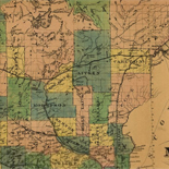
Section no. 2, Chevy Chase, Maryland /
Cadastral survey map of residential subdivisions in what is now the inc. town of Chevy Chase Village (Montgomery County, Md.).
Contributor: Thos. J. Fisher and Co Site: American Memory-cultural - Main Catalog Original Format: Map Date: 1909 View catalog record -
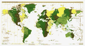
Standard time zones of the world.
"802649AI (R02183) 6-99."
Contributor: United States. Central Intelligence Agency Site: American Memory-cultural - Main Catalog Original Format: Map Date: 1999 View catalog record -

Bosnia and Herzegovina--ethnic population by opština, 1991 census.
Also shows opština (commune) boundaries/administrative centers and inter-entity boundaries.
Contributor: United States. Central Intelligence Agency Site: American Memory-cultural - Main Catalog Original Format: Map Date: 1997 View catalog record -

Autonomous areas in Russia.
Shows autonomous republics, oblasts, okrugs, and their names.
Contributor: United States. Central Intelligence Agency Site: American Memory-cultural - Main Catalog Original Format: Map Date: 1992 View catalog record -

USSR, major economic regions, February 1962.
Scale not given.
Contributor: United States. Central Intelligence Agency Site: American Memory-cultural - Main Catalog Original Format: Map Date: 1962 View catalog record -

Sanborn Fire Insurance Map from Boerne, Kendall County, Texas.
2 Sheet(s). Apr 1910.
Site: American Memory-cultural Original Format: Map Date: 1910-01-01 -

Sanborn Fire Insurance Map from Belton, Bell County, Texas.
6 Sheet(s). Oct 1907.
Site: American Memory-cultural Original Format: Map Date: 1907-01-01 -

Chad : [administrative divisions].
Available also through the Library of Congress Web site as a raster image.
Contributor: United States. Central Intelligence Agency Site: American Memory-cultural - Main Catalog Original Format: Map Date: 1977 View catalog record -

Sanborn Fire Insurance Map from Advance, Boone County, Indiana.
1 Sheet(s). Jan 1919.
Site: American Memory-cultural Original Format: Map Date: 1919 -

[August 26, 1944], HQ Twelfth Army Group situation map.
Available also through the Library of Congress web site as a raster image.
Contributor: Allied Forces. Army Group, 12th. Engineer Section Site: American Memory-cultural - Main Catalog Original Format: Map Date: 1944-08-26 View catalog record -

[March 8, 1945], HQ Twelfth Army Group situation map.
Available also through the Library of Congress web site as a raster image.
Contributor: Allied Forces. Army Group, 12th. Engineer Section Site: American Memory-cultural - Main Catalog Original Format: Map Date: 1945-03-08 View catalog record -

Sanborn Fire Insurance Map from Alexandria, Madison County, Indiana.
13 Sheet(s). Mar 1902.
Site: American Memory-cultural Original Format: Map Date: 1902-01-01 -

North America.
"802582 (R02067) 6-98."
Contributor: United States. Central Intelligence Agency Site: American Memory-cultural - Main Catalog Original Format: Map Date: 1998 View catalog record
Refine your search
Original Format
- Map
- Web Page [18]
Online Format
Date
Site
Contributor
- United States. Central Intelligence Agency [912]
- Allied Forces. Army Group, 12Th. Engineer Section [419]
- Fowler, T. M. [90]
- United States. National Park Service [79]
- Geological Survey (U.S.) [60]
- Hughes & Bailey [26]
- Geo. A. Ogle & Co [23]
- Rand Mcnally And Company [18]
- United States. Central Intelligence Agency] [18]
- Cinquin, Rene [13]
-
More Contributors