![[January 18, 1945], HQ Twelfth Army Group situation map.](https://cybercemetery.unt.edu/archive/oilspill/20120921145342im_/http://www.loc.gov/collections/static/world-war-II-maps-military-situation-maps-from-1944-to-1945/images/ict21228.jpg)


![[Plan of Fort Henry and its outworks.]](https://cybercemetery.unt.edu/archive/oilspill/20120921145342im_/http://www.loc.gov/collections/static/civil-war-maps/images/cw0414000.jpg)

![[Detailed map of part of Virginia from Alexandria to the Potomac River above Washington, D.C. 1886].](https://cybercemetery.unt.edu/archive/oilspill/20120921145342im_/http://www.loc.gov/collections/static/civil-war-maps/images/cw0523000.jpg)


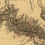
![Sketch-book of positions of forces of 2nd Corps A.N.Va., campaigns of 1864 : [Virginia]](https://cybercemetery.unt.edu/archive/oilspill/20120921145342im_/http://www.loc.gov/collections/static/hotchkiss-maps/images/cwh00003.jpg)
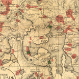
![[Base map of Alabama].](https://cybercemetery.unt.edu/archive/oilspill/20120921145342im_/http://www.loc.gov/collections/static/hotchkiss-maps/images/cwh00201.jpg)
![A correct map of a section of the United States showing the allignment [sic] of the Pittsburgh, Marion, and Chicago Railway between Chewton, Penna. and Marion, Ohio and connections.](https://cybercemetery.unt.edu/archive/oilspill/20120921145342im_/http://www.loc.gov/collections/static/railroad-maps-1828-to-1900/images/rr005350.jpg)


![Plan général du Fort Septentrional du Detour des Anglois, tel qu'il est présentement : [Louisiana]](https://cybercemetery.unt.edu/archive/oilspill/20120921145342im_/http://www.loc.gov/collections/static/louisiana-european-explorations-and-the-louisiana-purchase/images/lh000949.jpg)

Results
-

Map of Little North Mountain or Preston & Wilson iron lands /
General map, does not give mining information.
Contributor: Hotchkiss, Jedediah Site: American Memory-cultural - Main Catalog Original Format: Map Date: 1883 View catalog record -

Sketch of the battle of McDowell on Thursday, May 8th, 1862 (Jackson) /
Relief shown by hachures.
Contributor: Hotchkiss, Jedediah Site: American Memory-cultural - Main Catalog Original Format: Map Date: 1862 View catalog record -

The Am. Manufacturer's map of the New River & the Flat-top coking coal fields of the Virginias /
Shows areas in Fayette, Raleigh, and Wyoming counties, West Virginia, and adjacent areas.
Contributor: Hotchkiss, Jedediah Site: American Memory-cultural - Main Catalog Original Format: Map Date: 1886 View catalog record -

Augusta County, Virginia,
Scale ca. 1:126,720.
Contributor: Hotchkiss, Jedediah Site: American Memory-cultural - Main Catalog Original Format: Map Date: 1867 View catalog record -

[Maps illustrating campaign of Gen. T. J. (Stonewall) Jackson in the Shenandoah Valley of Virginia. 1862 /
Various scales.
Contributor: Hotchkiss, Jedediah Site: American Memory-cultural - Main Catalog Original Format: Map Date: 1880 View catalog record -

Memoranda of J. Hotchkiss, Top. Eng., Hd. Qrs., 2nd Corps, A.N.Va. : [Chancellorsville, Virginia].
Shows troop movements during the battle of Chancellorsville and names of some residents.
Contributor: Hotchkiss, Jedediah Site: American Memory-cultural - Main Catalog Original Format: Map Date: 1863 View catalog record -

Amherst County, Virginia
Scale ca. 1:126,720.
Contributor: Hotchkiss, Jedediah Site: American Memory-cultural - Main Catalog Original Format: Map Date: 1867 View catalog record -

Culpeper and Orange Counties, Virginia /
Pencil and pen-and-ink over pencil grid on paper mounted on cloth.
Contributor: Hotchkiss, Jedediah Site: American Memory-cultural - Main Catalog Original Format: Map Date: 1867 View catalog record -

[Sketch of the road from Waynesboro toward Staunton, in Augusta County, Virginia.].
Scale ca. 1:63,360.
Contributor: Hotchkiss, Jedediah Site: American Memory-cultural - Main Catalog Original Format: Map View catalog record -

[Map of the Shenandoah Valley from Harrisonburg to Mt. Jackson, with topographical detail along the principal roads from Thornton's Gap to Swift Run Gap and ...
Shows names of some residents.
Contributor: Hotchkiss, Jedediah Site: American Memory-cultural - Main Catalog Original Format: Map View catalog record -

Map of the N.C. Morse patent of eighty-six thousand acres of coal, timber, iron, etc. lands in Pike County, Kentucky ; Map of part of ...
General maps not showing coal mines or timber lands.
Contributor: Hotchkiss, Jedediah Site: American Memory-cultural - Main Catalog Original Format: Map Date: 1884 View catalog record -

Map of "Big Hill" iron lands, 592 1/2 acres, Botetourt Co., Virginia /
Relief shown by hachures.
Contributor: Hotchkiss, Jedediah Site: American Memory-cultural - Main Catalog Original Format: Map Date: 1881 View catalog record -

Map of the "Kanawha City" estates, Kanawha County, West Virginia, United States of America /
Relief shown by form lines.
Contributor: Hotchkiss, Jedediah Site: American Memory-cultural - Main Catalog Original Format: Map Date: 1875 View catalog record -

[Map of Louisa County, Virginia] /
LC Land ownership maps, 1290
Contributor: Hotchkiss, Jedediah Site: American Memory-cultural - Main Catalog Original Format: Map View catalog record -

Map of Piedmont Virginia /
Shows area from southwest Loudoun County to Carroll County, Virginia.
Contributor: Hotchkiss, Jedediah Site: American Memory-cultural - Main Catalog Original Format: Map Date: 1873 View catalog record -

Map of Augusta County, Virginia /
Scale 1:63,360 or 1 in. to the mile.
Contributor: Hotchkiss, Jedediah Site: American Memory-cultural - Main Catalog Original Format: Map Date: 1870 View catalog record -

Map of Louisa County, Virginia /
LC Civil War maps (2nd ed.), H297
Contributor: Hotchkiss, Jedediah Site: American Memory-cultural - Main Catalog Original Format: Map Date: 1871 View catalog record -

Preliminary map of Hanover County, Virginia /
Ink with title in pencil, mounted on cloth. Two tears on left side and some losses on right edge.
Contributor: Hotchkiss, Jedediah Site: American Memory-cultural - Main Catalog Original Format: Map Date: 1871 View catalog record -

Sketch of the battle of Belle Grove or Cedar Creek, Wednesday, Oct'r 19th, 1864 /
Shows fortifications but no troop movements and names of some residents.
Contributor: Hotchkiss, Jedediah Site: American Memory-cultural - Main Catalog Original Format: Map Date: 1864 View catalog record -

[Map of Hanover County, Virginia] /
Title and scale from Stephenson's Civil War maps, 1989.
Contributor: Hotchkiss, Jedediah Site: American Memory-cultural - Main Catalog Original Format: Map Date: 1886 View catalog record
Refine your search
Original Format
- Map
Online Format
- Image
Date
Site
- American Memory-cultural
- Main Catalog
Contributor
Subject
Location
Language
- English