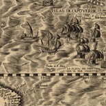
![Plano. I descripcion de la costa, desde el Cavo Cañaveral, hasta cerca de la boca de la Vir[g]inia, contando, costa de Florida, Georgia y Carolinas del S, y N, con todos sus puertos, este[ros ... ]letas, baxos, islas y rios; segun las vlti[mas not]icias, hata [sic] oy Octubre de 1756.](https://cybercemetery.unt.edu/archive/oilspill/20130108034010im_/http://www.loc.gov/collections/static/american-revolutionary-war-maps/images/ct000339.jpg)
![Plan général du Fort Septentrional du Detour des Anglois, tel qu'il est présentement : [Louisiana]](https://cybercemetery.unt.edu/archive/oilspill/20130108034010im_/http://www.loc.gov/collections/static/louisiana-european-explorations-and-the-louisiana-purchase/images/lh000949.jpg)
![[January 15, 1945], HQ Twelfth Army Group situation map.](https://cybercemetery.unt.edu/archive/oilspill/20130108034010im_/http://www.loc.gov/collections/static/world-war-ii-maps-military-situation-maps-from-1944-to-1945/images/ict21225.jpg)


![Carte particulière d'une partie de la Louisianne ou les fleuve et rivierres [i.e. rivières] onts etés relevé a l'estime & les routtes [i.e. routes] par terre relevé & mesurées aux pas, par les Srs. Broutin, de Vergés, ingénieurs & Saucier dessinateur](https://cybercemetery.unt.edu/archive/oilspill/20130108034010im_/http://www.loc.gov/collections/static/louisiana-european-explorations-and-the-louisiana-purchase/images/ct000681.jpg)

![[Map of Madison County, Va.].](https://cybercemetery.unt.edu/archive/oilspill/20130108034010im_/http://www.loc.gov/collections/static/hotchkiss-maps/images/cwh00046.jpg)
![[Map of parts of Caroline, Hanover, and Henrico counties, Va. west of the Mattaponi River and the Richmond, Fredericksburg, and Potomac Railroad].](https://cybercemetery.unt.edu/archive/oilspill/20130108034010im_/http://www.loc.gov/collections/static/hotchkiss-maps/images/cwh00025.jpg)
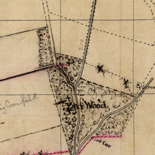
![[Sketches of portions of Madison County, Va.].](https://cybercemetery.unt.edu/archive/oilspill/20130108034010im_/http://www.loc.gov/collections/static/hotchkiss-maps/images/cwh00106.jpg)
Results
-

Pictorial map of the seat of war, showing parts of the states of Maryland, Delaware, Virginia, and North Carolina, and also the coast line from ...
From: Harper's weekly, June 8, 1861, p. 360-361.
Site: American Memory-cultural Original Format: Map Date: 1861 -

Plan of the N.W. frontier /
Shows the Mississippi River from St. Anthony Falls to St. Louis, the Missouri River west to South Dakota, the Illinois River east to Lake Michigan, and tributaries.
Contributor: Clark, William Site: American Memory-cultural - Main Catalog Original Format: Map Date: 1813 View catalog record -

Map of Bennett County, South Dakota /
Relief shown by hachures.
Contributor: Bates, Charles A. Site: American Memory-cultural - Main Catalog Original Format: Map Date: 1910 View catalog record -

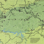
[June 28, 1944], HQ Twelfth Army Group situation map.
Available also through the Library of Congress web site as a raster image.
Contributor: Allied Forces. Army Group, 12th. Engineer Section Site: American Memory-cultural - Main Catalog Original Format: Map Date: 1944-06-28 View catalog record -

Asia.
Relief shown by shading.
Contributor: United States. Central Intelligence Agency Site: American Memory-cultural - Main Catalog Original Format: Map Date: 2000 View catalog record -

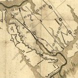
Spartanburgh District, South Carolina /
LC Civil War maps (2nd ed.), S153
Contributor: Mills, Robert Site: American Memory-cultural - Main Catalog Original Format: Map Date: 1820 View catalog record -

Richards standard atlas of the city of Lynn and the towns of Swampscott, Saugus and Nahant, Massachusetts : from official records, private plans and actual ...
Available also through the Library of Congress Web site as a raster image.
Contributor: Richards Map Company Site: American Memory-cultural - Main Catalog Original Format: Map Date: 1924 View catalog record -

Northern part of Florida
Scale 1:633,600.
Contributor: Lindenkohl, H. Site: American Memory-cultural - Main Catalog Original Format: Map Date: 1864 View catalog record -

Paraguay.
Relief shown by shading and spot heights.
Contributor: United States. Central Intelligence Agency Site: American Memory-cultural - Main Catalog Original Format: Map Date: 1983 View catalog record -

Europe, North Africa, and Southwest Asia.
"504554 (545524) 1-81."
Contributor: United States. Central Intelligence Agency Site: American Memory-cultural - Main Catalog Original Format: Map Date: 1981 View catalog record -

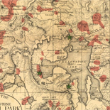
Plan of the west end of the public appropriation in the city of Washington, called the Mall : as proposed to be arranged for the ...
Pen-and-ink and watercolor.
Contributor: District of Columbia. Office of the Surveyor Site: American Memory-cultural - Main Catalog Original Format: Map Date: 1816 View catalog record -

North and South America.
"802532 (R02283) 11-96."
Contributor: United States. Central Intelligence Agency Site: American Memory-cultural - Main Catalog Original Format: Map Date: 1996 View catalog record -

Section no. 2, Chevy Chase, Maryland /
Cadastral survey map of residential subdivisions in what is now the inc. town of Chevy Chase Village (Montgomery County, Md.).
Contributor: Thos. J. Fisher and Co Site: American Memory-cultural - Main Catalog Original Format: Map Date: 1909 View catalog record -

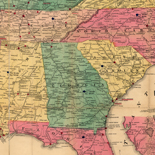
Map of the military Department of the Gulf /
Covers South Carolina, Georgia, Florida, Alabama, Mississippi, Arkansas, Louisiana, and eastern Texas.
Contributor: D'Avignon, Francis Site: American Memory-cultural - Main Catalog Original Format: Map Date: 1864 View catalog record -

A map of General Washington's farm of Mount Vernon from a drawing transmitted by the General.
Removed from: Letters from His Excellency George Washington, to Arthur Young, [etc.]. London, 1801. Opp. p. (E312.75.A27 Rare Book Rm.)
Contributor: Washington, George Site: American Memory-cultural - Main Catalog Original Format: Map Date: 1801 View catalog record -

Portions of Virginia and North Carolina, embracing Richmond & Lynchburg, Va. and Goldsboro & Salisbury, N.C.
Relief shown by hachures.
Contributor: United States. War Dept. Engineer Bureau Site: American Memory-cultural - Main Catalog Original Format: Map Date: 1864 View catalog record -

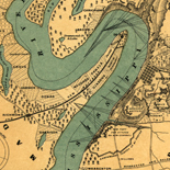
Map showing the railroad and highway bridge over the Missouri River at St. Joseph, Mo. and the railroads connecting therewith.
Scale 1:1,267,200.
Contributor: G.W. & C.B. Colton & Co Site: American Memory-cultural - Main Catalog Original Format: Map Date: 1872 View catalog record -
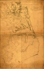
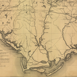
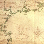
Coast of North Carolina & Virginia
Scale 1:200,000.
Contributor: Lindenkohl, A. Site: American Memory-cultural - Main Catalog Original Format: Map Date: 1863 View catalog record -

Standard time zones of the world.
"802649AI (R02183) 6-99."
Contributor: United States. Central Intelligence Agency Site: American Memory-cultural - Main Catalog Original Format: Map Date: 1999 View catalog record -

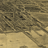
Bird's eye view of Flandreau, county seat of Moody Co., Dakota 1883.
Perspective map not drawn to scale.
Contributor: Brosius, H. Site: American Memory-cultural - Main Catalog Original Format: Map Date: 1883 View catalog record
Refine your search
Original Format
Online Format
Contributor
- United States. Central Intelligence Agency [1296]
- Allied Forces. Army Group, 12Th. Engineer Section [419]
- Sneden, Robert Knox [292]
- Fowler, T. M. [236]
- Ruger, A. [194]
- Texas. General Land Office [174]
- Burleigh, L. R. [134]
- Hotchkiss, Jedediah [128]
- G.W. & C.B. Colton & Co [127]
- United States Coast Survey [108]
-
More Contributors