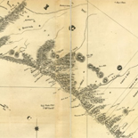

![[Plan of Fort Henry and its outworks.]](https://cybercemetery.unt.edu/archive/oilspill/20130108033159im_/http://www.loc.gov/collections/static/civil-war-maps/images/cw0414000.jpg)

![Plan général du Fort Septentrional du Detour des Anglois, tel qu'il est présentement : [Louisiana]](https://cybercemetery.unt.edu/archive/oilspill/20130108033159im_/http://www.loc.gov/collections/static/louisiana-european-explorations-and-the-louisiana-purchase/images/lh000949.jpg)


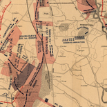
![Sketch-book of positions of forces of 2nd Corps A.N.Va., campaigns of 1864 : [Virginia]](https://cybercemetery.unt.edu/archive/oilspill/20130108033159im_/http://www.loc.gov/collections/static/hotchkiss-maps/images/cwh00003.jpg)
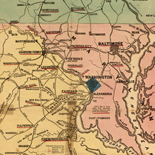
![[Topographical map of part of Washington D.C.].](https://cybercemetery.unt.edu/archive/oilspill/20130108033159im_/http://www.loc.gov/collections/static/civil-war-maps/images/cw0688500.jpg)

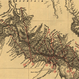
![[Map of cavalry engagement near Bridgewater, Va. Oct. 4th and 5th, 1864]](https://cybercemetery.unt.edu/archive/oilspill/20130108033159im_/http://www.loc.gov/collections/static/hotchkiss-maps/images/cwh00193.jpg)


Results
-

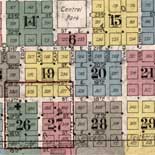
Richards standard atlas of the city of Lynn and the towns of Swampscott, Saugus and Nahant, Massachusetts : from official records, private plans and actual ...
Available also through the Library of Congress Web site as a raster image.
Contributor: Richards Map Company Site: American Memory-cultural - Main Catalog Original Format: Map Date: 1924 View catalog record -

Bird's-eye view of village of Barre, Mass. /
LC Panoramic maps (2nd ed.), 271.2.
Contributor: Spooner, W. R. Site: American Memory-cultural - Main Catalog Original Format: Map Date: 1890 View catalog record -

A correct view of the late battle at Charlestown, June 17th. 1775.
Shows troops in action, British ships, and the village of Charleston.
Contributor: Aitken, Robert Site: American Memory-cultural - Main Catalog Original Format: Map Date: 1775 View catalog record -

[Chart of Nantucket Island and the eastern half of Martha's Vineyard.
Scale ca. 1:51,000.
Contributor: Des Barres, Joseph F. W. Site: American Memory-cultural - Main Catalog Original Format: Map Date: 1776 View catalog record -
[Boston Harbour, with the surroundings, &c.
Scale ca. 1:24,000.
Contributor: Hills, John Site: American Memory-cultural - Main Catalog Original Format: Map Date: 1770 View catalog record -

Boston bird's-eye view from the north.
Perspective map not drawn to scale.
Contributor: Bachmann, John Site: American Memory-cultural - Main Catalog Original Format: Map Date: 1877 View catalog record -

Atlas of the city of Boston, Dorchester : from actual surveys and official plans.
Available also through the Library of Congress Web site as a raster image.
Contributor: G.W. Bromley & Co Site: American Memory-cultural - Main Catalog Original Format: Map Date: 1933 View catalog record -
A Map of forty miles north, thirty miles west, and twentyfive miles south of Boston, including an accurate draft of the harbour and town.
Scale ca. 1:320,000.
Site: American Memory-cultural - Main Catalog Original Format: Map Date: 1775 View catalog record -

Plan of the rebels works on Prospect-Hill. Plan of the rebels works on Winter-Hill.
Scale not given.
Site: American Memory-cultural - Main Catalog Original Format: Map Date: 1775 View catalog record -

Map of the environs of Roxbury showing roads to Jamaica, Cambridge, Dorchester, Milton, etc.
Scale not given.
Site: American Memory-cultural - Main Catalog Original Format: Map Date: 1775 View catalog record -

Uxbridge, Mass. 1880.
Perspective map not drawn to scale.
Contributor: Bigelow, H. B. Site: American Memory-cultural - Main Catalog Original Format: Map Date: 1880 View catalog record -

The Seat of war in New England, by an American volunteer, with the marches of the several corps sent by the Colonies towards Boston, with ...
Scale ca. 1:450,000.
Site: American Memory-cultural - Main Catalog Original Format: Map Date: 1775 View catalog record -

Buzzards Bay and shoals of Nantucket.
Scale ca. 1:100,000.
Contributor: Knight, John Site: American Memory-cultural - Main Catalog Original Format: Map Date: 1778 View catalog record -

Turners Falls, Mass. 1877.
Perspective map not drawn to scale.
Contributor: O.H. Bailey & Co Site: American Memory-cultural - Main Catalog Original Format: Map Date: 1877 View catalog record -

Map of Worcester County, Massachusetts.
Relief shown by hachures.
Contributor: Dockham, C. Augustine Site: American Memory-cultural - Main Catalog Original Format: Map Date: 1866 View catalog record -

Map of part of New Hampshire and Massachusetts, showing the location of the Wilton and other railroads.
Scale ca. 1:150,000.
Contributor: Wilton Railroad Site: American Memory-cultural - Main Catalog Original Format: Map Date: 1847 View catalog record -

Lands End, Rockport, Mass.
Bird's-eye view.
Contributor: O.H. Bailey & Co Site: American Memory-cultural - Main Catalog Original Format: Map View catalog record -

Map of Hampshire County, Massachusetts /
General map showing buildings and householders' names.
Contributor: Barker, Wm. J. Site: American Memory-cultural - Main Catalog Original Format: Map Date: 1854 View catalog record -

East Douglas, Mass. 1886.
Perspective map not drawn to scale.
Contributor: Burleigh, L. R. Site: American Memory-cultural - Main Catalog Original Format: Map Date: 1886 View catalog record -

Highlandville, Massachusetts 1887.
Perspective map not drawn to scale.
Contributor: O.H. Bailey & Co Site: American Memory-cultural - Main Catalog Original Format: Map Date: 1887 View catalog record
Refine your search
Original Format
- Map
- Web Page [1]