![[January 3, 1945], HQ Twelfth Army Group situation map.](https://cybercemetery.unt.edu/archive/oilspill/20120921144037im_/http://www.loc.gov/collections/static/world-war-II-maps-military-situation-maps-from-1944-to-1945/images/ict21213.jpg)

![[January 18, 1945], HQ Twelfth Army Group situation map.](https://cybercemetery.unt.edu/archive/oilspill/20120921144037im_/http://www.loc.gov/collections/static/world-war-II-maps-military-situation-maps-from-1944-to-1945/images/ict21228.jpg)

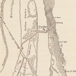
![[Map of cavalry engagement near Bridgewater, Va. Oct. 4th and 5th, 1864]](https://cybercemetery.unt.edu/archive/oilspill/20120921144037im_/http://www.loc.gov/collections/static/hotchkiss-maps/images/cwh00193.jpg)
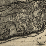
![[Map of parts of Caroline, Hanover, and Henrico counties, Va. west of the Mattaponi River and the Richmond, Fredericksburg, and Potomac Railroad].](https://cybercemetery.unt.edu/archive/oilspill/20120921144037im_/http://www.loc.gov/collections/static/hotchkiss-maps/images/cwh00025.jpg)


![[December 16, 1944], HQ Twelfth Army Group situation map.](https://cybercemetery.unt.edu/archive/oilspill/20120921144037im_/http://www.loc.gov/collections/static/world-war-II-maps-military-situation-maps-from-1944-to-1945/images/ict21195.jpg)
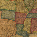
![A correct map of a section of the United States showing the allignment [sic] of the Pittsburgh, Marion, and Chicago Railway between Chewton, Penna. and Marion, Ohio and connections.](https://cybercemetery.unt.edu/archive/oilspill/20120921144037im_/http://www.loc.gov/collections/static/railroad-maps-1828-to-1900/images/rr005350.jpg)
Results
-

A plan of New York Island, with part of Long Island, Staten Island & east New Jersey, with a particular description of the engagement on ...
Scale ca. 1:85,000.
Contributor: Faden, William Site: American Memory-cultural - Main Catalog Original Format: Map Date: 1776 View catalog record -

Aero-view of Monroe, New York 1923.
Perspective map not drawn to scale.
Contributor: Hughes & Bailey Site: American Memory-cultural - Main Catalog Original Format: Map Date: 1923 View catalog record -

West Chazy, N.Y. /
Perspective map not drawn to scale.
Contributor: Fausel, C. Site: American Memory-cultural - Main Catalog Original Format: Map Date: 1899 View catalog record -

Carte de l'entrée de la rivière d'Hudson, dépuis Sandy-Hook jusques à New-York avec les bancs, sondes, marques de navigation &c.
Scale ca. 1:70,000.
Contributor: France. Dépôt des cartes et plans de la marine - France. Dépôt des cartes et plans de la marine Site: American Memory-cultural - Main Catalog Original Format: Map Date: 1778 View catalog record -

Reconnoissance, juillet, 1781.
Scale ca. 1:75,000.
Site: American Memory-cultural - Main Catalog Original Format: Map Date: 1781 View catalog record -

Designs for fortifying Governors Island near New York.
Scale 1:144; 12 ft. to an in.
Contributor: Montrésor, John - Montrésor, John Site: American Memory-cultural - Main Catalog Original Format: Map Date: 1766 View catalog record -

A map of the Province of New-York, reduc'd from the large drawing of that Province, compiled from actual surveys by order of His Excellency William ...
Scale ca. 1:1,000,000.
Contributor: Sauthier, Claude Joseph Site: American Memory-cultural - Main Catalog Original Format: Map Date: 1776 View catalog record -

Map of Washington County, New York /
Relief shown by hachures.
Contributor: Levey, Morris Site: American Memory-cultural - Main Catalog Original Format: Map Date: 1853 View catalog record -

Waverly, N.Y. 1881.
LC Panoramic maps (2nd ed.), 653
Contributor: Moray, John Site: American Memory-cultural - Main Catalog Original Format: Map Date: 1881 View catalog record -

Bay Side Park, 3d ward, borough of Queens, New York City.
Perspective map not drawn to scale.
Contributor: North Shore Realty Co Site: American Memory-cultural - Main Catalog Original Format: Map Date: 1915 View catalog record -

Sidney, N.Y. 1887.
Perspective map not drawn to scale.
Contributor: Burleigh, L. R. Site: American Memory-cultural - Main Catalog Original Format: Map Date: 1887 View catalog record -
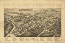
Lancaster, N.Y. /
Perspective map not drawn to scale.
Contributor: Burleigh Litho Site: American Memory-cultural - Main Catalog Original Format: Map Date: 1892 View catalog record -

City of Albany, New York /
Shows radial distances from city hall.
Contributor: Bingham, Reuben H. Site: American Memory-cultural - Main Catalog Original Format: Map Date: 1874 View catalog record -

A map of the provinces of New-York and New-Yersey, with a part of Pennsylvania and the Province of Quebec.
Scale ca. 1:1,040,000.
Contributor: Sauthier, Claude Joseph Site: American Memory-cultural - Main Catalog Original Format: Map Date: 1777 View catalog record -

Proposed site for World's Fair in 1883 : between 110th and 125th Streets, Morning Side and River Side Parks, N.Y. Area 300 acres.
Available also through the Library of Congress Web site as a raster image.
Contributor: Stranders, Walter Site: American Memory-cultural - Main Catalog Original Format: Map Date: 1879 View catalog record -

The city of New York.
Perspective map not drawn to scale.
Contributor: Currier & Ives Site: American Memory-cultural - Main Catalog Original Format: Map Date: 1892 View catalog record -

A chart of the bar of Sandy Hook the entrance of Hudson's River in the Province of New Jersey;
Scale ca. 1:30,000.
Contributor: Hills, John Site: American Memory-cultural - Main Catalog Original Format: Map Date: 1782 View catalog record -

Map of Troy, also West Troy, and Green Island /
Shows radial distances from court house.
Contributor: Young, William H. Site: American Memory-cultural - Main Catalog Original Format: Map Date: 1876 View catalog record -

Map of the city of Utica /
Oriented with north toward the upper left.
Contributor: Francis, Joseph H. Site: American Memory-cultural - Main Catalog Original Format: Map Date: 1873 View catalog record -

A plan of the operations of the King's army under the command of General Sir William Howe, K.B. in New York and east New Jersey, ...
Scale ca. 1:85,000.
Contributor: Sauthier, Claude Joseph Site: American Memory-cultural - Main Catalog Original Format: Map Date: 1776 View catalog record