![[December 21, 1944], HQ Twelfth Army Group situation map.](https://cybercemetery.unt.edu/archive/oilspill/20130108021455im_/http://www.loc.gov/collections/static/world-war-ii-maps-military-situation-maps-from-1944-to-1945/images/ict21200.jpg)

![[Plan of Fort Henry and its outworks.]](https://cybercemetery.unt.edu/archive/oilspill/20130108021455im_/http://www.loc.gov/collections/static/civil-war-maps/images/cw0414000.jpg)

![[Base map of Pennsylvania].](https://cybercemetery.unt.edu/archive/oilspill/20130108021455im_/http://www.loc.gov/collections/static/hotchkiss-maps/images/cwh00207.jpg)
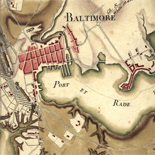
![Boston its environs and harbour, with the rebels works raised against that town in 1775... Sir Thomas Hyde Page, [1775?].](https://cybercemetery.unt.edu/archive/oilspill/20130108021455im_/http://www.loc.gov/collections/static/american-revolutionary-war-maps/images/ct000070.jpg)
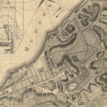
![Map of the Rappahannock River from [sic] Port Royal to Richards Ferry](https://cybercemetery.unt.edu/archive/oilspill/20130108021455im_/http://www.loc.gov/collections/static/civil-war-maps/images/cw0619600.jpg)

![[December 18, 1944], HQ Twelfth Army Group situation map.](https://cybercemetery.unt.edu/archive/oilspill/20130108021455im_/http://www.loc.gov/collections/static/world-war-ii-maps-military-situation-maps-from-1944-to-1945/images/ict21197.jpg)
Results
-

Pre-Contact America, Exploring the Early Americas
Deals principally with the pre-contact cultures of Mesoamerica, a territory that includes most of the modern countries of Mexico, Guatemala, Belize, western Honduras, and El Salvador.
Contributor: Aztecs - Incas - Mayas Site: LOC.gov web pages Original Format: Book - Three Dimensional Object - Map - Photo, Print, Drawing - Web Page -

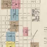
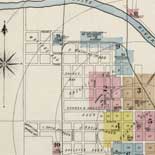
Overview - Sanborn Maps
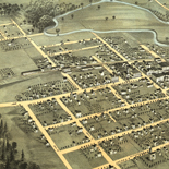
The Sanborn Fire Insurance Maps Online Checklist provides a searchable database of the fire insurance maps published by the Sanborn Map Company housed in the collections of the Geography and Map Division.
Contributor: Sanborn (Firm) Site: LOC.gov web pages - Main Catalog Original Format: Web Page - Map Date: 1867-01-01 View catalog record -

The Battle Of The Bulge - World War Ii Maps Military Situation Maps From 1944 To 1945
A timeline of the Battle of the Bulge told through the daily situation maps made for the US Military VIII Corps. December 16, 1944 - In a quick glance at the situation ...
Site: LOC.gov web pages Original Format: Map - Web Page Date: 1944-01-01 -
Introduction To The Collection - Sanborn Maps
(This article was published within the Library's publication, Fire Insurance Maps: in the Library of Congress) Key for interpreting Sanborn fire insurance maps The Sanborn map collection consists of a uniform series ...
Site: LOC.gov web pages Original Format: Web Page - Map -

Maps Of Arcadia National Park - National Parks Maps
Early European Maps | British Maps | Nineteenth Century Nautical Charts | Mount Desert Island | USGS Maps | National Park Service Maps of Acadia Map of the Discovery of the East ...
Site: LOC.gov web pages Original Format: Map - Web Page Date: 1999-06-02 -

Overview - Railroad Maps 1828 To 1900
The Railroad maps represent an important historical record, illustrating the growth of travel and settlement as well as the development of industry and agriculture in the United States. They depict the development ...
Site: LOC.gov web pages Original Format: Map - Web Page Date: 1998-10-19 -

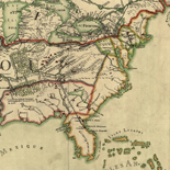
Overview - American Revolutionary War Maps
The American Revolution and Its Era: Maps and Charts of North America and the West Indies, 1750-1789 represents an important historical record of the mapping of North America and the Caribbean. Most ...
Site: LOC.gov web pages - Main Catalog Original Format: Map - Web Page Date: 2008-08-04 View catalog record -

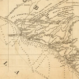
A Question Of Boundaries - Louisiana European Explorations And The Louisiana Purchase
French and American representatives faced a vexing issue when they met in Paris in April 1803 to negotiate a treaty by which the United States would purchase the province of Louisiana from ...
Site: LOC.gov web pages Original Format: Map - Web Page Date: 2007-08-13 -
Mapping The American Revolution And Its Era - American Revolutionary War Maps
Increased North American exploration in the 18th century created a great demand for improvement in the poor quality of existing maps, charts, and plans. An engraved view of a sea drama published ...
Site: LOC.gov web pages Original Format: Map - Web Page Date: 2008-08-04 -
History Of Railroads And Maps - Railroad Maps 1828 To 1900
Railways were introduced in England in the seventeenth century as a way to reduce friction in moving heavily loaded wheeled vehicles. The first North American "gravity road," as it was called, was ...
Site: LOC.gov web pages Original Format: Map - Web Page Date: 1998-10-19 -
Louisiana As A French Colony - Louisiana European Explorations And The Louisiana Purchase
Difficult Early Years of the Colony From its inception Louisiana faced an inauspicious existence. Its fate was bound to the French economy during the last years of the reign of Louis XIV. ...
Site: LOC.gov web pages Original Format: Map - Web Page Date: 2007-08-13 -

Exploring the Early Americas Home
Explores indigenous cultures, the drama of the encounters between Native Americans and Europeans, and the pivotal changes caused by the meeting of the American and European worlds.
Contributor: Gerard W. Gawalt - James H. Hutson - Pauline Maier - David McCullough - Garry Wills - Gordon Wood - Cokie Roberts - John Hope Franklin Site: LOC.gov web pages Original Format: Book - Three Dimensional Object - Map - Photo, Print, Drawing - Film, Video - Manuscript - Web Page -

Aftermath of the Encounter, Exploring the Early Americas
The encounter between the Americas and Europe altered both civilizations. This section covers three dramatic changes: Language and Religion, Competition for Empire, and Documenting New Knowledge.
Contributor: Sir Frances Drake - Amerigo Vespucci - Claudius Ptolemy - Alexander von Humboldt - John Gould - Juan Ponce de León Site: LOC.gov web pages Original Format: Book - Three Dimensional Object - Map - Photo, Print, Drawing - Manuscript - Web Page -

Creating the Bill of Rights, Creating the United States Exhibit
The Bill of Rights, the first ten amendments to the Constitution, passed by Congress in 1789, became the bedrock of individual rights and liberties.
Contributor: James Madison - Thomas Jefferson - George Washington - John Adams - Abigail Adams Site: LOC.gov web pages Original Format: Book - Manuscript - Map - Photo, Print, Drawing - Web Page -
The Louisiana Purchase - Louisiana European Explorations And The Louisiana Purchase
Napoleonic France Acquires Louisiana On October 1, 1800, within 24 hours of signing a peace settlement with the United States, First Consul of the Republic of France Napoleon Bonaparte, acquired Louisiana from ...
Site: LOC.gov web pages Original Format: Map - Web Page Date: 2007-08-13 -

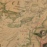
Overview - Rochambeau Maps
The Rochambeau Map Collection contains cartographic items used by Jean Baptiste Donatien de Vimeur, comte de Rochambeau (1725-1807), when he was commander in chief of the French expeditionary army (1780-82) during the ...
Site: LOC.gov web pages - Main Catalog Original Format: Map - Web Page Date: 1725-01-01 View catalog record -

Exploring the Early Americas Overview
Features selections from the more than 3,000 rare maps, documents, paintings, prints, and artifacts that make up the Jay I. Kislak Collection at the Library of Congress.
Site: LOC.gov web pages Original Format: Book - Three Dimensional Object - Map - Photo, Print, Drawing - Manuscript - Web Page -
Louisiana As A Spanish Colony - Louisiana European Explorations And The Louisiana Purchase
Diplomacy of the French Cession The impetus to cede the French colony of Louisiana to the Spanish was the long, expensive conflict of the French and Indian War, also known as the ...
Site: LOC.gov web pages Original Format: Map - Web Page Date: 2007-08-13 -

The Battle Of The Bulge - World War Ii Maps Military Situation Maps From 1944 To 1945
A timeline of the Battle of the Bulge told through the daily situation maps made for the US Military VIII Corps. December 16, 1944 - In a quick glance at the situation ...
Site: LOC.gov web pages Original Format: Map - Web Page Date: 1944-01-01 -
Overview - World War Ii Maps Military Situation Maps From 1944 To 1945
The World War II Military Situation Maps contains maps showing troop positions beginning on June 6, 1944 to July 26, 1945. Starting with the D-Day Invasion, the maps give daily details on ...
Site: LOC.gov web pages Original Format: Map - Web Page Date: 1944-01-01
Refine your search
Original Format
Online Format
- Web Page
- Image [42]
- PDF [1]