USGS - science for a changing world

Caribbean Water Science Center
  home   information/data   projects   publications   drought   flood   about   contact
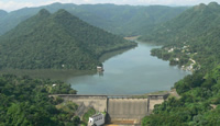
View of Lago Dos Bocas, Arecibo, PR.

DATA CENTER

PUERTO RICO PROJECTS

ABOUT THE CARIBBEAN
WSC

USGS IN YOUR STATE

USGS Water Science Centers are located in each state.

There is a USGS Water Science Center office in each State. Washington Oregon California Idaho Nevada Montana Wyoming Utah Colorado Arizona New Mexico North Dakota South Dakota Nebraska Kansas Oklahoma Texas Minnesota Iowa Missouri Arkansas Louisiana Wisconsin Illinois Mississippi Michigan Indiana Ohio Kentucky Tennessee Alabama Pennsylvania West Virginia Georgia Florida Caribbean Alaska Hawaii New York Vermont New Hampshire Maine Massachusetts South Carolina North Carolina Rhode Island Virginia Connecticut New Jersey Maryland-Delaware-D.C.

Water Resources of the Caribbean

Welcome to the USGS Caribbean Water Science Center. These pages are your source for water-resource information collected and interpreted by the U.S. Geological Survey in the Caribbean.

Current streamflow conditions in Puerto Rico; click to go to a live map.
Map legend showing percentile class groups.

Caribbean Water Science Center activities include:

  • Presentation of real-time streamflow, ground-water levels, water-quality data.
  • Operation and oversight of an extensive network of water-resource monitoring sites.
  • Archive of water-resource information collected for more than 100 years.
  • Data collection and investigative studies related to issues of concern to water-management entities and citizens.
  • Publishing data and topical reports.

Quick Link to Real-Time Data:


View site list: SW | GW | WQ

Quick Link to Water Data for Virgin Islands:

http://waterdata.usgs.gov/vi/nwis

Featured Video


Climate Connections: Questions from Puerto Rico


Also available: YouTube , QuickTime

(5:28) | Transcript/Links | Download directly (MP4)  

Caribbean Monitoring Networks

The USGS Caribbean Water Science Center continuously monitors surface water, ground water, and water quality parameters across the region. Monitoring sites are operated in cooperation with various local, State, or Federal agencies.

Find out about the Caribbean surface-water monitoring network.

Surface Water

Puerto Rico provides real-time water-stage, streamflow and precipitation data at 124 sites across the state.

Find out about the Caribbean ground-water monitoring network.

Ground Water

74 ground-water wells are monitored by the USGS in Puerto Rico.

Find out about the Caribbean water-quality monitoring network.

Water Quality

Water-quality conditions are continuously monitored by the USGS at 53 sites across Puerto Rico

Featured Project

Assessment of Hydrogeologic Conditions of the Punta de Cabullones Area, Puerto Rico
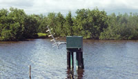
Picture of a station in Cabullones.

Monitoring station at Cabullones

The territorial development plan of Ponce seeks to separate a significant portion of the municipality for conservation purposes on the basis of esthetical, ecological, and hydrological values. Among the areas of the municipality considered for conservation is the Punta de Cabullones area, a unique coastal ecological system made up of channels, a saline-water lagoon, salt flats, and patches of mangrove forests.

Find out more

Quick Access to Real-Time Monitoring Networks

The USGS Caribbean Water Science Center continuously monitors surface water parameters across Honduras, El Salvador, Nicaragua, Guatemala, and Haiti. Monitoring sites are operated in cooperation with various local or Federal agencies.

Streamflow  |  Rainfall  |   |  All  - Puerto Rico
Streamflow  |  Rainfall  | 
--
 |  All  - El Salvador
Streamflow  |  Rainfall  | 
--
 |  All  - Guatemala
Streamflow  |  Rainfall  |   |  All  - Honduras
Streamflow  |  Rainfall  |   |  All  - Nicaragua
--
 | Rainfall
 |
--
|
All  - Haiti
--
|
--
|
--
|
All  - Virgin Islands

Data via GoogleMaps

New Maps Deliver Current Streamflow Conditions

Example of Google Map showing current streamflow conditions.Google-Map based Web page to deliver map-based current surface-water resources conditions in Puerto Rico was recently added.

The maps utilize zoom and pan to allow you to focus in on the water-monitoring sites that interest you. The maps show current streamflow as compared to historical records. By hovering your mouse over a site, a popup box shows the most recent stage and streamflow.

Highlighted Publications

The Caribbean Water Science Center produces publications about water resources.

SIR 2011-5057 Scientific Investigations Report 2011-5057
Sedimentation Survey of Lago Cerrillos, Ponce, Puerto Rico, April−May 2008
 

SIR 2010-5022 Scientific Investigations Report 2010-5022
Effects of Changes in Irrigation Practices and Aquifer Development on Groundwater Discharge to the Jobos Bay National Estuarine Research Reserve near Salinas, Puerto Rico

SIM 2010-3118 Scientific Investigations Map 2010-3118
Sedimentation Survey of Lago de Cidra, Puerto Rico, August 2007
 

SIM 2010-3128 Scientific Investigations Map 2010-3128
Sedimentation Survey of Lago Patillas, Puerto Rico, March 2007
 

Search our publications

USGS Home Water Climate Change Core Science Ecosystems Energy&Env. Health Hazards

Accessibility FOIA Privacy Policies and Notices

Take Pride in America logo USA.gov logo U.S. Department of the Interior | U.S. Geological Survey
URL: http://pr.water.usgs.govpr.water.usgs.gov/index.html
Page Contact Information: GS-W-PRsjn_webmaster@usgs.gov
Page Last Modified: Wednesday, 12-Dec-2012 09:54:18 EST

50055750: Flow=31cfs,Stage=9.16ft,Floodstage=18ft,2013-03-20 16:00,High,RIO GURABO BLW EL MANGO, PR 50144000: Flow=32cfs,Stage=0.71ft,Floodstage=11ft,2013-03-20 15:00,Low,RIO GRANDE DE ANASCO NR SAN SEBASTIAN, PR 50100450: Flow=0.21cfs,2013-03-20 16:00,Stage=2.86ft,2013-03-20 15:00:00,Low,RIO MAJADA AT LA PLENA, PR 50092000: Flow=8.4cfs,Stage=4.58ft,2013-03-20 15:00,Low,RIO GRANDE DE PATILLAS NR PATILLAS, PR 50090500: Flow=0.54cfs,Stage=3.06ft,2013-03-20 15:45,Low,RIO MAUNABO AT LIZAS, PR 50053025: Flow=3.4cfs,2013-03-20 16:00,Stage=3.73ft,2013-03-20 15:00:00,Low,RIO TURABO ABV BORINQUEN, PR 50051800: Flow=16cfs,Stage=6.85ft,Floodstage=14ft,2013-03-20 15:30,Low,RIO GRANDE DE LOIZA AT HWY 183 SAN LORENZO, PR 50050900: Flow=2.6cfs,2013-03-20 16:00,Stage=4.84ft,2013-03-20 15:00:00,Low,RIO GRANDE DE LOIZA AT QUEBRADA ARENAS, PR 50025155: Flow=2.8cfs,Stage=2.11ft,2013-03-20 15:30,Low,RIO SALIENTE AT COABEY NR JAYUYA, PR 50110900: Flow=5.9cfs,Stage=2.24ft,2013-03-20 15:30,>90,RIO TOA VACA ABV LAGO TOA VACA, PR 50106100: Flow=13cfs,Stage=3.78ft,Floodstage=10ft,2013-03-20 16:00,>90,RIO COAMO AT HWY 14 AT COAMO, PR 50061800: Flow=22cfs,Stage=2.49ft,2013-03-20 15:30,>90,RIO CANOVANAS NR CAMPO RICO, PR 50138000: Flow=40cfs,Stage=9.27ft,Floodstage=20ft,2013-03-20 15:30,76-90,RIO GUANAJIBO NR HORMIGUEROS, PR 50124200: Flow=7.9cfs,Stage=5.53ft,2013-03-20 15:15,76-90,RIO GUAYANILLA NEAR GUAYANILLA, PR 50114000: Flow=12cfs,Stage=1.57ft,2013-03-20 15:15,76-90,RIO CERRILLOS BLW LAGO CERRILLOS NR PONCE, PR 50111500: Flow=11cfs,2013-03-20 16:00,Stage=5.87ft,2013-03-20 15:10:00,76-90,RIO JACAGUAS AT JUANA DIAZ, PR 50081000: Flow=15cfs,Stage=0.62ft,2013-03-20 15:00,76-90,RIO HUMACAO AT LAS PIEDRAS, PR 50075000: Flow=8.6cfs,Stage=1.07ft,2013-03-20 15:45,76-90,RIO ICACOS NR NAGUABO, PR 50065500: Flow=37cfs,Stage=1.84ft,2013-03-20 16:00,76-90,RIO MAMEYES NR SABANA, PR 50063440: Flow=6.1cfs,Stage=3.45ft,2013-03-20 15:15,76-90,QUEBRADA SONADORA NR EL VERDE, PR 50057000: Flow=41cfs,Stage=3.95ft,Floodstage=18ft,2013-03-20 15:45,76-90,RIO GURABO AT GURABO, PR 50051310: Flow=24cfs,Stage=7.81ft,2013-03-20 16:00,76-90,RIO CAYAGUAS AT CERRO GORDO, PR 50047850: Flow=17cfs,Stage=2.48ft,2013-03-20 15:15,76-90,RIO DE BAYAMON NR BAYAMON, PR 50136400: Flow=9.9cfs,Stage=0.86ft,2013-03-20 15:30,10-24,RIO ROSARIO NR HORMIGUEROS, PR 50113800: Flow=6.1cfs,2013-03-20 16:05,Stage=1.14ft,2013-03-20 16:00:00,Floodstage=6ft,10-24,RIO CERRILLOS ABV LAGO CERRILLOS NR PONCE, PR 50100200: Flow=0.37cfs,Stage=4.39ft,2013-03-20 15:45,10-24,RIO LAPA NR RABO DEL BUEY, PR 50049100: Flow=12cfs,Stage=5.10ft,Floodstage=15ft,2013-03-20 15:15,10-24,RIO PIEDRAS AT HATO REY, PR 50045010: Flow=0.01cfs,Stage=6.77ft,Floodstage=16ft,2013-03-20 15:15,10-24,RIO DE LA PLATA BLW LA PLATA DAMSITE, PR 50038100: Flow=91cfs,Stage=10.32ft,Floodstage=25ft,2013-03-20 16:00,10-24,RIO GRANDE DE MANATI AT HWY 2 NR MANATI, PR 50029000: Flow=84cfs,Stage=2.50ft,2013-03-20 15:45,10-24,RIO GRANDE DE ARECIBO AT CENTRAL CAMBALACHE, PR 50147800: Flow=44cfs,Stage=9.95ft,Floodstage=24ft,2013-03-20 15:00,25-75,RIO CULEBRINAS AT HWY 404 NR MOCA, PR 50112500: Flow=5.5cfs,Stage=1.13ft,2013-03-20 15:45,25-75,RIO INABON AT REAL ABAJO, PR 50067000: Flow=4.2cfs,Stage=7.94ft,2013-03-20 15:00,25-75,RIO SABANA AT SABANA, PR 50064200: Flow=13cfs,Stage=4.42ft,2013-03-20 15:45,25-75,RIO GRANDE NR EL VERDE, PR 50063800: Flow=23cfs,Stage=2.93ft,2013-03-20 15:45,25-75,RIO ESPIRITU SANTO NR RIO GRANDE, PR 50059050: Flow=3.5cfs,Stage=2.93ft,2013-03-20 15:45,25-75,RIO GRANDE DE LOIZA BLW LOIZA DAMSITE, PR 50058350: Flow=7.4cfs,Stage=9.73ft,2013-03-20 15:15,25-75,RIO CANAS AT RIO CANAS, PR 50056400: Flow=11cfs,Stage=2.96ft,2013-03-20 15:15,25-75,RIO VALENCIANO NR JUNCOS, PR 50055225: Flow=19cfs,Stage=7.62ft,2013-03-20 15:15,25-75,RIO CAGUITAS AT VILLA BLANCA AT CAGUAS, PR 50055000: Flow=53cfs,Stage=4.10ft,Floodstage=16ft,2013-03-20 15:40,25-75,RIO GRANDE DE LOIZA AT CAGUAS, PR 50046000: Flow=82cfs,Stage=2.66ft,Floodstage=16ft,2013-03-20 15:30,25-75,RIO DE LA PLATA AT HWY 2 NR TOA ALTA, PR 50043800: Flow=42cfs,Stage=4.75ft,Floodstage=11ft,2013-03-20 15:30,25-75,RIO DE LA PLATA AT COMERIO, PR 50039500: Flow=39cfs,Stage=4.41ft,Floodstage=15ft,2013-03-20 15:30,25-75,RIO CIBUCO AT VEGA BAJA, PR 50035000: Flow=95cfs,Stage=2.39ft,Floodstage=10ft,2013-03-20 15:00,25-75,RIO GRANDE DE MANATI AT CIALES, PR 50034000: Flow=8.5cfs,Stage=5.31ft,2013-03-20 15:30,25-75,RIO BAUTA NR OROCOVIS, PR 50031200: Flow=30cfs,Stage=1.23ft,Floodstage=10ft,2013-03-20 15:15,25-75,RIO GRANDE DE MANATI NR MOROVIS, PR 50028400: Flow=61cfs,Stage=3.85ft,2013-03-20 15:30,25-75,RIO TANAMA AT CHARCO HONDO, PR 50028000: Flow=20cfs,Stage=3.12ft,2013-03-20 15:30,25-75,RIO TANAMA NR UTUADO, PR 50014800: Flow=39cfs,Stage=4.11ft,2013-03-20 15:30,25-75,RIO CAMUY NR BAYANEY, PR 50148890: Flow=2.2cfs,Stage=5.54ft,Floodstage=15ft,2013-03-20 15:00,Not ranked,RIO CULEBRINAS AT MARGARITA DAMSITE NR AGUADA, PR 50146073: Stage=105.53ft,2013-03-20 15:45,Not ranked,LAGO DAGUEY ABV ANASCO, PR 50145395: Flow=4.3cfs,Stage=4.50ft,2013-03-20 15:30,Not ranked,RIO CASEI ABV HACIENDA CASEI, PR 50143930: Stage=5.39ft,2013-03-20 15:30:00,Not ranked,Temporarily unavailable,RIO GRANDE DE ANASCO AT BO. GUACIO, PR 50142500: Stage=1484.74ft,2012-09-29 17:45,Not ranked,LAGO PRIETO NR ADJUNTAS, PR 50141500: Stage=1452.05ft,2013-03-20 16:00,Not ranked,LAGO GUAYO AT DAMSITE NR CASTANER, PR 50141100: Stage=1465.33ft,2013-03-20 15:45,Not ranked,LAGO YAHUECAS NR ADJUNTAS, PR 50131990: Stage=4.49ft,Floodstage=13ft,2013-03-20 15:00,Not ranked,RIO GUANAJIBO AT HWY 119 AT SAN GERMAN, PR 50129254: Flow=0.06cfs,Stage=2.29ft,2013-03-20 15:00,Not ranked,RIO LOCO AT LAS LATAS NR LA JOYA NR GUANICA, PR 50128948: Flow=2.8cfs,Stage=1.31ft,2013-03-20 15:45,Not ranked,CANAL DE RIEGO DE LAJAS AT BO. BETANCES, PR 50128945: Flow=7.4cfs,Stage=1.57ft,2013-03-20 15:00,Not ranked,CANAL DE RIEGO DE LAJAS AT BO. PALMAREJO NR LAJAS 50128940: Flow=17.2cfs,Stage=1.59ft,2013-03-20 15:45,Not ranked,CANAL DE RIEGO DE LAJAS BLW LAJAS FILT PLANT LAJAS 50128933: Flow=20.5cfs,Stage=2.68ft,2013-03-20 15:00,Not ranked,CANAL RIEGO DE LAJAS ABV LAJAS FILTRATION PLANT 50128931: Flow=13cfs,Stage=1.77ft,2013-03-20 15:00,Not ranked,LATERAL M63L AT CANAL DE RIEGO DE LAJAS, LAJAS PR 50128929: Flow=2.6cfs,2013-03-20 16:00,Stage=1.23ft,2013-03-20 15:00:00,Not ranked,LATERAL M37L AT CANAL DE RIEGO DE LAJAS SABANA GRA 50128928: Flow=1.5cfs,Stage=1.20ft,2013-03-20 15:45,Not ranked,LATERAL M33L CANAL DE RIEGO DE LAJAS SABANA GRANDE 50128925: Flow=46cfs,Stage=2.90ft,2013-03-20 15:30,Not ranked,CANAL DE RIEGO DE LAJAS BLW MAJINAS FILT. PLANT PR 50128920: Flow=50cfs,Stage=2.75ft,2013-03-20 15:15,Not ranked,CANAL DE RIEGO DE LAJAS ABV MAJINAS FILT. PLANT PR 50128918: Flow=0.00cfs,Stage=0.62ft,2013-03-20 15:45,Not ranked,LATERAL M22L, CANAL DE RIEGO LAJAS, SABANA GRANDE 50128907: Flow=0.77cfs,Stage=1.14ft,2013-03-20 15:55,Not ranked,LATERAL M5L, CANAL DE RIEGO DE LAJAS SABANA GRANDE 50128905: Flow=53cfs,Stage=1.29ft,2013-03-20 15:55,Not ranked,CANAL DE RIEGO DE LAJAS BLW LAGO LOCO DAM YAUCO PR 50128900: Stage=224.99ft,2013-03-20 15:45,Not ranked,LAGO LOCO AT DAMSITE NR YAUCO, PR 50126150: Flow=1.6cfs,Stage=2.04ft,2013-03-20 15:00,Not ranked,RIO YAUCO ABV DIVERSION MONSERRATE NR YAUCO, PR 50125780: Stage=551.93ft,2013-03-20 15:45,Not ranked,LAGO LUCCHETTI AT DAMSITE NR YAUCO, PR 50115230: Flow=4.7cfs,Stage=1.23ft,2013-03-20 15:45,Not ranked,RIO PORTUGUES BLW PORTUGUES DAMSITE, PR 50114900: Flow=7.2cfs,Stage=5.57ft,2013-03-20 16:00,Not ranked,RIO PORTUGUES NR TIBES, PR 50113950: Stage=564.91ft,2013-03-20 15:45,Not ranked,LAGO CERRILLOS AT DAMSITE NR PONCE, PR 50112525: Stage=296.95ft,2013-03-20 15:45,Not ranked,LAGO ANA MARIA AT HACIENDA ANA MARIA, PR 50111340: Flow=4.8cfs,Stage=1.65ft,2013-03-20 15:00,Not ranked,CANAL DE JUANA DIAZ AT BO. PENUELAS NR SALINAS, PR 50111330: Flow=11cfs,Stage=1.54ft,2013-03-20 15:30,Not ranked,CANAL DE JUANA DIAZ AT PASO SECO NR SANTA ISABEL 50111320: Flow=40cfs,Stage=2.33ft,2013-03-20 15:30,Not ranked,CANAL DE JUANA DIAZ AT PIEDRA AGUZADA NR JUANA DIA 50111310: Flow=9.7cfs,Stage=2.31ft,2013-03-20 15:45,Not ranked,WEST FOREBAY AT LAGO GUAYABAL, PR 50111305: Flow=15cfs,Stage=1.39ft,2013-03-20 15:45,Not ranked,EAST FOREBAY AT LAGO GUAYABAL, PR 50111300: Stage=339.34ft,2013-03-20 15:45,Not ranked,LAGO GUAYABAL AT DAMSITE NR JUANA DIAZ, PR 50111210: Stage=499.02ft,2013-03-20 15:45,Not ranked,LAGO TOA VACA AT DAMSITE NR VILLALBA, PR 50110650: Stage=10.97ft,2013-03-20 15:30,Not ranked,RIO JACAGUAS ABV LAGO GUAYABAL 50106850: Stage=160.03ft,2013-03-20 15:45,Not ranked,LAGO COAMO NR LOS LLANOS, PR 50095800: Stage=129.29ft,2013-03-20 15:45,Not ranked,LAGO MELANIA NR GUAYAMA, PR 50095000: Flow=3.4cfs,Stage=1.30ft,2013-03-20 16:05,Not ranked,CANAL DE GUAMANI OESTE AT HWY 15 GUAYAMA, PR 50094545: Flow=3.3cfs,Stage=1.21ft,2013-03-20 15:30,Not ranked,CANAL GUAMANI AT CARITE FOREBAY 50093120: Flow=0.00cfs,Stage=3.49ft,2013-03-20 15:15,Not ranked,RIO GRANDE DE PATILLAS BLW LAGO PATILLAS, PR 50093115: Flow=2.5cfs,Stage=1.32ft,2013-03-20 15:00,Not ranked,CANAL DE PATILLAS AT INTAKE 123, SALINAS PR 50093110: Flow=1.9cfs,Stage=1.25ft,2013-03-20 15:35,Not ranked,CANAL DE PATILLAS AT INTAKE 113 SALINAS, PR 50093095: Flow=4.4cfs,Stage=1.25ft,2013-03-20 15:45,Not ranked,CANAL DE PATILLAS BLW EL LEGADO INTAKE, PR 50093090: Flow=4.7cfs,Stage=1.27ft,2013-03-20 15:45,Not ranked,CANAL DE PATILLAS ABV EL LEGADO INTAKE, PR 50093085: Flow=4.4cfs,Stage=1.29ft,2013-03-20 15:00,Not ranked,CANAL DE PATILLAS BLW AES INTAKE AT GUAYAMA, PR 50093084: Flow=2.9cfs,Stage=1.45ft,2013-03-20 15:00,Not ranked,AES INTAKE CANAL AT CANAL DE PATILLAS, GUAYAMA, PR 50093083: Flow=5.0cfs,Stage=1.26ft,2013-03-20 15:00,Not ranked,CANAL DE PATILLAS ABV AES INTAKE AT GUAYAMA, PR 50093078: Flow=10.6cfs,Stage=1.43ft,2013-03-20 15:30,Not ranked,CANAL DE PATILLAS BLW GUAYAMA FILTRATION PLANT, PR 50093075: Flow=20.1cfs,Stage=2.61ft,2013-03-20 15:30,Not ranked,CANAL DE PATILLAS ABV GUAYAMA FILTRATION PLANT, PR 50093053: Flow=27.5cfs,Stage=1.66ft,2013-03-20 15:15,Not ranked,CANAL DE PATILLAS AT FOREBAY, PR 50093045: Stage=213.94ft,2013-03-20 15:45,Not ranked,LAGO PATILLAS AT DAMSITE NR PATILLAS, PR 50093000: Flow=3.7cfs,Stage=7.99ft,2013-03-20 15:45,Not ranked,RIO MARIN NR PATILLAS, PR 50085100: Flow=19cfs,Stage=12.09ft,2013-03-20 15:30,Not ranked,RIO GUAYANES AT CENTRAL ROIG, PR 50083500: Flow=24cfs,Stage=9.93ft,2013-03-20 15:45,Not ranked,RIO GUAYANES NR YABUCOA, PR 50076800: Stage=85.03ft,2013-03-20 15:30,Not ranked,LAGO BLANCO NEAR NAGUABO, PR 50076000: Flow=25cfs,Stage=9.35ft,2013-03-20 15:45,Not ranked,RIO BLANCO NR FLORIDA, PR 50075550: Flow=7.23cfs,2011-05-11 07:45,Stage=1841.51ft,2013-03-20 15:45:00,Not ranked,LAGO ICACOS AT DAMSITE, PR 50071225: Stage=157.97ft,2013-03-20 15:30,Not ranked,LAGO FAJARDO NEAR VAPOR, PR 50071000: Stage=1.08ft,2013-03-20 15:45:00,Not ranked,Rating being developed or revised,RIO FAJARDO NR FAJARDO, PR 50070900: Flow=5.1cfs,Stage=4.28ft,2013-03-20 15:20,Not ranked,RIO FAJARDO AT PARAISO NR FAJARDO, PR 50059210: Flow=3.4cfs,Stage=4.06ft,2013-03-20 15:45,Not ranked,QUEBRADA GRANDE AT BO. DOS BOCAS, PR 50059000: Stage=131.21ft,Floodstage=136ft,2013-03-20 16:00,Not ranked,LAGO LOIZA AT DAMSITE NR TRUJILLO ALTO, PR 50055380: Flow=3.8cfs,Stage=4.47ft,2013-03-20 15:45,Not ranked,RIO BAIROA ABV BAIROA, CAGUAS, PR 50050360: Stage=3.40ft,2013-03-20 15:48,Not ranked,LAGUNA TORRECILLA NR CAROLINA, PR 50050330: Stage=3.67ft,2013-03-20 15:48,Not ranked,LAGUNA PINONES NR CAROLINA, PR 50049855: Stage=3.36ft,2013-03-20 15:54,Not ranked,CANO MARTIN PENA AT ACUAEXPRESO, SAN JUAN, PR 50049800: Stage=3.48ft,2013-03-20 15:54,Not ranked,LAGUNA SAN JOSE AT SAN JUAN, PR 50048770: Stage=4.17ft,Floodstage=11ft,2013-03-20 15:15,Not ranked,RIO PIEDRAS AT EL SENORIAL, PR 50048690: Flow=3.0cfs,Stage=7.63ft,2013-03-20 15:45,Not ranked,QUEBRADA LAS CURIAS BLW LAS CURIAS OUTFLOW, PR 50048680: Stage=315.81ft,2013-03-18 15:45,Not ranked,LAGO LAS CURIAS AT DAMSITE NR RIO PIEDRAS, PR 50048565: Stage=1.08ft,2013-03-20 15:30,Not ranked,QUEBRADA SANTA CATALINA NEAR GUAYNABO, PR 50047560: Flow=13cfs,Stage=6.27ft,2013-03-20 15:15,Not ranked,RIO DE BAYAMON BLW LAGO DE CIDRA DAM, PR 50047550: Stage=1313.04ft,2013-03-20 15:45,Not ranked,LAGO DE CIDRA AT DAMSITE NR CIDRA, PR 50047535: Flow=0.15cfs,Stage=1.04ft,2013-03-20 15:30,Not ranked,RIO DE BAYAMON AT ARENAS, PR 50046510: Stage=2.95ft,2013-03-20 15:15,Not ranked,LEVITTOWN LAKE 8, TOA BAJA, PR 50045000: Stage=161.33ft,2013-03-20 15:45,Not ranked,LAGO LA PLATA AT DAMSITE NR TOA ALTA, PR 50044810: Flow=20cfs,Stage=2.73ft,2013-03-20 15:30,Not ranked,RIO GUADIANA NR GUADIANA, NARANJITO PR 50044100: Stage=568.84ft,2013-03-20 14:45,Not ranked,REPRESA DE COMERIO 2 BLW COMERIO, PR 50043197: Flow=2.0cfs,Stage=4.14ft,2013-03-20 15:00,Not ranked,RIO USABON AT HWY 162 NR BARRANQUITAS, PR 50043000: Stage=10.16ft,Floodstage=20ft,2013-03-20 15:15,Not ranked,RIO DE LA PLATA AT PROYECTO LA PLATA, PR 50039995: Flow=0.00cfs,Stage=1777.51ft,2013-03-20 15:15,Not ranked,LAGO CARITE AT SPILLWAY, PR 50038320: Stage=2.84ft,2013-03-20 15:00:00,Floodstage=13ft,Not ranked,Temporarily unavailable,RIO CIBUCO BLW COROZAL, PR 50032590: Stage=2405.95ft,2013-03-20 16:05,Not ranked,LAGO DE MATRULLAS AT DAMSITE NR OROCOVIS, PR 50032290: Stage=2953.72ft,2013-03-20 15:45,Not ranked,LAGO EL GUINEO AT DAMSITE NR VILLALBA, PR 50027600: Flow=77cfs,Stage=5.08ft,Floodstage=11ft,2013-03-20 15:30,Not ranked,RIO GRANDE DE ARECIBO NR SAN PEDRO, PR 50027100: Stage=288.35ft,Floodstage=297ft,2013-03-20 15:45,Not ranked,LAGO DOS BOCAS AT DAMSITE NR UTUADO, PR 50027000: Flow=25cfs,Stage=6.37ft,2013-03-20 15:30,Not ranked,RIO LIMON ABV LAGO DOS BOCAS, PR 50026200: Not ranked,Rating being developed or revised,RIO CAONILLAS BLW LAGO CAONILLAS TUNNEL, PR 50026140: Stage=795.53ft,2013-03-20 15:45,Not ranked,LAGO CAONILLAS AT DAMSITE NR UTUADO, PR 50026025: Flow=21cfs,Stage=3.18ft,2013-03-20 15:00,Not ranked,RIO CAONILLAS AT PASO PALMA, PR 50024950: Flow=53cfs,Stage=6.18ft,Floodstage=14ft,2013-03-20 15:30,Not ranked,RIO GRANDE DE ARECIBO BLW UTUADO, PR 50023110: Stage=1065.03ft,2013-03-20 15:45,Not ranked,LAGO VIVI NR UTUADO, PR 50021700: Flow=21cfs,Stage=3.60ft,2013-03-20 15:45,Not ranked,RIO GRANDE DE ARECIBO ABV UTUADO, PR 50020550: Stage=1245.07ft,2013-03-20 16:00,Not ranked,LAGO ADJUNTAS NR ADJUNTAS, PR 50020100: Stage=2412.04ft,2013-03-20 15:45,Not ranked,LAGO GARZAS NR ADJUNTAS, PR 50011200: Flow=4.9cfs,Stage=4.31ft,2013-03-20 15:45,Not ranked,RIO GUAJATACA BLW LAGO GUAJATACA, PR 50011190: Flow=2.5cfs,Stage=1.36ft,2013-03-20 15:15,Not ranked,CANAL AGUADILLA BLW LAGO RAMEY, AGUADILLA PR 50011180: Flow=19cfs,Stage=1.64ft,2013-03-20 15:45,Not ranked,CANAL DE AGUADILLA ABV LAGO RAMEY, AGUADILLA PR 50011128: Flow=0.00cfs,Stage=0.99ft,2013-03-20 15:30,Not ranked,CANAL MOCA ABV AGUADILLA PLANT, AGUADILLA, PR 50011095: Flow=6.1cfs,Stage=1.31ft,2013-03-20 15:30,Not ranked,CANAL MOCA BLW HWY 112, PR 50011088: Stage=514.52ft,2013-03-20 15:45,Not ranked,LAGO REGULADOR DE ISABELA NR HWY 112 ISABELA, PR 50011085: Flow=12cfs,Stage=1.60ft,2013-03-20 15:15,Not ranked,CANAL DE MOCA ABV LAGO REGULADOR (E13) ISABELA, PR 50011080: Flow=10.8cfs,Stage=1.49ft,2013-03-20 15:00,Not ranked,CANAL MOCA BLW FOREBAY, PR 50011000: Flow=52cfs,Stage=2.75ft,2013-03-20 16:00,Not ranked,CANAL DIVERSION LAGO GUAJATACA, PR 50010800: Stage=630.18ft,2013-03-20 15:45,Not ranked,LAGO GUAJATACA AT DAMSITE NR QUEBRADILLAS, PR 50010500: Flow=1.0cfs,Stage=8.36ft,2013-03-20 15:15,Not ranked,RIO GUAJATACA AT LARES, PR Go to WaterWatch (offsite) for a larger map with additional options