CURRENT STREAMFLOW CONDITIONS IN NY

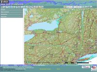
 View a detailed map. View a detailed map.
SEARCH THE NY WSC
QUESTIONS
 Ask New York USGS Ask New York USGS
DATA CENTER
ABOUT THE New York
WSC
USGS IN YOUR STATE
USGS Water Science Centers are located in each state.
|
United States Geological Survey (USGS): Water Resources of New York
Here you'll find information on New York's rivers, lakes, and estuaries. You'll also find information about groundwater, water quality, and many other topics. The USGS New York Water Science Center operates the most extensive satellite network of stream- and tide-gaging stations in the state, many of which form the backbone of flood-warning systems. The USGS provides current ("real-time") stream stage and surface-water, water-quality, and groundwater levels for over 300 sites in New York.
For emergency situations, please contact Gary Firda, Surface Water Specialist at the USGS New York Water Science Center or call our general number (518) 285-5600 and follow the directions to leave voicemail which will be immediately forwarded to a responsible party and responded to as quickly as possible.
NOTICE March 4, 2013 -- USGS to Discontinue Streamgages Due to Sequestration:
The U.S. Geological Survey (USGS) will discontinue operation of up to 375 streamgages nationwide due to budget cuts as a result of sequestration. Additional streamgages may be affected if partners reduce their funding to support USGS streamgages. The USGS is working to identify which streamgages will be impacted and will post this information as it becomes available. Streamgages are used nationwide to predict and address drought and flood conditions by monitoring water availability. Nationwide, the USGS and over 850 Federal, State, and local agencies cooperatively fund the USGS streamgaging network, which consists of over 8,000 streamgages. When budget fluctuations occur, the network is impacted. Specific impacts to the New York streamgage network currently are not known.
Hurricane Sandy Information
|
New York Water Sciences
|
Gages Remain Unfunded
NOTICE Februaury 20, 2013 -- Gage shutdown postponed until June 1, 2013.
Support for the Susquehanna Flood Forecast and Warning System in the Susquehanna River basin in New York is very likely for 2013, averting the potential shutdown of these critical flood warning sites. Currently the sites have been unfunded since October 1, 2012 and continue to be unfunded. But USGS may again get stop-gap funding to support the network for fiscal year 2013 (through to September 30, 2013). The USGS will continue operation of these sites through June 1, 2013, while negotiations continue.
For more information and and the complete list of threatened sites see: real-time water data page or map. Fact Sheets describe maintenance costs and USGS streamgage operation ( 1, 2, 3, 4).
For more information please contact Rob Breault or Ward Freeman of the USGS New York Water Science Center at (518-285-5658 or dc_ny@usgs.gov).
|
|
Water News and Notices |
    |
| New York Water Science Center in the News |
 USGS Water Alert and WaterNow USGS Water Alert and WaterNow
|
| New York Water Science Center News Releases |
| Sign up for our newsletter |
| U.S. Water Monitor |
| River and Streamflow News |
| Earthquake News |
|
Recent Reports
Featured Projects
|
|
|
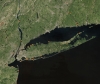 |
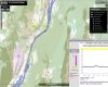
Coastal conditions in Southeastern New York; click to go to a live map |
 |
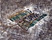
Manufacturing Facilities Release Pharmaceuticals to the Environment |
 |
Streamstats for New York |
 |
 Flood-Inundation Maps for the West Branch Delaware River, Delhi, New York Flood-Inundation Maps for the West Branch Delaware River, Delhi, New York |
 |
Water Resources and Natural Gas Production from the Marcellus Shale |
 |
Soil and Low-Ionic-Strength Water Quality Laboratory |
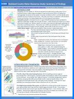 |
Rockland County Water-Resources Study: Summary of Findings |
|
|


