USGS - science for a changing world

Virginia Water Science Center

Data Center


Information Center

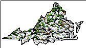
USGS IN YOUR STATE

USGS Water Science Centers are located in each state.

There is a USGS Water Science Center office in each State. WashingtonOregonCaliforniaIdahoNevadaMontanaWyomingUtahColoradoArizonaNew MexicoNorth DakotaSouth DakotaNebraskaKansasOklahomaTexasMinnesotaIowaMissouriArkansasLouisiana Wisconsin IllinoisMississippiMichiganIndianaOhioKentuckyTennesseeAlabamaPennsylvaniaWest VirginiaGeorgiaFloridaCaribbeanAlaskaHawaiiNew YorkVermontNew HampshireMaineMassachusettesSouth CarolinaNorth Carolina Rhode Island VirginiaConnecticutNew JerseyMaryland-Delaware-D.C.

Water Resources of Virginia

NOTICE March 5, 2013USGS to Discontinue Streamgages Due to Sequestration: The U.S. Geological Survey (USGS) will discontinue operation of up to 375 streamgages nationwide due to budget cuts as a result of sequestration. Additional streamgages may be affected if partners reduce their funding to support USGS streamgages. The USGS is working to identify which streamgages will be impacted and will post this information as it becomes available. Streamgages are used nationwide to predict and address drought and flood conditions by monitoring water availability. The USGS and over 850 Federal, State, and local agencies cooperatively fund the USGS streamgaging network, which consists of over 8,000 streamgages. When budget fluctuations occur, the network is impacted. Specific impacts to the Virginia real-time network currently are not known.

Welcome to the U.S. Geological Survey (USGS) Web page for the water resources of Virginia; this is your direct link to all kinds of water-resource information. Here you'll find information on Virginia's rivers and streams. You'll also find information about groundwater, water quality, and many other topics.

Instant Information about Water Conditions: Ask the River to Text You a Water Alert!!
(Press Release May 17, 2010)
Downloadable Word Document 81 KB


New Publication:  Comparison of Two Regression-Based Approaches for Determining Nutrient and Sediment Fluxes and Trends in the Chesapeake Bay Watershed

Cover of SIR 2012-5244

This report documents the comparison of two multiple regression approaches, ESTIMATOR and WRTDS, for the determination of nutrient and sediment fluxes in the Chesapeake Bay watershed. Discharge, nutrient, and sediment data collected from 1985 through 2010 at the RIM stations on the Susquehanna, Potomac, James, Rappahannock, Appomattox, Pamunkey, Mattaponi, Patuxent, and Choptank Rivers were used to construct ESTIMATOR and WRTDS models for predicting daily constituent concentrations and fluxes. ESTIMATOR and WRTDS discrete flux estimates were compared to direct observations of flux at each of the nine RIM stations to determine the accuracy and bias associated with each model. Annual estimates of nutrient and sediment flux were compared to determine the average difference in annual fluxes generated by ESTIMATOR and WRTDS. Finally, this report provides trends in WRTDS-derived annual nutrient and sediment fluxes, represented as the flow-normalized annual flux, for the periods 1985–2010 and 2001–2010.

New Publication:  South Fork Shenandoah River Habitat-Flow Modeling to Determine Ecological and Recreational Characteristics during Low-Flow Periods

Cover of SIR 2012-5081

The ecological habitat requirements of aquatic organisms and recreational streamflow requirements of the South Fork Shenandoah River were investigated by the U.S. Geological Survey in cooperation with the Central Shenandoah Valley Planning District Commission, the Northern Shenandoah Valley Regional Commission, and Virginia Commonwealth University. Physical habitat simulation modeling was conducted to examine flow as a major determinant of physical habitat availability and recreation suitability using field-collected hydraulic habitat variables such as water depth, water velocity, and substrate characteristics. Fish habitat-suitability criteria specific to the South Fork Shenandoah River were developed for sub-adult and adult smallmouth bass (Micropterus dolomieu), juvenile and sub-adult redbreast sunfish (Lepomis auritus), spotfin or satinfin shiner (Cyprinella spp), margined madtom (Noturus insignis),and river chub (Nocomis micropogon). Historic streamflow statistics for the summer low-flow period during July, August, and September were used as benchmark low-flow conditions and compared to habitat simulation results and water-withdrawal scenarios based on 2005 withdrawal data.

Current Hydrological Conditions in Virginia

Current streamflow conditions in virginia

water levels


explanation

Current Hydrologic Conditions

The map on the left shows current streamflow conditions. The map on the right shows current groundwater conditions. Click on the map for more detailed information. The maps below show streamflow conditions relative to long-term statistics (Duration Plots) for each gaged site and by hydrologic unit (Drought Conditions).


Summary of streamflow Duration Plots for Virginia, data analysis by month.
Duration Plots
Drought conditions for Virginia, data analysis based on streamflow data by HUC.
Drought Conditions

dot Virginia Drought Monitoring Task Force Report September 1, 2011  (pdf)

more drought information...

USGS StreaMail

phone

USGS StreaMail is a system for accessing real-time river stage and streamflow from hand-held wireless devices, such as cell phones and Blackberries. All you have to do is send an email or text message to "streamail@usgs.gov" and use a USGS station number in the "Subject" line. In a few minutes you'll get back an email with the most recent stage and streamflow.


Download plug-in viewers for Microsoft Office files here:

Note: PDF Reader available at get.adobe.com/reader/


USGS Home Water Resources Biology Geography Geology Geospatial Program

Accessibility FOIA Privacy Policies and Notices

Take Pride in America logo USA dot Gov: The U.S. Government's Official Web Portal U.S. Department of the Interior | U.S. Geological Survey
URL: http://va.water.usgs.gov/index.html
Page Contact Information: webmaster@va.water.usgs.gov
Page Last Modified: 12/13/2011 14:01

02072000: Flow=1460cfs,Stage=5.15ft,2007-12-12 07:15,High,SMITH RIVER NEAR PHILPOTT, VA 02075500: Flow=704cfs,Stage=2.58ft,Floodstage=20ft,2007-12-12 07:45,Low,DAN RIVER AT PACES, VA 02068500: Flow=55cfs,Stage=1.29ft,2007-12-12 04:45,Low,DAN RIVER NEAR FRANCISCO, NC 02065500: Flow=17cfs,Stage=1.60ft,2007-12-12 07:45,Low,CUB CREEK AT PHENIX, VA 02061500: Flow=57cfs,Stage=2.24ft,2007-12-12 07:45,Low,BIG OTTER RIVER NEAR EVINGTON, VA 02059500: Flow=32cfs,Stage=1.13ft,2007-12-12 07:30,Low,GOOSE CREEK NEAR HUDDLESTON, VA 02051500: Flow=46cfs,Stage=1.72ft,Floodstage=15ft,2007-12-12 07:45,Low,MEHERRIN RIVER NEAR LAWRENCEVILLE, VA 02051000: Flow=4.1cfs,Stage=0.46ft,2007-12-12 07:45,Low,NORTH MEHERRIN RIVER NEAR LUNENBURG, VA 02047000: Flow=76cfs,Stage=3.48ft,Floodstage=16ft,2007-12-12 07:15,Low,NOTTOWAY RIVER NEAR SEBRELL, VA 02046000: Flow=4.9cfs,Stage=0.97ft,2007-12-12 06:45,Low,STONY CREEK NEAR DINWIDDIE, VA 02044500: Flow=40cfs,Stage=2.45ft,Floodstage=10ft,2007-12-12 07:30,Low,NOTTOWAY RIVER NEAR RAWLINGS, VA 02039000: Flow=18cfs,Stage=2.29ft,2007-12-12 07:30,Low,BUFFALO CREEK NEAR HAMPDEN SYDNEY, VA 02035000: Flow=984cfs,Stage=0.94ft,Floodstage=20ft,2007-12-12 07:45,Low,JAMES RIVER AT CARTERSVILLE, VA 01673000: Flow=141cfs,Stage=3.58ft,Floodstage=14.0ft,2007-12-12 07:45,Low,PAMUNKEY RIVER NEAR HANOVER, VA 01671100: Flow=12cfs,Stage=2.20ft,2007-12-12 07:45,Low,LITTLE RIVER NEAR DOSWELL, VA 01660400: Flow=2.5cfs,Stage=0.48ft,2007-12-12 07:30,Low,AQUIA CREEK NEAR GARRISONVILLE, VA 03527000: Flow=175cfs,Stage=1.88ft,Floodstage=18.0ft,2007-12-12 07:15,<10,CLINCH RIVER AT SPEERS FERRY, VA 03176500: Flow=1380cfs,Stage=2.71ft,Floodstage=15ft,2007-12-12 06:00,<10,NEW RIVER AT GLEN LYN, VA 03168000: Flow=962cfs,Stage=1.31ft,Floodstage=15.0ft,2007-12-12 05:45,<10,NEW RIVER AT ALLISONIA, VA 02074500: Flow=43cfs,Stage=1.28ft,2007-12-12 07:30,<10,SANDY RIVER NEAR DANVILLE, VA 02072500: Flow=76cfs,Stage=1.51ft,2007-12-12 07:15,<10,SMITH RIVER AT BASSETT, VA 02064000: Flow=47cfs,Stage=2.75ft,2007-12-12 07:30,<10,FALLING RIVER NEAR NARUNA, VA 02056650: Flow=8.6cfs,Stage=2.51ft,2007-12-12 07:15,<10,BACK CREEK NEAR DUNDEE, VA 02055000: Flow=65cfs,Stage=0.54ft,Floodstage=10ft,2007-12-12 07:15,<10,ROANOKE RIVER AT ROANOKE, VA 02049500: Flow=11cfs,Stage=2.22ft,Floodstage=12ft,2007-12-12 07:45,<10,BLACKWATER RIVER NEAR FRANKLIN, VA 02036500: Flow=4.9cfs,Stage=1.70ft,2007-12-12 07:45,<10,FINE CREEK AT FINE CREEK MILLS, VA 02031000: Flow=25cfs,Stage=4.50ft,2007-12-12 07:45,<10,MECHUMS RIVER NEAR WHITE HALL, VA 02026000: Flow=871cfs,Stage=2.83ft,Floodstage=16ft,2007-12-12 07:45,<10,JAMES RIVER AT BENT CREEK, VA 02018500: Flow=3.8cfs,Stage=2.14ft,2007-12-12 07:45,<10,CATAWBA CREEK NEAR CATAWBA, VA 02011800: Flow=115cfs,Stage=8.62ft,2007-12-12 07:30,<10,JACKSON RIVER BL GATHRIGHT DAM NR HOT SPGS, VA 01674500: Flow=141cfs,Stage=3.44ft,Floodstage=14.0ft,2007-12-12 05:00,<10,MATTAPONI RIVER NEAR BEULAHVILLE, VA 01674000: Flow=35cfs,Stage=2.44ft,2007-12-12 07:45,<10,MATTAPONI RIVER NEAR BOWLING GREEN, VA 01673800: Flow=11cfs,Stage=1.53ft,2007-12-12 07:45,<10,PO RIVER NEAR SPOTSYLVANIA, VA 01669000: Flow=9.9cfs,Stage=3.49ft,2007-12-12 07:45,<10,PISCATAWAY CREEK NEAR TAPPAHANNOCK, VA 01665500: Flow=27cfs,Stage=1.64ft,2007-12-12 07:45,<10,RAPIDAN RIVER NEAR RUCKERSVILLE, VA 01662800: Flow=4.0cfs,Stage=1.04ft,2007-12-12 07:45,<10,BATTLE RUN NEAR LAUREL MILLS, VA 01654000: Flow=5.2cfs,Stage=1.99ft,2007-12-12 07:45,<10,ACCOTINK CREEK NEAR ANNANDALE, VA 01634000: Flow=99cfs,Stage=1.87ft,Floodstage=17ft,2007-12-12 07:45,<10,N F SHENANDOAH RIVER NEAR STRASBURG, VA 01631000: Flow=309cfs,Stage=1.13ft,Floodstage=12ft,2007-12-12 07:15,<10,S F SHENANDOAH RIVER AT FRONT ROYAL, VA 01629500: Flow=345cfs,Stage=2.24ft,Floodstage=12.0ft,2007-12-12 07:45,<10,S F SHENANDOAH RIVER NEAR LURAY, VA 01626000: Flow=33cfs,Stage=2.43ft,Floodstage=9.5ft,2007-12-12 07:15,<10,SOUTH RIVER NEAR WAYNESBORO, VA 01622000: Flow=47cfs,Stage=1.73ft,2007-12-12 07:45,<10,NORTH RIVER NEAR BURKETOWN, VA 03478400: Flow=7.7cfs,Stage=2.67ft,2007-12-12 07:45,<10,BEAVER CREEK AT BRISTOL, VA 03171000: Flow=853cfs,Stage=1.78ft,Floodstage=14ft,2007-12-12 05:45,<10,NEW RIVER AT RADFORD, VA 03165500: Flow=719cfs,Stage=2.08ft,2007-12-12 07:00,<10,NEW RIVER AT IVANHOE, VA 03164000: Flow=487cfs,Stage=0.88ft,Floodstage=9ft,2007-12-12 05:30,<10,NEW RIVER NEAR GALAX, VA 02077500: Flow=20cfs,Stage=4.53ft,2007-12-12 04:15,<10,HYCO RIVER NEAR DENNISTON, VA 02077303: Flow=2.8cfs,Stage=3.00ft,2007-12-12 05:00,<10,HYCO R BL ABAY D NR MCGEHEES MILL, NC 02070500: Flow=128cfs,Stage=1.16ft,2007-12-12 07:45,<10,MAYO RIVER NEAR PRICE, NC 02069700: Flow=38cfs,Stage=3.29ft,2007-12-12 07:45,<10,SOUTH MAYO RIVER NEAR NETTLERIDGE, VA 02066000: Flow=775cfs,Stage=5.28ft,Floodstage=21ft,2007-12-12 07:45,<10,ROANOKE (STAUNTON) RIVER AT RANDOLPH, VA 02062500: Flow=544cfs,Stage=6.19ft,Floodstage=23ft,2007-12-12 07:45,<10,ROANOKE (STAUNTON) RIVER AT BROOKNEAL, VA 02055100: Flow=1.7cfs,Stage=1.21ft,2007-12-12 07:45,<10,TINKER CREEK NEAR DALEVILLE, VA 02053800: Flow=24cfs,Stage=0.66ft,2007-12-12 07:30,<10,S F ROANOKE RIVER NEAR SHAWSVILLE, VA 02045500: Flow=79cfs,Stage=2.80ft,Floodstage=15ft,2007-12-12 07:30,<10,NOTTOWAY RIVER NEAR STONY CREEK, VA 02041650: Flow=171cfs,Stage=1.77ft,Floodstage=10ft,2007-12-12 07:45,<10,APPOMATTOX RIVER AT MATOACA, VA 02041000: Flow=24cfs,Stage=1.74ft,2007-12-12 07:30,<10,DEEP CREEK NEAR MANNBORO, VA 02040000: Flow=146cfs,Stage=7.06ft,Floodstage=21ft,2007-12-12 07:30,<10,APPOMATTOX RIVER AT MATTOAX, VA 02034000: Flow=103cfs,Stage=2.53ft,Floodstage=17ft,2007-12-12 07:45,<10,RIVANNA RIVER AT PALMYRA, VA 02030500: Flow=47cfs,Stage=2.49ft,2007-12-12 07:15,<10,SLATE RIVER NEAR ARVONIA, VA 02029000: Flow=887cfs,Stage=2.74ft,Floodstage=20ft,2007-12-12 07:15,<10,JAMES RIVER AT SCOTTSVILLE, VA 02028500: Flow=17cfs,Stage=0.51ft,2007-12-12 07:45,<10,ROCKFISH RIVER NEAR GREENFIELD, VA 02027500: Flow=13cfs,Stage=2.06ft,2007-12-12 07:45,<10,PINEY RIVER AT PINEY RIVER, VA 02027000: Flow=21cfs,Stage=2.61ft,2007-12-12 07:45,<10,TYE RIVER NEAR LOVINGSTON, VA 01672500: Flow=60cfs,Stage=1.89ft,2007-12-12 05:00,<10,SOUTH ANNA RIVER NEAR ASHLAND, VA 01668000: Flow=185cfs,Stage=2.02ft,Floodstage=999ft,2007-12-12 07:00,<10,RAPPAHANNOCK RIVER NEAR FREDERICKSBURG, VA 01667500: Flow=65cfs,Stage=0.55ft,Floodstage=14ft,2007-12-12 07:45,<10,RAPIDAN RIVER NEAR CULPEPER, VA 01666500: Flow=38cfs,Stage=1.75ft,2007-12-12 07:45,<10,ROBINSON RIVER NEAR LOCUST DALE, VA 01656000: Flow=4.0cfs,Stage=2.07ft,2007-12-12 07:45,<10,CEDAR RUN NEAR CATLETT, VA 01628500: Flow=164cfs,Stage=2.33ft,Floodstage=16ft,2007-12-12 07:45,<10,S F SHENANDOAH RIVER NEAR LYNNWOOD, VA 01627500: Flow=58cfs,Stage=2.28ft,2007-12-12 07:45,<10,SOUTH RIVER AT HARRISTON, VA 02011460: Flow=125cfs,Stage=1.61ft,2007-12-12 07:00,76-90,BACK CREEK NEAR SUNRISE, VA 03531500: Flow=74cfs,Stage=1.35ft,Floodstage=18.0ft,2007-12-12 07:45,10-24,POWELL RIVER NEAR JONESVILLE, VA 03524000: Flow=149cfs,Stage=1.68ft,Floodstage=14.0ft,2007-12-12 07:45,10-24,CLINCH RIVER AT CLEVELAND, VA 03488000: Flow=77cfs,Stage=0.76ft,Floodstage=10ft,2007-12-12 07:45,10-24,N F HOLSTON RIVER NEAR SALTVILLE, VA 03475000: Flow=72cfs,Stage=1.95ft,2007-12-12 07:45,10-24,M F HOLSTON RIVER NEAR MEADOWVIEW, VA 03474000: Flow=43cfs,Stage=1.14ft,2007-12-12 07:45,10-24,M F HOLSTON RIVER AT SEVEN MILE FORD, VA 03473000: Flow=132cfs,Stage=2.62ft,2007-12-12 07:45,10-24,S F HOLSTON RIVER NEAR DAMASCUS, VA 03471500: Flow=29cfs,Stage=1.36ft,2007-12-12 07:45,10-24,S F HOLSTON RIVER AT RIVERSIDE, NEAR CHILHOWIE, VA 03209000: Flow=39cfs,Stage=2.03ft,2007-12-12 06:15,10-24,POUND RIVER BELOW FLANNAGAN DAM, NEAR HAYSI, VA 03208950: Flow=13cfs,Stage=1.76ft,2007-12-12 05:30,10-24,CRANES NEST RIVER NEAR CLINTWOOD, VA 03173000: Flow=50cfs,Stage=3.05ft,2007-12-12 05:30,10-24,WALKER CREEK AT BANE, VA 03170000: Flow=132cfs,Stage=1.06ft,2007-12-12 05:30,10-24,LITTLE RIVER AT GRAYSONTOWN, VA 03167000: Flow=70cfs,Stage=1.40ft,2007-12-12 07:00,10-24,REED CREEK AT GRAHAMS FORGE, VA 03165000: Flow=29cfs,Stage=1.38ft,2007-12-12 07:00,10-24,CHESTNUT CREEK AT GALAX, VA 02080500: Flow=2290cfs,Stage=3.17ft,Floodstage=9ft,2007-12-12 07:45,10-24,ROANOKE RIVER AT ROANOKE RAPIDS, NC 02077000: Flow=173cfs,Stage=3.68ft,2007-12-12 07:00,10-24,BANISTER RIVER AT HALIFAX, VA 02070000: Flow=59cfs,Stage=1.49ft,2007-12-12 07:45,10-24,NORTH MAYO RIVER NEAR SPENCER, VA 02060500: Flow=619cfs,Stage=2.96ft,Floodstage=18ft,2007-12-12 07:30,10-24,ROANOKE RIVER AT ALTAVISTA, VA 02058400: Flow=162cfs,Stage=2.56ft,2007-12-12 05:00,10-24,PIGG RIVER NEAR SANDY LEVEL, VA 02056000: Flow=142cfs,Stage=1.67ft,2007-12-12 07:45,10-24,ROANOKE RIVER AT NIAGARA, VA 02054500: Flow=51cfs,Stage=1.19ft,2007-12-12 07:45,10-24,ROANOKE RIVER AT LAFAYETTE, VA 02047500: Flow=16cfs,Stage=2.78ft,2007-12-12 07:45,10-24,BLACKWATER RIVER NEAR DENDRON, VA 02042500: Flow=64cfs,Stage=3.20ft,2007-12-12 08:00,10-24,CHICKAHOMINY RIVER NEAR PROVIDENCE FORGE, VA 02039500: Flow=107cfs,Stage=4.12ft,Floodstage=16ft,2007-12-12 07:45,10-24,APPOMATTOX RIVER AT FARMVILLE, VA 02038850: Flow=3.0cfs,Stage=1.01ft,2007-12-12 07:45,10-24,HOLIDAY CREEK NEAR ANDERSONVILLE, VA 02037500: Flow=1210cfs,Stage=3.61ft,Floodstage=12ft,2007-12-12 07:30,10-24,JAMES RIVER NEAR RICHMOND, VA 02030000: Flow=31cfs,Stage=1.54ft,2007-12-12 07:45,10-24,HARDWARE RIVER BL BRIERY RUN NR SCOTTSVILLE, VA 02025500: Flow=786cfs,Stage=4.18ft,Floodstage=22ft,2007-12-12 07:45,10-24,JAMES RIVER AT HOLCOMB ROCK, VA 02024000: Flow=115cfs,Stage=1.48ft,Floodstage=17ft,2007-12-12 07:45,10-24,MAURY RIVER NEAR BUENA VISTA, VA 02022500: Flow=8.6cfs,Stage=2.72ft,2007-12-12 07:45,10-24,KERRS CREEK NEAR LEXINGTON, VA 02021500: Flow=57cfs,Stage=1.21ft,2007-12-12 07:00,10-24,MAURY RIVER AT ROCKBRIDGE BATHS, VA 02020500: Flow=21cfs,Stage=1.68ft,2007-12-12 07:45,10-24,CALFPASTURE RIVER ABOVE MILL CREEK AT GOSHEN, VA 02019500: Flow=573cfs,Stage=2.29ft,Floodstage=17ft,2007-12-12 07:45,10-24,JAMES RIVER AT BUCHANAN, VA 02018000: Flow=60cfs,Stage=3.68ft,Floodstage=7.0ft,2007-12-12 07:15,10-24,CRAIG CREEK AT PARR, VA 02017500: Flow=22cfs,Stage=2.79ft,2007-12-12 07:45,10-24,JOHNS CREEK AT NEW CASTLE, VA 02014000: Flow=35cfs,Stage=2.15ft,Floodstage=5.0ft,2007-12-12 07:30,10-24,POTTS CREEK NEAR COVINGTON, VA 02013100: Flow=205cfs,Stage=4.60ft,Floodstage=17ft,2007-12-12 07:30,10-24,JACKSON RIVER BL DUNLAP CREEK AT COVINGTON, VA 01664000: Flow=246cfs,Stage=3.40ft,Floodstage=15ft,2007-12-12 07:15,10-24,RAPPAHANNOCK RIVER AT REMINGTON, VA 01663500: Flow=84cfs,Stage=2.73ft,2007-12-12 07:15,10-24,HAZEL RIVER AT RIXEYVILLE, VA 01653600: Flow=12cfs,Stage=2.57ft,2007-12-12 07:30,10-24,PISCATAWAY CREEK AT PISCATAWAY, MD 01646000: Flow=20cfs,Stage=2.90ft,2007-12-12 07:15,10-24,DIFFICULT RUN NEAR GREAT FALLS, VA 01644000: Flow=39cfs,Stage=1.40ft,Floodstage=12ft,2007-12-12 07:45,10-24,GOOSE CREEK NEAR LEESBURG, VA 01643700: Flow=22cfs,Stage=2.45ft,2007-12-12 07:45,10-24,GOOSE CREEK NEAR MIDDLEBURG, VA 01638480: Flow=16cfs,Stage=2.99ft,2007-12-12 07:30,10-24,CATOCTIN CREEK AT TAYLORSTOWN, VA 01636500: Flow=772cfs,Stage=1.69ft,Floodstage=13.5ft,2007-12-12 04:00,10-24,SHENANDOAH RIVER AT MILLVILLE, WV 01633000: Flow=60cfs,Stage=2.41ft,2007-12-12 07:45,10-24,N F SHENANDOAH RIVER AT MOUNT JACKSON, VA 01632900: Flow=17cfs,Stage=1.16ft,2007-12-12 07:45,10-24,SMITH CREEK NEAR NEW MARKET, VA 01632000: Flow=14cfs,Stage=2.06ft,Floodstage=15ft,2007-12-12 07:15,10-24,N F SHENANDOAH RIVER AT COOTES STORE, VA 01625000: Flow=85cfs,Stage=3.30ft,2007-12-12 07:15,10-24,MIDDLE RIVER NEAR GROTTOES, VA 03213500: Flow=6.6cfs,Stage=2.70ft,2007-12-12 05:30,25-75,PANTHER CREEK NEAR PANTHER, WV 03208500: Flow=117cfs,Stage=2.50ft,Floodstage=19ft,2007-12-12 05:30,25-75,RUSSELL FORK AT HAYSI, VA 03207800: Flow=189cfs,Stage=3.15ft,Floodstage=21ft,2007-12-12 06:30,25-75,LEVISA FORK AT BIG ROCK, VA 03175500: Flow=159cfs,Stage=3.24ft,2007-12-12 06:00,25-75,WOLF CREEK NEAR NARROWS, VA 02079640: Flow=42cfs,Stage=3.49ft,2007-12-12 07:30,25-75,ALLEN CREEK NEAR BOYDTON, VA 02074000: Flow=386cfs,Stage=2.27ft,2007-12-12 07:00,25-75,SMITH RIVER AT EDEN, NC 02073000: Flow=319cfs,Stage=2.20ft,2007-12-12 07:45,25-75,SMITH RIVER AT MARTINSVILLE, VA 02052000: Flow=280cfs,Stage=2.38ft,Floodstage=23ft,2007-12-12 07:30,25-75,MEHERRIN RIVER AT EMPORIA, VA 02037000: Flow=86cfs,Stage=6.22ft,2007-12-12 07:30,25-75,JAMES RIVER AND KANAWHA CANAL NEAR RICHMOND, VA 02016500: Flow=523cfs,Stage=2.11ft,Floodstage=16ft,2007-12-12 07:45,25-75,JAMES RIVER AT LICK RUN, VA 02016000: Flow=231cfs,Stage=2.03ft,Floodstage=16.0ft,2007-12-12 07:30,25-75,COWPASTURE RIVER NEAR CLIFTON FORGE, VA 02015700: Flow=117cfs,Stage=1.78ft,2007-12-12 07:45,25-75,BULLPASTURE RIVER AT WILLIAMSVILLE, VA 02013000: Flow=48cfs,Stage=1.61ft,Floodstage=8.0ft,2007-12-12 07:30,25-75,DUNLAP CREEK NEAR COVINGTON, VA 02011500: Flow=255cfs,Stage=3.26ft,Floodstage=7.0ft,2007-12-12 07:30,25-75,BACK CREEK NEAR MOUNTAIN GROVE, VA 02011400: Flow=101cfs,Stage=3.60ft,2007-12-12 07:30,25-75,JACKSON RIVER NEAR BACOVA, VA 01658500: Flow=8.7cfs,Stage=1.90ft,Floodstage=5.0ft,2007-12-12 07:15,25-75,S F QUANTICO CREEK NEAR INDEPENDENT HILL, VA 01653000: Flow=12cfs,Stage=1.13ft,2007-12-12 05:15,25-75,CAMERON RUN AT ALEXANDRIA, VA 01652500: Flow=4.8cfs,Stage=4.20ft,2007-12-12 08:00,25-75,FOURMILE RUN AT ALEXANDRIA, VA 01646500: Flow=4110cfs,Stage=3.22ft,Floodstage=10ft,2007-12-12 07:45,25-75,POTOMAC RIVER NEAR WASH, DC LITTLE FALLS PUMP STA 01645000: Flow=75cfs,Stage=2.10ft,Floodstage=7.5ft,2007-12-12 05:15,25-75,SENECA CREEK AT DAWSONVILLE, MD 01643500: Flow=29cfs,Stage=1.67ft,2007-12-12 06:30,25-75,BENNETT CREEK AT PARK MILLS, MD 01638500: Flow=9990cfs,Stage=3.68ft,Floodstage=16ft,2007-12-12 07:45,25-75,POTOMAC RIVER AT POINT OF ROCKS, MD 01635500: Flow=17cfs,Stage=3.31ft,2007-12-12 07:45,25-75,PASSAGE CREEK NEAR BUCKTON, VA 01634500: Flow=30cfs,Stage=1.87ft,2007-12-12 07:45,25-75,CEDAR CREEK NEAR WINCHESTER, VA 01620500: Flow=10cfs,Stage=1.21ft,2007-12-12 08:00,25-75,NORTH RIVER NEAR STOKESVILLE, VA 01615000: Flow=25cfs,Stage=4.51ft,2007-12-12 05:00,25-75,OPEQUON CREEK NEAR BERRYVILLE, VA 01613900: Flow=7.7cfs,Stage=0.64ft,2007-12-12 07:30,25-75,HOGUE CREEK NEAR HAYFIELD, VA 01607500: Flow=47cfs,Stage=1.27ft,2007-12-12 06:00,25-75,SO FK SO BR POTOMAC R AT BRANDYWINE, WV 0211371675: Stage=1.34ft,2007-12-12 05:45:00,Not ranked,PAULS CREEK ABOVE SR 1625 NEAR PINE RIDGE, NC 0207730290: Stage=372.96ft,2007-12-12 05:00:00,Not ranked,AFTERBAY RESERVOIR AT DAM NR MCGEHEES MILL, NC 0163626650: Flow=7.1cfs,Stage=1.78ft,2007-12-12 05:00,Not ranked,MANASSAS RUN AT RT 645 NEAR FRONT ROYAL, VA 03529500: Flow=38cfs,Stage=1.91ft,2007-12-12 07:15,Not ranked,POWELL RIVER AT BIG STONE GAP, VA 03277300: Flow=28cfs,Stage=1.29ft,Floodstage=10ft,2007-12-12 06:45,Not ranked,NORTH FORK KENTUCKY RIVER AT WHITESBURG, KY 03212980: Flow=61cfs,Stage=2.79ft,2007-12-12 04:00,Not ranked,DRY FORK AT BEARTOWN, W. VA. 03209300: Stage=6.29ft,2007-12-12 05:30:00,Floodstage=21ft,Not ranked,RUSSELL FORK AT ELKHORN CITY, KY 03182888: Stage=46.64ft,2007-12-12 07:00:00,Not ranked,DRY CREEK AT TUCKAHOE, WV 03178150: Stage=16.96ft,2007-12-12 06:00:00,Not ranked,MIDDLE FORK BRUSH CREEK AT EDISON, WV 03177710: Flow=23cfs,Stage=1.19ft,2007-12-12 07:45,Not ranked,BLUESTONE RIVER AT FALLS MILLS, VA 03170500: Stage=1.29ft,2007-12-12 07:30:00,Not ranked,LITTLE RIVER RESERVOIR NEAR RADFORD, VA 02079500: Stage=2.87ft,2007-12-12 07:15:00,Not ranked,ROANOKE RIVER AT BUGGS ISLAND, VA 02077670: Flow=3.1cfs,Stage=1.92ft,2007-12-12 06:15,Not ranked,MAYO CR NR BETHEL HILL, NC 02077280: Stage=7.12ft,2007-12-12 06:00:00,Not ranked,HYCO LAKE AT DAM NR ROXBORO, NC 02075045: Flow=517cfs,Stage=4.34ft,Floodstage=17ft,2007-12-12 07:45,Not ranked,DAN RIVER AT STP NEAR DANVILLE, VA 02071530: Flow=20cfs,Stage=2.30ft,2007-12-12 07:45,Not ranked,SMITH RIVER AT SMITH RIV CHURCH NR WOOLWINE, VA 02061000: Stage=1.42ft,2007-12-12 07:15:00,Not ranked,BIG OTTER RIVER NEAR BEDFORD, VA 02059485: Stage=1.82ft,2007-12-12 07:15:00,Not ranked,GOOSE CREEK AT RT 747 NEAR BUNKER HILL, VA 02056900: Flow=31cfs,Stage=1.68ft,2007-12-12 07:45,Not ranked,BLACKWATER RIVER NEAR ROCKY MOUNT, VA 02054530: Flow=56cfs,Stage=1.95ft,2007-12-12 07:15,Not ranked,ROANOKE RIVER AT GLENVAR, VA 02032640: Flow=17cfs,Stage=1.28ft,2007-12-12 07:45,Not ranked,N F RIVANNA RIVER NEAR EARLYSVILLE, VA 02032250: Flow=9.3cfs,Stage=2.70ft,2007-12-12 07:45,Not ranked,MOORMANS RIVER NEAR FREE UNION, VA 02024915: Flow=7.7cfs,Stage=2.60ft,2007-12-12 07:30,Not ranked,PEDLAR RIVER AT FOREST ROAD NEAR BUENA VISTA, VA 02024752: Flow=797cfs,Stage=4.14ft,2007-12-12 07:45,Not ranked,JAMES RIVER AT BLUE RIDGE PKWY NR BIG ISLAND, VA 02024750: Stage=5.82ft,2007-12-12 07:15:00,Not ranked,JAMES RIVER AT BEDFORD DAM NR MAJOR, VA 02011490: Flow=6.8cfs,Stage=1.14ft,2007-12-12 07:45,Not ranked,LITTLE BACK CREEK NEAR SUNRISE, VA 02011470: Flow=165cfs,Stage=4.95ft,2007-12-12 07:30,Not ranked,BACK CREEK AT SUNRISE, VA 01673638: Flow=1.5cfs,Stage=3.91ft,2007-12-12 07:15,Not ranked,COHOKE MILL CREEK NEAR LESTER MANOR, VA 01673550: Flow=18cfs,Stage=2.27ft,2007-12-12 07:45,Not ranked,TOTOPOTOMOY CREEK NEAR STUDLEY, VA 01671025: Flow=22cfs,Stage=3.00ft,2007-12-12 07:45,Not ranked,NORTH ANNA RIVER ABOVE LITTLE RIVER NR DOSWELL, VA 01671020: Flow=18cfs,Stage=2.33ft,2007-12-12 07:45,Not ranked,NORTH ANNA RIVER AT HART CORNER NEAR DOSWELL, VA 01670400: Flow=9.9cfs,Stage=3.98ft,2007-12-12 07:15,Not ranked,NORTH ANNA RIVER NEAR PARTLOW, VA 01669520: Flow=46cfs,Stage=4.05ft,2007-12-12 07:45,Not ranked,DRAGON SWAMP AT MASCOT, VA 01660795: Stage=0.80ft,2007-12-12 07:54:00,Not ranked,POTOMAC RIVER NEAR NEWBURG, MD 01660000: Stage=3.32ft,2007-12-12 07:00,Not ranked,Rating being developed or revised,S BRANCH CHOPAWAMSIC CREEK NR GARRISONVILLE, VA 01659500: Flow=1.3cfs,Stage=1.68ft,2007-12-12 07:00,Not ranked,M BRANCH CHOPAWAMSIC CREEK NR GARRISONVILLE, VA 01659000: Flow=0.40cfs,Stage=3.13ft,2007-12-12 07:00,Not ranked,N BRANCH CHOPAWAMSIC CR NR INDEPENDENT HILL, VA 01658000: Flow=32cfs,Stage=2.46ft,2007-12-12 05:30,Not ranked,MATTAWOMAN CREEK NEAR POMONKEY, MD 01656903: 0000-00-00 00:00,Stage=0.69ft,2007-12-12 08:00:00,Not ranked,Rating being developed or revised,FLATLICK BRANCH ABOVE FROG BRANCH AT CHANTILLY, VA 01651800: 0000-00-00 00:00,Stage=-0.51ft,2007-12-12 07:15:00,Not ranked,Rating being developed or revised,WATTS BRANCH AT WASHINGTON, DC 01651750: Stage=0.84ft,2007-12-12 07:36:00,Not ranked,ANACOSTIA RIVER AQUATIC GARDENS AT WASHINGTON, DC 01647600: Stage=1.65ft,2007-12-12 07:54:00,Floodstage=7ft,Not ranked,POTOMAC RIVER AT WISCONSIN AVE, WASHINGTON, DC 01645762: 0000-00-00 00:00,Stage=1.02ft,2007-12-12 08:00:00,Not ranked,Rating being developed or revised,SF LITTLE DIFFICULT RUN AB MOUTH NR VIENNA, VA 01645704: 0000-00-00 00:00,Stage=1.29ft,2007-12-12 08:00:00,Not ranked,Rating being developed or revised,DIFFICULT RUN ABOVE FOX LAKE NEAR FAIRFAX, VA 01644280: Flow=27cfs,Stage=2.69ft,2007-12-12 05:00,Not ranked,BROAD RUN NEAR LEESBURG, VA 01643880: Flow=9.6cfs,Stage=1.89ft,2007-12-12 07:45,Not ranked,BEAVERDAM CREEK AT RT 734 NEAR MOUNTVILLE, VA 01643805: Stage=2.49ft,2007-12-12 05:00,Not ranked,Equipment malfunction,N F GOOSE CREEK AT RT 729 NEAR LINCOLN, VA 01643590: Flow=2.7cfs,Stage=0.64ft,2007-12-12 07:45,Not ranked,LIMESTONE BRANCH NEAR LEESBURG, VA 01638420: Flow=6.7cfs,Stage=2.03ft,2007-12-12 05:00,Not ranked,N F CATOCTIN CREEK AT RT 681 NEAR WATERFORD, VA 01638350: Flow=4.5cfs,2007-12-12 07:15,Not ranked,S F CATOCTIN CREEK AT RT 698 NEAR WATERFORD, VA 01636690: Flow=1.1cfs,Stage=0.95ft,2007-12-12 05:00,Not ranked,PINEY RUN NEAR LOVETTSVILLE, VA 01636316: Flow=9.8cfs,Stage=1.64ft,2007-12-12 08:00,Not ranked,SPOUT RUN AT RT 621 NEAR MILLWOOD, VA 01636242: Flow=13cfs,Stage=1.72ft,2007-12-12 07:45,Not ranked,CROOKED RUN BELOW HWY 340 AT RIVERTON, VA 01635090: Flow=43cfs,Stage=1.81ft,2007-12-12 08:00,Not ranked,CEDAR CREEK ABOVE HWY 11 NEAR MIDDLETOWN, VA 01632082: Flow=9.7cfs,Stage=1.39ft,2007-12-12 07:45,Not ranked,LINVILLE CREEK AT BROADWAY, VA 01630700: Flow=4.1cfs,Stage=1.23ft,2007-12-12 05:00,Not ranked,GOONEY RUN NEAR GLEN ECHO, VA 01626850: Flow=40cfs,Stage=2.15ft,2007-12-12 07:45,Not ranked,SOUTH RIVER NEAR DOOMS, VA 01621050: Flow=7.4cfs,Stage=2.74ft,2007-12-12 05:00,Not ranked,MUDDY CREEK AT MOUNT CLINTON, VA 01620000: Stage=5.20ft,2007-12-12 05:00:00,Floodstage=18ft,Not ranked,POTOMAC RIVER AT HARPERS FERRY, WV 01616100: Flow=1.8cfs,Stage=1.36ft,2007-12-12 07:15,Not ranked,DRY MARSH RUN NEAR BERRYVILLE, VA 01616075: Flow=0.77cfs,Stage=2.86ft,2007-12-12 05:00,Not ranked,FAY SPRING NEAR WINCHESTER, VA 01614830: Flow=3.1cfs,Stage=3.27ft,2007-12-12 05:00,Not ranked,OPEQUON CREEK NEAR STEPHENS CITY, VA 01610400: Flow=6.8cfs,Stage=2.84ft,2007-12-12 05:15,Not ranked,WAITES RUN NEAR WARDENSVILLE, WV 01607300: Stage=46.76ft,2007-12-12 07:00:00,Not ranked,BRUSHY FORK NEAR SUGAR GROVE, WV real-time va map real-time va map