
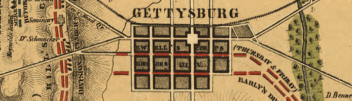
[Detail] Field of Gettysburg, July 1st, 2nd & 3rd, 1863
Standards
Collection Overview
Civil War Maps, a subset of Map Collections: 1500-2004, contains approximately 2,240 Civil War maps and charts and 76 atlase and sketchbooks depicting battles, troop positions and movements, engagements, and fortifications. Included are maps of the whole United States, maps of major regions such as the Eastern or Southern States, maps of the Mississippi River, and state maps. The vast majority of the maps were prepared by Federal forces or by commercial firms in the North, but there are also a substantial number by Confederate military authorities and a few by Southern publishers.
In a hurry? Save or print these Collection Connections as a single file.
Special Features
These online exhibits provide context and additional information about this collection.
Historical Eras
These historical era(s) are best represented in the collection, although they may not be all-encompassing.
- The Civil War and Reconstruction, 1850-1877
Related Collections and Exhibits
These collections and exhibits contain thematically-related primary and secondary sources. Also browse the Collection Finder for more related material on the American Memory Web site.
- Abraham Lincoln Papers at the Library of Congress
- African-American Experience in Ohio
- African American Odyssey
- African American Perspectives, 1818-1907
- Band Music from the Civil War Era
- Civil War Photographs, 1861-1865
- Civil War Sheet Music
- The Gettysburg Address
- Historic American Sheet Music, 1850-1920
- Narratives of the American South, 1860-1920
- Nineteenth-Century Song Sheets
- Pioneering the Upper Midwest: Books from Michigan, Minnesota, and Wisconsin, ca. 1820-1910
- Recovered Notebooks from the Thomas Biggs Harned Walt Whitman Collection
- Small-Town America: Stereoscopic Views from the Robert Dennis Collection, 1850-1920
- Taking the Long View: Panoramic Photographs, 1851-1991
- The Alfred Whital Stern Collection of Lincolniana
Other Resources
Recommended additional sources of information.
Search Tips
Specific guidance for searching this collection.
To find items in this collection, search by Keyword or browse the Subject Index, Creator Index, Title List, or Geographic Index.
For help with general search strategies, go to Finding Items in American Memory.