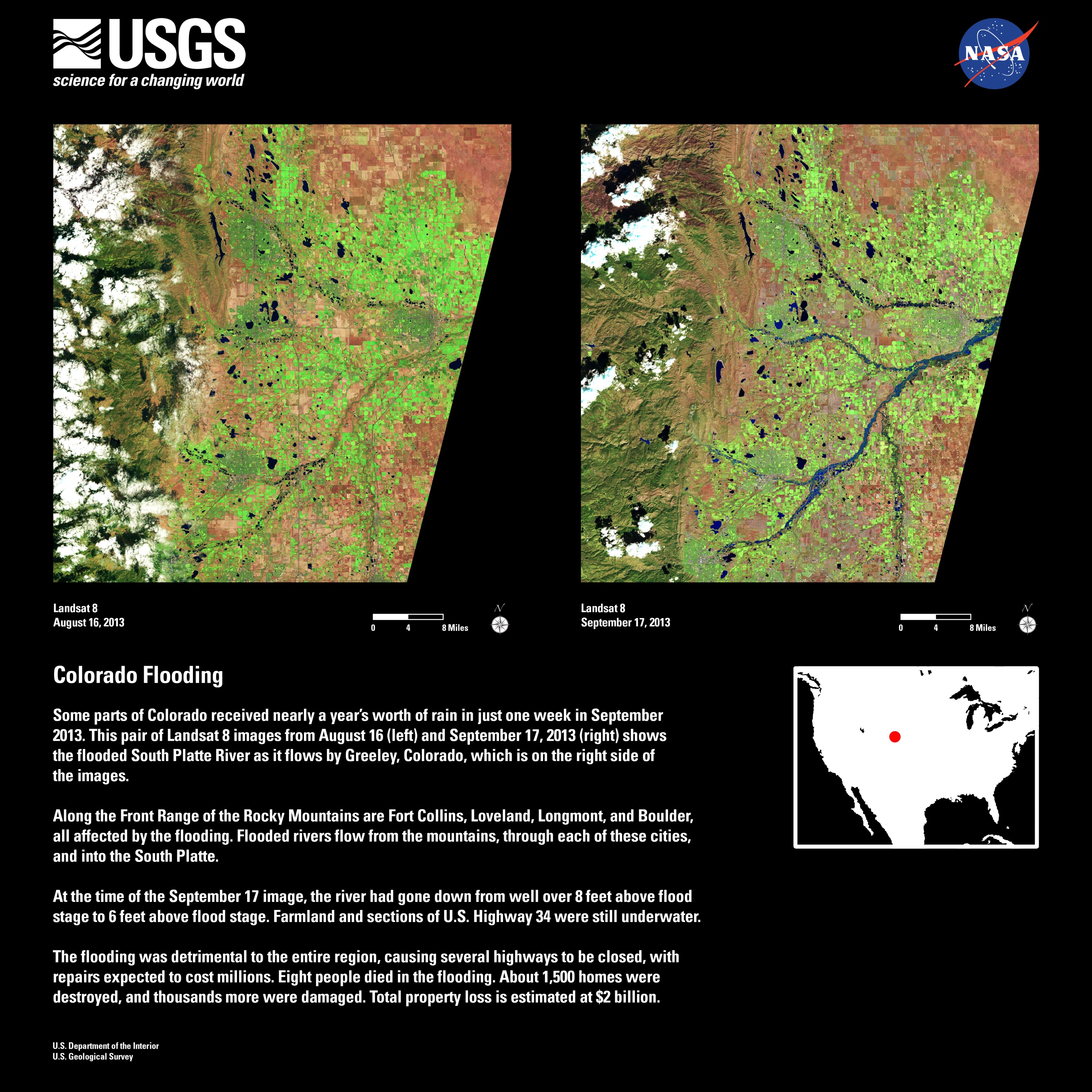
Some parts of Colorado received nearly a year’s worth of rain in just one week in September 2013. This pair of Landsat 8 images from August 16 (left) and September 17, 2013 (right) shows the flooded South Platte River as it flows by Greeley, Colorado, which is on the right side of the images.
Along the Front Range of the Rocky Mountains are Fort Collins, Loveland, Longmont, and Boulder, all affected by the flooding. Flooded rivers flow from the mountains, through each of these cities, and into the South Platte.
At the time of the September 17 image, the river had gone down from well over 8 feet above flood stage to 6 feet above flood stage. Farmland and sections of U.S. Highway 34 were still underwater.
The flooding was detrimental to the entire region, causing several highways to be closed, with repairs expected to cost millions. Eight people died in the flooding. About 1,500 homes were destroyed, and thousands more were damaged. Total property loss is estimated at $2 billion.


