| Update November 29, 2011: |
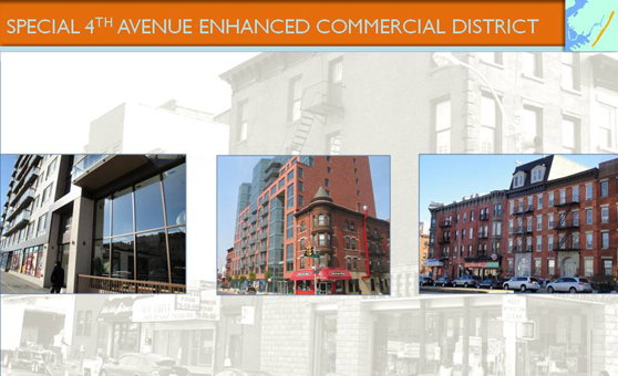
| On November 29, 2011 the City Council adopted the Special 4th Avenue Enhanced Commercial District.
The zoning text and map changes are now in effect. |
 Introduction
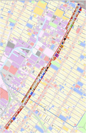
The Department of City Planning (DCP) is proposing a zoning text amendment and zoning map change to create the Special Fourth Avenue Enhanced Commercial District for the portion of Fourth Avenue from Atlantic Avenue to 24th Street in Brooklyn Community Districts 2, 6 and 7. The proposed special district would ensure the continued development of Fourth Avenue as a lively, mixed use neighborhood by establishing regulations to promote a vibrant mix of commercial and community facility uses on the ground floor of new developments and enlargements, and would apply certain streetscape and sidewalk continuity guidelines in place to enhance the pedestrian environment.
The proposed actions are the result of close collaboration with the local community boards, civic groups and elected officials. The portions of Fourth Avenue to which these regulations would apply have been rezoned in recent years to encourage mid-density mixed use development with ground floor commercial uses. The proposed Special District would ensure that this trend of creating a vibrant mixed use corridor would continue.
While many of the more recent mixed use developments and proposals along this portion of Fourth Avenue have included a mix of uses at the ground floor to better engage the growing pedestrian population, the Department has been engaged with the local community to explore regulations that would ensure a more lively streetscape context with streetscape controls and ground floor neighborhood services and amenities to better serve the growing residential population. The proposed changes would apply to new developments and enlargements along 56 blockfronts of Fourth Avenue zoned R8A/C2-4 or R8A in the Park Slope and South Park Slope neighborhoods of Brooklyn.
Brief explanations of terms in green italics can be viewed by clicking on the term. Words and phrases followed by an asterisk (*) are defined terms in the Zoning Resolution, primarily in Section 12-10. Consult the Zoning Resolution for the official and legally binding definitions of these words and phrases.
|