Description
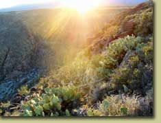
Adjacent to rapidly expanding communities, the 70,900-acre Agua Fria National Monument is approximately 40 miles north of central Phoenix. The area is located on a high mesa semi-desert grassland, cut by the canyon of the Agua Fria River and other ribbons of valuable riparian forest, contributing to an outstanding biological resource. The diversity of vegetative communities, topographic features, and a dormant volcano decorates the landscape with a big rocky, basaltic plateau. The Agua Fria river canyon cuts through this plateau exposing precambrian rock along the canyon walls. Elevations range from 2,150 feet above sea level along the Agua Fria Canyon to about 4,600 feet in the northern hills. This expansive mosaic of semi-desert area, cut by ribbons of valuable riparian forest, offers one of the most significant systems of prehistoric sites in the American Southwest. In addition to the rich record of human history, the monument contains outstanding biological resources.
The area is the home to coyotes, bobcats, antelope, mule deer, javelina, a variety of small mammals and songbirds. Eagles and other raptors may also be seen. Native fish such as the longfin dace, the Gila mountain sucker, the Gila chub, and the speckled dace, exist in the Agua Fria River and its tributaries.
Directions
The Agua Fria National Monument is located 40 miles north of Phoenix, AZ. It is easily accessed by traveling on Interstate 17 to the Badger Springs (Exit #256), Bloody Basin Road (Exit #259), or Cordes Junction exits.
Visitor Activities
There is lots to see and do within the Agua Fria National Monument, depending on the season. Hiking, viewing cultural sites, wildlife viewing, birdwatching, hunting (big-game and upland game-bird), scenic drives, and four-wheel driving (off-road travel is not allowed) are just a sampling of activities you can enjoy.
Special Features
A desert grassland extends across an extensive mesa cut by canyon walls and the Agua Fria River. Pueblo la Plata showcases a major settlement of stone masonry pueblos. To visit la Plata, travel 8.3 miles on Bloody Basin Road from the entrance of the national monument. Turn north and follow the dirt road for approximately one mile. A high clearance vehicle is recommended. Limited parking is available. Walk to the site by following the rocky and uneven trail.
Permits, Fees, Limitations
Permits are required for visiting groups of 25 or more people. Commercial guides must also be permitted. Livestock grazing and authorized rights-of-way are still allowed. New mining claims are not permitted.
Accessibility
The monument has no developed facilities. The terrain is rough and rocky – a high clearance 4 x 4 vehicle is required.
Camping and Lodging
There are no facilities within the monument. Undeveloped areas are available for camping with a 14 day limit. Local campgrounds and motels are located in the adjacent communities of Black Canyon City and Cordes Lakes.
Food and Supplies
Grocery and hardware stores, restaurants, and gas stations are located in the adjacent communities of Black Canyon City and Cordes Lakes.
First Aid
There is no first-aid station on-site. The nearest hospital is located in north Phoenix.
Additional Information
The elevation of the monument ranges from 2,000 to 4,000 feet. Summer visitors must take extra precaution to drink plenty of water as temperatures may exceed 110 degrees Fahrenheit. Sunscreen, sunglasses, and a large brimmed hat are recommended. Make sure your gasoline tank is full, carry additional water in your vehicle, and make sure your vehicle is in good condition.
The hot desert sun stirs up rattlesnakes and other reptiles as early as February. Summer is rough on visitors and recreationists must drink plenty of water. Flash floods caused by sudden storms can be dangerous in washes, so it is best to have a survival plan to prevent emergency situations. Contact the Monument office for additional information.
Agua Fria National Monument
Tom Jones, Acting Monument Manager
21605 N. 7th Avenue
Phoenix, AZ 85027-2929
(623) 580-5500