United States Geological Survey (USGS): Water Resources of Florida
The mission of the Water Discipline, which supports the overall mission of the U.S. Department of the Interior and the U.S. Geological Survey, is to provide the hydrologic information and understanding needed for the best use and management of the Nation's water resources for the benefit of the people of the United States.
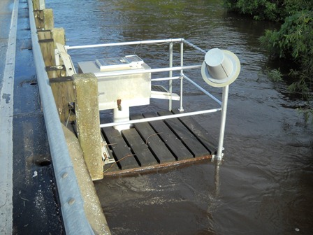
The USGS provides current ("real-time") stream stage and streamflow, water-quality, and groundwater levels for sites in Florida. The NWIS Mapper is available to display active and historical station locations with links to their available data.
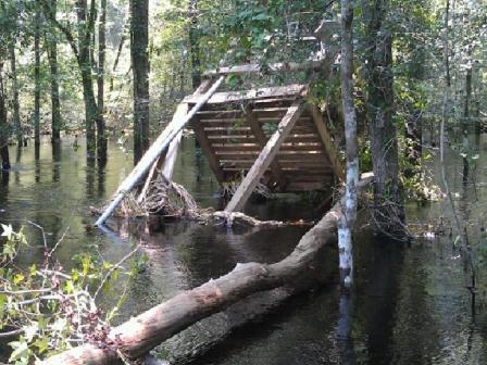
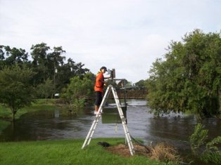
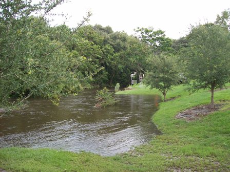
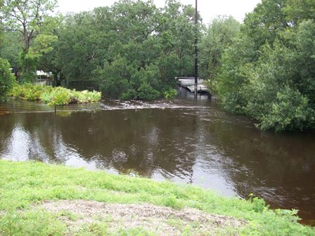
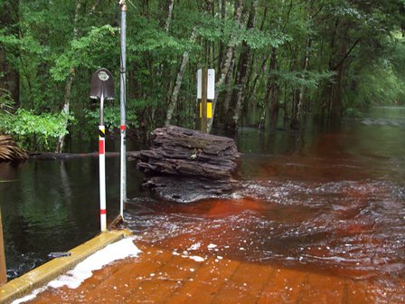
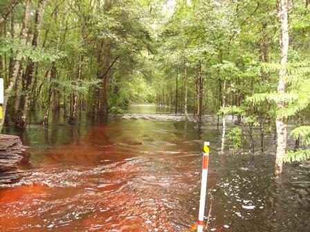
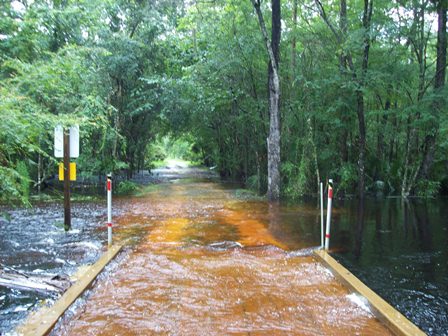
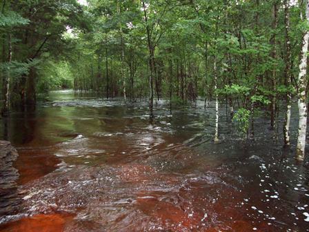
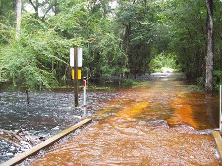
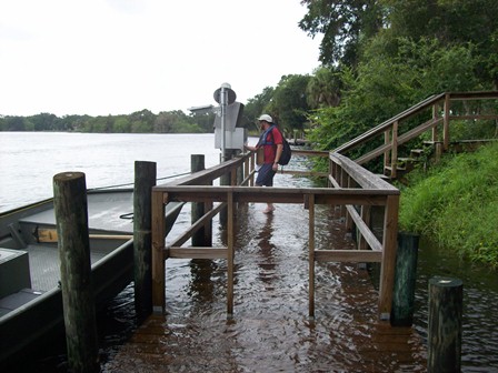
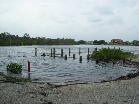
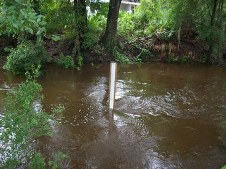
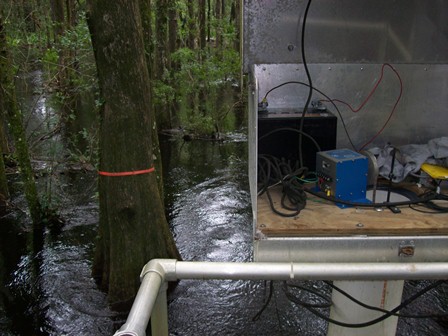
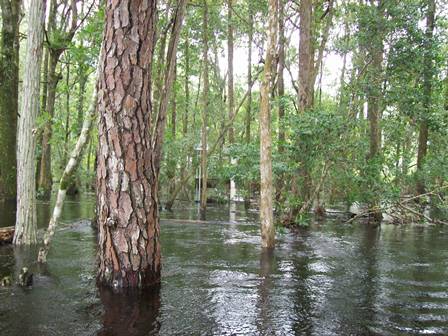
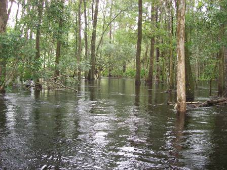
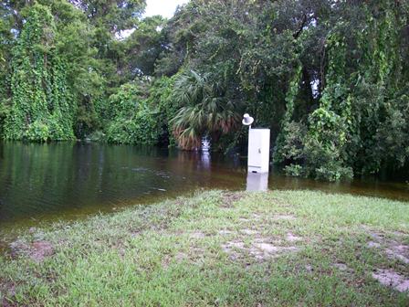
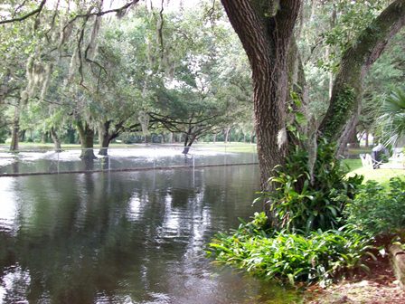
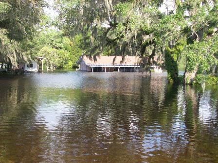
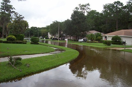
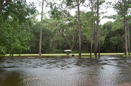
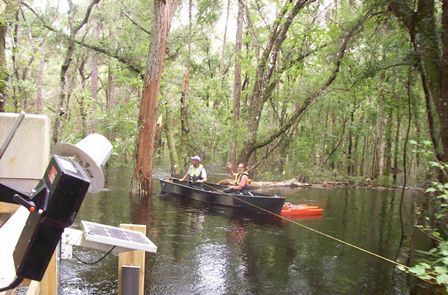
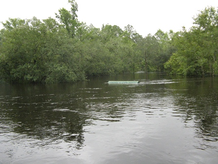
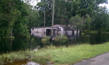
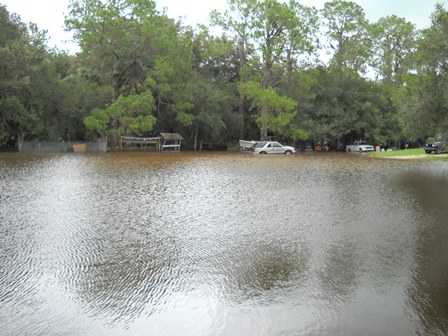
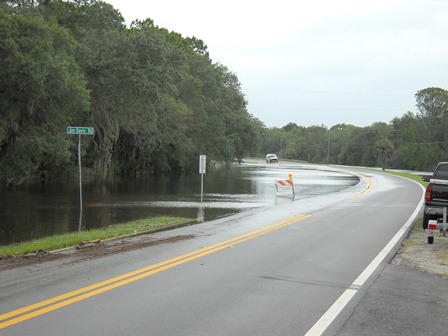
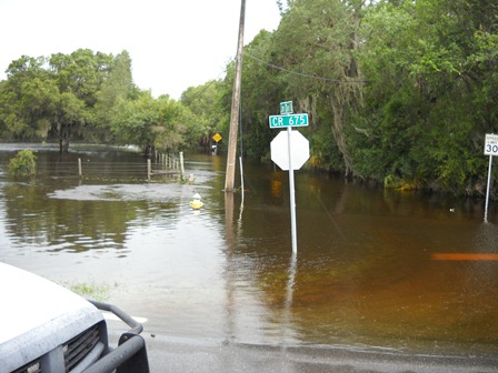
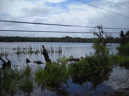
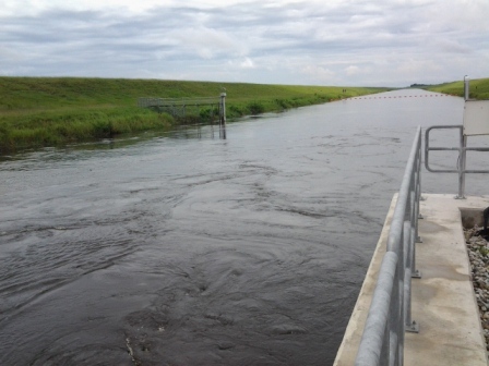
Flooding in Florida from Tropical Storm Debby, June 2012
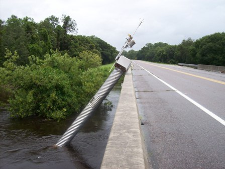
Heavy rain from Tropical Storm Debby began affecting west-central Florida on June 21, 2012 as it moved into the Gulf of Mexico. The storm idled off of the coast of north Florida before making landfall near Steinhatchee on June 26 then moved across north Florida and into the Atlantic Ocean on June 27 near Palm Coast, north of Daytona, Fl. Heavy rains occurred in the Tampa Bay area (15 inches) on June 24, in Wakulla (26 inches) on June 25, and in Jacksonville (6 inches) on June 26 resulting in widespread flooding. USGS streamflow gages recorded 9 stations with period of record peaks. USGS staff made over 100 discharge measurements during this time and repaired numerous gages. In the Tampa area, the resulting flood at Anclote River near Elfers, Florida was the second highest in 67 years and had a 1% (1 chance in 100 for any given year) chance of recurring. In north Florida, south of Tallahassee the flood at Sopchoppy River near Sopchoppy, Fl was the highest in 51 years of record. The chance of recurring was over 0.2% (1 chance in 500 for any given year). In northeast Florida, at North Fork Black Creek near Middleburg the peak was the highest since 1919 and also had a 1% chance of recurring.
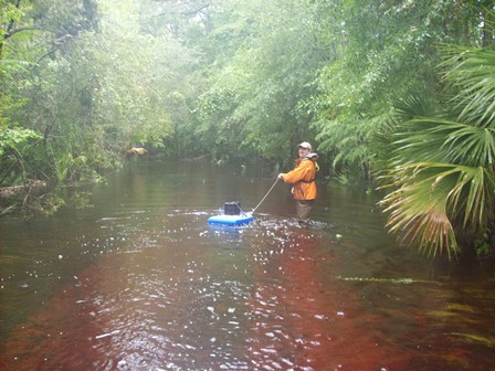
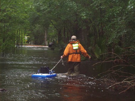
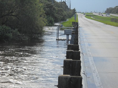
In Florida the USGS maintains a network of more than 500 stream gages that provide data in real time. Data from these gages are used by local, state and federal officials for numerous purposes, including public safety and flood forecasting by the National Weather Service.
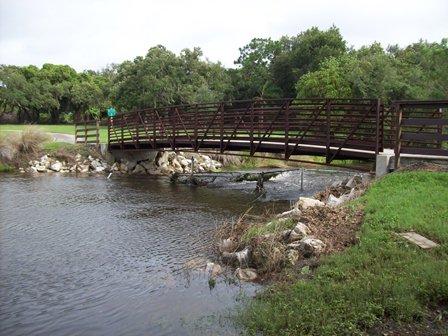
This video was taken 6/27/12 on Lassie Black Road after heading South on US441 from State Road 6. Employees were heading to site 02315500, Suwanee at White Springs, as they approached a washed out bridge at Falling Creek forcing them to turn around. Tropical Storm Debby Video.
USGS Florida Science Highlights
Carbonate Aquifer Characterization Laboratory
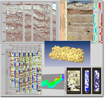 The Carbonate Aquifer Characterization Laboratory (CACL) was initiated to promote collaborative research on carbonate aquifer characterization between the U.S. Geological Survey (USGS) Florida Water Science Center (Davie office) and other governmental scientific agencies and academia. And, also to provide applied research for local, state, and federal agencies, and private industry, when research needs are within the scope of the USGS mission. The Carbonate Aquifer Characterization Laboratory (CACL) was initiated to promote collaborative research on carbonate aquifer characterization between the U.S. Geological Survey (USGS) Florida Water Science Center (Davie office) and other governmental scientific agencies and academia. And, also to provide applied research for local, state, and federal agencies, and private industry, when research needs are within the scope of the USGS mission.
As the primary Federal science agency for water-resources information, the USGS is responsible for monitoring the quantity and quality of water in the Nation's rivers and aquifers and assessing the sources and fate of contaminants in aquatic systems. Towards this goal, a top priority for the USGS is to provide information to better define and manage the quality of the Nation's water resources. The CACL directly addresses this priority issue for the USGS by improving strategies to identify and protect drinking-water sources. The approach of the CACL is focused on the integration of the various disciplines that include core examination, sequence stratigraphy, borehole geophysics, digital optical borehole imaging, seismic, ground-penetrating radar, computational methods (eg., Lattice Boltzmann methods), and 3D geomodeling.
 Find out more Find out more
Gages Remain Unfunded
NOTICE (3/8/2012) Budget shortfalls at all levels of government have cause reductions in the amount of hydrologic data collected in Florida. Across the state, 229 USGS stream, lake, rainfall, water quality, and groundwater monitoring sites have been discontinued as of 10/1/2011. In addition, some long-term projects like the potentiometric surface maps of the Upper Floridan aquifer have been discontinued.
For a map of discontinued sites, go to Florida discontinued stations. Although historic data for these sites will remain accessible through this web site, no new data will be collected by the USGS. For some sites, data collection has been taken over by other agencies and new data may be available through them. If you have questions about any of these stations, please contact Richard Kane of the USGS Florida Water Science Center (813-498-5057, rkane@usgs.gov).
Florida Weather
Recent Publications
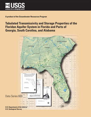 |
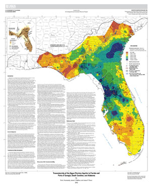
Data Series 669—Tabulated Transmissivity and Storage Properties of the Floridan aquifer system in Florida and Parts of Georgia, South Carolina, and Alabama |
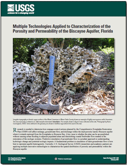 |
Open-File Report 2011-1037—Multiple Technologies Applied to Characterization of the Porosity and Permeability of the Biscayne aquifer, Florida |
 View our recent publications. View our recent publications.
USGS WaterAlert
 The U.S. Geological Survey WaterAlert service sends e-mail or text messages when certain parameters measured by a USGS water-monitoring site exceed user-definable thresholds. You can subscribe to Florida water-monitoring sites and be alerted when high water hits. The U.S. Geological Survey WaterAlert service sends e-mail or text messages when certain parameters measured by a USGS water-monitoring site exceed user-definable thresholds. You can subscribe to Florida water-monitoring sites and be alerted when high water hits.
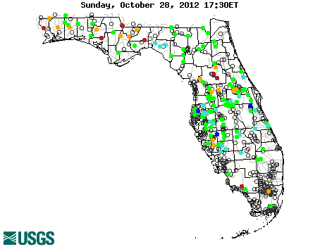
Florida WaterWatch
Maps Deliver Current Streamflow Conditions
 A Google-Map based Web page to deliver map-based current surface-water resources conditions in Florida was recently added. A Google-Map based Web page to deliver map-based current surface-water resources conditions in Florida was recently added.
The maps utilize zoom and pan to allow you to focus in on the water-monitoring sites that interest you. Maps and data about current and past streamflow, floods, and drought are available.
| 


.JPG)
.jpg)
.jpg)
.jpg)
.JPG)
.JPG)


.jpg)
.jpg)
.jpg)
.jpg)
.jpg)
.jpg)


.jpg)