CURRENT CONDITIONS

 View a detailed map. View a detailed map.
DATA CENTER
INFORMATION CENTER
ABOUT THE TEXAS WSC
USGS IN YOUR STATE
USGS Water Science Centers are located in each state.

|
Water Resources of Texas
The U.S. Geological Survey (USGS) Texas Water Science Center works in cooperation with approximately 100 municipalities,
river authorities, groundwater districts, and State and Federal agencies in Texas to provide reliable, impartial scientific
information to resource managers, planners, and other customers. This information is gathered by the USGS Texas Water
Science Center to minimize the loss of life and property from natural disasters, to contribute to the conservation and sound
economic and physical development of the Nation's natural resources, and to enhance the quality of life by monitoring water,
biological, energy, and mineral resources.
The USGS provides real-time stream stage and stream flow, water quality, and groundwater levels for more than 650 sites in Texas.
|
Quick Link to Real-Time Data
View site list: SW | GW | QW
|
|
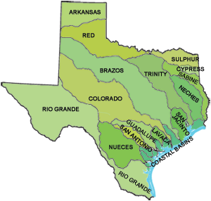
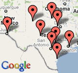
Click on the map to view real-time sites by river basin
|
Spotlight on Texas Projects
The Texas Water Science Center conducts hydrologic projects that address a wide variety of water-resources issues, including water supply, groundwater contamination, nutrient loading in streams, effects of land use on water quality, and basic hydrologic data collection.
 All Texas Projects All Texas Projects
Featured Project:
Elevated concentrations of sediment-associated contaminants are typically associated with urban areas, and San Antonio is the seventh most populous city in the U.S. During 2007–09, the USGS collected streambed sediment samples during baseflow and suspended-sediment samples during stormwater runoff at 20 sites in the Medio Creek, Medina River, Elm Creek, Martinez Creek, Chupaderas Creek, Leon Creek, Salado Creek, and San Antonio River watersheds. The samples were analyzed for major and trace elements and organic compounds including halogenated compounds and polycyclic aromatic hydrocarbons (PAHs). Concentrations were mostly low compared to consensus-based sediment-quality guidelines and compared to samples collected during previous USGS studies in the Austin and Fort Worth areas. The overall degree of sediment contamination was highest in samples collected from four sites in Leon Creek and one site in the San Antonio River.
Fact Sheet | Spanish language version
Podcasts/Videos
Paint it Black
by Douglas Harned
Pete Van Metre and Barbara Mahler discuss an experiment to assess release of Polycyclic Aromatic Hydrocarbons (PAHs) from coal tar pavement sealant after application on a parking lot.
Watch the video at vimeo.com
|
Featured Publications
Spatially Pooled Depth-Dependent Reservoir Storage, Elevation, and Water-Quality Data for Selected Reservoirs in Texas,
January 1965–January 2010
By Thomas E. Burley, William H. Asquith, and Donald L. Brooks
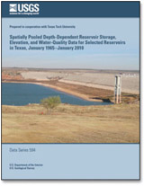
The U.S. Geological Survey, in cooperation with Texas Tech University, constructed a dataset of selected reservoir storage, reservoir elevation, and water-quality data from 59 reservoirs throughout Texas. Data were acquired from existing databases, spreadsheets, delimited text files, and hard-copy reports. Data were combined from multiple sources to create as complete a set of properties and constituents as the disparate databases allowed. By devising a unique per-reservoir short name to represent all sites on a reservoir regardless of their source, all sampling sites at a reservoir were spatially pooled by reservoir and temporally combined by date. This report presents a collection of delimited text files of source-aggregated, spatially pooled, depth-dependent, instantaneous water-quality data as well as instantaneous, daily, and monthly storage and elevation reservoir data.
Data Series Report
 Search our publications Search our publications
|
|