![Plano. I descripcion de la costa, desde el Cavo Cañaveral, hasta cerca de la boca de la Vir[g]inia, contando, costa de Florida, Georgia y Carolinas del S, y N, con todos sus puertos, este[ros ... ]letas, baxos, islas y rios; segun las vlti[mas not]icias, hata [sic] oy Octubre de 1756.](https://cybercemetery.unt.edu/archive/oilspill/20121025065413im_/http://www.loc.gov/collections/static/american-revolutionary-war-maps/images/ct000339.jpg)

![[Topographical map of part of Washington D.C.].](https://cybercemetery.unt.edu/archive/oilspill/20121025065413im_/http://www.loc.gov/collections/static/civil-war-maps/images/cw0688500.jpg)
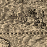

![Amérique septentrion.lle [i.e. septentrionale] : composée, corigée, et augmētée, sur les iournaux, mémoires, et observations les plus justes qui en ón'́etes.tes en l'année 1685 & 1686, par plusieurs particuliés](https://cybercemetery.unt.edu/archive/oilspill/20121025065413im_/http://www.loc.gov/collections/static/discovery-and-exploration/images/ct000667.jpg)


![[January 3, 1945], HQ Twelfth Army Group situation map.](https://cybercemetery.unt.edu/archive/oilspill/20121025065413im_/http://www.loc.gov/collections/static/world-war-II-maps-military-situation-maps-from-1944-to-1945/images/ict21213.jpg)

![[December 16, 1944], HQ Twelfth Army Group situation map.](https://cybercemetery.unt.edu/archive/oilspill/20121025065413im_/http://www.loc.gov/collections/static/world-war-II-maps-military-situation-maps-from-1944-to-1945/images/ict21195.jpg)
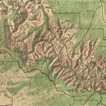
![[Rough sketch of the Rich Mountain battle area extending from Beverly, W. Va. to Clarksburg].](https://cybercemetery.unt.edu/archive/oilspill/20121025065413im_/http://www.loc.gov/collections/static/hotchkiss-maps/images/cwh00078.jpg)
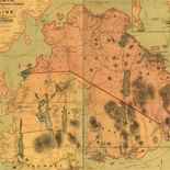
![[Base map of Alabama].](https://cybercemetery.unt.edu/archive/oilspill/20121025065413im_/http://www.loc.gov/collections/static/hotchkiss-maps/images/cwh00201.jpg)
Results
Refined by:
Original Format: Map India.
Contributor:
United States. Central Intelligence Agency
Site:
American Memory-cultural, Main Catalog
Original Format:
Map
Date:
2001
View catalog record
India.
Contributor:
United States. Central Intelligence Agency
Site:
American Memory-cultural, Main Catalog
Original Format:
Map
Date:
2001
View catalog record
 A plan of the city and environs of Philadelphia : with the works and encampments of His Majesty's forces under the command of Lieutenant General ...
Contributor:
Faden, William
Site:
American Memory-cultural, Main Catalog
Original Format:
Map
Date:
1779
View catalog record
A plan of the city and environs of Philadelphia : with the works and encampments of His Majesty's forces under the command of Lieutenant General ...
Contributor:
Faden, William
Site:
American Memory-cultural, Main Catalog
Original Format:
Map
Date:
1779
View catalog record
 Map showing completed canals in Southern Drainage District to June 1, 1934.
Site:
American Memory-cultural
Original Format:
Map
Date:
1934-06-01
Map showing completed canals in Southern Drainage District to June 1, 1934.
Site:
American Memory-cultural
Original Format:
Map
Date:
1934-06-01
 Texas Coast showing points of occupation of expedition under Maj. Gen. N.P. Banks : Nov'r 1863.
Site:
American Memory-cultural, Main Catalog
Original Format:
Map
Date:
1863
View catalog record
Texas Coast showing points of occupation of expedition under Maj. Gen. N.P. Banks : Nov'r 1863.
Site:
American Memory-cultural, Main Catalog
Original Format:
Map
Date:
1863
View catalog record
 [Rough draught of Boston and harbour.
Site:
American Memory-cultural, Main Catalog
Original Format:
Map
Date:
1776
View catalog record
[Rough draught of Boston and harbour.
Site:
American Memory-cultural, Main Catalog
Original Format:
Map
Date:
1776
View catalog record
 Map of the village of Lockport, Niagara Co., N.Y. /
Contributor:
Callan, Bernard
Site:
American Memory-cultural, Main Catalog
Original Format:
Map
Date:
1851
View catalog record
Map of the village of Lockport, Niagara Co., N.Y. /
Contributor:
Callan, Bernard
Site:
American Memory-cultural, Main Catalog
Original Format:
Map
Date:
1851
View catalog record
 [October 28, 1944], HQ Twelfth Army Group situation map.
Contributor:
Allied Forces. Army Group, 12th. Engineer Section
Site:
American Memory-cultural, Main Catalog
Original Format:
Map
Date:
1944-10-28
View catalog record
[October 28, 1944], HQ Twelfth Army Group situation map.
Contributor:
Allied Forces. Army Group, 12th. Engineer Section
Site:
American Memory-cultural, Main Catalog
Original Format:
Map
Date:
1944-10-28
View catalog record
 A Plan of the Straits of St. Mary, and Michilimakinac, to shew the situation & importance of the two westernmost settlements of Canada for the ...
Site:
American Memory-cultural, Main Catalog
Original Format:
Map
Date:
1750
View catalog record
A Plan of the Straits of St. Mary, and Michilimakinac, to shew the situation & importance of the two westernmost settlements of Canada for the ...
Site:
American Memory-cultural, Main Catalog
Original Format:
Map
Date:
1750
View catalog record
 Carte de l'isle de Saint Domingue, pour servir à l'Histoire générale des voyages.
Contributor:
Bellin, Jacques Nicolas
Site:
American Memory-cultural, Main Catalog
Original Format:
Map
Date:
1758
View catalog record
Carte de l'isle de Saint Domingue, pour servir à l'Histoire générale des voyages.
Contributor:
Bellin, Jacques Nicolas
Site:
American Memory-cultural, Main Catalog
Original Format:
Map
Date:
1758
View catalog record

 Map of Fayette Co., Pa.
Site:
American Memory-cultural, Main Catalog
Original Format:
Map
View catalog record
Map of Fayette Co., Pa.
Site:
American Memory-cultural, Main Catalog
Original Format:
Map
View catalog record
 Map of St. Helena Sound, and the coast between Charleston and Savannah /
Contributor:
A. Williams & Co
Site:
American Memory-cultural, Main Catalog
Original Format:
Map
Date:
1861
View catalog record
Map of St. Helena Sound, and the coast between Charleston and Savannah /
Contributor:
A. Williams & Co
Site:
American Memory-cultural, Main Catalog
Original Format:
Map
Date:
1861
View catalog record
 Topographical sketch of the battle field of Stone River near Murfreesboro, Tennessee, December 30th 1862 to January 3d 1863 . . . Position of the ...
Contributor:
Weyss, J. E.
Site:
American Memory-cultural, Main Catalog
Original Format:
Map
Date:
1863
View catalog record
Topographical sketch of the battle field of Stone River near Murfreesboro, Tennessee, December 30th 1862 to January 3d 1863 . . . Position of the ...
Contributor:
Weyss, J. E.
Site:
American Memory-cultural, Main Catalog
Original Format:
Map
Date:
1863
View catalog record
 Part of Federal point entrance to Cape Fear River. Sketch showing line of rebel forifications captured by the combined naval and military forces
Contributor:
United States. Navy
Site:
American Memory-cultural, Main Catalog
Original Format:
Map
Date:
1865
View catalog record
Part of Federal point entrance to Cape Fear River. Sketch showing line of rebel forifications captured by the combined naval and military forces
Contributor:
United States. Navy
Site:
American Memory-cultural, Main Catalog
Original Format:
Map
Date:
1865
View catalog record
 Egyptian-Israeli disengagement lines, January 1974. 1-74.
Contributor:
United States. Central Intelligence Agency
Site:
American Memory-cultural, Main Catalog
Original Format:
Map
Date:
1974
View catalog record
Egyptian-Israeli disengagement lines, January 1974. 1-74.
Contributor:
United States. Central Intelligence Agency
Site:
American Memory-cultural, Main Catalog
Original Format:
Map
Date:
1974
View catalog record
 To His Excellency Genl. Washington, Commander in Chief of the armies of the United States of America, this plan of the investment of York and ...
Contributor:
Bauman, Sebastian
Site:
American Memory-cultural, Main Catalog
Original Format:
Map
Date:
1782
View catalog record
To His Excellency Genl. Washington, Commander in Chief of the armies of the United States of America, this plan of the investment of York and ...
Contributor:
Bauman, Sebastian
Site:
American Memory-cultural, Main Catalog
Original Format:
Map
Date:
1782
View catalog record
 America Septentrionalis /
Contributor:
Jansson, Jan
Site:
American Memory-cultural, Main Catalog
Original Format:
Map
Date:
1652
View catalog record
America Septentrionalis /
Contributor:
Jansson, Jan
Site:
American Memory-cultural, Main Catalog
Original Format:
Map
Date:
1652
View catalog record
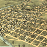
 East Saginaw, Michigan, 1867 /
Contributor:
Ruger, A.
Site:
American Memory-cultural, Main Catalog
Original Format:
Map
Date:
1867
View catalog record
East Saginaw, Michigan, 1867 /
Contributor:
Ruger, A.
Site:
American Memory-cultural, Main Catalog
Original Format:
Map
Date:
1867
View catalog record
 Bird's eye view of Jefferson City, the capitol of Missouri 1869.
Contributor:
Ruger, A.
Site:
American Memory-cultural, Main Catalog
Original Format:
Map
Date:
1869
View catalog record
Bird's eye view of Jefferson City, the capitol of Missouri 1869.
Contributor:
Ruger, A.
Site:
American Memory-cultural, Main Catalog
Original Format:
Map
Date:
1869
View catalog record
 Index sheet of battlefield maps for Fredericksburg, Spottsylvania C. H., Wilderness, Chancellorsville, Virginia. [1862-64] To accompany report of the Battlefield Commission created by Act of ...
Site:
American Memory-cultural, Main Catalog
Original Format:
Map
Date:
1925
View catalog record
Index sheet of battlefield maps for Fredericksburg, Spottsylvania C. H., Wilderness, Chancellorsville, Virginia. [1862-64] To accompany report of the Battlefield Commission created by Act of ...
Site:
American Memory-cultural, Main Catalog
Original Format:
Map
Date:
1925
View catalog record
 [October 12, 1944], HQ Twelfth Army Group situation map.
Contributor:
Allied Forces. Army Group, 12th. Engineer Section
Site:
American Memory-cultural, Main Catalog
Original Format:
Map
Date:
1944-10-12
View catalog record
[October 12, 1944], HQ Twelfth Army Group situation map.
Contributor:
Allied Forces. Army Group, 12th. Engineer Section
Site:
American Memory-cultural, Main Catalog
Original Format:
Map
Date:
1944-10-12
View catalog record
 An accurate map of North America describing and distinguishing the British and French dominions on this great continent according to the definitive treaty concluded at ...
Contributor:
Sayer, Robert
Site:
American Memory-cultural, Main Catalog
Original Format:
Map
Date:
1763
View catalog record
An accurate map of North America describing and distinguishing the British and French dominions on this great continent according to the definitive treaty concluded at ...
Contributor:
Sayer, Robert
Site:
American Memory-cultural, Main Catalog
Original Format:
Map
Date:
1763
View catalog record
 Plano de la ciudad de Puerto Real, en la isla de la Jamaica.
Contributor:
López, Juan
Site:
Main Catalog
Original Format:
Map
Date:
1782
Plano de la ciudad de Puerto Real, en la isla de la Jamaica.
Contributor:
López, Juan
Site:
Main Catalog
Original Format:
Map
Date:
1782
 Hardwick, Vt. 1892.
Contributor:
Norris, George E.
Site:
American Memory-cultural, Main Catalog
Original Format:
Map
Date:
1892
View catalog record
Hardwick, Vt. 1892.
Contributor:
Norris, George E.
Site:
American Memory-cultural, Main Catalog
Original Format:
Map
Date:
1892
View catalog record
 Belleville, St. Clair Co., Illinois 1867.
Contributor:
Ruger, A.
Site:
American Memory-cultural, Main Catalog
Original Format:
Map
Date:
1867
View catalog record
Belleville, St. Clair Co., Illinois 1867.
Contributor:
Ruger, A.
Site:
American Memory-cultural, Main Catalog
Original Format:
Map
Date:
1867
View catalog record
 New county and railway map of the United States and the Dominion of Canada compiled from information obtained from official sources showing the lines of ...
Contributor:
Rand McNally and Company
Site:
American Memory-cultural, Main Catalog
Original Format:
Map
Date:
1883
View catalog record
New county and railway map of the United States and the Dominion of Canada compiled from information obtained from official sources showing the lines of ...
Contributor:
Rand McNally and Company
Site:
American Memory-cultural, Main Catalog
Original Format:
Map
Date:
1883
View catalog record
 Map of the battlefield of Bull Run, Virginia. Brig. Gen. Irvin McDowell commanding the U.S. forces, Gen. [P.] G. T. Beauregard commanding the Confederate forces, ...
Contributor:
United States. Army. Corps of Engineers
Site:
American Memory-cultural, Main Catalog
Original Format:
Map
Date:
1877
View catalog record
Map of the battlefield of Bull Run, Virginia. Brig. Gen. Irvin McDowell commanding the U.S. forces, Gen. [P.] G. T. Beauregard commanding the Confederate forces, ...
Contributor:
United States. Army. Corps of Engineers
Site:
American Memory-cultural, Main Catalog
Original Format:
Map
Date:
1877
View catalog record
 Plainfield and North Plainfield, N.J. 1899.
Contributor:
Landis and Hughes
Site:
American Memory-cultural, Main Catalog
Original Format:
Map
Date:
1899
View catalog record
Plainfield and North Plainfield, N.J. 1899.
Contributor:
Landis and Hughes
Site:
American Memory-cultural, Main Catalog
Original Format:
Map
Date:
1899
View catalog record
 Map of Botetourt County /
Contributor:
Izard, Walter
Site:
American Memory-cultural
Original Format:
Map
Date:
1865
Map of Botetourt County /
Contributor:
Izard, Walter
Site:
American Memory-cultural
Original Format:
Map
Date:
1865
 Map of Colbert County, Alabama /
Contributor:
Bacon, Delos H.
Site:
American Memory-cultural, Main Catalog
Original Format:
Map
Date:
1896
View catalog record
Map of Colbert County, Alabama /
Contributor:
Bacon, Delos H.
Site:
American Memory-cultural, Main Catalog
Original Format:
Map
Date:
1896
View catalog record
 Afghanistan /
Contributor:
Jackson, Nicholas A.
Site:
American Memory-cultural, Main Catalog
Original Format:
Map
Date:
2009
View catalog record
Afghanistan /
Contributor:
Jackson, Nicholas A.
Site:
American Memory-cultural, Main Catalog
Original Format:
Map
Date:
2009
View catalog record
 Latest war map of Europe : as seen through French eyes /
Contributor:
Hadol, Paul
Site:
American Memory-cultural, Main Catalog
Original Format:
Map
Date:
1870
View catalog record
Latest war map of Europe : as seen through French eyes /
Contributor:
Hadol, Paul
Site:
American Memory-cultural, Main Catalog
Original Format:
Map
Date:
1870
View catalog record
 Map of the old portion of the city surrounding the plaza, showing the old plaza church, public square, the first gas plant and adode buildings, ...
Contributor:
Ruxton, A. G.
Site:
American Memory-cultural, Main Catalog
Original Format:
Map
Date:
1873
View catalog record
Map of the old portion of the city surrounding the plaza, showing the old plaza church, public square, the first gas plant and adode buildings, ...
Contributor:
Ruxton, A. G.
Site:
American Memory-cultural, Main Catalog
Original Format:
Map
Date:
1873
View catalog record
 Map showing route of marches of the army of Genl. W. T. Sherman from Atlanta, Ga., to Goldsboro, N.C. : to accompany the report of ...
Contributor:
United States. Army. Corps of Engineers
Site:
American Memory-cultural, Main Catalog
Original Format:
Map
Date:
1865
View catalog record
Map showing route of marches of the army of Genl. W. T. Sherman from Atlanta, Ga., to Goldsboro, N.C. : to accompany the report of ...
Contributor:
United States. Army. Corps of Engineers
Site:
American Memory-cultural, Main Catalog
Original Format:
Map
Date:
1865
View catalog record
 Map of Resaca and vicinity. [1864]
Contributor:
Western and Atlantic Railroad Company
Site:
American Memory-cultural, Main Catalog
Original Format:
Map
Date:
1864
View catalog record
Map of Resaca and vicinity. [1864]
Contributor:
Western and Atlantic Railroad Company
Site:
American Memory-cultural, Main Catalog
Original Format:
Map
Date:
1864
View catalog record
 Perry, N.Y., Wyoming Co., 1892 /
Contributor:
Burleigh Litho
Site:
American Memory-cultural, Main Catalog
Original Format:
Map
Date:
1892
View catalog record
Perry, N.Y., Wyoming Co., 1892 /
Contributor:
Burleigh Litho
Site:
American Memory-cultural, Main Catalog
Original Format:
Map
Date:
1892
View catalog record
 Louisiana.
Contributor:
Lewis, Samuel
Site:
American Memory-cultural, Main Catalog
Original Format:
Map
Date:
1805
View catalog record
Louisiana.
Contributor:
Lewis, Samuel
Site:
American Memory-cultural, Main Catalog
Original Format:
Map
Date:
1805
View catalog record
 Map of the defences of Charleston city and harbor, showing also the works erected by the U.S. forces in 1863 and 1864 /
Contributor:
United States. Army. Corps of Engineers
Site:
American Memory-cultural
Original Format:
Map
Map of the defences of Charleston city and harbor, showing also the works erected by the U.S. forces in 1863 and 1864 /
Contributor:
United States. Army. Corps of Engineers
Site:
American Memory-cultural
Original Format:
Map
 Under a black cloud!
Site:
American Memory-cultural, Main Catalog
Original Format:
Map
Date:
1883
View catalog record
Under a black cloud!
Site:
American Memory-cultural, Main Catalog
Original Format:
Map
Date:
1883
View catalog record
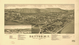 Panoramic view of Dayton, W.T., county seat of Columbia County 1884.
Contributor:
Wellge, H.
Site:
American Memory-cultural, Main Catalog
Original Format:
Map
Date:
1884
View catalog record
Panoramic view of Dayton, W.T., county seat of Columbia County 1884.
Contributor:
Wellge, H.
Site:
American Memory-cultural, Main Catalog
Original Format:
Map
Date:
1884
View catalog record