![[December 25, 1944], HQ Twelfth Army Group situation map.](https://cybercemetery.unt.edu/archive/oilspill/20121227131348im_/http://www.loc.gov/collections/static/world-war-ii-maps-military-situation-maps-from-1944-to-1945/images/ict21204.jpg)

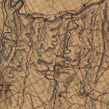


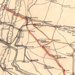
![[Rough sketch of the Rich Mountain battle area extending from Beverly, W. Va. to Clarksburg].](https://cybercemetery.unt.edu/archive/oilspill/20121227131348im_/http://www.loc.gov/collections/static/hotchkiss-maps/images/cwh00078.jpg)
![[December 21, 1944], HQ Twelfth Army Group situation map.](https://cybercemetery.unt.edu/archive/oilspill/20121227131348im_/http://www.loc.gov/collections/static/world-war-ii-maps-military-situation-maps-from-1944-to-1945/images/ict21200.jpg)
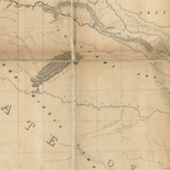
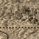
![Plan général du Fort Septentrional du Detour des Anglois, tel qu'il est présentement : [Louisiana]](https://cybercemetery.unt.edu/archive/oilspill/20121227131348im_/http://www.loc.gov/collections/static/louisiana-european-explorations-and-the-louisiana-purchase/images/lh000949.jpg)
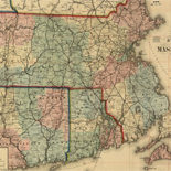
![[Detailed map of part of Virginia from Alexandria to the Potomac River above Washington, D.C. 1886].](https://cybercemetery.unt.edu/archive/oilspill/20121227131348im_/http://www.loc.gov/collections/static/civil-war-maps/images/cw0523000.jpg)
Results
-

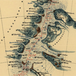
Fort Wagner. Morris Island
NOTE: Researchers will be served a color photocopy of this scrapbook image.
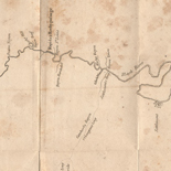
Contributor: Sneden, Robert Knox Site: American Memory-cultural Original Format: Map Date: 1863 -


The Civil War, 1861-1865. Catalog Record Only
col. map. 9 x 127 cm.
Contributor: George F. Cram Company Site: Main Catalog Original Format: Map Date: 1953 -
Great peoples of the past. Ancient Greece / Catalog Record Only
Relief shown by shading on map.
Contributor: National Geographic Maps (Firm) Site: Main Catalog Original Format: Map Date: 1999 -
[Maps of World-War-II German military installations on the Aegean Islands]. Catalog Record Only
Relief shown by spot heights on some maps.
Contributor: Great Britain. Army. Middle East Drawing and Reproduction Site: Main Catalog Original Format: Map Date: 1941 -
Die Graftschaft Neuburg am Inn. Catalog Record Only
xvii, 300 p. fold. col. map (in pocket) 25 cm.
Contributor: Hofbauer, Josef Site: Main Catalog Original Format: Map Date: 1969 -
Atlas of the official records of the Civil War Catalog Record Only
Title from disc label.
Contributor: Guild Press of Indiana Site: Main Catalog Original Format: Map Date: 1999 -
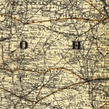
Kansas, 1861 : Kansas became the 34th state to join the Union, January 29, 1861 / Catalog Record Only
"Reproduced from the Fletcher-Boeselt Collection ... Carto-Graphics Galleries, San Antonio, Texas, St. Louis, Mo."
Contributor: Fletcher & Boeselt Site: Main Catalog Original Format: Map Date: 1861-01-29 -
Illustrated historical atlas of Northumberland and Durham Counties, Ontario. Catalog Record Only
Reprint of the 1878 ed. published in Toronto by H. Belden under title: Illustrated historical atlas of the counties of Northumberland and Durham, Ont.
Contributor: H. Belden & Co Site: Main Catalog Original Format: Map Date: 1972 -
Ticonderoga & its dependencies, August 1776. Catalog Record Only
Scale ca. 1:18,000.
Contributor: Trumbull, John Site: Main Catalog Original Format: Map Date: 1841 -

Map of the Confederate lines from Fort Gregg to Mrs. Price's : [Virginia] /
Relief shown by hachures.
Contributor: Hoffmann, J. Paul Site: American Memory-cultural - Main Catalog Original Format: Map View catalog record -
Hē "charta" tou Rēga Pheraiou : [Archaia Hellas]. Catalog Record Only
Shows historic sites and events in the territory of Ancient Greece including southern Balkan Peninsula and western Anatolia.
Contributor: Rēgas, Velestinlēs Site: Main Catalog Original Format: Map Date: 1991 -
Sozdanie leninskoĭ partii / Catalog Record Only
Covers central Europe and European Russia.
Contributor: Soviet Union. Glavnoe upravlenie geodezii i kartografii Site: Main Catalog Original Format: Map Date: 1984 -

The heart of the rebellion: scene of the late Seven Days battles near Richmond; new base of operations of the Army of the [P]otomac.
Scale ca. 1:138,000.
Site: American Memory-cultural - Main Catalog Original Format: Map Date: 1862 View catalog record -
Virginia Civil War trails. Catalog Record Only
"Map and brochure design by Virginia Tech, Public Service Programs, Outreach Division".
Contributor: Virginia Civil War Trails (Firm) Site: Main Catalog Original Format: Map Date: 1997 -
Topographical map of the original District of Columbia and environs showing the fortifications around the city of Washington / Catalog Record Only
Also shows school districts and householders' names in rural areas.
Contributor: Arnold, E. G. Site: Main Catalog Original Format: Map Date: 1862 -
The Far Eastern Geographical Establishment's New atlas of China. Catalog Record Only
All maps in Chinese and English.
Contributor: Shang-hai Yüan tung ti li hsüeh hui Site: Main Catalog Original Format: Map Date: 1920 -
Evolutie van het belgisch spoorwegnet vanaf 1890 = Evolution du réseau ferroviaire belge depuis 1890. Catalog Record Only
"Dat. 15 01 81."
Contributor: Société nationale des chemins de fer belges Site: Main Catalog Original Format: Map Date: 1981 -

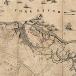
Richmond and York River Railroad
"Sketch from the Confederate Engineer Bureau in Richmond, Va. General J.F. Gilmer, Chief Engineer[.] Presented to the Virginia Historical Society by his only daughter, Mrs. J.F. Minis, Sav[ana]h, Ga."--Note on map.
Site: American Memory-cultural Original Format: Map Date: 1864 -

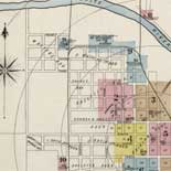
Combination atlas map of Delaware County, Pennsylvania /
On title page ill.: "N. Friend, engr. Philad." ; "C.L. Smith, del."
Contributor: Everts & Stewart Site: American Memory-cultural - Main Catalog Original Format: Map Date: 1875 View catalog record -
Historical Scotland / Catalog Record Only
Pictorial map.
Contributor: Bullock, L. G. Site: Main Catalog Original Format: Map Date: 1985
Refine your search
Original Format
- Map
Online Format
Date
Contributor
- Sneden, Robert Knox [277]
- Fletcher & Boeselt [159]
- Soviet Union. Glavnoe Upravlenie Geodezii I Kartografii [134]
- National Geographic Society (U.S.). Cartographic Division [73]
- United States. National Park Service [56]
- United States Coast Survey [34]
- Nystrom (Firm) [34]
- Rand Mcnally And Company [33]
- United States. Army. Corps of Engineers [33]
- United States. Central Intelligence Agency [31]
-
More Contributors