
![[Plan of Fort Henry and its outworks.]](https://cybercemetery.unt.edu/archive/oilspill/20121227011809im_/http://www.loc.gov/collections/static/civil-war-maps/images/cw0414000.jpg)
![[Detailed map of part of Virginia from Alexandria to the Potomac River above Washington, D.C. 1886].](https://cybercemetery.unt.edu/archive/oilspill/20121227011809im_/http://www.loc.gov/collections/static/civil-war-maps/images/cw0523000.jpg)
![[Topographical map of part of Washington D.C.].](https://cybercemetery.unt.edu/archive/oilspill/20121227011809im_/http://www.loc.gov/collections/static/civil-war-maps/images/cw0688500.jpg)

![Map of the Rappahannock River from [sic] Port Royal to Richards Ferry](https://cybercemetery.unt.edu/archive/oilspill/20121227011809im_/http://www.loc.gov/collections/static/civil-war-maps/images/cw0619600.jpg)
![[Sketch of the battles of Chancellorsville, Salem Church, and Fredericksburg], May 2, 3, and 4, 1863](https://cybercemetery.unt.edu/archive/oilspill/20121227011809im_/http://www.loc.gov/collections/static/civil-war-maps/images/cwh00129.jpg)
Overview
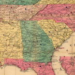
Civil War Maps brings together materials from three premier collections: the Library of Congress Geography and Map Division, the Virginia Historical Society, and the Library of Virginia. Among the reconnaissance, sketch, and theater-of-war maps are the detailed battle maps made by Major Jedediah Hotchkiss for Generals Lee and Jackson, General Sherman's Southern military campaigns, and maps taken from diaries, scrapbooks, and manuscripts all available for the first time in one place.
Most of the items presented here are documented in Civil War Maps: An Annotated List of Maps and Atlases in the Library of Congress, compiled by Richard W. Stephenson in 1989. New selections from 2,240 maps and 76 atlases held by the Library will be added monthly.
Civil War Maps contains items from the Library of Congress Geography and Map Division, the Library of Virginia, and the Virginia Historical Society.
This presentation contains approximately 2,240 Civil War maps and charts and 76 atlases and sketchbooks that are held within the Geography and Map Division, 200 maps from the Library of Virginia, and 400 maps from the Virginia Historical Society.
The maps, charts, and atlases depict battles, troop positions and movements, engagements, and fortifications. Also included are reconnaissance maps, sketch maps, coastal charts, and theater of war maps. An introductory essay traces the development of mapping during the Civil War, with special reference to maps and atlases in the Geography and Map Division. The Geography and Map Division materials are based on Civil War Maps: An Annotated List of Maps and Atlases in the Library of Congress, compile by Richard W. Stephenson in 1989. This bibliography not only includes descriptions of printed, photoreproduced, annotated, and hand-drawn maps made between 1861 and 1865, but also maps made later to illustrate or explain specific events, movements, and battles of the war. The vast majority of the maps were prepared by Federal forces or by commercial firms in the North, but there are also a substantial number by Confederate military authorities and a few by Southern publishers.
The largest group among the Confederate works are the 341 manuscript maps and sketch books that make up the Hotchkiss Map Collection. Assembled by Major Jedediah Hotchkiss, who served as topographic engineer with the Army of Northern Virginia, this remarkable collection was acquired by the Library of Congress in 1948 from Hotchkiss's granddaughter, Mrs. R. E. Christian of Deerfield, Virginia. The entries for the collection, described in a separate section, were prepared in 1951 by Clara Egli LeGear and were originally published by the Library of Congress under the title The Hotchkiss Map Collection: A List of Manuscript Maps, Many of the Civil War Period, Prepared by Major Jedediah Hotchkiss, and Other Manuscript and Annotated Maps in His Possession.
Included here are maps of the whole United States, maps of major regions such as the Eastern or Southern States, maps showing all or parts of more than two states, and maps of the Mississippi River. State maps are also included, with maps of specific battles, cities and towns, and natural features listed alphabetically under each state.
In addition to the Hotchkiss Map Collection, the Sherman Map Collection is also presented. Consisting of 210 maps and 3 atlases belonging to Gen. William Tecumseh Sherman, it was formed by the Library of Congress from three separate accessions. The first, received in 1912, numbered some 58 maps that were included among the papers presented to the Library of Congress by Sherman's son, Philemon Tecumseh Sherman. A second segment was obtained in 1942 from the general's granddaughter, Miss Eleanor Sherman Fitch. The final group of maps was obtained in 1955 from the William L. Clements Library, Ann Arbor, Michigan, in exchange for a copy of Joseph F. W. Des Barres's The Atlantic Neptune (London, 1774-1781). The collection includes a significant number of maps and atlases owned by Sherman either before or after the war.
The Library of Virginia's map collection includes about 200 maps relating to the Civil War. Of the maps included in this project, there are maps accompanying a report to the Governor of Virginia, Confederate imprints, a variety of printed and manuscript maps, mostly of Virginia areas, and a small group of field maps of Southwestern Virginia found in books belonging to Major General William W. Loring, C.S.A.
The Virginia Historical Society items include images created by officers of the Confederate Army's Engineer Corps of counties and regions within Virginia (including the so-called Jeremy Gilmer maps). These manuscript maps are distinctive in that they include not only roads, bridges, waterways, and major buildings, but also identify farms and plantations by owners' surnames. Another set of images comes from the multi-volume diary and scrapbook of Union Private Robert K. Sneden, who served with the Army of the Potomac. These consist primarily of battle plans and details of fortifications both in Virginia and elsewhere. Some of Sneden's work has been reproduced in two recent publications, Eye of the Storm and Images from the Storm. The few remaining images in the collection are drawn more generally from the Society's manuscript holdings, including those contained in the letters of individual soldiers.
Most of the entries include a brief paragraph describing the contents of the map, but no attempt has been made to analyze the maps completely or to evaluate them critically.
All three libraries actively seek to enrich their cartographic collection and would welcome information that may lead to the acquisitions of maps and atlases of the American Civil War not already included in their holdings. Any new, original items received by the Library of Congress will be included in updates to this online collection. New selections from the Stephenson bibliography will be added monthly.
Rights And Access
The maps in the Civil War Maps materials were either published prior to 1922, produced by the United States government, or both (see catalogue records that accompany each map for information regarding date of publication and source). The Library of Congress is providing access to these materials for educational and research purposes and is not aware of any U.S. copyright protection (see Title 17 of the United States Code) or any other restrictions in the Map Collection materials.
Note that the written permission of the copyright owners and/or other rights holders (such as publicity and/or privacy rights) is required for distribution, reproduction, or other use of protected items beyond that allowed by fair use or other statutory exemptions. Responsibility for making an independent legal assessment of an item and securing any necessary permissions ultimately rests with persons desiring to use the item.
More about American Memory, Copyright and other Restrictions
Credit Lines: use the following as appropriate
Library of Congress, Geography and Map Division
Library of Virginia, Map Collection
The Virginia Historical Society
Citing Primary Souces on the Teachers Page.
How to Order Reproductions
Geography and Map Division
Photographic copies of maps from the Geography and Map Division are available through the Library of Congress Photoduplication Service. These reproductions are made from digital images. (Digital reproductions in TIFF format are also available.)
The Photoduplication Service estimates that it takes 3-6 weeks to complete an order. To request a reproduction:
Take down the DIGITAL ID number and the TITLE from the bibliographic description.
Consult the Photoduplication Service for pricing details and order forms: http://www.loc.gov/preserv/pds/
Contact the Photoduplication Service to place an order:
Library of Virginia
The Library of Virginia’s Photographic and Digital Imaging Services department offers a variety of choices for reproductions:
- Digital images transferred to CD-ROM (PC or MAC compatible)
- Full size inkjet prints
- 8 x 10 dye sublimation prints (suitable for publication)
Please direct all inquiries regarding the duplication of the Library of Virginia’s Civil War map collection to any of the following:
- Regular mail
The Library of Virginia
Archives Research Services
800 East Broad Street
Richmond, VA 23219
- Telephone
804-692-3888
Tuesday through Saturday, 9 a.m.-5 p.m. EDT
- Fax
804-692-3556
Please include your name, address, daytime phone number, the name of the map and the LVA item number (ex.: LVA000125) in all correspondence.
Costs for duplication vary. Service and use fees may apply. Permission to reproduce, publish, or exhibit materials from the Library of Virginia’s collections must be obtained from Archives Research Services.
Acquiring copies of materials in any format from the Archives does not confer the right to recopy, reproduce, publish, or exhibit them without the express written consent of the Library, or the holder of copyright to those materials.
Virginia Historical Society
To request copies of these maps, please contact Stephanie Jacobe (sjacobe@vahistorical.org) or visit the VHS website (www.vahistorical.org) for more information. Images will be available as digital files or prints, and a price list is posted on the site