![A map of the most inhabited part of New England... Thomas Jefferys, [London] Thos. Jefferys, 1755.](https://cybercemetery.unt.edu/archive/oilspill/20130108030901im_/http://www.loc.gov/collections/static/american-revolutionary-war-maps/images/ar079700.jpg)
![[Detailed map of part of Virginia from Alexandria to the Potomac River above Washington, D.C. 1886].](https://cybercemetery.unt.edu/archive/oilspill/20130108030901im_/http://www.loc.gov/collections/static/civil-war-maps/images/cw0523000.jpg)

Results
-

Chickamauga Battlefield /
Scale ca. 1:12,200.
Contributor: McElroy, Joseph C. Site: American Memory-cultural - Main Catalog Original Format: Map Date: 1895 View catalog record -

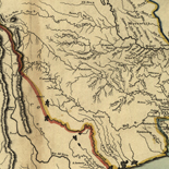
[Map of the Etowah River from Rome to Cartersville, Georgia].
Shows fords, bridges, and ferries across the Etowah River spanning southeastern Floyd County and southwestern Bartow County, Georgia. Fortifications shown at Caldwell Ford, Bartow County.
Site: American Memory-cultural - Main Catalog Original Format: Map Date: 1864 View catalog record -

Macon, Geo. 1864.
Shows defenses at Macon, Georgia.
Site: American Memory-cultural - Main Catalog Original Format: Map Date: 1864 View catalog record -

May 17 to 23, 1864, Adairsville to Euharlee, GA, route of Harrison's brigade /
Gift; Mrs. Geo. W. Volk; Lexington, Nebraska; January 1966.
Contributor: Blakeslee, G. H. Site: American Memory-cultural - Main Catalog Original Format: Map Date: 1864 View catalog record -

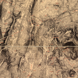
Birds-eye map of the Western and Atlantic R.R., the great Kennesaw route; Army operations, Atlanta campaign, 1864.
Scale not given.
Contributor: Fleming, Brewster & Alley Site: American Memory-cultural - Main Catalog Original Format: Map Date: 1887 View catalog record -

Fort McAllister : [Georgia].
Relief shown by hachures.
Site: American Memory-cultural - Main Catalog Original Format: Map Date: 1864 View catalog record -

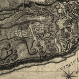
Part of Paulding County showing the position of the left wing 16th A.C., June 4th, 1864.
Relief shown by hachures.
Site: American Memory-cultural - Main Catalog Original Format: Map Date: 1864 View catalog record -

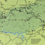
Atlas of the battlefields of Chickamauga, Chattanooga, and vicinity.
Cover title.
Contributor: United States. Chickamauga and Chattanooga National Park Commission Site: American Memory-cultural - Main Catalog Original Format: Map Date: 1901 View catalog record -
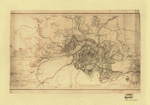
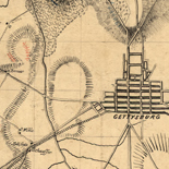
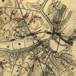
Map illustrating the siege of Atlanta, Ga., by the U.S. forces under command of Maj. Gen. W.T. Sherman, from the passage of Peach Tree Creek, ...
Partial cadastral map showing selected buildings and householders' names beyond city limits.
Contributor: Poe, O. M. Site: American Memory-cultural - Main Catalog Original Format: Map Date: 1865-01-01 View catalog record -

"Atlanta campaign," left wing 16th Army Corps., May 4th to Sept. 8th, 1864 : Maj. Genl. G.M. Dodge, comdg., Genls. Corse and Burke, comdg. divisions ...
Shows dates, troop positions, and campsites in northwestern Georgia between Chattanooga and Atlanta.
Contributor: Bell, C. J. Site: American Memory-cultural - Main Catalog Original Format: Map Date: 1890 View catalog record -

1892 Tallapoosa, Ga. Haralson Co.
Perspective map not drawn to scale.
Contributor: Norris, George E. Site: American Memory-cultural - Main Catalog Original Format: Map Date: 1892 View catalog record -

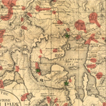
Tour route, Chickamauga Battlefield, Chickamauga and Chattanooga National Military Park, Georgia and Tennessee.
Scale ca. 1:55,000.
Contributor: United States. National Park Service Site: American Memory-cultural - Main Catalog Original Format: Map Date: 1957 View catalog record -

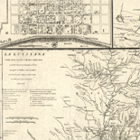
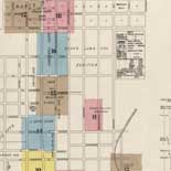
Sanborn Fire Insurance Map from Newnan, Coweta County, Georgia.
14 Sheet(s). Jan 1906.
Site: American Memory-cultural Original Format: Map Date: 1906 -

Andersonville Prison, Georgia in July 1864.
Lower margin of the map: "Whole Content of Stockade 25 1/2 acres, including swamp. Number of Prisoners July 1st."
Contributor: Sneden, Robert Knox Site: American Memory-cultural Original Format: Map Date: 1861 -

Map illustrating the operations of the army under command of General W.T. Sherman, in Georgia, from May the 5th to September the 4th, 1864 /
Shows Union and Confederate works in southeastern Tennessee and northwestern Georgia.
Contributor: Glümer, J. v - Glümer, J. v Site: American Memory-cultural - Main Catalog Original Format: Map Date: 1864 View catalog record -

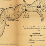
Copy of official plan of the siege of Fort Pulaski. Cockspur Island. Savannah Georgia April 1862 : by Union forces under Genl Gillmore and Hunter.
"Genl Gillmore opened fire on Fort Pulaski from 30 ten inch guns in battery 11th April concentrating his fire on the salient angle A and ravelin B which after 30 hours battering ...
Contributor: Sneden, Robert Knox Site: American Memory-cultural Original Format: Map Date: 1862 -

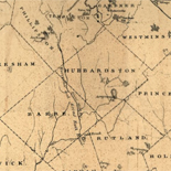
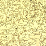
Information map of part of Georgia.
Shows vicinity of Pumpkinvine Creek in southeast Bartow County.
Contributor: United States. Army. Dept. of the Cumberland. Topographical Engineers Site: American Memory-cultural - Main Catalog Original Format: Map Date: 1864 View catalog record -

Sanborn Fire Insurance Map from Newnan, Coweta County, Georgia.
9 Sheet(s). Mar 1900.
Site: American Memory-cultural Original Format: Map Date: 1900-01-01 -

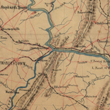
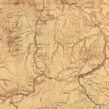
From the Etowah to Burnt-Hickory, Ga.
Scale ca. 1:27,600.
Contributor: Blakeslee, G. H. Site: American Memory-cultural - Main Catalog Original Format: Map Date: 1864 View catalog record -

[Map of part of Catoosa, Whitfield, and Walker counties, Georgia].
Railroads and principal towns are colored red by hand.
Site: American Memory-cultural - Main Catalog Original Format: Map Date: 1864 View catalog record
Refine your search
Original Format
- Map
- Web Page [1]
Online Format
Contributor
- Sneden, Robert Knox [30]
- Lindenkohl, A. [15]
- Western And Atlantic Railroad Company [11]
- United States Coast Survey [8]
- United States. Army. Dept. of The Cumberland. Topographical Engineers [8]
- United States. Army of The Cumberland. Topographical Engineers Office [5]
- Geological Survey (U.S.) [5]
- United States. National Park Service [5]
- Poe, O. M. [5]
- Blakeslee, G. H. [4]
-
More Contributors